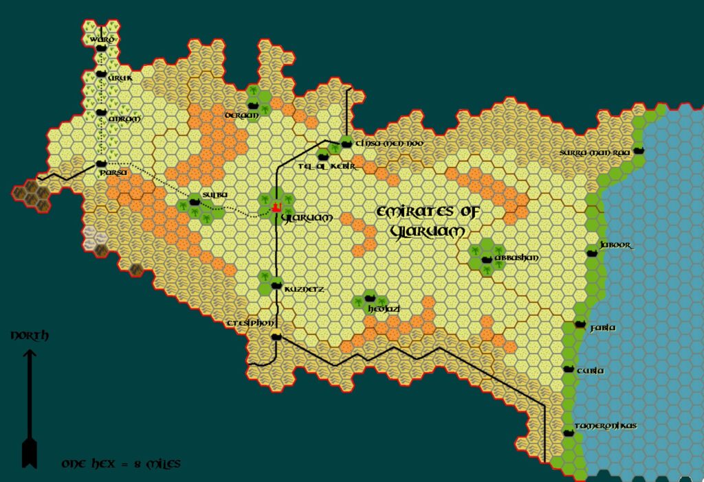
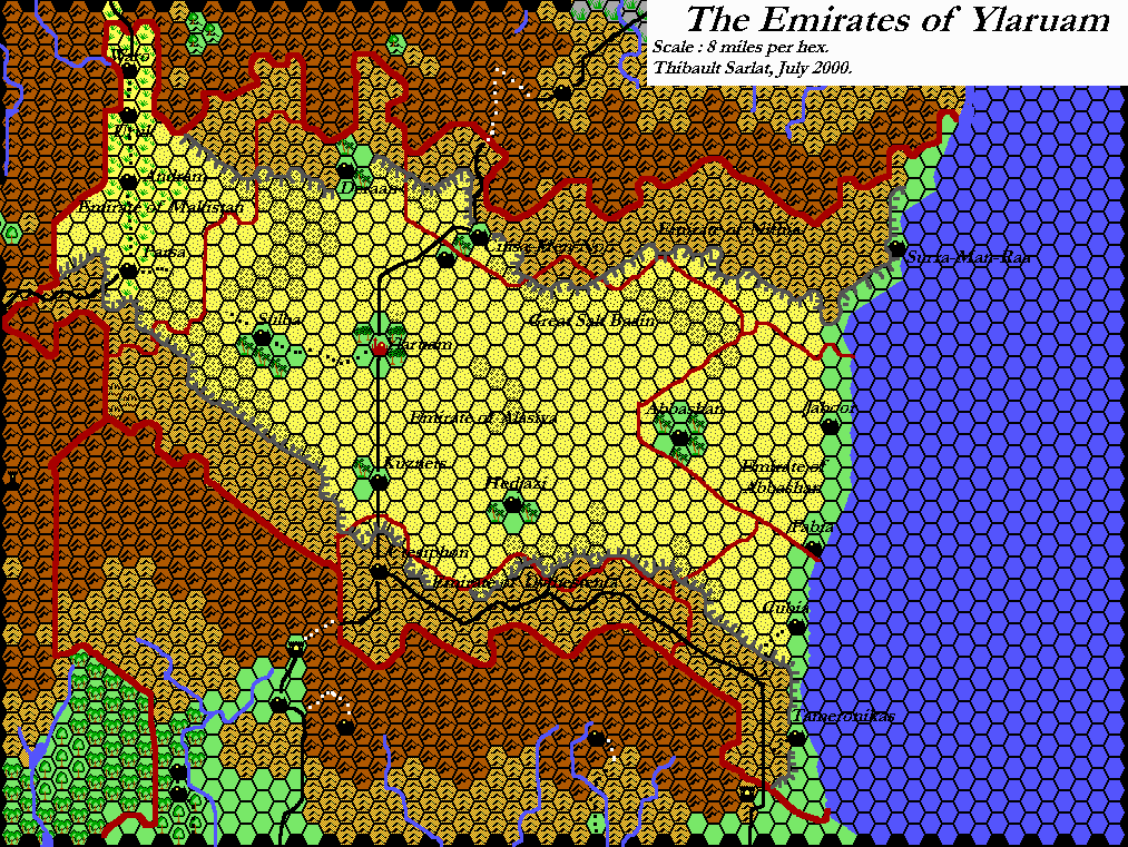
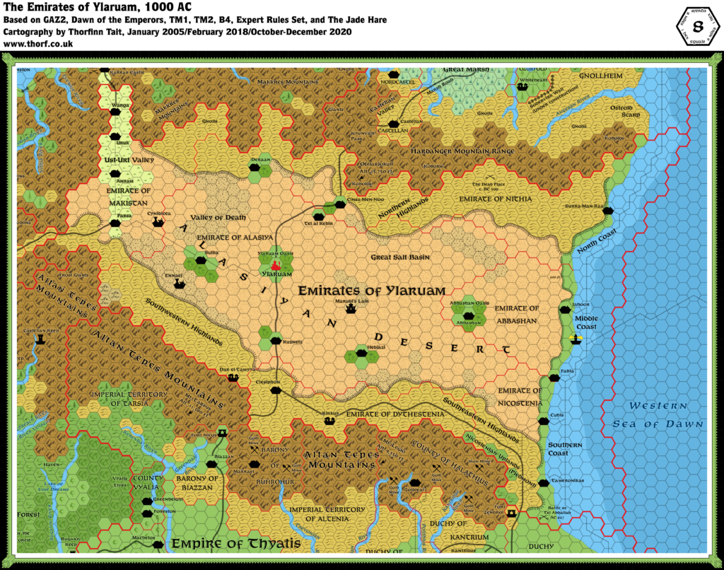
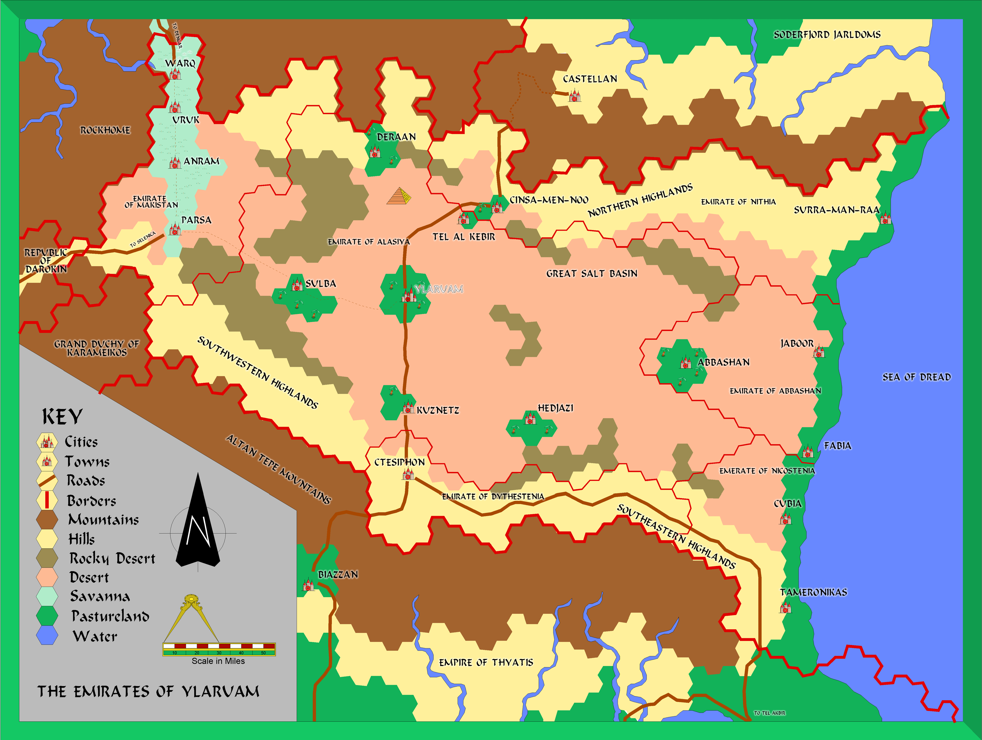
Alan’s Ylaruam, 8 miles per hex
With Karameikos finished, Alan next set his sights on Ylaruam. The first map he shared was his own version of GAZ2’s hex map. He elected to use coloured hexes, mostly without terrain symbols. Visually, it looks like a hex map, but there is no actual grid. There are also no plateaus, even though he had included them in previous maps. Perhaps the art was just too troublesome to work with; Alan would not be the only fan cartographer to grapple with this problem, as I myself can attest.
As with his Karameikos map, this one is a faithful rendition of the GAZ2 original. It even includes two features from that map that were superseded by later maps: the Sea of Dread label (soon to become the Eastern Sea of Dawn), and Altan Tepe Mountains (which had already become Altan Tepes Mountains in GAZ1).
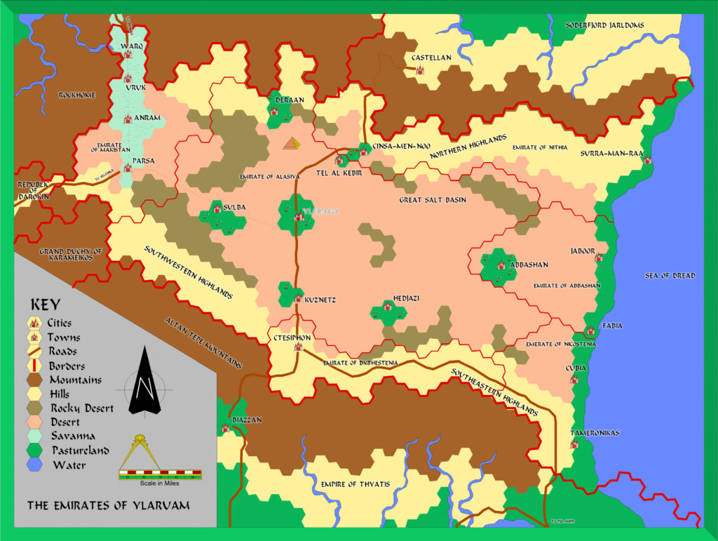
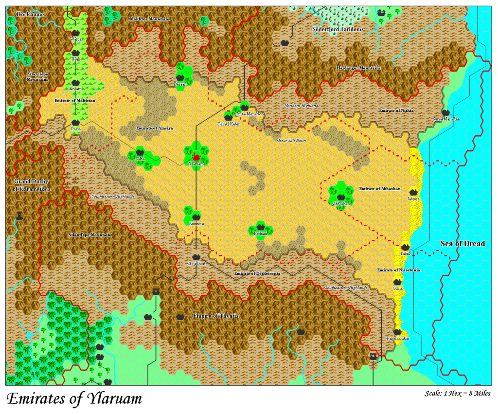
Below is my CC3+ conversion of Alan’s original file. The slight glow around the labels to increase legibility is my only addition. Second below is Alan’s original CC2 export.
Fan-made Map by Alan Derek Jones (August 2001)
exported in high resolution by Thorfinn Tait, April 2025
Fan-made Map by Alan Derek Jones (August 2001)
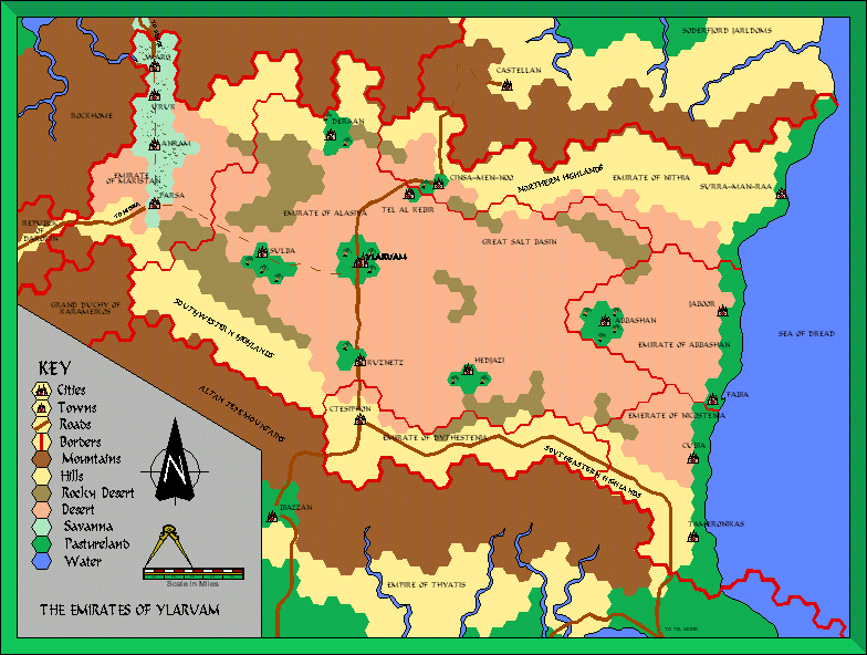
This is an original map created by one of Mystara’s excellent fan cartographers. For more information on the cartographer, including a gallery of all their maps, see also Appendix M: Mappers of Mystara.
Sources
- GAZ2 The Emirates of Ylaruam (1987) (PDF at DriveThruRPG)
Fan Sources
- None.
References
- All of Alan’s maps at the Atlas of Mystara
- Alan’s entry in Appendix M: Mappers of Mystara (upcoming)
- Alan’s author page at the Vaults of Pandius
Chronological Analysis
This is a fan-made map. It was published in August 2001. The updated Atlas version of this map is not yet available. See also Appendix C for annual chronological snapshots of the area. For the full context of this map in Mystara’s publication history, see the upcoming Let’s Map Mystara 2001. (Please note that it may be some time before the project reaches this point.)
The following lists are from the Let’s Map Mystara project. Additions are new features, introduced in this map. Revisions are changes to previously-introduced features. Hex Art & Fonts track design elements. Finally, Textual Additions are potential features found in the related text. In most cases, the Atlas adopts these textual additions into updated and chronological maps.
Under Construction! Please check back again soon for updates.
Additions
Revisions
- Spellings — There was a typo in the Emirate of Nicostenia’s label.
Hex Art & Fonts
- Art — Campaign Cartographer 2 style symbols, art and palette.
- Fonts — Beanie, except the scale which is in Arial.