Reconciling X9’s proper placement with the Savage Baronies (1991)
Under Construction! Please check back again soon for updates.
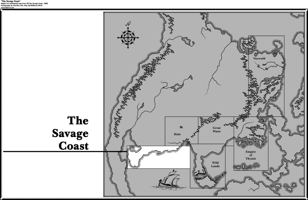
The Maps in Question
The Problem
Background
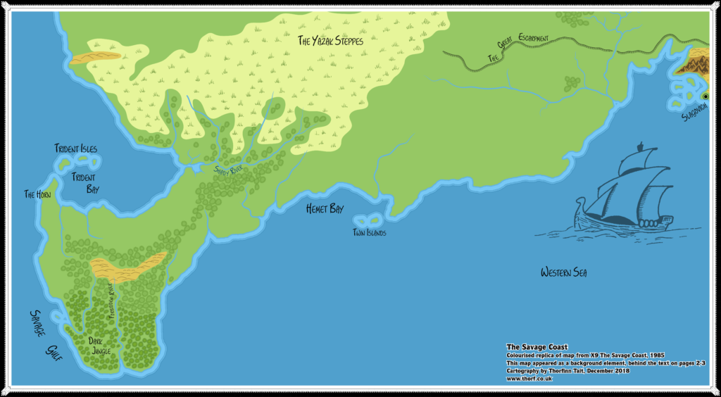
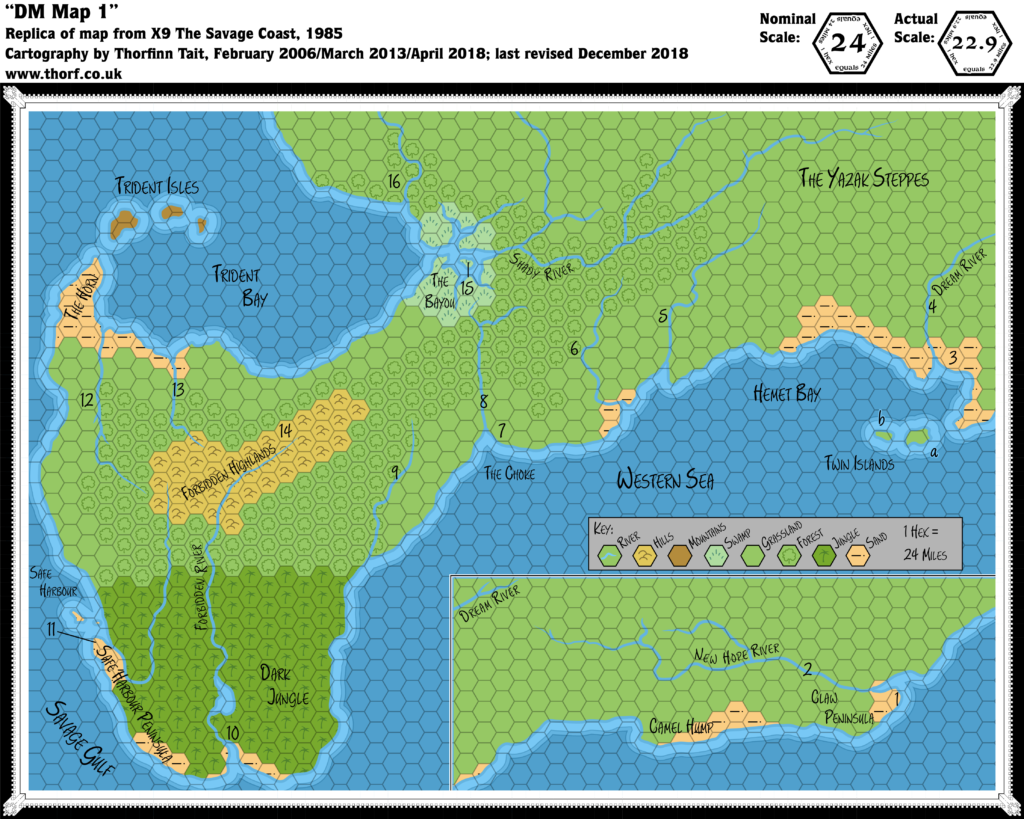
When X9 was released in 1985, the join between its map and the previous X5 map of the Gulf of Hule was rather ambiguous. The Savage Dilemma article provides a detailed analysis of this issue, but suffice it to say, the correct placement involves not only a rescaling but also a rotation. (See Savage Coast, 22.9 miles per hex (1985) and Savage Coast, 24 miles per hex (1985) for corrected maps.) It goes without saying that such a complex solution was far beyond the mapping tools available in 1985.
It should therefore come as no surprise, then, that the Voyage of the Princess Ark maps of the area in 1991 were based on a simple join of X5 and X9’s hex maps using the hex grid alone. This was the only rational solution at the time, and it remained the preferred (or even universal) solution among fan cartographers for decades.
Problems
However, it causes two major problems: first, there is no way to reconcile these maps with the continental and world maps. Specifically, the rotation and scale are both wrong, so that the coast is angled in the wrong direction, and takes up too much space. The solution to these problems is that outlined in The Savage Dilemma.
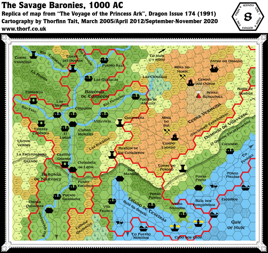
Second, the placement used in the Dragon Magazine maps missed out a whole section of the western Gulf of Hule coast. Dragon’s Savage Baronies consisted of three “bumps” on the coastline, while the continental map had four. This latter problem is the subject of this article, which I call The Gulf of Hule Problem.
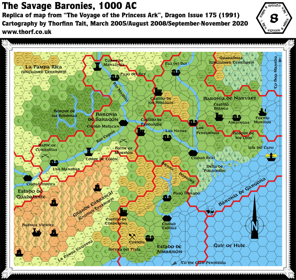
To help visualise the problem, the following composite shows X9’s non-hex map together with the joined up Dragon 174-176 maps. I have displaced the Dragon maps, but everything is presented at the same scale.
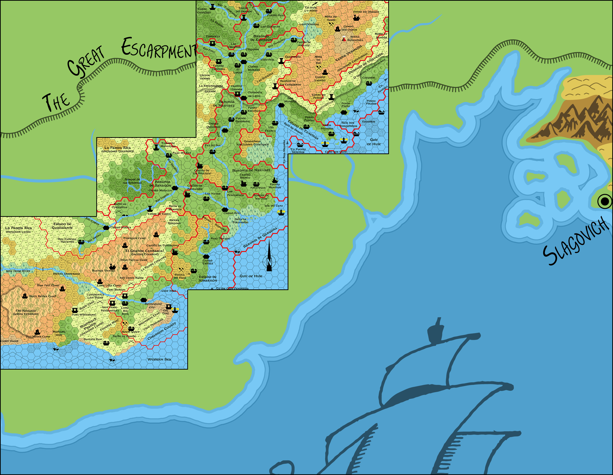
Texeiras’ capital, Boa Mansão on the Baia da Sereia, as well as Cabo dos Cãos (the peninsula with two lighthouses and the village of Velha Navalha) appear at the same latitude in this image. Moving southwards, it’s clear that the “bump” south of Puerto Morillos, as well as the Delta de Pozaverde, line up. However, the “bump” between the delta and Ciudad Tejillas is missing from the Dragon hex maps. Consequently, the Claw Inlet and Smokestone City are further north than they should be.
A Further Complication
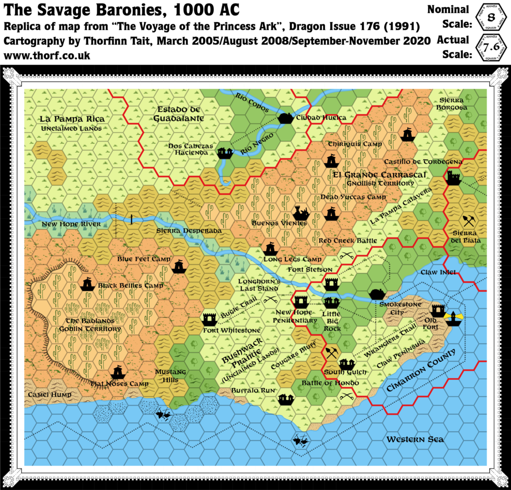
There’s another issue with these Dragon maps: they don’t take into account the rotation and scaling required to solve The Savage Dilemma (outlined above and detailed in its own article). Instead, they are based purely on X5 and X9. Since X5 was 24 miles per hex, this means that Dragon 174 is 8 miles per hex, as marked. However, to join X9’s hex map with X5’s, X9’s must be reinterpreted as 22.9 miles per hex. From partway through Dragon 175’s map (the same place as the missing coastline, between the delta and Ciudad Tejillas), it should be taken to be 7.6 miles per hex.
All of the other Dragon maps based on X9 can also be reinterpreted as 7.6 miles per hex. The only really problematic area is that depicted in Dragon 175.
Summary
It seems clear that Dragon 175 is the heart of the problem. It missed out a section of coastline, shortening the western Gulf of Hule coastline by approximately 70 miles. At the same time is straddles the messy join between X5 and X9, with the accidental change of scale.
Community Discussions
Under Construction! Please check back again soon for updates.
This issue seems to have gone unnoticed until relatively recently, although it has undoubtedly been causing problems for much longer.
As noted in The Savage Dilemma, Rimx was the first to draw attention to the problem with X5 and X9’s join. He mentioned it in passing in Michele’s Southold composite map thread at The Piazza in July 2008:
A mapping error was made with the Voyage of the Princess Ark maps. The maps from X5 and X9 were overlapped instead of joining the maps at their borders. X5 was placed about 5 24 mile hexes further south than it should have.
But his map from 2007 did not tackle the issue; likely he became of the issue while working on that map, but not early enough to try to fix it.
After that, I have been unable to find any references to this problem until my own projects. In my first Lining Up Mystara project in 2016, I had terrible problems with the Savage Coast, because I didn’t apply any sort of rotation to make it fit the continental map. It wasn’t until I started again with Let’s Map Mystara that I was able to discover the root of the problem and propose a solution for The Savage Dilemma.
I then mentioned the related Gulf of Hule Problem in various places, including in a December 2023 Patreon post and in private correspondence with Mark Howard.
As a result of our conversations, Mark had a go at tackling the problem in 2025, proposing two different solutions in his Western Gulf of Hule v1 and Western Gulf of Hule v2 maps.
The Solution
Under Construction! Please check back again soon for updates.
The Revised Maps
Below are the revised maps for Mystara 1991 as they appear in the Atlas of Mystara.
Under Construction! Please check back again soon for updates.