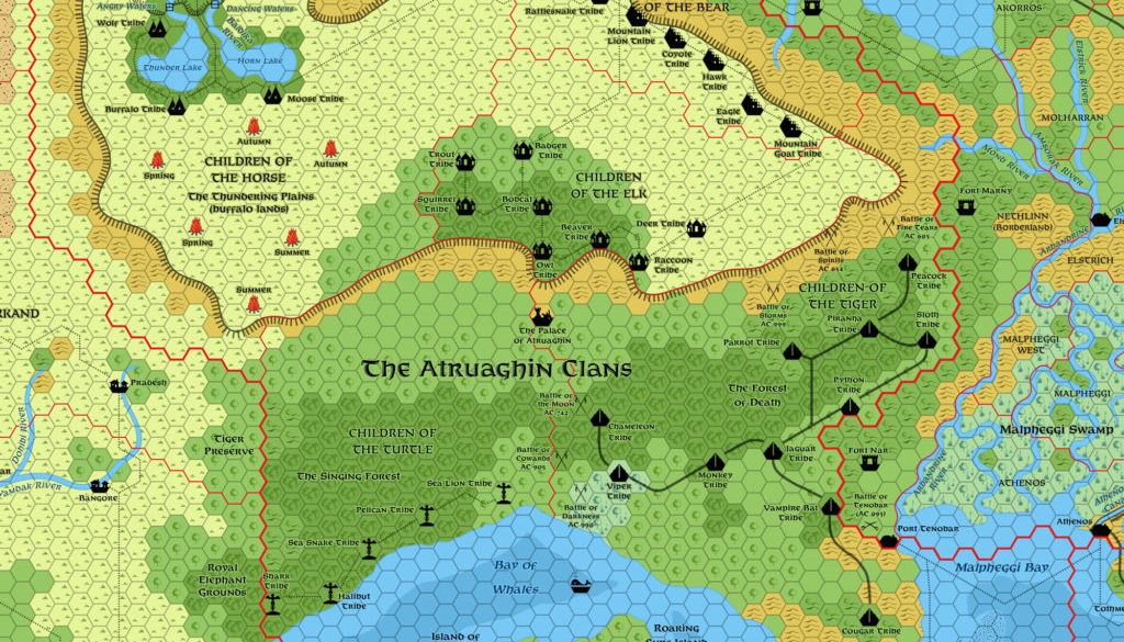
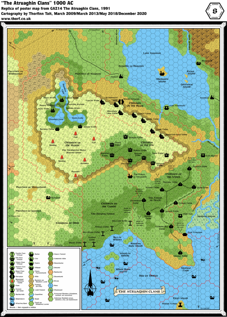
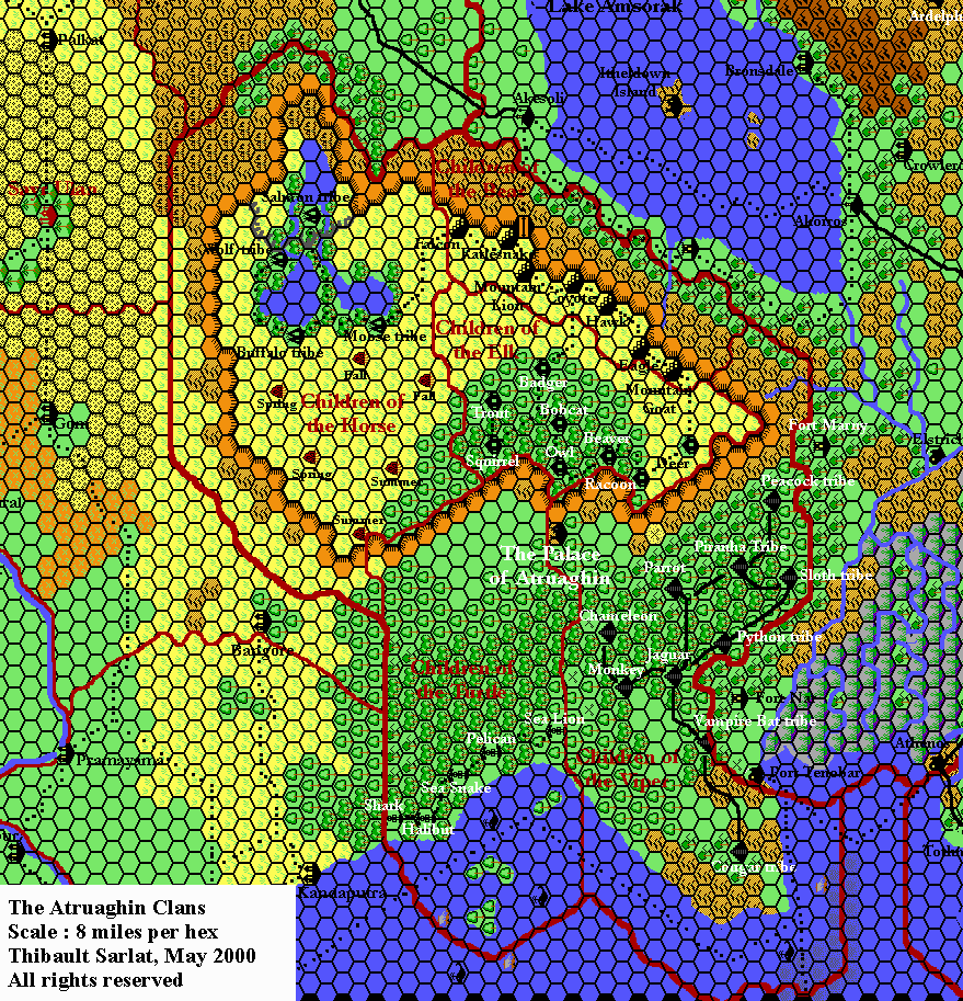
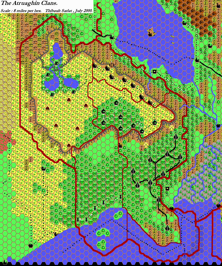
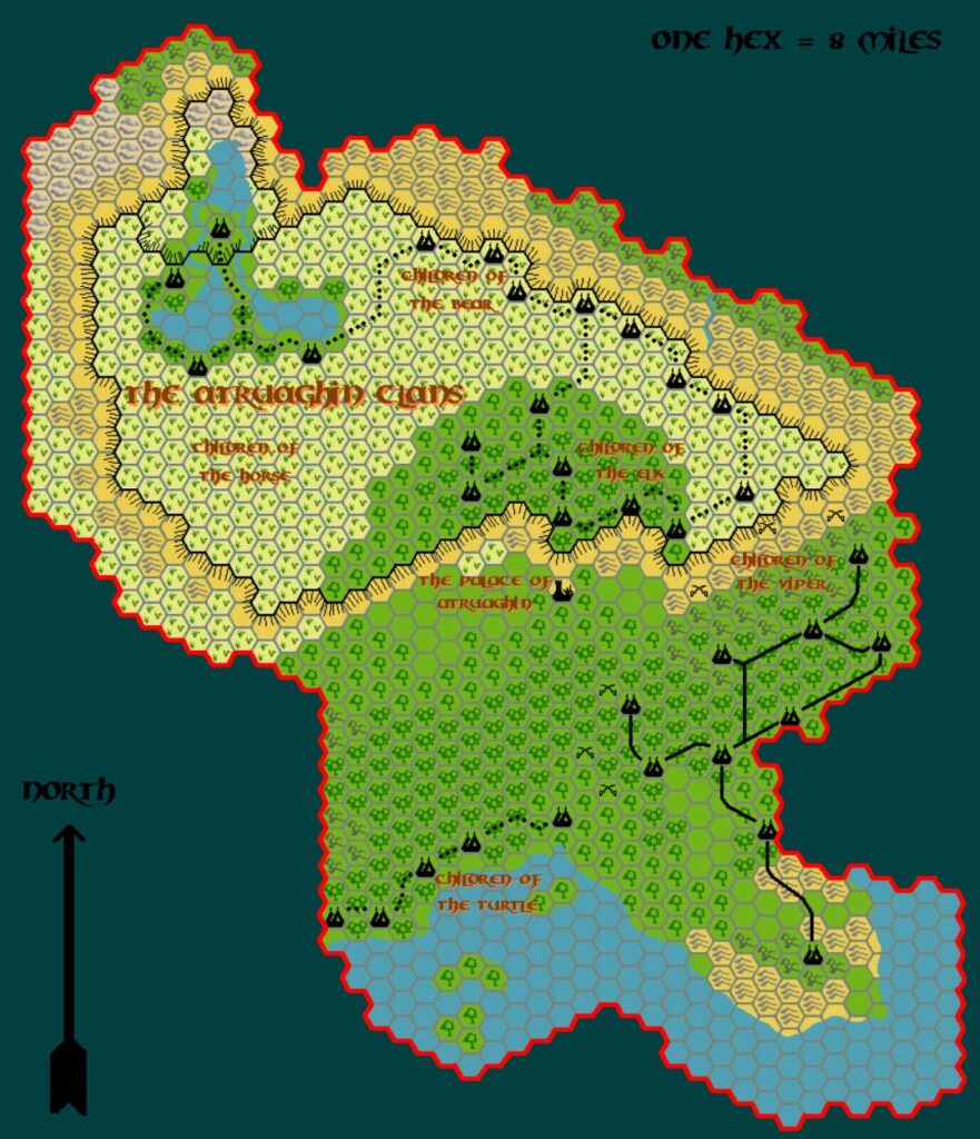
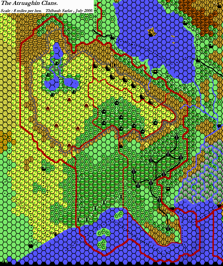
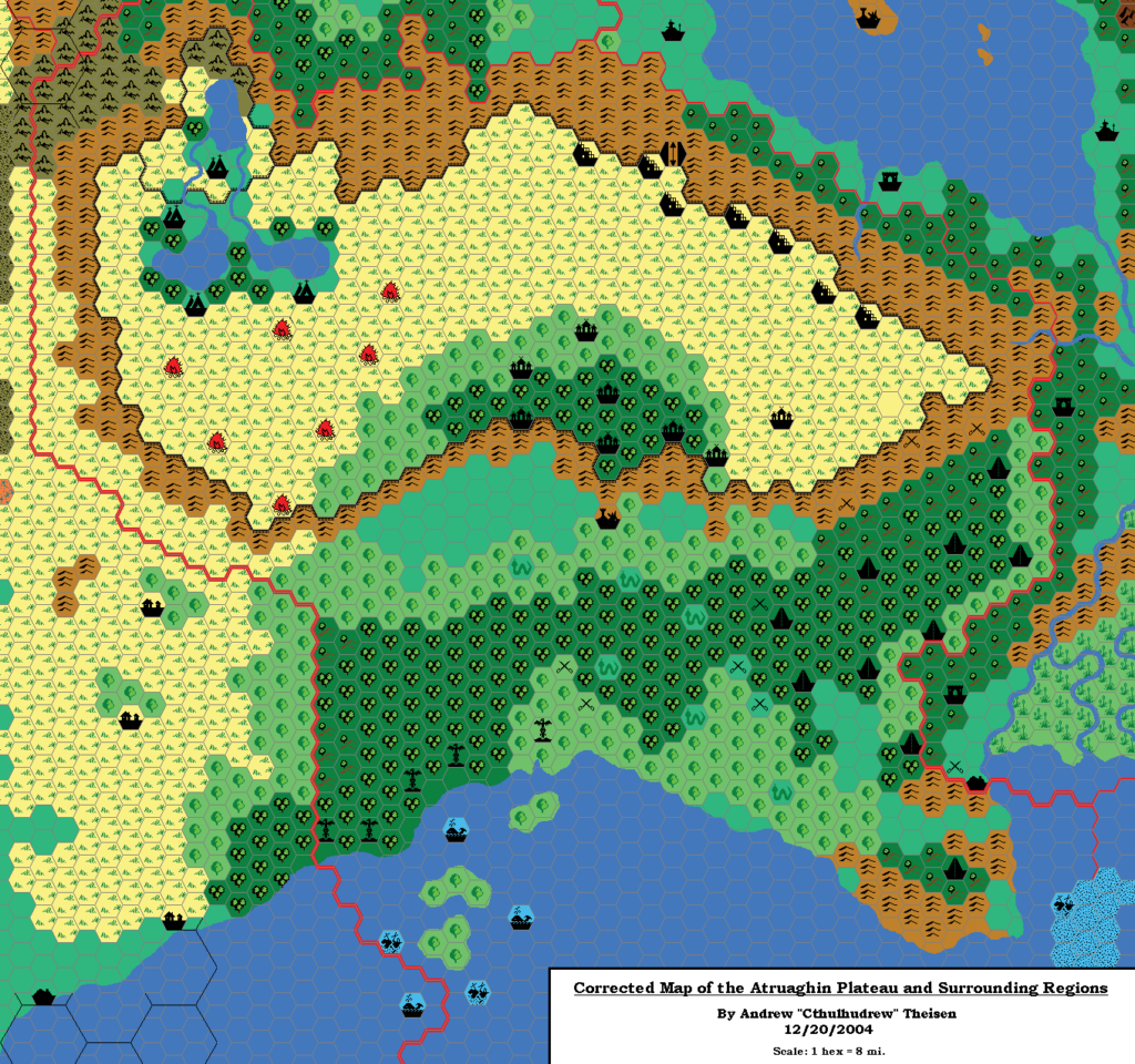
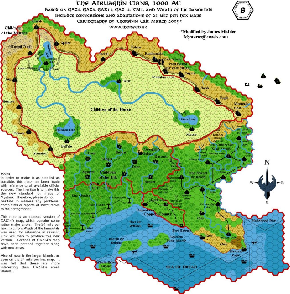
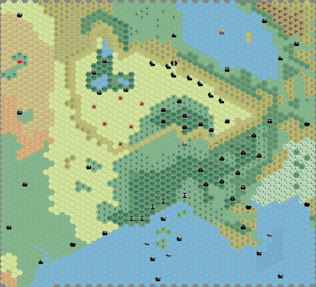
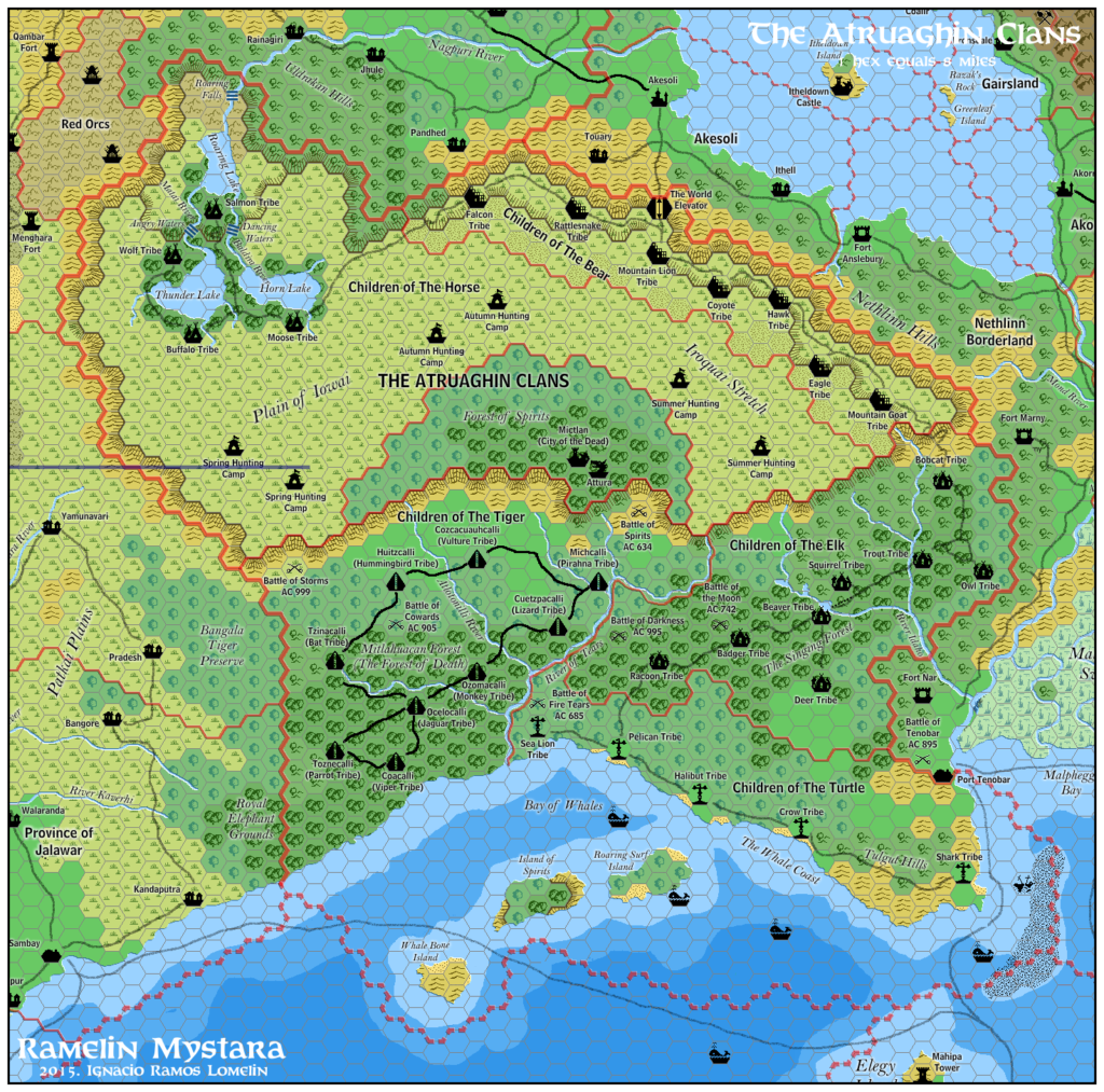
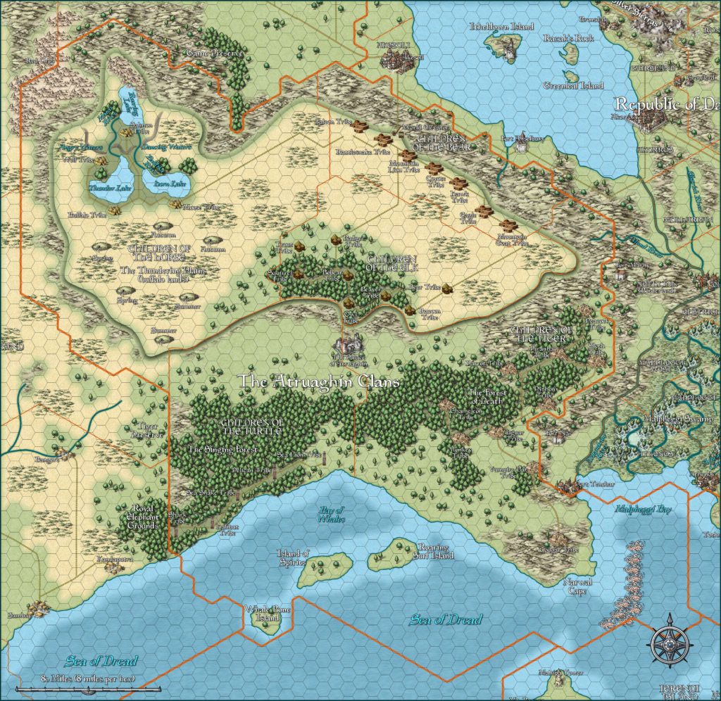
Atruaghin, 8 miles per hex
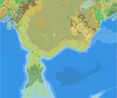
The plateau itself is a steep-sided environment that has been raised 2,700 feet above the level of the surrounding land. There are no convenient or safe trails up to the top, which makes the plateau an inaccessible and safe haven for its inhabitants. The plateau features plains upon which horses and buffalo graze, though there are some forested areas.
from the Poor Wizard’s Almanac, by Aaron Allston
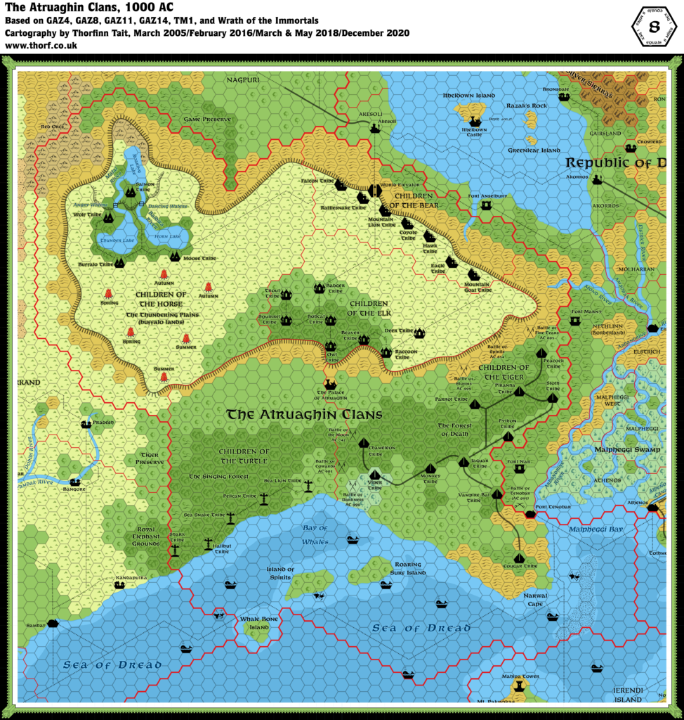
Map (December 2020)
Sources
- GAZ14 The Atruaghin Clans (1991) (PDF at DriveThruRPG)
- GAZ4 The Kingdom of Ierendi (1987) (PDF at DriveThruRPG)
- GAZ8 The Five Shires (1988) (PDF at DriveThruRPG)
- GAZ11 The Republic of Darokin (1989) (PDF at DriveThruRPG)
- X10 Red Arrow, Black Shield (1985) (PDF at DriveThruRPG)
- TM1 The Western Countries (1989) (PDF at DriveThruRPG)
- Wrath of the Immortals (1992) (PDF at DriveThruRPG)
- PC3 The Sea People (1990) (PDF at DriveThruRPG)
- Rules Cyclopedia (1991) (PDF at DriveThruRPG)
- Karameikos: Kingdom of Adventure (1994) (PDF at DriveThruRPG)
Fan Sources
- Thibault’s Atruaghin, 8 miles per hex v1 (2000-2001)
- Thibault’s Atruaghin, 8 miles per hex v2 (2000-2001)
- Cthulhudrew’s Atruaghin, 8 miles per hex (2004)
- Mystaros’ Atruaghin, 8 miles per hex (2005)
- Thibault’s Atruaghin, 8 miles per hex v3 (2005)
- Ramelin’s Atruaghin, 8 miles per hex (2015)
Comments
GAZ14’s poster map has some major errors, and is highly inconsistent with other official maps. Unfortunately, it is also the only 8 mile per hex source which shows the whole area.
The updated map has been remade using the 24 mile per hex map from Wrath of the Immortals for reference to revise GAZ14’s map. It features a larger plateau, and consequently the coast and the land below the plateau have also been extended. Sections of GAZ14’s map have been patched together along with new areas to fill in the gap.
Also of note are the larger islands, as seen on the 24 mile per hex map. It was felt that these are more interesting than GAZ14’s small islands.
Notes
- Coastal Waters — despite being released after TM1, which included part of Atruaghin’s coastal waters, GAZ14 failed to distinguish between shallow and deep water. This information is rarely shown on 24 mile per hex maps, but in fact one source did provide the details: the 24 mile per hex map in Karameikos: Kingdom of Adventure.
- Darokin/Five Shires Border — the border in Malpheggi Bay, shown in previous maps as extending across the whole bay almost to the Five Shires coast, was shortened in GAZ14 so that it ended close to the Atruaghin coast. The Wrath of the Immortals 24 miles per hex map concurs with TM1, while Poor Wizard’s Almanac II’s 72 miles per hex map gives Malpheggi Bay to Darokin. Since Darokin and the Shires seem to be comparatively weaker in seafaring issues, the Atlas favours the original border, giving the bay to the clans.
- Ierendi Border — GAZ14’s southern border with Ierendi is different from GAZ4, TM1 and Wrath of the Immortals. Five more hexes are marked as being Ierendi territory. The Atlas uses the GAZ4 border.
- Islands — the islands in the Bay of Whales are in different positions in Wrath of the Immortals from where they are in GAZ14, and are larger too. The updated map uses the larger islands.
- Plateau — the eastern half of the plateau appeared on the original X1/Expert Set map, with the western half following up on X4’s map. Unfortunately, the join is rather ambiguous, and later maps present various different versions. In 1985, X10 presented the whole plateau for the first time. Wrath of the Immortals showed a similar but slightly expanded outline. Unfortunately, GAZ14 shrunk this considerably. The Atlas uses Wrath of the Immortals as the base for the plateau’s shape and size, expanding the lands around the plateau accordingly.
- Raccoon Tribe — this tribe of the Children of the Elk was spelled “Racoon” on the map. Although this is a valid spelling, the Atlas adopts the more usual “Raccoon”.
- Tiger Clan — GAZ14’s text refers to the Tiger Clan throughout. The map, however, labelled this are “Children of the Viper”. The Atlas goes with the text’s Children of the Tiger.
- Viper Tribe — as noted under “Tiger Clan” above, GAZ14’s map mislabelled the Tiger Clan as the “Viper Clan”. The Atlas corrects this mistake, but also places a new “Viper Tribe”. In rearranging the map to fit the larger Atruaghin Plateau, space was created between the Tiger and Turtle Clans. Adding this tribe solves that problem. Moreover, GAZ14 Referee’s Guide page 28a actually mentions a Viper Tribe in the Tribal Totems section: “For example, a tribe of the Clan of the Tiger that lives in a swampy region noted for its natural reptilian life might be the Tribe of the Viper.” To match this description, a small swamp has also been added.
References
Thanks to:
Andrew Theisen (Cthulhudrew)

