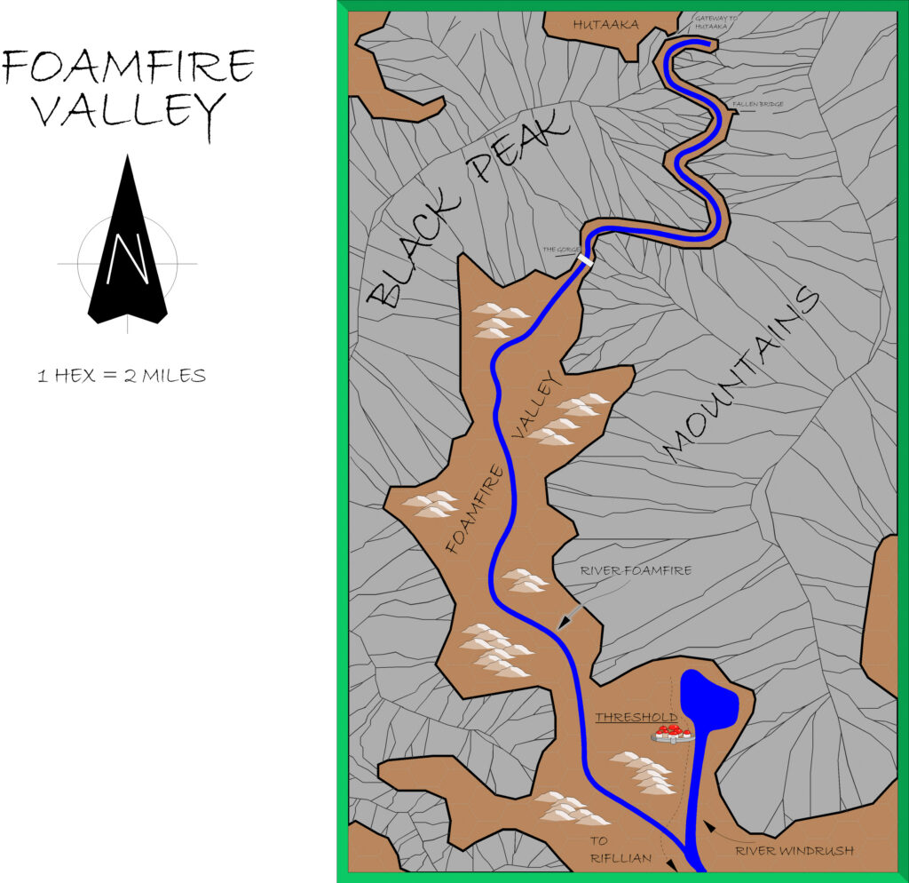
B10 Foamfire Valley, 2 miles per hex
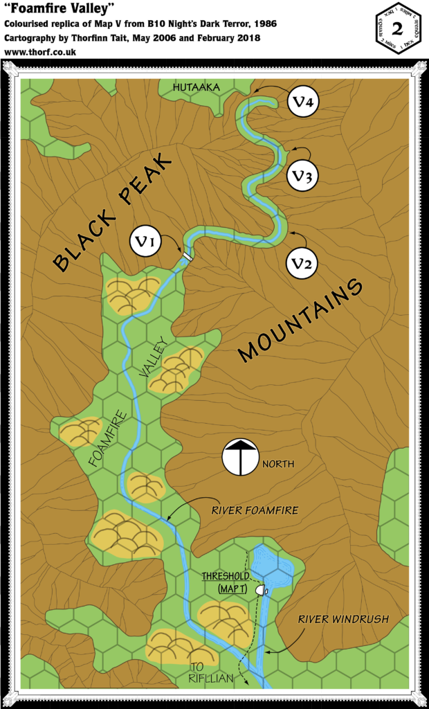
B10 Night’s Dark Terror is surely one of Mystara’s best-loved adventures. It also includes some of the most detailed maps of Karameikos in any official source, even providing ridge lines for the Black Peak Mountains to the north of the realm.
The region was further developed in later modules, as well as of course in GAZ1, which was released the following year.
Replica Map (February 2018)
Sources
- B10 Night’s Dark Terror (1986) (PDF at DriveThruRPG)
- Map V: Foamfire Valley, from B10’s poster map (Cartography by Geoff Wingate)
Chronological Analysis
This is Map 41. It was published in February 1986. The updated version of this map has not yet been released. See also Appendix C for annual chronological snapshots of the area. For the full context of this map in Mystara’s publication history, see Let’s Map Mystara 1986.
The following lists are from the Let’s Map Mystara project. Additions are new features, introduced in this map. Revisions are changes to previously-introduced features. Hex Art & Fonts track design elements. Finally, Textual Additions are potential features found in the related text. In most cases, the Atlas adopts these textual additions into updated and chronological maps.
Additions
- Mountain Passes — The pass leading to the Lost Valley is shown at a new level of detail.
- Terrain — The Foamfire Valley is named here for the first time, and the blanket hills of the smaller scale map are divided up into several clumps on the plains of the valley floor.
Revisions
- Lakes — The lake north of Threshold is shown in more detail, though it remains unnamed.
- Mountains — The ridges of the Black Peaks on this map are slightly different from the other maps, and don’t quite match.
- Rivers — The River Foamfire is shown in more detail.
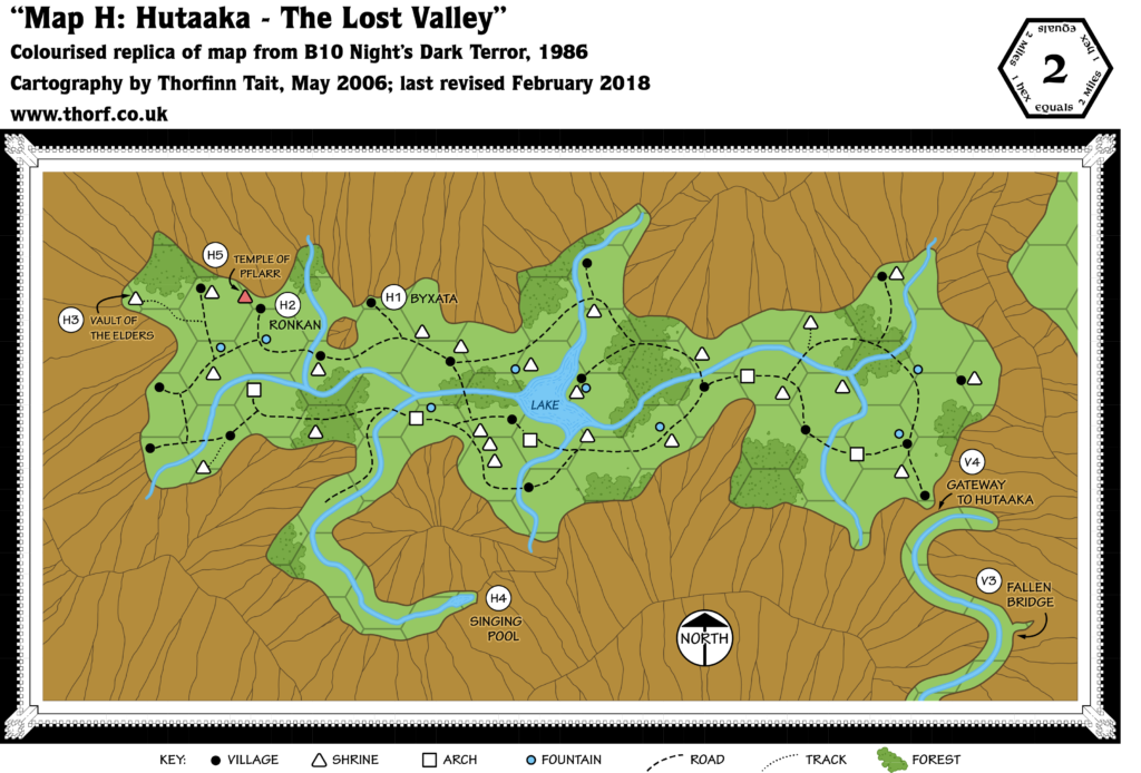
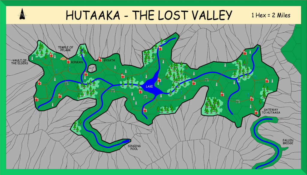
- Terrain — The Lost Valley previously appeared on 6 mile per hex maps, but is here labelled Hutaaka for the first time.
Hex Art & Fonts
- Fonts — Hand-written text in a clear, architect-like style. The replica map uses Tekton Pro.
- New Symbols — Compass Rose (circle with arrow inside, “North” written alongside).
Textual Additions (B10 1986)
Only those references relevant to this map are listed. For the full list, see B10 Eastern Karameikos, 3 miles per hex.
- Bridges — There are four bridges on the path to Hutaaka: two intact, across the Gorge and the High Bridge; and two broken, the Fallen Bridge and before the Gate to Hutaaka.
- History — The Hutaakan Empire “extended over the lands now covered by northern and eastern Karameikos”, “many millennia” ago. Their realm “expanded from the valley of their birth out onto the lowlands”, where they conquered the “primitive human tribe” known as the Traldar. “Hutaakan civilisation flourished both inside and outside the valley. As it was reaching its zenith, the lowlands were invaded by gnoll hordes.” At this point the Hutaakans withdrew to their valley with their human minions. Subsequently, the Traldar revolted, beginning “years of bitter inter-racial warfare” in which “most of the valley’s population perished”. The struggle continues to this day. (All page 4.)
- Lakes — The (still nameless) lake on whose shores Threshold sits has rather different sizes: the 3 mile per hex map has it about 8 square miles, while the 2 mile map has it about 6 square miles, and slightly further north. The Atlas tends to view larger scale maps as the best sources, so I have gone with the smaller lake from the Foamfire Valley map.
- Races — B10 introduces a large range of named tribes and clans — far more than any previous module, and they are far more detailed, too.
- The Death’s Head (Galt-kalat) gnolls (PSVI) claim most of the Foamfire Valley as their territory: “A few miles from Threshold, the route along the Foamfire enters the lands claimed by the Gnolls of the Death’s Head. … Further upstream, the gnolls’ territory ends at a majestic waterfall where the Foamfire crashes down from a narrow mountain pass.” “The lands of the Death’s Head gnolls begin at the point where the Foamfire valley narrows north-west of Threshold.” (Page 40) (See also Lairs above.)
- Rivers — The rivers of Karameikos are quite a focus in B10, with a lot of mentions in the text.
- Foamfire — “The Foamfire river is not navigable by watercraft.” (Page 38)
- Windrush — This river is navigable from Threshold to Rifllian and beyond to Kelven. (Page 32)
- Settlements — Threshold “lies on the shores of a small lake” (page 34), though the town map in Expert 1983 shows that it is slightly removed from the lake; B10’s town map has the lake cropped out entirely as it is more zoomed in on the town itself. (See Analysis below for more on this.) “Built primarily of wood (a major resource in the area), it is home to about 500 humans and 50 demi-humans.” (Page 34) This is exactly in line with previous figures. “Threshold is ruled by … Patriarch Sherlane, from his lakeside castle of Tarnskeep.” (Page 34) Tarnskeep appeared on the Expert map of Threshold.
- Terrain — B10 added a number of features to the by-now-familiar terrain of Karameikos:
- The Lost Valley is also known as the Lost Valley of Hutaaka, and Hutaaka — The Lost Valley. Page 4 even notes that the name of the race is taken from the name of the valley, “where they originated”.
Join in the Discussion at The Piazza
Come and join in the discussion about this map at The Piazza, where I am holding a “read through” of the Let’s Map Mystara project.
Past and Future Versions of this Map



26 June 2021 @ 4:13 am
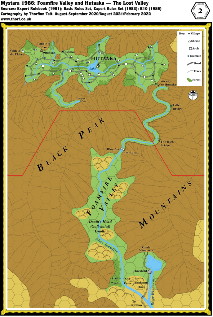
Should the Old Caves where Aleena died be in this area? Is there a map which shows all the cave entrances for the Old Caves area?
10 July 2021 @ 10:35 pm
They should indeed!
Mystara 1986 includes the Old Caves on its updated version of this map.