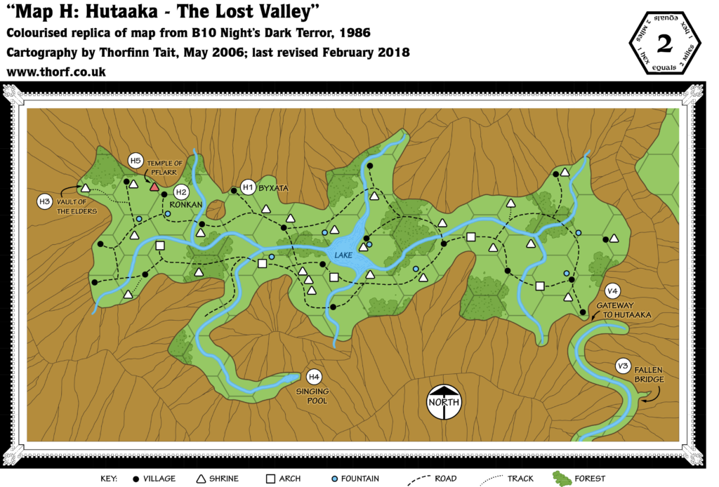
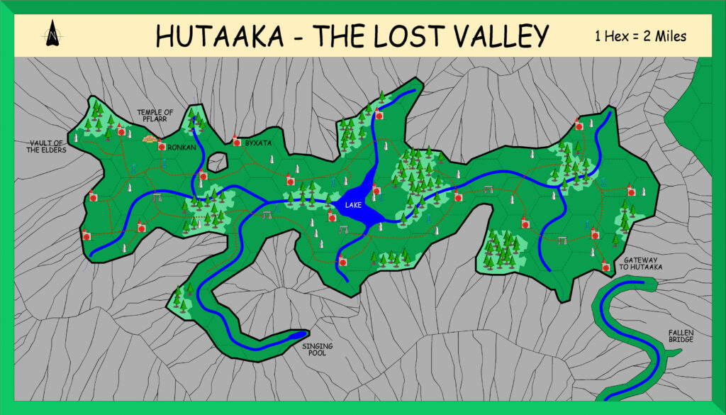
B10 Lost Valley of Hutaaka, 2 miles per hex
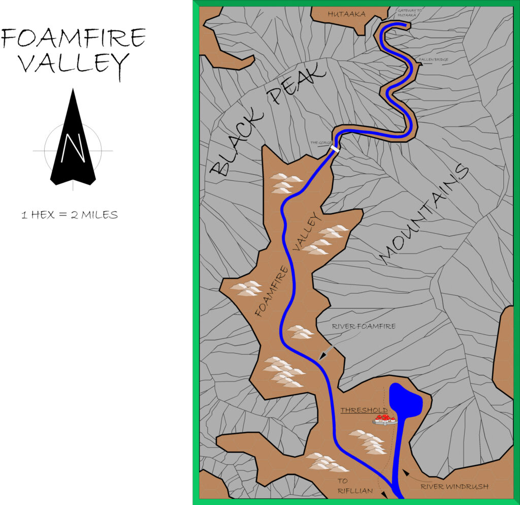
B10 Night’s Dark Terror is surely one of Mystara’s best-loved adventures. It also includes some of the most detailed maps of Karameikos in any official source, even providing ridge lines for the Black Peak Mountains to the north of the realm.
The region was further developed in later modules, as well as of course in GAZ1, which was released the following year.
Replica Map (February 2018)
Sources
- B10 Night’s Dark Terror (1986) (PDF at DriveThruRPG)
- Map H: Hutaaka – The Lost Valley, from B10’s poster map (Cartography by Geoff Wingate)
Chronological Analysis
This is Map 42. It was published in February 1986. The updated version of this map has not yet been released. See also Appendix C for annual chronological snapshots of the area. For the full context of this map in Mystara’s publication history, see Let’s Map Mystara 1986.
Additions
- Lakes — The unnamed lake in the middle of the valley is new here, as is the tiny Singing Pool in a side-valley to the south.
- Mountain Passes — While it’s not exactly a pass, the Gateway to Hutaaka marks the entrance to the valley.
- Rivers — The extensive river network inside the valley appears here for the first time.
- Settlements — Unnamed villages, shrines, arches and fountains appear throughout the valley. The Vault of the Elders and the Temple of Pflarr are named shrines. Ronkan and Byxata appear to refer to villages — likely those closest to their H2 and H1 tags.
- Terrain — The exact shape of the valley and its terrain are detailed here for the first time; previously it has appeared to be all hills.
- Trails & Roads — The whole valley is served by a very efficient system of roads, as well as a single trail in the west.
Revisions
- Mountains — Again, the ridge lines shown on this map do not quite match up with the other maps.
Hex Art & Fonts
- Fonts — Hand-written text in a clear, architect-like style. The replica map uses Tekton Pro.
- New Symbols — Shrine (unfilled triangle with rounded corners; a red-filled triangle seems to represent a Temple), Arch (unfilled square with rounded corners), Fountain (unfilled circle). The Compass Rose is the same as the previous map, but with “North” written inside the circle below the arrow.
Textual Additions (B10 1986)
Only those references relevant to this map are listed. For the full list, see B10 Eastern Karameikos, 3 miles per hex.
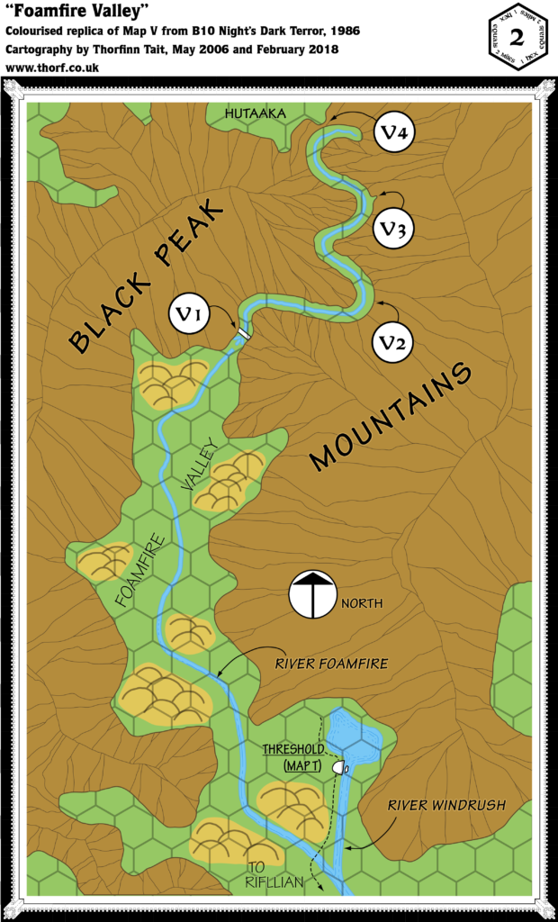
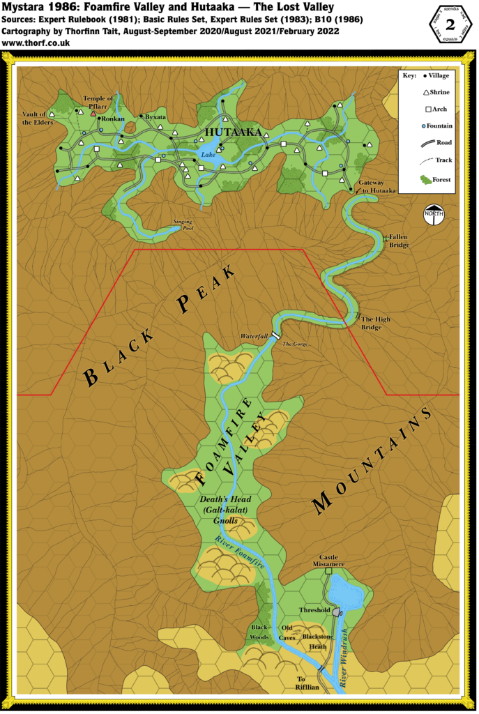
- Bridges — There is a bridge crossing the Syereb River directly west of Sukiskyn; in fact, the homestead is located at a bend in the river (pages 7 and 9). There are four bridges on the path to Hutaaka: two intact, across the Gorge and the High Bridge; and two broken, the Fallen Bridge and before the Gate to Hutaaka.
- History — The Hutaakan Empire “extended over the lands now covered by northern and eastern Karameikos”, “many millennia” ago. Their realm “expanded from the valley of their birth out onto the lowlands”, where they conquered the “primitive human tribe” known as the Traldar. “Hutaakan civilisation flourished both inside and outside the valley. As it was reaching its zenith, the lowlands were invaded by gnoll hordes.” At this point the Hutaakans withdrew to their valley with their human minions. Subsequently, the Traldar revolted, beginning “years of bitter inter-racial warfare” in which “most of the valley’s population perished”. The struggle continues to this day. (All page 4.)
- Terrain — The Lost Valley is also known as the Lost Valley of Hutaaka, and Hutaaka — The Lost Valley. Page 4 even notes that the name of the race is taken from the name of the valley, “where they originated”.
Join in the Discussion at The Piazza
Come and join in the discussion about this map at The Piazza, where I am holding a “read through” of the Let’s Map Mystara project.



22 March 2022 @ 6:47 am
Hi Thorf
You said;
Gnomes’ Ferry is a ferry and hostelry on the Shutturga river run by 5 gnomes (page 41).
That is u know TM1 tables had a note on this same location;
Quote;
Imperial Thyatian Travellers Advisory*
Region; Kelven
Road Cause’ Over-priced service caravanseries
Recommendations; Bring your own spare wagon wheel and food
I learned from a Euro Gencon that the creator of these tables did play B10, and found these gnomes ridiculously expensive (as is explained in B10 page 41)