
B10 Threshold
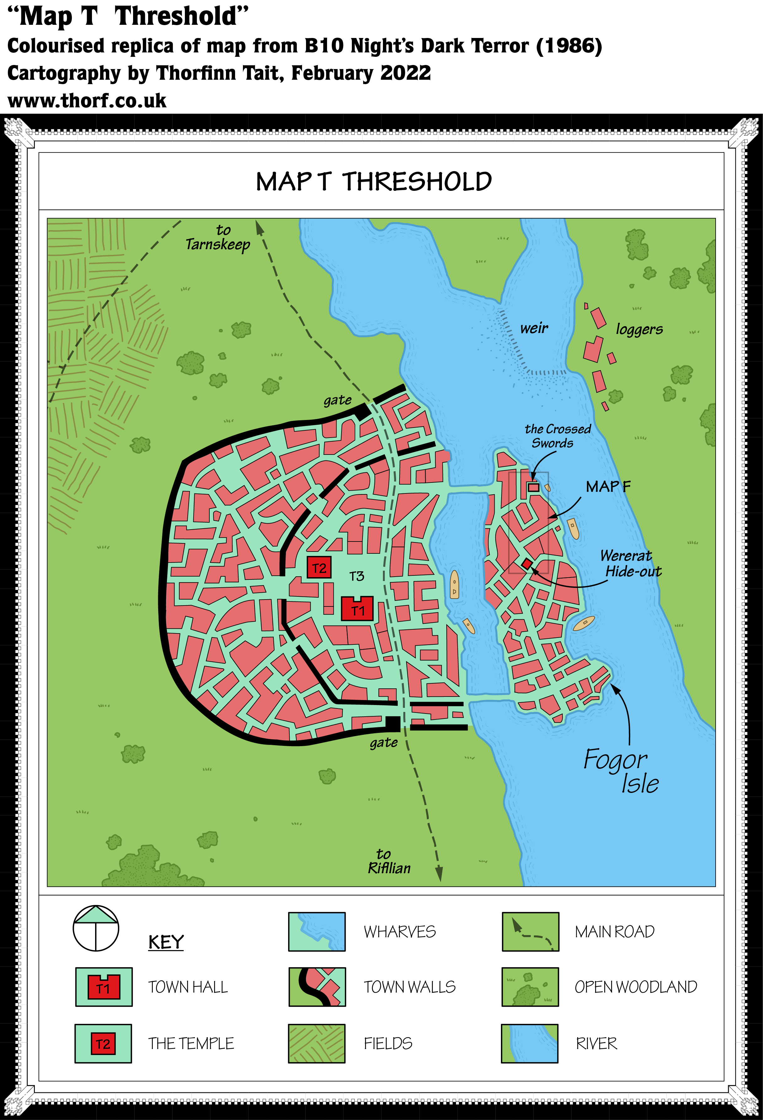
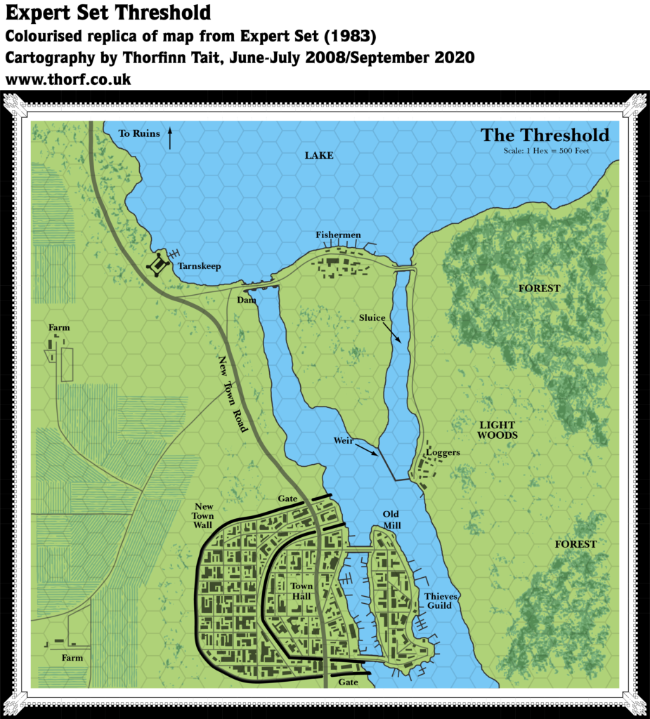
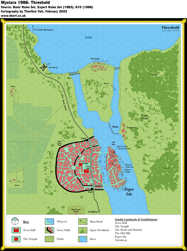
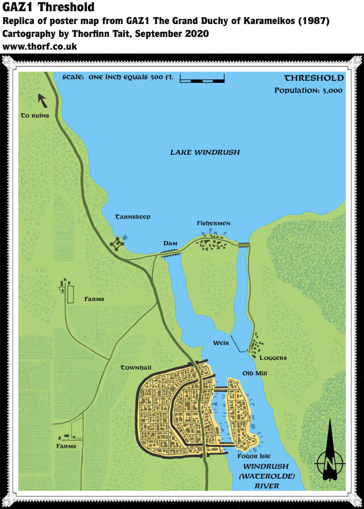
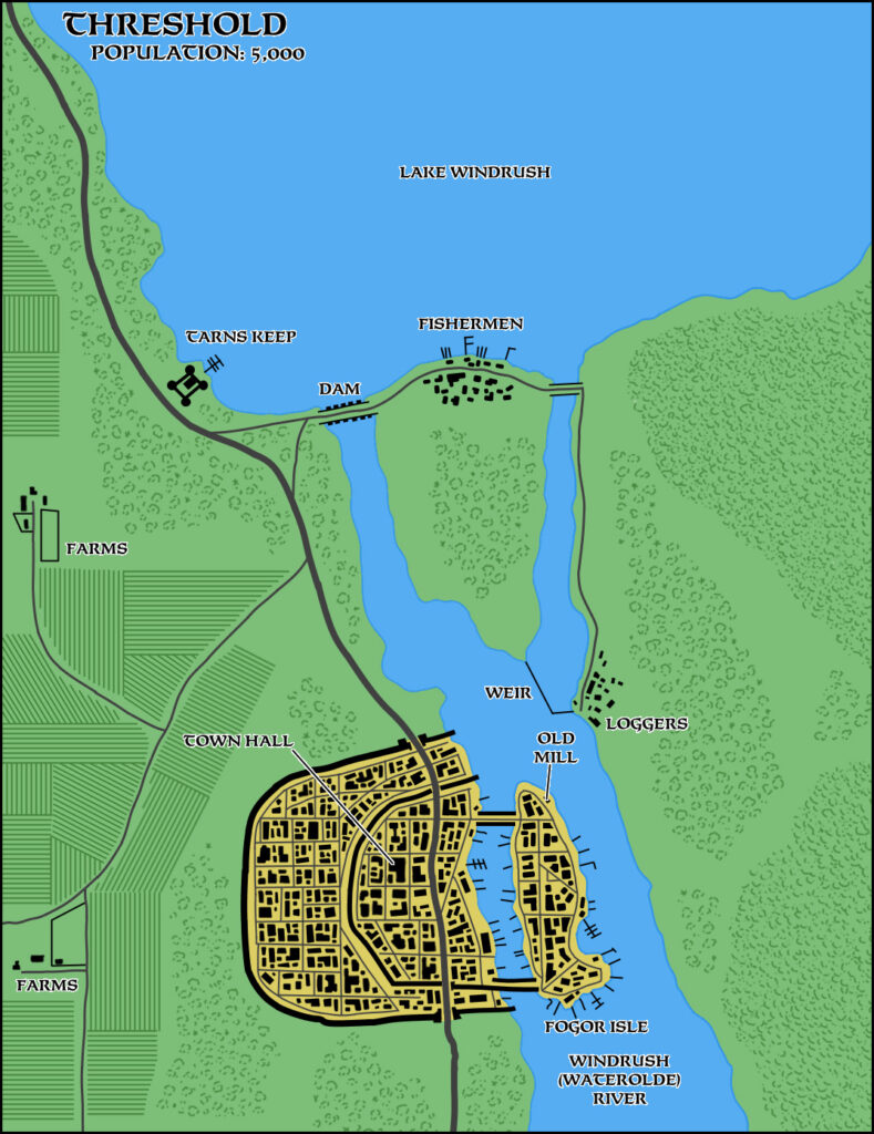
This was the second time for Threshold to be mapped — rather an extravagance considering how few towns had received a map up until this point! Nonetheless, although it retains the same general view as the previous Expert 1983 map, it differs in quite a few details. For one, the framing is rather different, with the north cut off before Tarnskeep and the lake, but the south expanded.
But the biggest change has to be the streets and blocks of the town itself. While the town walls are almost identical, the street layout is completely different: where Expert Threshold was regimented and mostly followed a regular grid pattern, B10’s streets are far more organic. In short, they are incompatible — although that hasn’t stopped fans. In 2021, Robin posted an article merging the two configurations into one map.
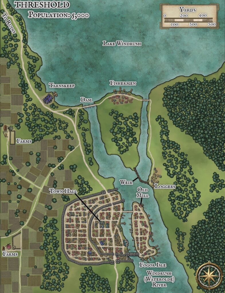
Replica Map (February 2022)
Sources
- B10 Night’s Dark Terror (1986) (PDF at DriveThruRPG)
- Map T on the poster map (Cartography by Geoff Wingate)
Chronological Analysis
This is a town map. It was published in February 1986. The updated version of this map has not yet been released. See also Appendix C for annual chronological snapshots of the area. For the full context of this map in Mystara’s publication history, see Let’s Map Mystara 1986.
The following lists are from the Let’s Map Mystara project. Additions are new features, introduced in this map. Revisions are changes to previously-introduced features. Hex Art & Fonts track design elements. Finally, Textual Additions are potential features found in the related text. In most cases, the Atlas adopts these textual additions into updated and chronological maps.
Additions
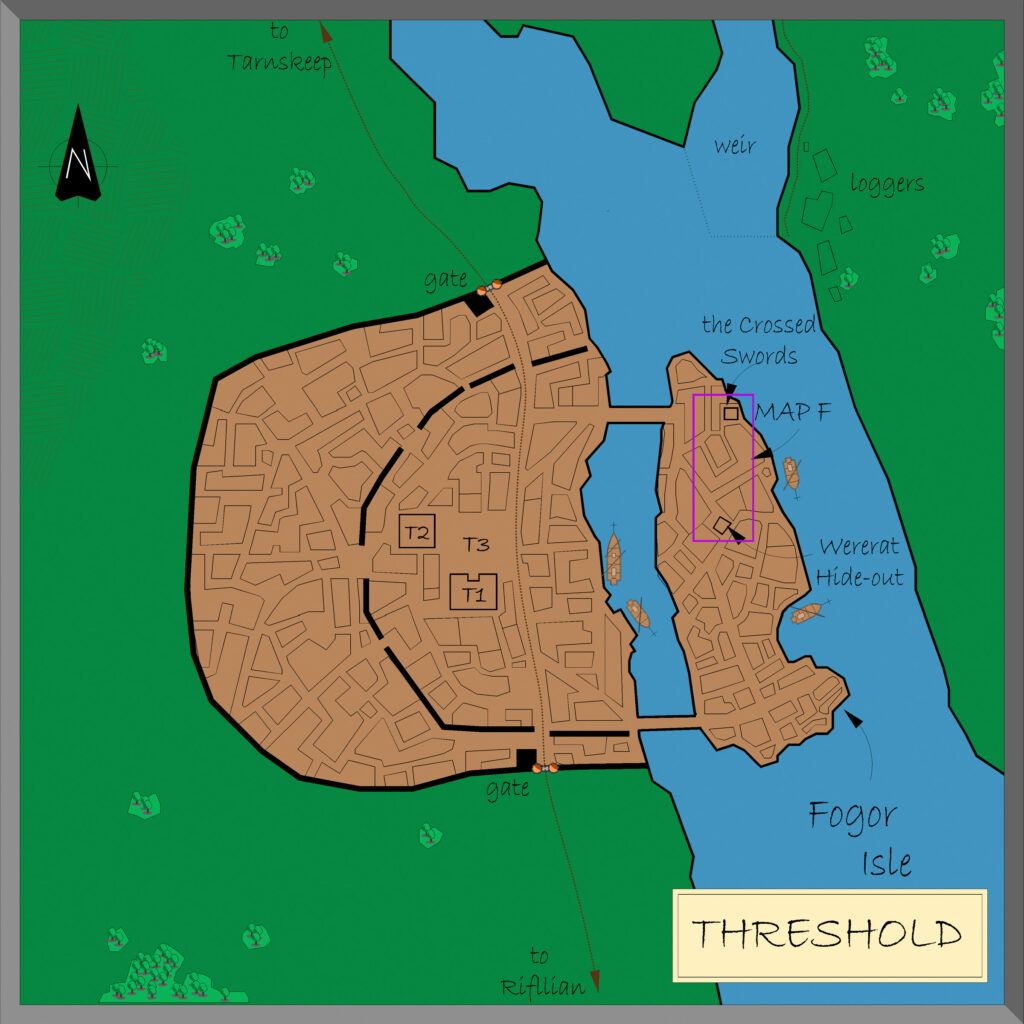
- Features — Fogor Isle and its two named locations, the Crossed Swords and Wererat Hide-out. The Temple is also new.
- Terrain — The entire bottom fifth of the map south of the town is new.
- Trails — The trail leading over the fields to the western edge of the map is new.
Revisions
- Buildings — While the general layout of the walls is the same, the layout of blocks and buildings is radically different from Expert 1983’s, as is the street layout. The location of the Town Hall is about the same, but its shape is completely different.
- Piers — All of the piers and wharves of Expert Threshold are gone, although the key seems to indicate they are to be assumed.
Hex Art & Fonts
- Fonts — Hand-written text throughout. The replica map uses Tekton Pro.
- Art — Hand-drawn, without any particular symbols.
Textual Additions (B10)
Only those references relevant to this map are listed. For the full list, see B10 Eastern Karameikos, 3 miles per hex.
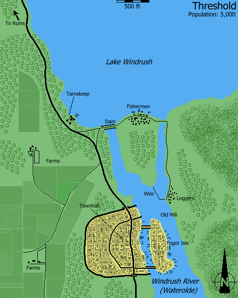
- Threshold “lies on the shores of a small lake” (page 34), though the town map in Expert 1983 shows that it is slightly removed from the lake; B10’s town map has the lake cropped out entirely as it is more zoomed in on the town itself. “Built primarily of wood (a major resource in the area), it is home to about 500 humans and 50 demi-humans.” (Page 34) This is exactly in line with previous figures. “Threshold is ruled by … Patriarch Sherlane, from his lakeside castle of Tarnskeep.” (Page 34) This also matches Expert 1983, where Tarnskeep appeared by the shore of the lake on the map of Threshold.
- Fogor Isle is named for the first time (page 35 as well as poster map).
- Locations within Threshold itself include:
- Cardia’s Carpet Service — outside the town hall. (Page 37) This is another item originally from Expert 1983.
- The Crossed Swords — “a deserted inn on the wharf side of Fogor Isle”, “home to a vicious troll”. Also known as the Inn of the Crossed Swords and the Crossed Swords Tavern. (Page 37)
- Gates — north and south, again the same as Expert 1983.
- Guard Posts — near the two bridges, on the side away from Fogor Isle, as well as at the two town gates. (Page 35)
- Hook and Hatchet Tavern — “by the old town wall”, frequented by the town guard and its leader Sgt. Arthol (page 36).
- Inns — Threshold is said to have many inns, “most streets having at least one.” (Page 36)
- Northbridge — one of two stone bridges linking Fogor Isle to the rest of Threshold. (Page 36)
- Southbridge — not actually named in B10, but this seems the likely name for the second bridge linking the town with Fogor Isle.
- Temple — “an impressive stone building near the town hall”. Always occupied by 20 clerics, with spells up to 4th level available. (Page 37)
- Thieves’ Guild — on Fogor Isle, as in Expert 1983. (Page 36)
- Town Hall — also named on Expert 1983 map, referenced again here. It is “one of the few stone buildings in Threshold”. It houses the Clerical Court, as well as a vault to store valuables. Weapons not allowed inside the town gates (anything but swords and daggers) are also kept here. (Pages 35-37)
- Wererat Hideout — the lair of 4 wererats and an Iron Ring hideout (poster map and page 38).
- Trail — Expert 1983 stated that no trail leads north, despite the New Town Road on the map clearly leading north off the edge of the map. In B10 this is clarified as follows: there is a “trail north-west towards the Black Peak mountains … However, after passing a few outlying farms the trail peters out” and ends “in real wilderness”. (Page 38)
Join in the Discussion at The Piazza
Come and join in the discussion about this map at The Piazza, where I am holding a “read through” of the Let’s Map Mystara project.
")
")
