B3 Gulluvia
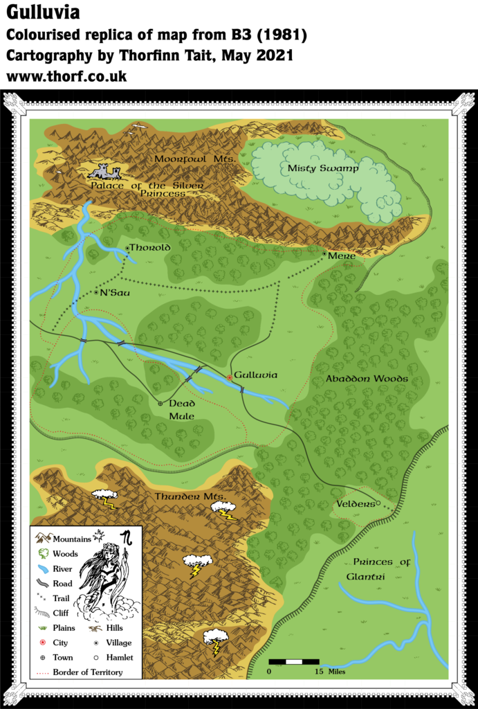
As most of you will already be aware, this map comes from the original, orange-cover version of B3 Palace of the Silver Princess, which was recalled as soon as it was printed. As such, it was pretty much unavailable back in 1981, being replaced by the green-cover version. It only became widely available in 2000, when Wizards of the Coast posted a PDF of it on their web site.
Gulluvia only existed in the orange-cover version of the module. It’s a fascinating map, as it places the nation up on the plateau that later came to be known as the Adri Varma Plateau, right next to Glantri.
Due to the module’s recall and destruction, Mystara’s designers were likely unaware of the nation up on the plateau. But as it happens nothing else was developed for the area. Fan creations added a number of things later, including at least two different adaptations of Gulluvia to the plateau: Michele Carpita’s adaptation in 2006, which Francesco Defferrari expanded into a more detailed version later the same year; and Andrea Barbiero’s in 2016, which placed the map more literally, adapting it to an 8 mile hex map.
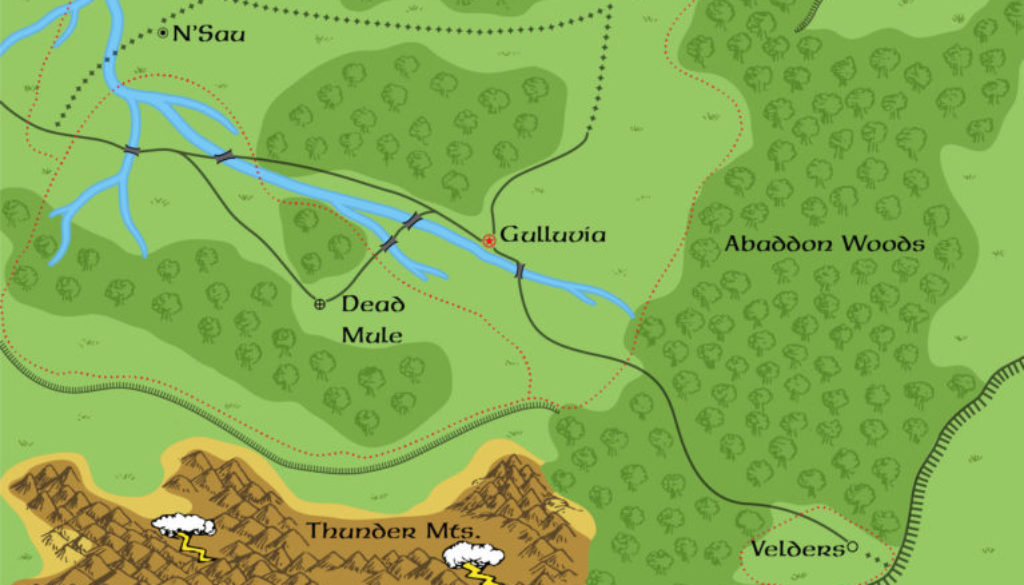
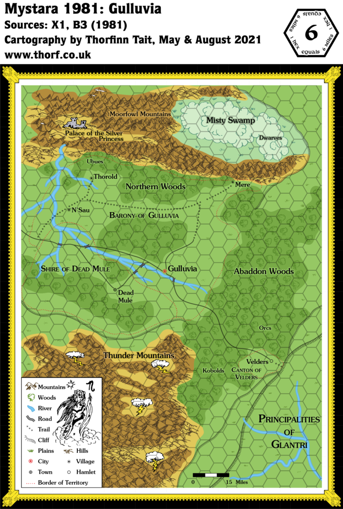
Replica Map (May 2021)
Sources
- B3 Palace of the Silver Princess (1981) (PDF at Vaults of Pandius)
- Map on page 5 (Cartography by Jean Wells)
Chronological Analysis
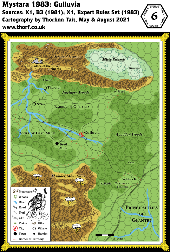
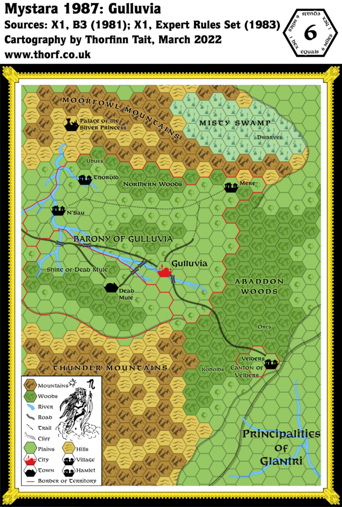
This is Map 6. It was published in 1981, although since B3 was recalled almost immediately, it didn’t become widely available until 2000. The updated version of this map has not yet been released. See also Appendix C for annual chronological snapshots of the area. For the full context of this map in Mystara’s publication history, see Let’s Map Mystara 1981 and Placing B3’s Gulluvia map.
The following lists are from the Let’s Map Mystara project. Additions are new features, introduced in this map. Revisions are changes to previously-introduced features. Hex Art & Fonts track design elements. Finally, Textual Additions are potential features found in the related text. In most cases, the Atlas adopts these textual additions into updated and chronological maps.
Additions
- Borders — Gulluvia, Dead Mule, and Velders are all encompassed by borders.
- Bridges — Four bridges are depicted on the river system between Gulluvia, N’Sau, and Dead Mule.
- Mountains — The Moorfowl Mountains lie north of Gulluvia, while the Thunder Mountains are to the south. These two ranges bracket the rest of the map.
- Nations — It’s not clear from the map whether the borders indicate nations or dominions, though Gulluvia’s use of the “capital” symbol (here noted as “city”) suggests it is the principal settlement of the area. It’s also not clear if this are is intended to be part of the Princes of Glantri, or a separate nation or group of states.
- Plateaus — Two more plateaus/cliffs are added to the top of the plateau: one south of Dead Mule, atop which the Thunder Mountains stand; the other northwest of Mere and the Misty Swamp, forming a ridge around those areas.
- Rivers — An extensive river system runs through the map, although it’s not at all clear where it is running to; indeed, it appears that the rivers start in the plains and join together until they flow into the valley of the Palace of the Silver Princess — in other words up into the mountains. It’s a rather strange river system.
- Settlements — Gulluvia is a city, apparently the chief city of its region, which includes three villages: N’Sau, Thorold, and Mere. Southwest of Gulluvia is the town of Dead Mule. Finally, a hamlet called Velders sits near the edge of the plateau. Finally, the Palace of the Silver Princess is a ruined castle in a valley northwest of Thorold.
- Terrain — Aside from the Misty Swamp near Mere, the map includes extensive forests, of which only the forest surrounding Velders on the edge of the plateau is named, Abaddon Woods.
- Trails & Roads — A trail leads from Velders to the edge of the plateau, suggesting that this hamlet may be the gateway between this region and Glantri. Roads lead west from Velders, to Gulluvia and then on to the west, taking in Dead Mule in a side loop on the way. It’s not clear what lies at the end of the road further west. The three smaller villages are linked to the roads by a network of trails.
Revisions
- Terrain — The main revision in this map is the terrain on top of the plateau, which was depicted as empty plains on X1’s map.
Hex Art & Fonts
- Fonts — Neue Hammer Unziale, with Souvenir in the legend.
- New Symbols — The map was hand-drawn. It includes a new symbol for Towns (circle with a cross inside), hand-drawn little Bridges, and Thunder Clouds for the Thunder Mountains. Finally, there is a custom Ruined Castle symbol for the Palace of the Silver Princess.


Textual Additions (B3 1981)
- History — Page 7 mentions the Silver Princess, Argenta, as having looked very fair “nearly 500 years ago”, placing the destruction of her domain in the distant past; page 2 details the whole story as a “distant legend”. It also states that half of her palace was destroyed in an accident caused by one of her magic-users.
- Mines — Pages 2 and 4 both mention dwarven mines in the Moorfowl Mountains, once yielding silver and rubies for the Silver Princess, but now “barren and not worth working”.
- Nations — Page 2 states that the area shown on the map is part of “the land of the Princes of Glantri”. It defines the borders on the map as follows: Gulluvia is a Barony; Dead Mule is a Shire, once independent but now “occupied by Gulluvian soldiers”; Velders is a Canton under the protection of Gulluvia (page 4).
- Races — Dwarves in the Misty Swamp: “the dwarves who make Anterian Brandy live in the swamp near their secret ingredient, the swamp water.” (Page 4) Ubues live in the northern woods. (Page 7) Orcs and kobolds often raid Velders. (Page 4)
- Rulers — Lady D’hmis is the Baroness of Gulluvia (pages 4 and 7). Dead Mule and Thorold are said to have mayors, but no NPCs are named; Thorold’s mayor is “a distant cousin” of D’hmis. (Page 4)
- Settlements — Gulluvia is “a ruthless place filled with terror”, a “chaotic nightmare” with arbitrary laws that are brutally enforced. Dead Mule “was once a peaceful place, named by the group of miners who settled here after their pack mule died”; now it is “occupied by Gulluvian soldiers”. N’Sau is a “small farming village” — so small that it doesn’t even have a tavern or inn — “still untouched by the cruel hand of D’hmis”. Thorold is a “lovely little village” that raises “the best thoroughbred horses in all of Glantri”, and is “rather large” for a village. Mere is “primarily inhabited by halflings”, though the other three major races are also present. It is “under the protection of Gulluvia”, though it’s generally avoided due to its proximity to the Misty Swamps, and as such is a way station for “escaped slaves and prisoners” fleeing from D’hmis. It is between N’Sau and Thorold in size. Velders is cut off from Gulluvia by the dangerous Abaddon Woods, houses a trading post, and suffers from orc and kobold raids. (All page 4)
- Terrain — The Misty Swamp has a peculiar effect on magic, and is inhabited by various dangerous creatures. The Moorfowl Mountains are an “ugly, dead, tall range” that “forms a protective shield that keeps the mist from Misty Swamp from spreading”, suggesting that the Misty Swamp occupies the entire bowl between the Moorfowl Mountains and the cliff to the northeast. Where once dwarves delved for the silver princess, now evil creatures roam, and the mines are exhausted. The Abaddon Woods, once a haven for good woodland creatures, is now “a desolate place” filled with evil beings.The Thunder Mountains are “low pine-covered mountains” that see little sunlight because they are usually covered with “thick storm clouds”. “An evil wizardess is rumored to live in the mountains in a giant hollow oak she uses as a lab.” She is believed to be behind the constant storms. (All page 4) The woods in the north of the map are referred to as “the northern woods” (page 7); this may not be an actual name, but it has been added to the map nonetheless.
See also this post at the Atlas of Mystara Patreon for a more in-depth analysis by Travis Henry. Thanks, Travis!
Join in the Discussion at The Piazza
Come and join in the discussion about this map at The Piazza, where I am holding a “read through” of the Let’s Map Mystara project.

