
B6 Specularum
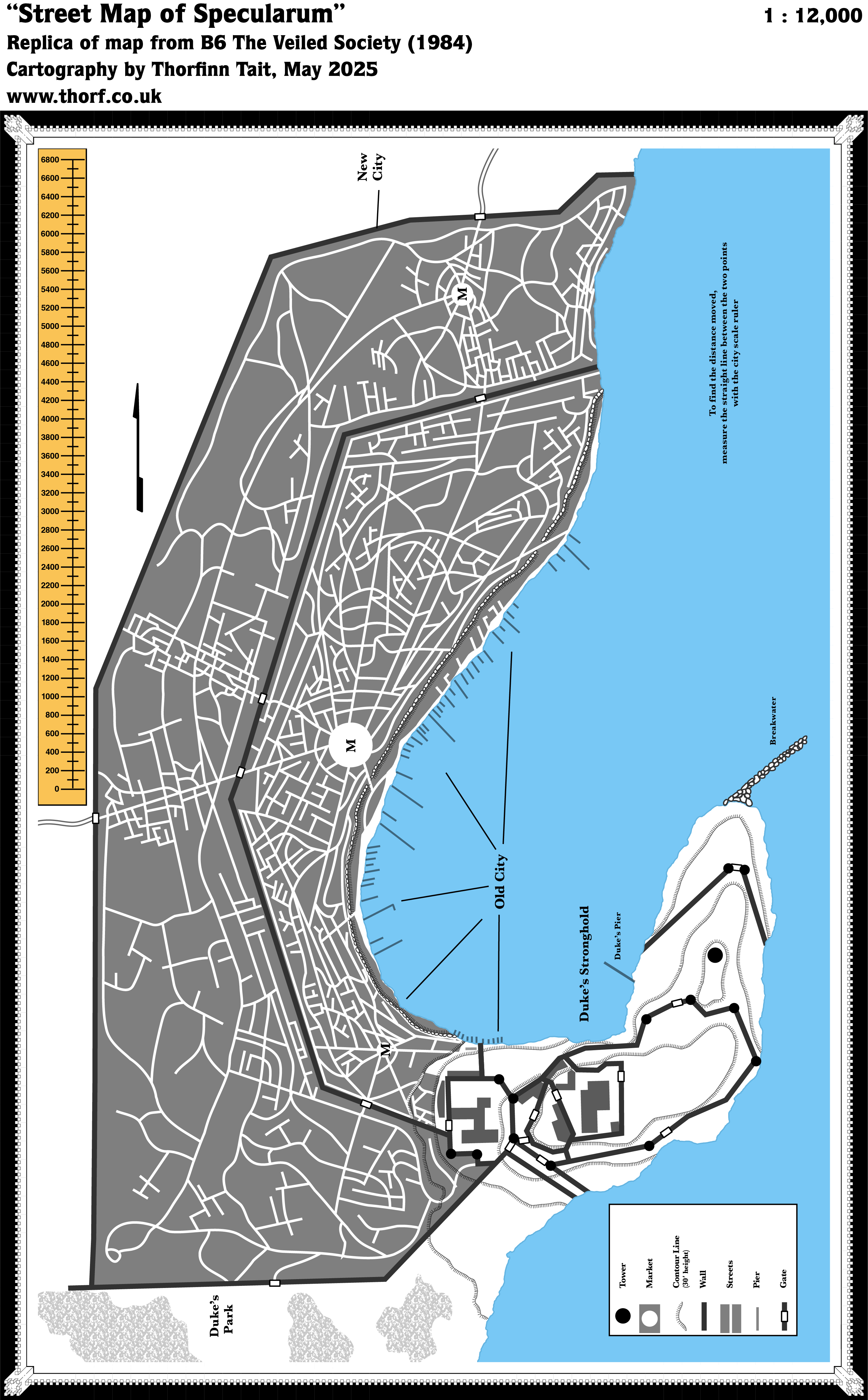
The first map of the city of Specularum appeared in module B6, in 1984. It showed a large urban area with hundreds of streets crowded around a large bay. The city was divided into the Old City, with a dense network of small streets, and the New City, with large meandering avenues and the occasional cluster of crisscrossed streets. A wall encompassed the New City, with an older wall fencing in the Old City inside it. Both cities featured central markets (marked M) upon which the surrounding roads converged.
The Duke’s Stronghold lay on a hill on the promontory to the east, bordering the city but apart from it.
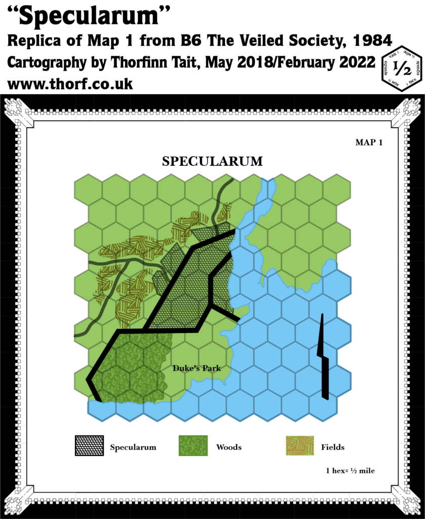
This configuration also appeared in the same module’s Specularum, 0.5 miles per hex map, although the two depictions only matched in a general sense.
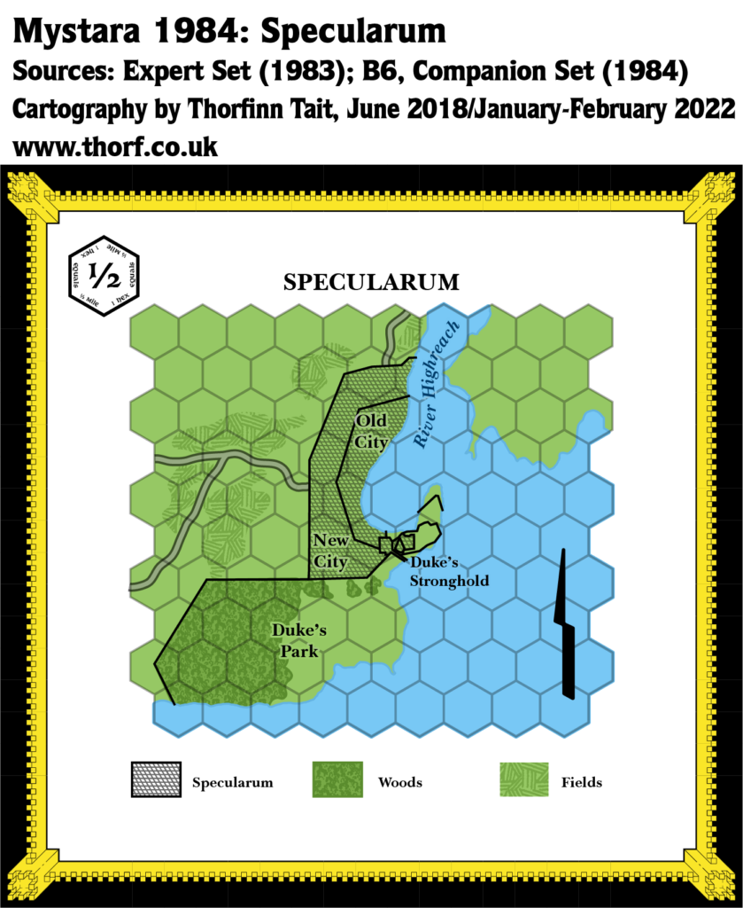
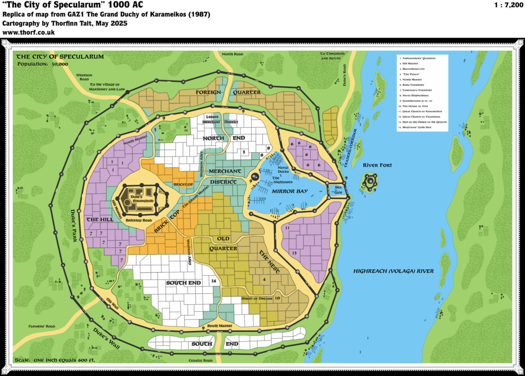
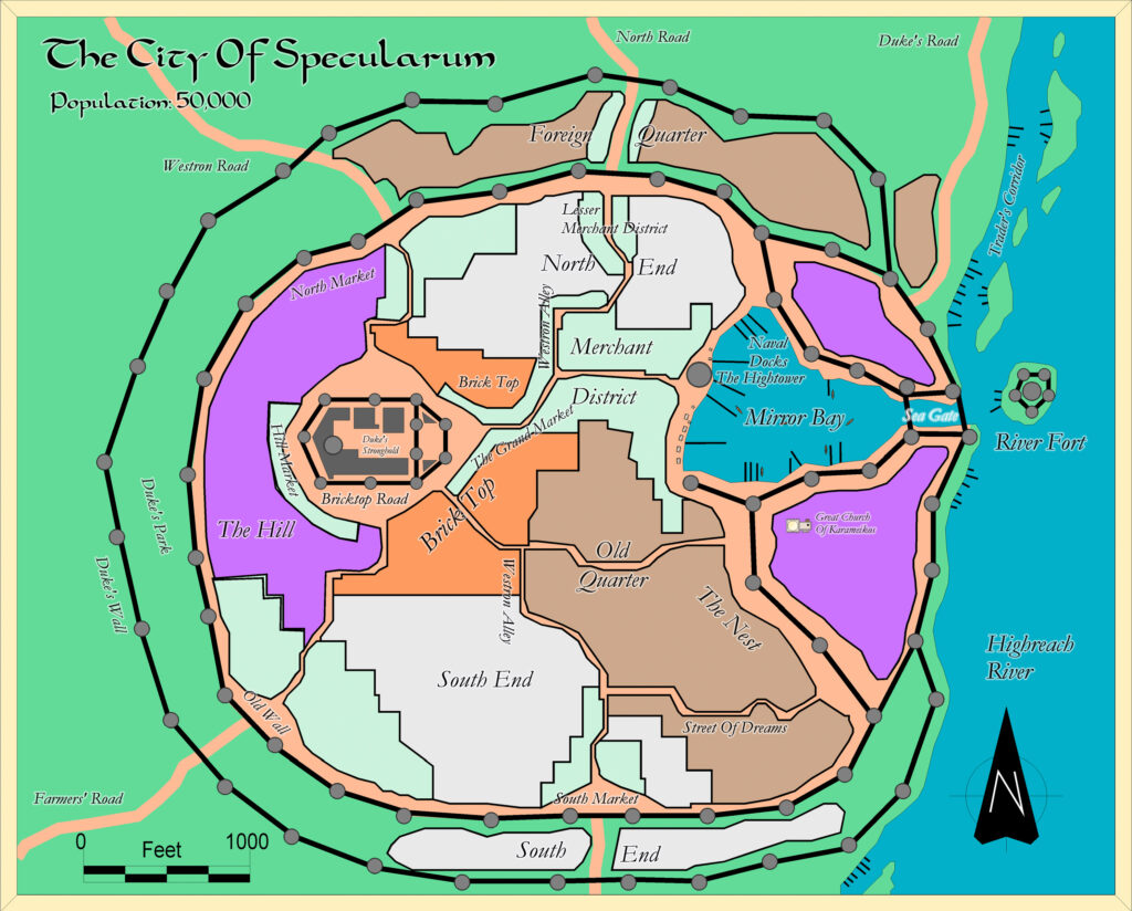
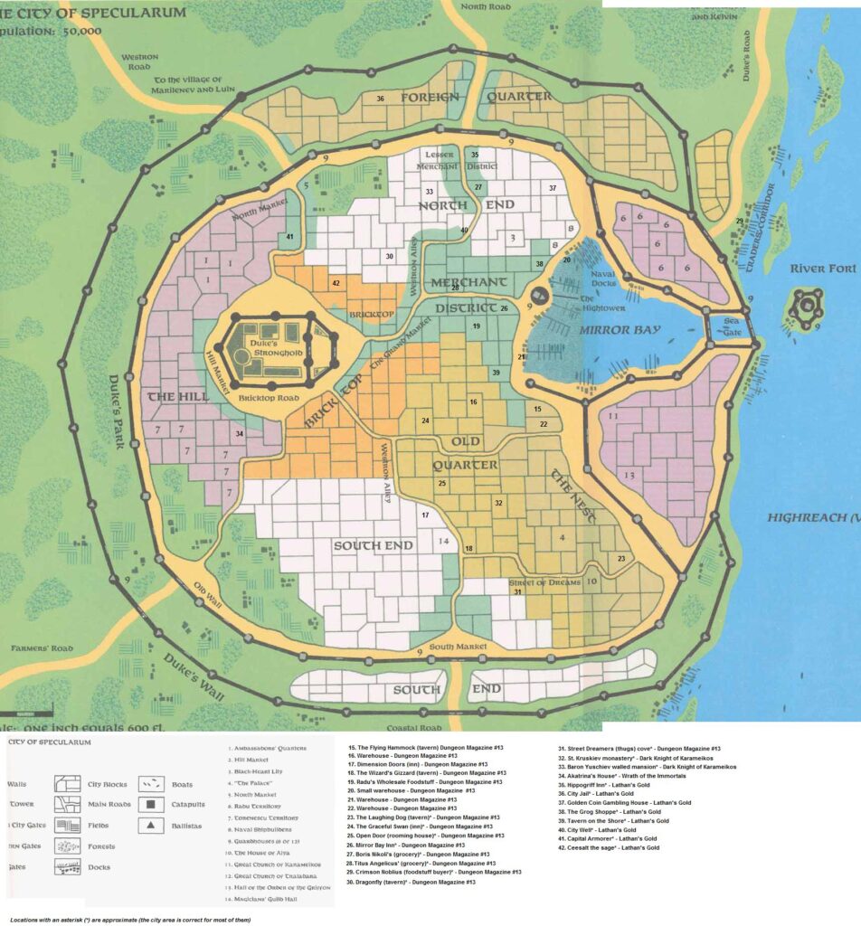
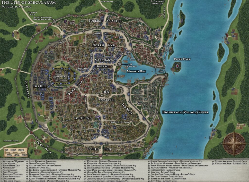
Specularum was remapped in 1987’s GAZ1, which presented a radically different map.
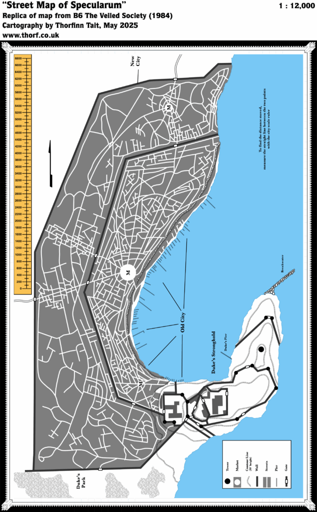
Replica Map (May 2025)
Sources
- B6 The Veiled Society (1984) (PDF at DriveThruRPG)
- Inside cover map, Cartographer Unknown
References
- New Map: B6 Specularum post at Patreon
Chronological Analysis
This is a Town Map. It was published in 1984. The updated version of this map has not yet been released. See also Appendix C for annual chronological snapshots of the area. For the full context of this map in Mystara’s publication history, see Let’s Map Mystara 1984.
The following lists are from the Let’s Map Mystara project. Additions are new features, introduced in this map. Revisions are changes to previously-introduced features. Hex Art & Fonts track design elements. Finally, Textual Additions are potential features found in the related text. In most cases, the Atlas adopts these textual additions into updated and chronological maps.
Under Construction! Please check back again soon for updates.
Additions
- XXX —
Revisions
- XXX —
Hex Art & Fonts
- Hex Art —
- Fonts —
Textual Additions (B6, 1984)
- XXX —
")

