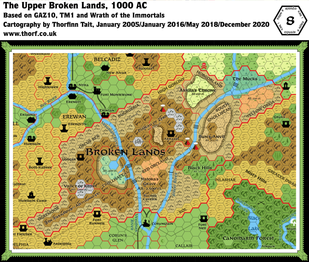
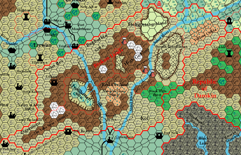
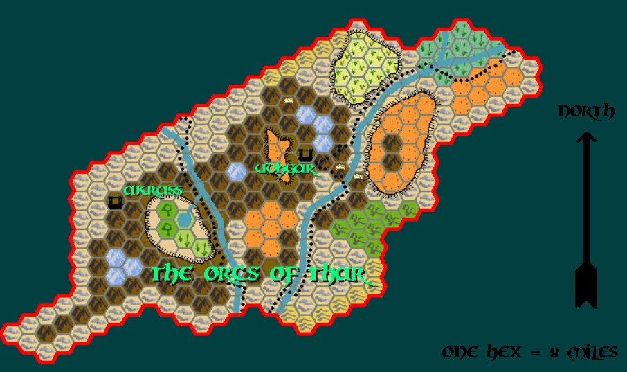
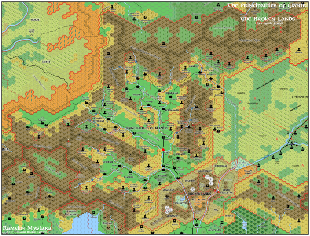
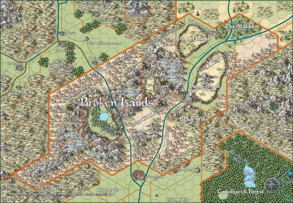
Broken Lands, 8 miles per hex
Covering a region of rugged hills, mountains, and narrow canyons near the centre of the Known World, the area is thought to be abandoned by civilisation. Few humans and demi-humans ever venture any distance from the treacherous merchant tracks along the Vesubia and Streel Rivers, but the Broken Lands are far from deserted.
Although the rugged surface may be baked by the sun of summer and frozen by the winds of winter, many are its inhabitants. These are denizens of the depths, nomadic hordes of darkness, and fierce caravan raiders. They are the Hordes of Thar.
from GAZ10 The Orcs of Thar, by Bruce Heard
Map (December 2020)
Sources
- GAZ10 The Orcs of Thar (1989) (PDF at DriveThruRPG)
- GAZ12 The Golden Khan of Ethengar (1989) (PDF at DriveThruRPG)
- TM1 The Western Countries (1989)
- Rules Cyclopedia (1991) (PDF at DriveThruRPG)
- Wrath of the Immortals (1992) (PDF at DriveThruRPG)
Comments
The real Broken Lands of course lay beneath the surface, but the Upper Broken Lands have their fair share of interest, too. There’s quite a variety of terrain in the relatively small space occupied by this humanoid enclave between civilised lands.
Notes
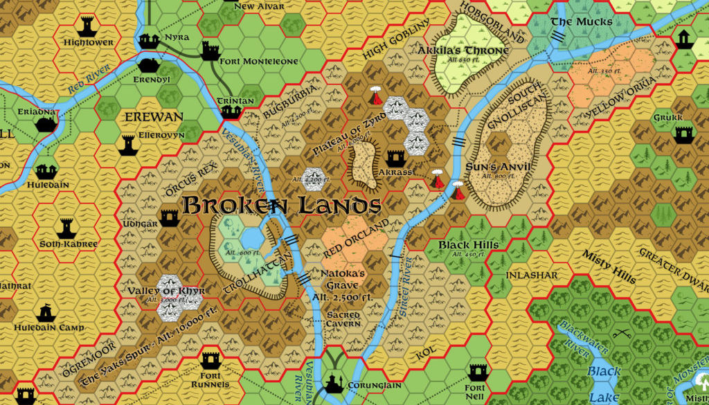
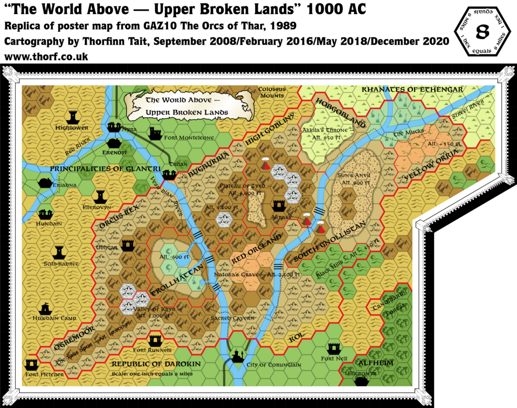
- Altitude markers — two markers present in GAZ10 were missing from TM1.
- Blank hexes — a number of hexes were coloured but left symbol-less on GAZ10’s map. These were corrected on TM1.
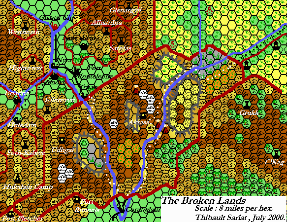
- Broken Lands trail — the trail leading into the Broken Lands from Ethengar was reduced to a straight line on GAZ12’s poster map. This simplification unfortunately later crept into TM1, causing further errors. The eastern trail even has a part missing where the trail crosses the volcanoes. The updated map reverts to GAZ10’s trails.
- Dol-Anur River — a greater cataract was added on TM1. The updated map includes it.
- Streel River — on TM1, the southern cataract was reduced from GAZ10’s greater to lesser. For the sake of variety, the Atlas has gone with the lesser cataract.
- Trintan — this Glantrian village bordering Bugburbia was misspelled “Tritan” on GAZ10’s poster map.
- Trollhattan swamps — the single tree swamp icon has been replaced with the Atlas‘s swamp icon, splitting Trollhattan’s swamps into two swamp and two marsh hexes.
- Vesubian River — the southernmost run-off into Trollhattan was missing from TM1. Additionally, two of the three greater cataracts shown on GAZ10’s map were missed out.

10 May 2016 @ 11:57 pm
With the utmost respect I have to say there seems to be a minor mapping flaw in this map you have taken over from later canon maps. As seen on the older maps (gazetteer) there was never a waterfall in the Mucks (NE broken lands) not only is this illogical, (as swamps are stagnant or soft flowing water, but the older maps do not give this feature.
How that crept in the canon series I do not know, yet it seems a flaw nobody noticed.
Hope you can do something with this information.
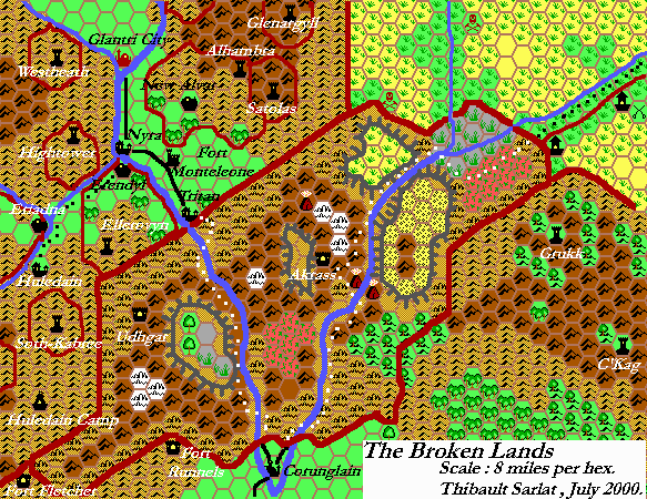
I am currently working on a 1 mile map of the Broken lands, Where I remove this flaw, and repair several others. I am hoping for some of your expert opinion about this.
Read more in my post of 1 mile hex mapping on Piazza.
http://www.thepiazza.org.uk/bb/viewtopic.php?f=3&t=15023&start=25
28 October 2016 @ 7:19 am
Hi Thorf
As promised the Eastern half of the 1 hex mile map is finished.
http://breathofmystara.blogspot.nl/2016/10/1-mile-hex-map-eastern-half-of-broken.html
Hope you’ll like it.
Love to hear your reflection, as you being the Great mapping master 😉