Champions of Mystara Ulimwengu
Champions of Mystara didn’t just reprint The Voyage of the Princess Ark series; it also provided new details of countries in the Great Waste and Serpent Peninsula area. Of course this meant Sind and Yavdlom, both of which had been introduced much earlier but with little detailing. But Ann Dupuis also created two completely new nations: Graakhalia and Ulimwengu.
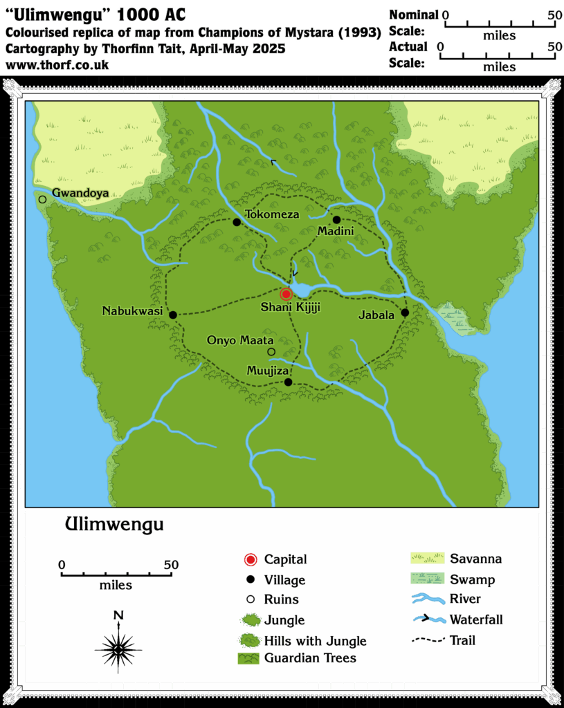
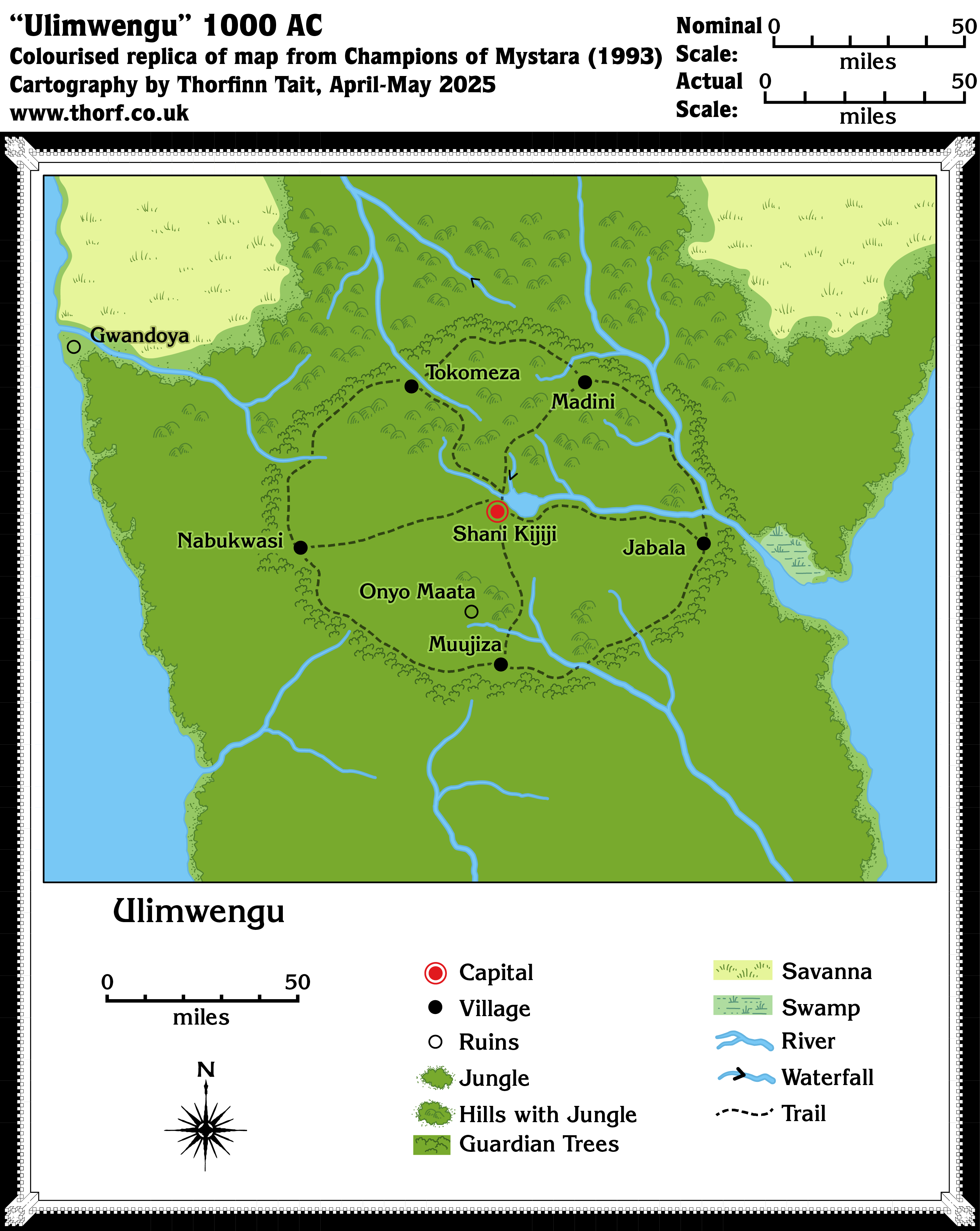
This is one of two maps of Ulimwengu. The other was a town map of its capital, Shani Kijiji. Since Ulimwengu is a hidden country, only its border appeared on the 24 mile per hex Serpent Peninsula map. This map, which did not have hexes, is nonetheless the equivalent of an 8 mile per hex map of the nation.
As we would expect from a product so late in Mystara’s publication history, the map lines up rather well with the other maps in Champions of Mystara.
Replica Map (May 2025)
Sources
- Champions of Mystara (1993) (PDF at DriveThruRPG)
- Explorer’s Manual, page 49 map (Cartography by Diesel, John Knecht)
Chronological Analysis
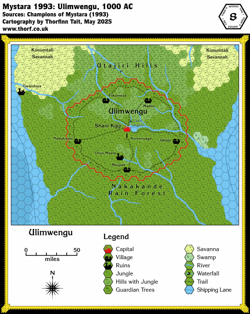
This is Map 237. It was published in October 1993. The updated version of this map has not yet been released. See also Appendix C for annual chronological snapshots of the area. For the full context of this map in Mystara’s publication history, see Let’s Map Mystara 1993.
The following lists are from the Let’s Map Mystara project. Additions are new features, introduced in this map. Revisions are changes to previously-introduced features. Hex Art & Fonts track design elements. Finally, Textual Additions are potential features found in the related text. In most cases, the Atlas adopts these textual additions into updated and chronological maps.
Additions
- Lakes — A small lake in the approximate centre of Ulimwengu.
- Rivers — There are more rivers than were shown on the 24 mile per hex map, both entirely new rivers as well as new tributaries. The two waterfalls are also new.
- Settlements — Jabala, Madini, Muujiza, Nabukwasi, Onyo Maata, Shani Kijiji, Tokomeza are all new on this map. Onyo Maata is ruins, while Shani Kijiji is a capital; the rest are all villages.
- Terrain — The small unnamed swamp in the east is new, as are the small areas of hills in the south and east of Ulimwengu.
- Trails — All the trails here are new.
Revisions
- Spelling — The ruins of Gwandoya also appeared on the 24 mile per hex map, where the name was spelled Gwondoya. As the former means “met with misery” in Luganda, this map’s Gwandoya is likely the correct spelling.
Hex Art & Fonts
- Art — Hand-drawn art using conventional symbols. The original map was black and white.
- Fonts — Korinna throughout.
Textual Additions
- Features — Kereenyaga, the Rock of Mystery, also known as Ulimwengu’s Heart and Lightning’s Child, “stands at the exact centre of the ring of Guardian Trees”. It is a 100’ granite spire located “just five miles south by southwest of Shani Kijiji”. (All Explorer’s page 64)
- Lakes — Lake Utajiri is mentioned in the text, as well as on the Shani Kijiji city map (Explorer’s pages 48, 50).
- Settlements — The meanings of Ulimwengu’s settlement names is given in detail (Explorer’s page 48).
- Spelling — The map’s Onyo Maata is Onyo Maafa in the text (Explorer’s page 48). Since the latter means “disaster warning” in Swahili, the text spelling is likely the correct one.
- Terrain — The hills are known as the Utajiri Hills (Explorer’s page 48).
Analysis
The scale as marked makes this look like it is the equivalent of an 8 mile per hex map. I have therefore scaled my replica so that it is the same resolution as my 8 mile per hex maps. Matching up with the 24 mile per hex map gives a good fit, with the scale ruler ending up at just under 48 miles rather than the 50 marked. This seems like a very reasonable margin for error.