Christian’s Nine Kingdoms, 1950 BC
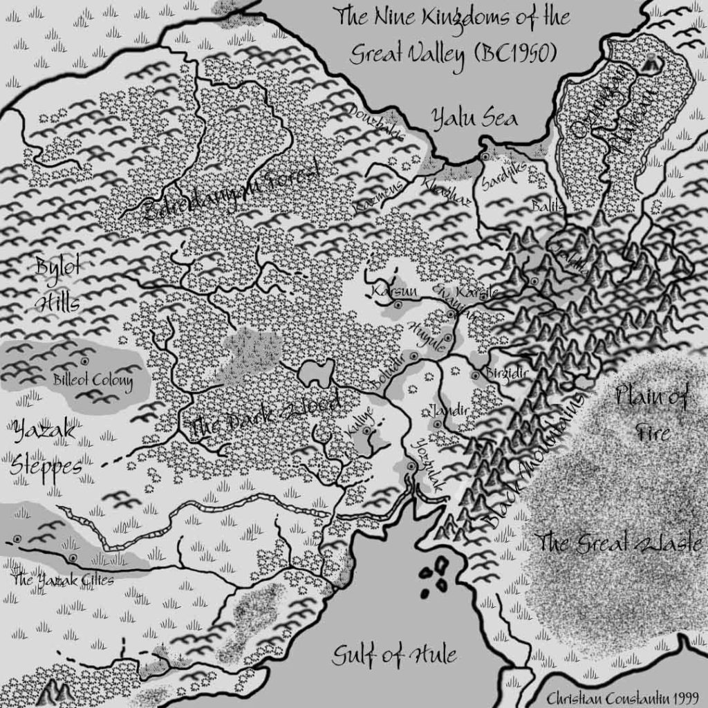
Of the four maps Christian posted to kick off his Hule project on the Mystara Mailing List, only one was a hex map; the other three were historical maps showing the extent of the Hulean Empire at various stages of its history.
The first of the three showed porto-Hule way back in 1950 BC, almost 3,000 years before the present day of the Gazetteer series. At this stage, it wasn’t even known as Hule yet, although of course the familiar terrain was already present. The main feature of the map is the Great Valley, in which some early cities were growing.
It’s great that Christian went to the effort of developing these maps, as they provide a very welcome view into Mystara’s past — something that has become gradually more and more popular in the years since.
Fan-made Map by Christian Constantin (May 1999)
This is an original map created by one of Mystara’s excellent fan cartographers. For more information on the cartographer, including a gallery of all their maps, see also Appendix M: Mappers of Mystara.
Sources
- X4 Master of the Desert Nomads (1983) (PDF at DriveThruRPG)
- X5 Temple of Death (1983) (PDF at DriveThruRPG)
- Companion Rules Set (1984) (PDF at DriveThruRPG)
- Master Rules Set (1985) (PDF at DriveThruRPG)
- Hollow World Campaign Set (1990) (PDF at DriveThruRPG)
- Outer World Planetary Map
- Champions of Mystara (1993) (PDF at DriveThruRPG)
Secondary Sources
References
- Christian’s entry in Appendix M: Mappers of Mystara
- Christian’s author page at the Vaults of Pandius
Chronological Analysis
This is a fan-made map. It was published in 1999. The updated Atlas version of this map is not yet available. See also Appendix C for annual chronological snapshots of the area. For the full context of this map in Mystara’s publication history, see the upcoming Let’s Map Mystara 1999. (Please note that it may be some time before the project reaches this point.)
The following lists are from the Let’s Map Mystara project. Additions are new features, introduced in this map. Revisions are changes to previously-introduced features. Hex Art & Fonts track design elements. Finally, Textual Additions are potential features found in the related text. In most cases, the Atlas adopts these textual additions into updated and chronological maps.
Coming Soon


