CM1 Norwold, 24 miles per hex
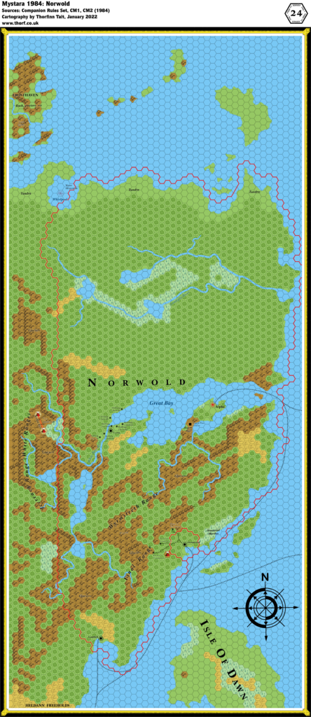
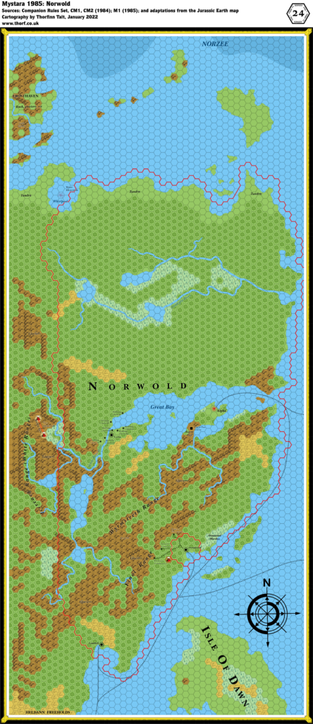
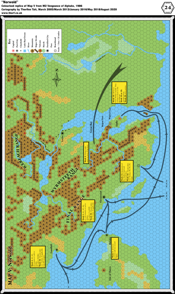
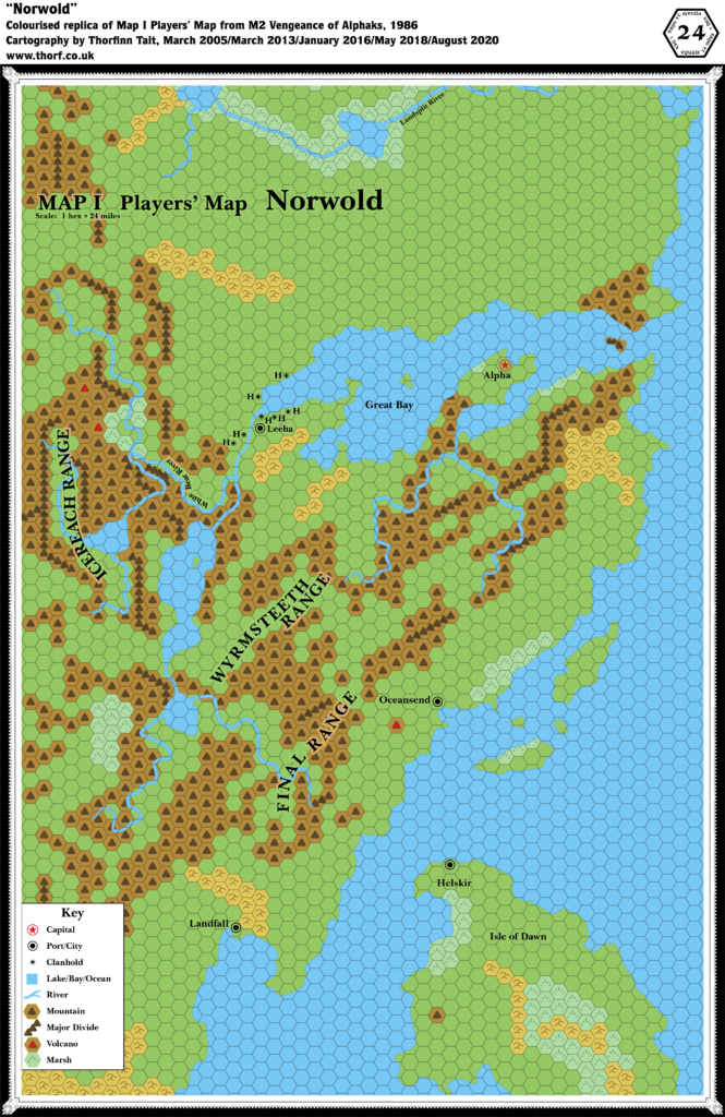
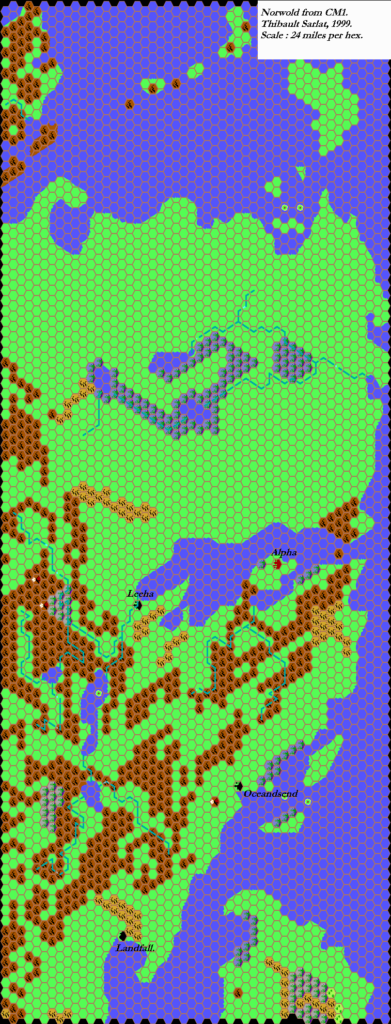
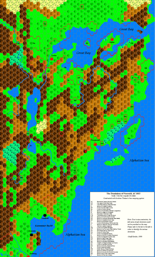
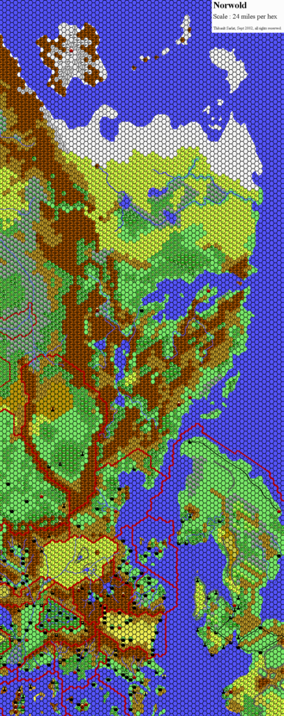
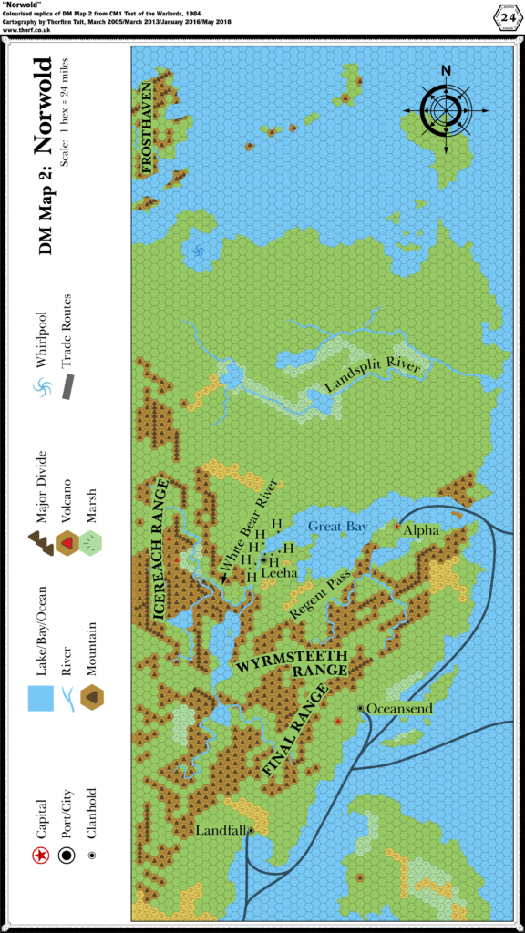
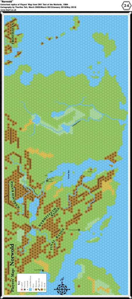
The region of Norwold made its debut in 1984’s CM1. Aside from the continental map showing its position in relation to the other established areas of the world at that point, there were two 24 mile per hex maps of Norwold: one for the DM, and one for the players.
While previous books such as X1 and X6 provided players’ maps, CM1’s players’ map is almost identical to the DM’s map. The only major difference is the lack of trade routes on the players’ map. The crop was also slightly different, with the DM’s map showing a sliver more terrain the north, east, and south.
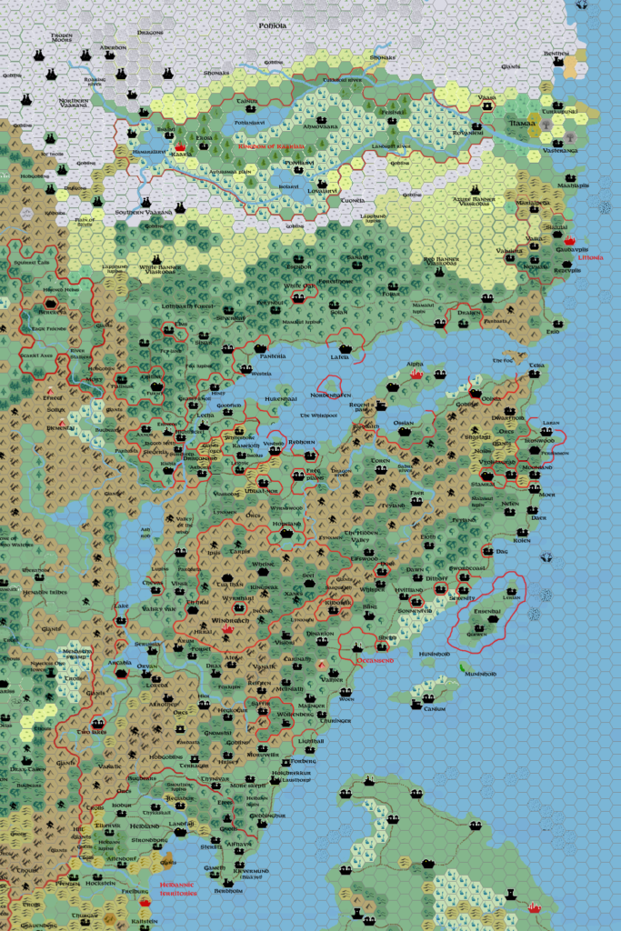
The DM’s map was printed on a single page of the module, while the players’ map took up all three panels of the inside cover. Both replicas here use standard Atlas of Mystara hex sizes, which explains why the DM’s map’s labels look so huge — the original was printed at less than a third of the size of the replica.
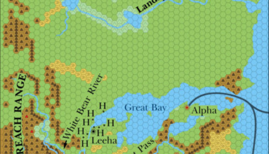
Replica Map (May 2018)
Sources
- CM1 Test of the Warlords (1984) (PDF at DriveThruRPG)
- Player’s Map: Norwold, inside cover (Cartography by Diesel)
- DM Map 2: Norwold, page 5 (Cartography by Diesel)
Chronological Analysis
This is Map 23. It was published in June 1984. The updated version of this map has not yet been released. See also Appendix C for annual chronological snapshots of the area. For the full context of this map in Mystara’s publication history, see Let’s Map Mystara 1984.
The following lists are from the Let’s Map Mystara project. Additions are new features, introduced in this map. Revisions are changes to previously-introduced features. Hex Art & Fonts track design elements. Finally, Textual Additions are potential features found in the related text. In most cases, the Atlas adopts these textual additions into updated and chronological maps.
Additions
- Borders — none are shown, although the continental map showed almost the whole area of the map as belonging to Alphatia, and presumably part of Norwold.
- Coastline — all of the coastline on the map appears for the first time at this scale.
- Islands — the northern tip of the Isle of Dawn; four islands north of the Isle of Dawn; islands of the Great Bay; islands of the far north, including Frosthaven.
- Lakes — six large lakes: three in the Icereach and Wyrmsteeth Ranges, and three along the Landsplit River.
- Mountains — three major mountain ranges: the Icereach Range in the west, the Final Range close to the coast, and the Wyrmsteeth Range in between.
- Mountain Passes — Regent Pass sounds like a mountain pass, although the label is not very clear.
- Nations — Norwold.
- Rivers — around fifteen major rivers and tributaries are added, although only two are named: the Landsplit River and the White Bear River.
- Seas — the Great Bay. Other seas remain nameless.
- Settlements — Landfall (a city), Oceansend (a city), Alpha (capital of Norwold), Leeha (a city), and seven clanholds around Leeha.
- Terrain — terrain other than mountains is rather sparse, with a few patches of hills and marsh but nothing else. Most of the terrain is left blank. There is a whirlpool marked in a bay southeast of Frosthaven.
- Trails & Roads — shipping trails are shown coming from the south and leading north via Landfall through Oceansend and on to Alpha in the Great Bay. Two routes lead off towards Alphatia in the east, one from the Great Bay, the other from south of Oceansend.
Revisions (Players’ Map)
- Terrain — a few hexes that were obscured on the DM’s Map are clear here.
- Trails & Roads — the trails from the DM’s Map are missing here.
Hex Art & Fonts
- Fonts — Baskerville.
- New Symbols — Clanhold (a tiny city symbol), Major Divide (mountain symbols placed in a row, extending between hexes).

Textual Additions (CM1 1984)
- Borders — Oceansend’s border can be extrapolated from the text: the city is surrounded by farms and small villages, most of which lie “within 50 miles or so of the city”. (p. 8) It therefore seems reasonable to consider its territory to expand two hexes from the city in all directions.
- Climate — “Norwold is a northern temperate region having four distinct seasons. Each of these seasons lasts approximately three months. Seasons in the southern part of Norwold are less severe than the seasons in the north. Precipitation is common in Norwold, and comes in the form of snow in winter, and rain in summer. During the spring and fall, the precipitation may come as either rain or snow (50% chance, modified plus or minus 30% based on the location of the specific region, and the time of the season-late spring, late fall, etc.). Some form of precipitation falls every four days. Of course, a thunderstorm or snowstorm may last much longer than one day. Also, a dry spell might last for weeks. Use the four-day figure as a rough average…” (p. 6)
- Dominions — the nature of CM1 is that various dominions, starting at a single 24 mile hex each, will be added to the map. However, exact locations are left to players and the DM to decide. Seven NPCs (see Rulers below) from CM1 are to be given dominions in Norwold. (p. 10-14) Alak Dool’s dominion apparently includes (or perhaps is composed primarily of?) humanoids, given the makeup of his military force. (p. 29) Finally six prerolled characters are provided for PCs, all of whom can also be considered dominion rulers. (Cover gatefold)
- Fauna — fire elementals near the Arch of Fire (p. 7); water elementals near the whirlpool (p. 8); frost giants in Frosthaven (p. 8); dragons in the Wyrmsteeth Range (p. 8).
- Forests — “A variety of terrain types covers the land of Norwold. Most of these types are shown on the players’ map. Consider unmarked hexes to be forest, as this is Norwold’s most common terrain type.” (p. 4) Also “Forests cover most of the land in Norwold.” (p. 6) So it seems that the blank hexes on the map are to be considered forest rather than plains — which makes sense if Norwold is largely an unsettled wilderness.
- “Trees grow in the lower mountain valleys as far north as the Great Bay. Mountainous areas north of the bay are barren of trees. NO trees grow at altitudes higher than 8,000 feet.” (p. 5) This presumably applies to the clear hexes surrounded by mountains, of which there are quite a lot on the map.
- “Dense forests cover most of the hilly areas in Norwold. Pines and other evergreens are the predominant forms of trees.” (p. 5) So most of the hills are forested with evergreens.
- “Evergreens are the only types of trees that grow in the northern forests, while broad stretches of oak, hickory, maple, elm, ash, fruit, and other hardwood trees mix with the evergreens in the southern forests.” (p. 6) There’s also a paragraph tackling the light versus heavy forest, noting that the DM should vary density to match the desired pace of the adventure. This is not very helpful from a mapping point of view.
- Meadows/prairies, some of which stretch 5-10 miles, as well as low hills may be included in any given forest hex. (p. 6)
- Government — Alphatia is a magiocracy. “The empire built its power on a solid foundation of magic. No fewer than 1,000 36th level magic-users make up this empire’s ruling council.” (p. 4) Thyatis “has developed upon a triad of powers. The theocratic, magical, and military elements of the empire all share the responsibilities of problem solving and policy development.” (Also p. 4) Norwold is a feudal monarchy. Leeha is a federation of halfling clanholds. (p. 8)
- Hills — “Where a mountain hex on the players’ map is adjacent to a clear hex, assume that half of the mountain hex is made up of ‘‘foothills’’- long, gradually rising ridges of rock that lead to the mountains.” (p. 5) This is difficult to mark at this scale, but worth remembering for larger scales such as 8 miles per hex. “Lakes and clear- ings dot the hills, and flowers and herbs are common in the thick meadows. Bogs and marshes fill some of the low spots on the hilly terrain.” (p. 5) This information could also be used to add some detail at a larger scale.
- Lakes — “As with rivers, only the major lakes are shown on the Norwold maps. Since so much of the land of Norwold is wooded and rainy, small lakes dot much of the land (at least one per hex in the south, as many as a dozen per hex in the north). All of the inland lakes are freshwater lakes. The mountain lakes are very deep, while the flatland lakes are shallow.”
- Marshes — “These areas are simply wet lowlands, and are unsuitable for development. No permanent structures could stand in these areas. There is a 20% chance, however, that a marsh hex contains small areas of higher ground large enough to hold a small village. … The nearby rivers and lakes flood the marsh areas each spring, covering all but the highest ground in 2-8 feet of water. The marshes freeze in winter”. (p. 5-6)
- Military — page 29 outlines the military forces of Norwold, as well as the Thyatian forces that attack during the adventure.
- Mountains — “The mountains of Norwold are towering pinnacles of rock that dwarf the summits of the renowned Altan Tepe Range, which lies far to the south.” “Many peaks in both ranges are snow-covered all year long. In the upper reaches of both ranges, huge glaciers sprawl outward. The ice in these areas has not melted for thousands of years.” (p. 5)
- “The Final Range runs parallel to the southeastern coast of Norwold. It is situated about 200 miles inland. The range took its name from ancient explorers who thought it represented the far edge of the world.” A number of peaks in the central regions of the Find Range reach 18,000 feet above sea level”. (p. 5)
- “The other range in Norwold is even greater than the Final Range. It runs north and south along the kingdom’s western border. Barbarians and savages refer to it as the Icereach Range or White Range, but the new govern- ment has not officially explored and named the range.” “…at least a dozen peaks in the Icereach tower over 24,000 feet high.” (p. 5)
- The Wyrmsteeth Range “lies to the northeast of the Final Range. No civilised beings live there, because it is the home of nearly 1,000 dragons. The range is named for the appearance of the peaks. If characters view the range from the horizon, they see that the main ridges look like the lower jaw of a drag- on’s mouth, and that the towering pinnacles of rock closely resemble a serpent’s drooling fangs.” The dragons live in numerous caves. (p. 8)
- Mountain Passes — page 7 confirms that Regent Pass is indeed a mountain pass: it’s the only gap through the mountains at the neck of Alpha’s peninsula. A garrison of 500 watches over the pass, stationed at a fortress. (p. 29)
- Nations — the Empire of Alphatia “has claimed the vast lands of Norwold, and has appointed a king to rule over those lands. This monarch is in need of steadfast characters to administer the many dominions that may be carved from the wilderness of Norwold”. (p. 2) “Norwold is little more than wilderness when the adventure begins”, though it has great potential for settlement, and “valuable natural resources”. (Also p. 2)
- As well as Norwold, this is the first mention of Alphatia. “Alphatia is the oldest empire in the world. It is located on a massive island off the eastern coast of Norwold.” (p. 4) Its true name is said to be “Atlantis”. (p. 27-28)
- Thyatis is given a little detail, too: “This empire is much younger than Alphatia. Actually, it is little more than a century old. The empire has spread rapidly outward from Thyatis, its capital city. It now encompasses several large islands off the southern coast of the continent.” “Many historians attribute Thyatis’ rapid growth to its leaders’ fabled capacity for greed and trickery. Although several of Thyatis’ territorial battles appear to have been fought on the field of honour, many more, historians agree, were won through treachery and deceit.” (p. 4)
- Placement — “Norwold lies to the north of the land shown on p. 33 of the D&D Expert rule book. To see how the Expert map relates to Norwold, line up the coastline near the bottom left corner of the map shown on this adventure’s inside booklet cover with the coastline at the top of the Expert map (near the Heldann Freeholds).” (p. 4)
- Resources — “Most mountain resources are mineral in nature. The most common mineral resources in hilly areas are tar, clay, coal, and stone. Besides the obvious wood and timber resources in forest areas, the main resources in these areas are animal or vegetable in nature. Tundra areas have only a 30% chance of holding a resource. A tundra hex never holds more than one resource, and that resource is never animal in nature.” (p. 6)
- Rivers — “Only the largest of Norwold’s many rivers are shown on the players’ map. Those rivers that are shown may be 1-4 miles wide at any given spot. For the most part, these rivers are too deep for wading. Assume that at least one river (50-200 feet wide) and several streams drain each hex on the map. Feel free to add to the waterways marked on the Norwold maps.” (p. 6)
- Ruins — Alinor was once a mighty port, but earthquakes and erosion caused it to sink below ground level. Now only a small part remains, in underground ruins accessible via a cave. The location within Norwold is not fixed. (p. 18-19)
- Rulers — King Ericall of Norwold (p. 4, 9) is the second son of Eriadna the Wise, current Empress of Alphatia. (p. 4) Thincol the Brave is the current Emperor of Thyatis. (p. 4) Lernal the Swill is Ericall’s younger “demented half-brother”, lord of Landfall. (p. 7, 9) King Yarrvik the Just is ruler of the free city of Oceansend. (p. 7, 9) Norwold dominion rulers: Alak Dool, Sir Ernest Day, Rutger Dag from Vestland, Sandralene of Glantri, Max the First, Allisa Patrician from the Ethengar Khanate, Longtooth. (p. 10-11) Also prerolled PCs: Fergus the Justifier from Vestland, Geoffrey of Heldann, Weston the Tall, Quillan Elm-Grower from Alfheim, Brogahn of the Steppes from Ethengar, and Claransa the Seer from Karameikos. (Cover gatefold) Gard Rocktooth is Clanmaster of the dwarven stronghold of Stormhaven. (p. 22) Collin the Sheriff leads Leeha’s military force, and is presumably one of the seven sheriffs of Leeha’s halfling clanholds. (p. 29)
- Seas — during winter “ice connects Frosthaven to the shores of northern Norwold”. (p. 8) In particularly extreme winters the Great Bay itself may freeze over. (p. 16)
- Settlements — “The only civilised areas in Norwold when the adventure begins are Alpha and the five hexes that surround that city; the demi-human strongholds; Landfall; Oceansend, and the coastal hexes on each side of that port city.” (p. 6)
- Alpha (p. 6-7), population 30,000, with more than 60,000 living and working in the civilised regions nearby. Has “a splendid deep-water port”. Bustling waterfront. Connected by trade route with Alphatia as well as the rest of Norwold. Large fishing industry. Farms surrounding Alpha are very prosperous, and are populated by natives who “have welcomed the arrival of King Ericall and are happy to be members of an established form of government”. Built “on the ruins of an ancient fortress, utilising some of the old fortifications”. Heavily fortified city. Fortress has direct harbour access, room for 10,000 people to shelter. King’s palace “stands on a hill in the centre of the fortified zone”.
- Landfall (p. 7), population 10,000, “little more than a collection of squalid huts and sleazy dives”. “The dirty, ramshackle docks of Landfall mar the shore of a once placid bay.” “Lernal lives in a large, poorly built wood mansion, and the rest of the city is devoid of any stone buildings or fortresses.” “Poor farms are scattered throughout the land that surrounds the city.”
- Oceansend (p. 7), population 20,000 (of which 3,000 are dwarves, 2,000 halflings, 500 elves), a “heavily fortified community” with another 20,000 people living in the countryside that surrounds Oceansend — most “on prosperous farms or in small villages within 50 miles or so of the city”. A free city, not yet aligned with Alpha and the Kingdom of Norwold. A “thriving, vibrant city that is much older than either Alpha or Landfall”. (p. 8)
- Small dwarven communities near some branches of the Final Range mountains west of Oceansend. These dwarves trade metal items with Oceansend for produce and imported goods, and they have a staunch alliance. (p. 7)
- Leeha and the seven halfling clanholds (p. 8). Population is 700-1,200 in each clanhold, total 6,500. Leeha is “the clans’ central gathering place” on the White Bear River. The halflings have “excavated huge warrens along the riverbank, so that the members of all the clans may stay in Leeha”. From this description, the permanent population of Leeha is uncertain.
- “Several dozen” Foresthomes (elven communities) “thrive in the forests or Norwold”. The exact locations are left up to the DM. “Each of the communities is home to 200-1,200 elves.” “Most of the elven communities exist in areas where the trees are a mixture of evergreens and hardwoods.” This suggests that the elves may be mostly in the southern forests, as the northern forests are said to be mostly evergreen. “The few meandering paths the elves leave on the ground are almost unnoticeable. A Tree of Life stands at the centre of each of these communities. The elven agriculture consists mainly of a few small gardens.” (p. 8) Another piece of evidence for Foresthome locations: when Frosthaven giants enter Norwold and head for Leeha and the mouth of the Great Bay, “several elven communities lie in the giants’ paths” (p. 16). The implication is that there are indeed Foresthomes north of the Great Bay.
- Stormhaven is a dwarven stronghold, “a network of caves located high in a rugged mountain range”. Population 2,500. Stormhaven’s location is left up to the DM, who is instructed to place it in a mountain hex near the characters’ dominions. (p. 22) Given that PC dominions could be almost anywhere, it seems that Stormhaven could also be anywhere that dominions could be placed nearby.
- Crystykk is a mountain cave, inhabited by the three crones. (p. 24-27) The location is not fixed: “in a dark region of rocky peaks, far from any civilised lands” and “somewhere in the uncivilised lands of Norwold”.
- The Regent Pass fortress guards the mountain pass, with a garrison of 500. (p. 7, 29)
- Terrain — Frosthaven is “a barren island of ice and rocks”. “Because the island lies so far north, no plants other than mosses and fungi grow on the island. Icy winds and blizzards sweep Frosthaven three seasons of the year.” A “huge clan” of frost giants lives here in “a number of huge caverns, which are carved into the ice of the living glaciers. A complicated series of ice tunnels connects most of these caves. Some 6,000 frost giants live on the island; 2,000 of them are warlike males.” (p. 8) The marsh near Oceansend is referred to as the Oceansend Marshes (p. 28) In addition Norwold has two special features:
- the Arch of Fire is an arc of elemental fire between two volcanoes near the Icereach Range. “They stand 75 miles apart.” “The arch of fire is visible up to 72 miles away (3 hexes) at night, and up to 48 miles away by day. The arch reaches a height of 6 miles in its centre, and forms a tube roughly 300 feet in diameter.” “The hexes containing the two volcanoes are true wastelands of fire. The land that surrounds each of the volcanoes is relatively flat, and is crisscrossed by flowing rivers of lava. Huge lakes of fire lie at the bases of the volcanoes. Many small cave mouths dot the rocks that surround the mountains. Although most of these openings lead nowhere, some do connect to fissures deep within the earth. Rushing gouts of steam occasionally scald these caves. Fire giants, red dragons,” and fire elementals inhabit these caves, which also include wormholes to the plane of fire. (p. 7)
- the giant whirlpool in the bay south of Frosthaven is actually a vortex leading to the elemental plane of water. (p. 7-8)
- Trade Routes — “Well-traveled trade routes lead west from Oceansend to some branches of the Final Range”.
- Tundra — “This flat, wet land exists only at the extreme northern end of Norwold.” (p. 6) The question is, how much of Norwold does “extreme north” include? We don’t have latitudes for reference yet at this point, so comparison with the real world, in which tundra generally falls north of 60 or 70º latitude, can’t help us yet. Since the word “extreme” was used, I’m just going to consider the northernmost two or three rows of hexes to be tundra for now. Page 6 goes on to provide a nice definition of tundra: “The tundra is a region of terrifyingly severe winters and soggy, muddy summers. Herds of grazing animals cross the tundra during the pleasant months, stalked by an occasional predator. All but the cold-loving creatures abandon the tundra in winter, however. During the summer, 10-40% (1d4x10) of a tundra hex is covered by ponds, and wide, shallow lakes. Fish are not common in these bodies of water, but huge swarms of insects usually are.”
Analysis
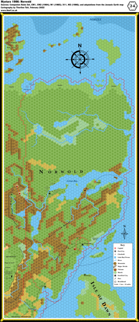
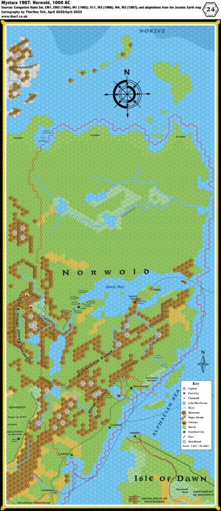
Adding the hex maps to the compiled maps up to this point is rather problematic. It’s easy enough to do as the text suggests and simply place the two maps together, but the resulting placement doesn’t fit with the continental map at all.
The solution may seem rather drastic, but it works quite well: place the map so that the coastline roughly lines up, as the text suggests, then rotate the whole Norwold map 1º clockwise. With a little nudging, this fits rather well with the continental map.
The obvious downside to this solution is that the hex grid no longer lines up perfectly with other areas, since it has been rotated. However, this is only really a problem when considering maps covering the join between Norwold and neighbouring region. This issue can be fixed by producing a new map with the hex grid rotated back to the usual position, while keeping the terrain, coastlines, etc. in their rotated position. Such a map will look slightly different from the original Norwold maps, but both maps will be equally valid and compatible with each other.
So why do this? The main reason is that it preserves the integrity of the continental map as well as the hex maps. This is a major issue, because the CM1 and Companion Set maps of Brun are the best sources for much of the continent; maintaining the integrity of these maps is therefore a very desirable thing.
My previous attempt at tackling this problem, in 2016’s Lining Up Mystara project, resulted in cutting up the Brun map and placing the pieces back together as best I could. It worked, though it involved a lot of arbitrary decisions. But this new placement provides the possibility of preserving the integrity of both the Brun map and the hex maps, allowing us to take the Brun map at face value.
Another point to note is that some of 1985’s maps also require some rotation to fit them to the continental map, so it does make sense to use this solution here. But I’m getting ahead of myself.
There’s a lot of information in CM1, and indeed it has taken me a long time to get through all of the text. Unfortunately a lot of it is very hard to add to the map; to compensate for this, I have taken extensive notes for future reference.
Major things that were mentioned in the text but not added to the map for lack of even a vague official location include: dwarven communities near Oceansend; dwarven stronghold Stormhaven; several dozen elven Foresthomes; seven NPC dominions and six prerolled PC dominions (all of which have named rulers but no dominion names); Crystykk; caves for dragons in the Wyrmsteeth Range; caves for frost giants in Frosthaven; and other things besides.
There are also various terrain types that have not been added yet for lack of appropriate hex art. I have noted many of these on the map — most notably tundra and glaciers.
Join in the Discussion at The Piazza
Come and join in the discussion about this map at The Piazza, where I am holding a “read through” of the Let’s Map Mystara project.

