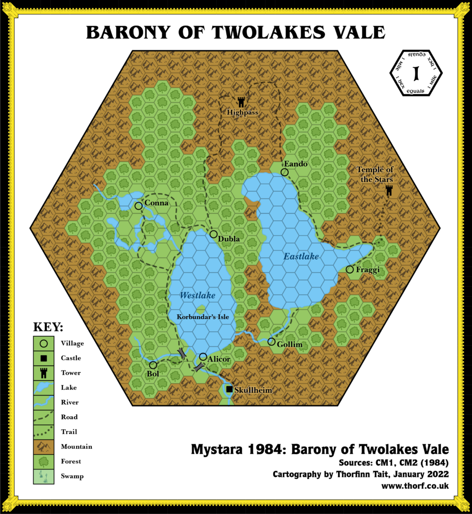
CM2 Twolakes Vale, 1 mile per square
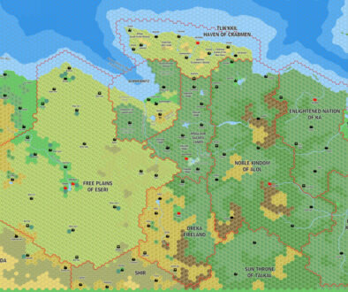
After CM1, much of the Companion module series continued to focus on Norwold. CM2 added the Barony of Twolakes Vale, a single 24 mile hex on CM1’s Norwold map. The exact location in Norwold was left up to the DM; fans have proposed a number of likely locations.
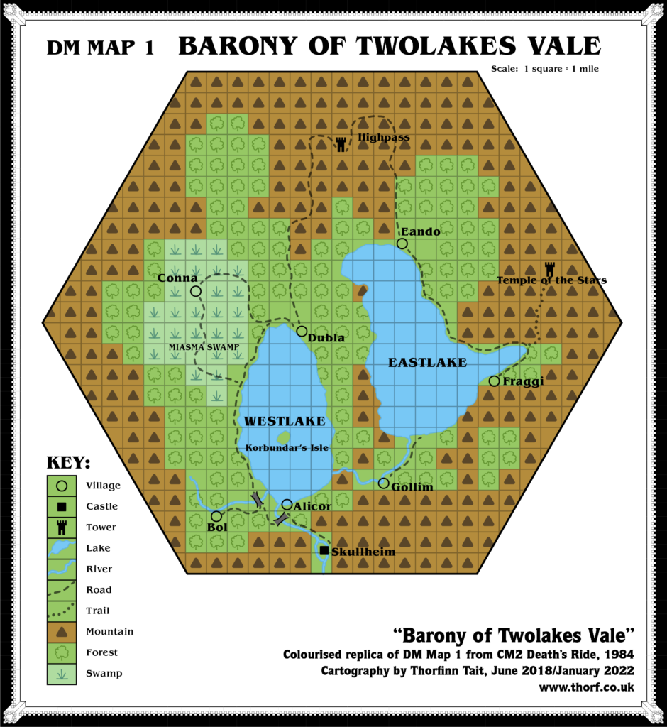
The map itself is rather unique among Mystara maps in that even though it details a hex-shaped area, the actual map is divided into a grid of squares. One glance at the colourised replica here quickly reveals the problem with this: whereas hexes give at least an impression of disorder and natural shapes, squares look decidedly digital. The original map was black and white, and the problem wasn’t so obvious there, though it still looked a bit too regimented.
Finally, there’s an amusing little easter egg hidden in the place names of this map. Did you spot it?
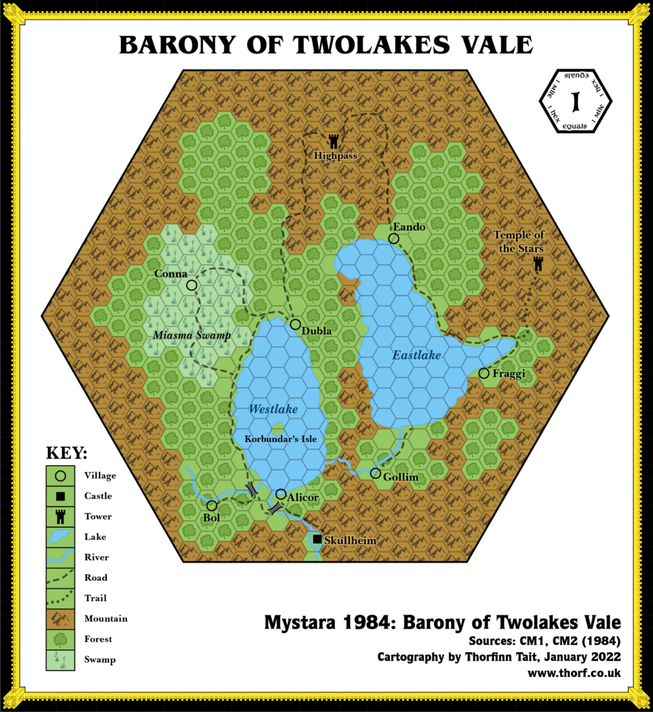
Replica Map (January 2022)
Sources
- CM2 Death’s Ride (1984) (PDF at DriveThruRPG)
- DM Map 1, inside cover (Cartography by Diesel)
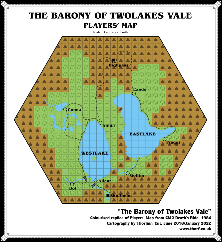
- Player’s Map, page 32 (Cartography by Diesel)
Chronological Analysis
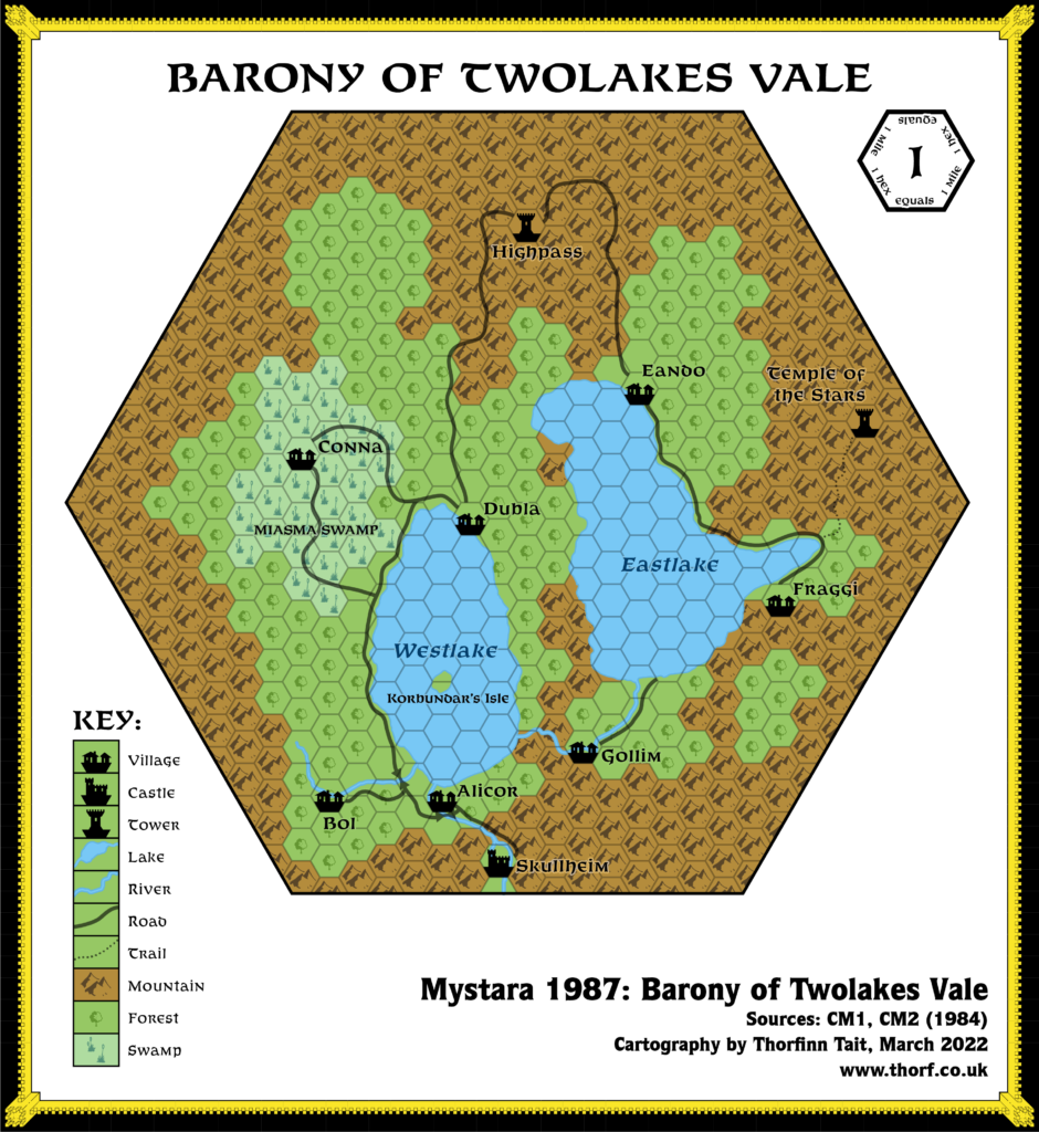
This is Map 25. It was published in October 1984. The updated version of this map has not yet been released. See also Appendix C for annual chronological snapshots of the area. For the full context of this map in Mystara’s publication history, see Let’s Map Mystara 1984.
The following lists are from the Let’s Map Mystara project. Additions are new features, introduced in this map. Revisions are changes to previously-introduced features. Hex Art & Fonts track design elements. Finally, Textual Additions are potential features found in the related text. In most cases, the Atlas adopts these textual additions into updated and chronological maps.
Additions
- Borders — the barony’s borders appear to be the 24 mile hex.
- Bridges — two bridges over the rivers in the southwest.
- Dominions — the Barony of Twolakes Vale.
- Islands — Kobundar’s Lair is on a lone island in Westlake.
- Lakes — Westlake and Eastlake.
- Mountains — the vale is rings by mountains, although none are named.
- Mountain Passes — Highpass appears to sit on a mountain pass.
- Rivers — a number of rivers, all unnamed.
- Settlements — Skullheim (castle), Alicor (village), Bol (village), Conna (village), Dubla (village), Eando(village), Fraggi (village), Gollim (village), Highpass (tower), Temple of the Stars (tower).
- Terrain — the Miasma Swamp surrounds the village of Conna.
- Trails & Roads — a network of roads weaves its way through the vale, connecting most of the villages. A trail up into the mountains leads to the Temple of the Stars.
Hex Art & Fonts
- Fonts — Benguiat.
- New Symbols — None, although this is the first use of the Tower symbol on a map; it previously appeared only in the Companion Set legend.

Players’ Map Revisions
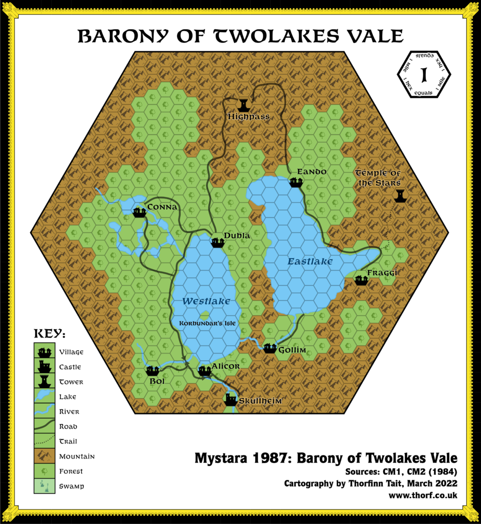
- Lakes — eight small lakes around the village of Conna in the west, where the DM’s map had the Miasma Swamp.
Analysis
It would appear that the barony would fit in any hill or mountain hex on the Norwold map — even one in the middle of a mountain range.
The players’ map shows the state of the barony before the events of CM2 occur. The only difference of note is the western region around Conna.
Textual Additions (CM2 1984)
- Dominions — the Barony of Twolakes Vale is described as “a distant mountain dominion”. (p. 3) The dominion is extensively detailed in the text. (p. 5-7)
- Island — Korbundar’s island is “roughly 350 ft. square”. (p. 13) This is much, much smaller than the large island shown on the map. DM Map 4 shows the island in detail, and this could be used to update the main map.
- Rivers — there are dangerous, unnavigable rapids between Skullheim and Alicor. (p. 12)
- Rulers — Baron Sir Maltus Fharo rules Twolakes Vale. (p. 3)
- Settlements — Skullheim, population 25 families (125 people), is the village in which Skullheim Castle is located. The castle’s population is uncertain, but likely a few hundred at the very most. “The castle sits on an island bordered by the river that flows southward from Westlake. The island is literally only a few yards wider than the castle’s outer walls; the river flows in a raging torrent along the castle’s west wall.” (p. 4, 5, 8) Alicor, a fishing/farming village, population 100 families (500 people). (p. 5) Bol, a logging/farming village, population 25 families (125 people). (p. 5) Conna, a gourmet/fishing/farming village, population 25 families (125 people). (p. 5) Dubla, a fishing/farming village, population 50 families (250 people). (p. 5) Eando, a fishing/farming village, population 50 families (250 people). (p. 5) Fraggi, a fishing/farming (some logging) village, population 75 families (375 people). (p. 5) Gollim is a lead mining/farming village, population 150 families (750 people). It is “nestled in the hills southwest of Eastlake”. (p. 4, 5, 23) Korbundar’s Lair is located on Korbundar’s Isle. (p. 4)
- Terrain — Twolakes Vale appears to be split into two valleys. Despite the apparent connection in the centre of the map, the module states that “the best way to get to Eando, Fraggi, and Gollim is by the Highpass road; the terrain off-road is very rugged and dangerous, and has been getting worse”. (p. 12)
- Trails & Roads — the Westlake Road. (p. 4) “Blocks of yellow clay pave parts of this road as it leads north from Skullheim into the barony.” (p. 12) A “major trade route” leads into Twolakes Vale from the south, terminating at Skullheim. (p. 8)
Analysis
There are a few details here to improve the map of Twolakes Vale, but only a few hints to resolve the problem of where to place the barony in Norwold. “Distant” presumably means distant from Alpha, and possibly somewhere inland. Northwest of the Great Bay might be a good choice.
Join in the Discussion at The Piazza
Come and join in the discussion about this map at The Piazza, where I am holding a “read through” of the Let’s Map Mystara project.

15 June 2018 @ 11:32 pm
easteregg…hmm..did you mean gollim…aka gollum?
15 June 2018 @ 11:37 pm
That may well be an easter egg, but it’s not the one I was thinking of.
15 June 2018 @ 11:51 pm
Dubla and Conna may be wordplay on Irish locations.
16 June 2018 @ 6:44 am
ABCDEFG?
16 June 2018 @ 7:22 am
We have a winner! 😀
There’s actually an H, too: Highpass.
It looks like this was a conscious choice by the designer. I thought it was quite fun when I noticed it.
17 June 2018 @ 1:51 am
The H doesn’t fit the clockwise pattern, though. 🙂