CM4 Vyolstagrad, 2 miles per hex
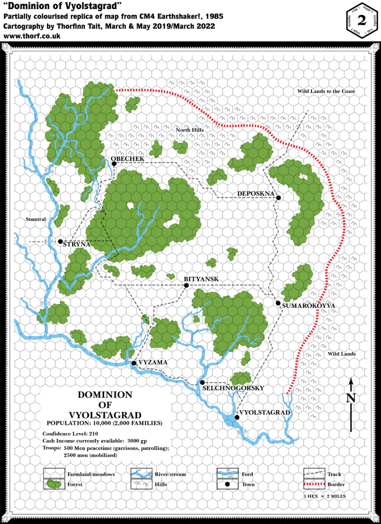
1985’s Earthshaker! provided another close-up example of a Companion Set-style dominion. It’s a peculiar map, with no border and no clear indication of where it begins and ends.
Replica Map (March 2022)

Sources
- CM4 Earthshaker! (1985) (PDF at DriveThruRPG)
- “Dominion of Vyolstagrad”, page I3 (Cartography by Dave “Diesel” LaForce)
Chronological Analysis
This is Map 32. It was published in April 1985. The updated version of this map has not yet been released. See also Appendix C for annual chronological snapshots of the area. For the full context of this map in Mystara’s publication history, see Let’s Map Mystara 1985.
The following lists are from the Let’s Map Mystara project. Additions are new features, introduced in this map. Revisions are changes to previously-introduced features. Hex Art & Fonts track design elements. Finally, Textual Additions are potential features found in the related text. In most cases, the Atlas adopts these textual additions into updated and chronological maps.
Additions
- Borders— A border is only shown on the north and east sides of the dominion. The inference seems to be that the river forms a natural border to the south and west.
- Dominions— The Dominion of Vyolstagrad. A label “Stamtral” on the western edge of the map could be interpreted as the name of a neighbouring dominion. The eastern and northeastern edges are both marked as “Wild Lands”, presumably unsettled.
- Fords — A number of unnamed fords are marked.
- Islands — One tiny island in the equally tiny lake south of Selchnogorsky.
- Lakes — Vyolstagrad town sits on the northeastern shore of a small lake. There also appears to be a small lake with an island in its centre just south of Selchnogorsky.
- Military — Unusually, the map itself lists a militia of 500 in peacetime, including garrisons and patrols, with 2,500 when mobilised for war. It’s not clear if these figures are included in or in addition to civilian population.
- Rivers — A rather extensive river network, but with no names.
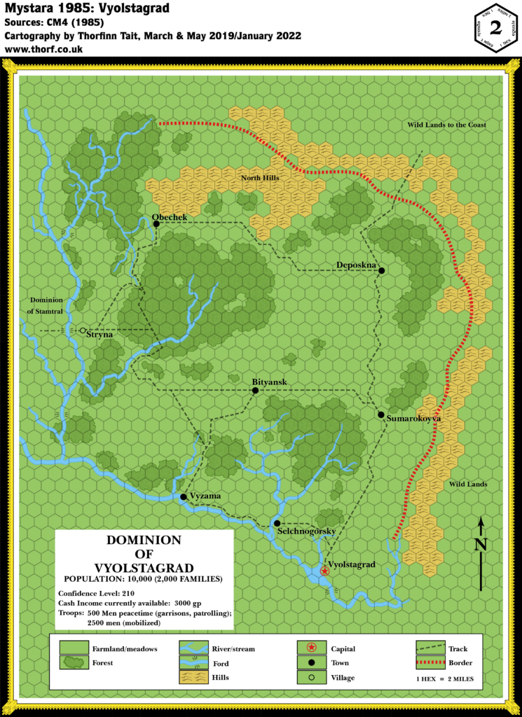
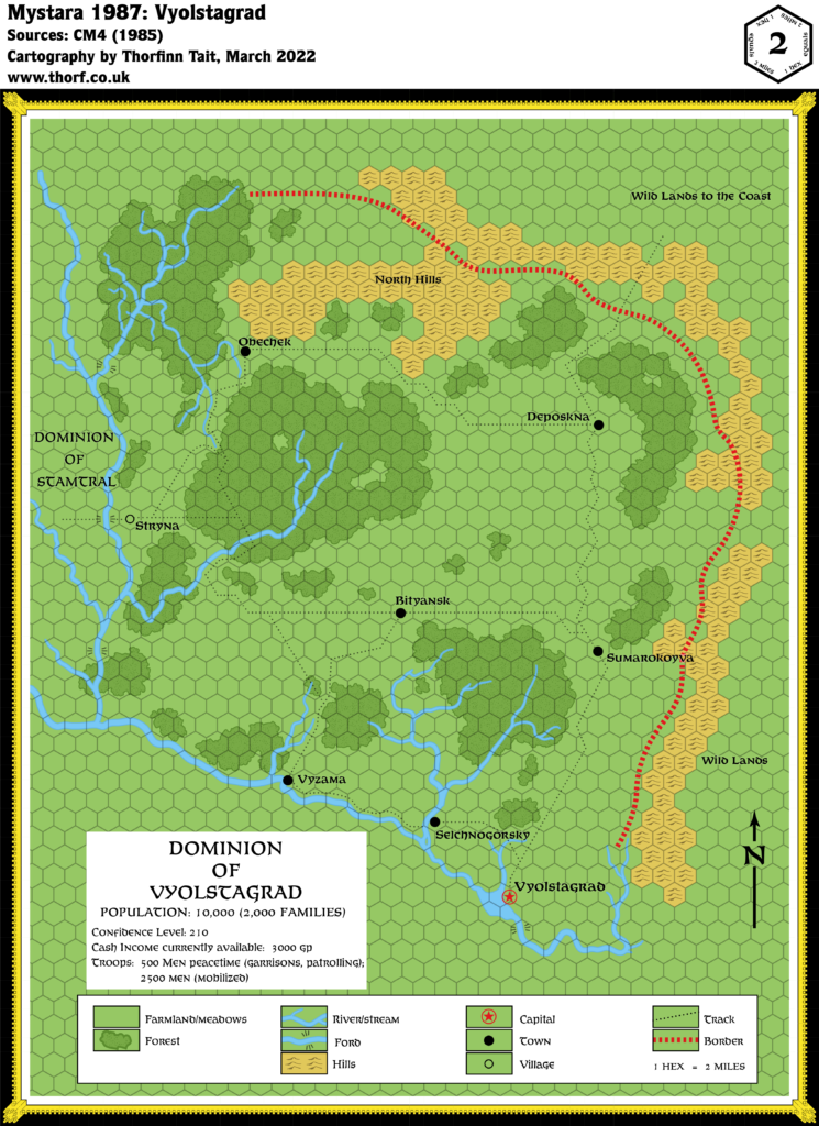
- Settlements — Vyolstagrad, Bityansk, Deposkna, Obechek, Selchnogorsky, Stryna, Sumarokoyva, Vyzama — all “towns”. The map lists dominion population at 10,000, suggesting an average population of 1,250.
- Terrain — The most peculiar feature of the map is the way the terrain simply stops at the apparent edges of the dominion. The map largely uses terrain (hills and rivers) to define the extent of the dominion, with everything outside that being blank hexes — which are also used to show “farmland/meadows”, thus leaving the edges of the map ambiguous. Within Vyolstagrad, there are extensive unnamed forests dotting the farmlands. The only named terrain feature is the North Hills, the only major part of the surrounding hills located within the dominion’s borders.
- Trails & Roads — No roads, but an extensive network of “tracks” links the settlements. The trail leading into the unknown northeastern corner of the map ends in the label “Wild Lands to the Coast”, suggesting that the nearest coast is in that direction.
Hex Art & Fonts
- Fonts— Baskerville throughout.
- New Symbols— Hills symbol is more pointy than usual, with only two peaks. Ford (six lines leading away from a river crossing point, three on each side).
Textual Additions (CM4 1985)
- Dominions— The western map label is confirmed to be the Dominion of Stamtral(p. 5-6).
- Placement— Vyolstagrad is said to be “somewhere near the Wyrmsteeth Range” (p. 2).
- Races— The depiction of gnomes in CM4 suggests that they are demi-humans just like elves, dwarves and halflings, complete with Clanmaster, Keeper, and indeed Relic (p. 3).
- Rulers— Vyolstagrad is lead by Duke Nevik(p. 2). Stamtral is lead by Duke Stamtral(p. 23).
- Settlements— Styrna is noted to be a village rather than a town (p. 5-6).
Join in the Discussion at The Piazza
Come and join in the discussion about this map at The Piazza, where I am holding a “read through” of the Let’s Map Mystara project.
Past and Future Versions of this Map
This article was originally published on 27th March 2019.

