CM7 Selinar, 3 miles per hex
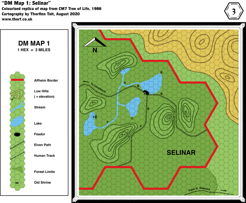
Bruce Heard’s second foray into Mystara, and his first focusing on a Known World nation, CM7 focused on the Selinar region of Alfheim. Following the development of the Emerlas region in O2 two years before, CM7 was the second module to zoom in on Alfheim, although in fact much of the module takes place in the Sylvan Realm on the other side of the continent.
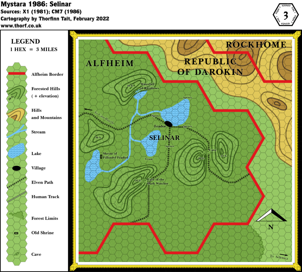
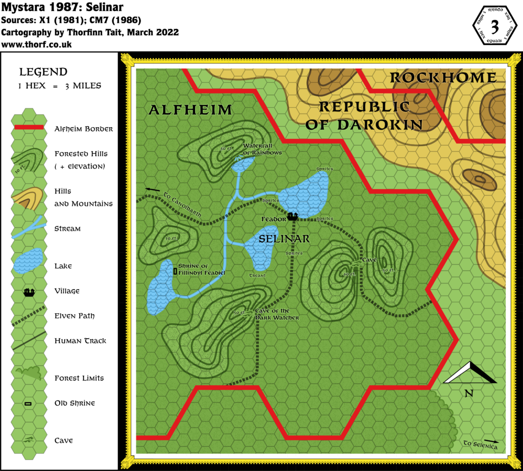
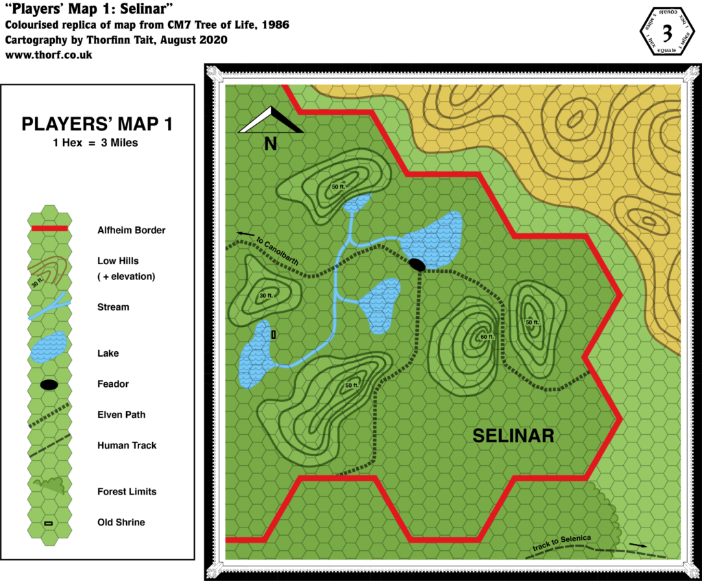
CM7’s maps are primarily notable for their use of contour lines — a first for Mystara’s geographical maps, and one that would not be repeated in many future maps.
Replica Map (August 2020)
Sources
- CM7 The Tree of Life (1986) (PDF at DriveThruRPG)
- “DM Map 1”, page 19 (Cartography by Tom Darden)
- “Players’ Map 1”, page 39 (Cartography by Tom Darden)
Chronological Analysis
This is Map 46. It was published in February 1986. The updated version of this map has not yet been released. See also Appendix C for annual chronological snapshots of the area. For the full context of this map in Mystara’s publication history, see Let’s Map Mystara 1986.
The following lists are from the Let’s Map Mystara project. Additions are new features, introduced in this map. Revisions are changes to previously-introduced features. Hex Art & Fonts track design elements. Finally, Textual Additions are potential features found in the related text. In most cases, the Atlas adopts these textual additions into updated and chronological maps.
Additions
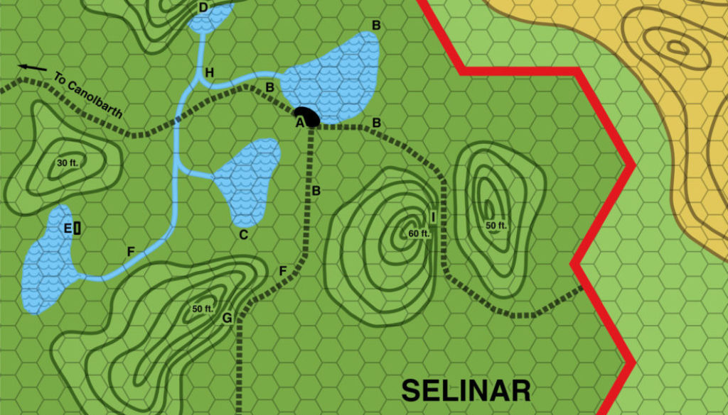
- Contours — Five hills are marked, complete with altitudes, but they are so low as to be meaningless at this scale. Some hills are also marked in the area to the northeast, across the border in Darokin.
- Lakes — The four lakes of Selinar, though they have no names at this point.
- Rivers — A small network of rivers links the lakes, although it’s not entirely clear which direction they flow in. The shape of the connections between the rivers suggest that they all flow north to the smallest lake. Where the water goes after that is also not clear, as there is no outflow. Presumably it either evaporates or goes underground.
- Settlements — Feador appears for the first time, although it’s unclear if it’s a town or a village.
- Trails & Roads — Human tracks (outside Alfheim) are distinguished from Elven paths (within). There is a network of such paths leading from south, east and west from Feador.
Revisions
- Borders — The Darokin-Rockhome border that should appear in the top right corner is not present.
- Forests — Selinar is the only major label on the map, and it appears to refer to this section of forest, in the same way that “Emerlas” was used in O2. The “to Canolbarth” label suggests that Selinar is a separate entity rather than a part of the larger Canolbarth Forest.
- Roads & Trails — The “Track to Selenica” on the bottom edge of the map is slightly further north than on previous maps. It seems likely it was included here as a reference point and a contrast to the “Elven Paths” rather than out of an intent to shift the position of the trail.
- Terrain — The high ground in the top right should include both hills and mountains. It’s not clear from the map if these are intended to follow the same scale as the key’s “Low Hills”, as their contour lines are spaced differently.
Hex Art & Fonts
- New Symbols — Feador (black lozenge shape), likely either a town or a village; Old Shrine (unfilled rectangle).
- Fonts — Helvetica.

Textual Additions (CM7 1986)
- Clans — Alfheim is said to be organised into clans of elves, with the Feadiel Clan dwelling in the Selinar region of Alfheim. (Page 3)
- Dragons — Sulfar, a large red dragon that Moorkroft has sent to Selinar (pages 3-4, 6). It sits atop the hill with the Cave of the Dark Watcher. Presumably it usually resides in or near the Sylvan Realm.
- Fauna — Due to the nature of the adventure, most of the encounters around Selinar are not its usual inhabitants, but interlopers to harry to adventurers. As such, they are not useful to mark on the map. This includes many of the keyed encounters on the maps. Of these, the sprites at location B are locals, as is the ancient treant known as the “Old King of the Woods” at location C (page 4). The wolves, dire wolves, werewolves, and hellhounds chasing the sprites at B and also at F are interlopers (pages 4-6).
- Features — The Old Shrine at location E turns out to be “the grave of Fillindyl Feadiel, the first elder of the … clan”. It’s just a simple altar. (Page 5) The Cave of the Dark Watcher at location G is “a cave in the southeast side of a hill, overlooking the southern elven path”. It is a circular cave with a “throne made of rough stone”, currently occupied by a beholder, the titular Dark Watcher. Though the beholder is not native to the woods, I have chosen to name the cave anyway as it’s better than just putting another nameless cave. The cave also hosts a “magical portal to the Tower of Light” in the Sylvan Realm; it’s not clear if this is a permanent feature. (Page 6) The Cave at location I, “A Nest of Spies”, is just a simple cave occupied by the agents of Moorkroft. (Page 6)
- Forests — Selinar, also referred to as “the forest of Selinar” (page 3) is located in eastern Alfheim.
- History — The story of the Sylvan Realm was detailed as follows: “Long before the oldest elf of the Feadiel tribe was born, the most ancient elven clan faced its doom. At the end of a long and bloody war, surrounded by their sylvan domain, the clan decided to hide their Tree of Life and magic-jar in mass, one elf into each great oak of the forest, hoping to outlive this dark century. Only one would remain as Keeper of the Sacred Tree, until the twilight of his life, at which time another elf would be wakened to replace the eldest.” Although the lifespan of an elf has not been explicitly fixed at this point, this presumably places the Sylvan Realm’s struggle far in the past. (The next paragraph gives a hint in that the Treekeeper only needs to wake a replacement in the time of the Mage’s great-grandson, i.e. Moorkroft IV.) The text continues: “When the black army swarmed the woods, no elf was there to be found “alive.” The Sylvan Realm was ransacked and, without knowing, many elves were destroyed.” After this, the land was occupied by the forces of Moorkroft. This continued for another three generations of Moorkrofts, so that the current Moorkroft IV is “the mage’s great-grand-son” (all page 2 up to this point) — actually his fourth incarnation. Moorkroft I, II, and III presumably had normal lifespans, so the last tree keeper returned at some point after the span of three human lifetimes. Moorkroft IV has been extending his life since then. (All page 25) One more point is worth noting here: “As for the Feadiels, refusing the passive solution of the clan, they took a small limb of the Tree of Life and fled. They established another tribe, in another land, and so became the ancestors of the party’s clan.” This clearly refers to the Feadiels of Alfheim. (Page 2)
- Nations — CM7 introduced more details than ever before on the elves of Mystara:
- Alfheim is “a group of large clans allied under the authority of a sole king for the defense of the woodland and of their civilization.” (Page 3)
- Races — While Alfheim is predominantly elven, it is noted that “Many powerful druids live in Alfheim, helping the elves to maintain the sylvan realm.” (Page 3)
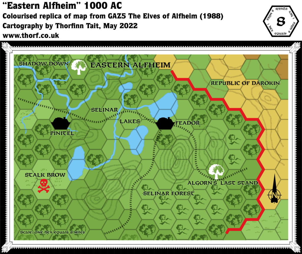
- Settlements — “The Feadiels’ clanhold is located in the forest of Selinar, on the shore of a small lake. The hold is called Feador.” It is repeatedly referred to as a village. (All page 3)
- Terrain — The Selinar region of Alfheim: “Selinar is that portion of forest northwest of Selenica, above the Grand Duchy of Karameikos.” (Page 2) It sounds like Selinar is the name of the forest here, which gels with the “to Canolbarth” labels on the maps. This is also in accordance with O2’s Emerlas region, which also seemed to be portrayed as a separately named forest region rather than a region within the overall Canolbarth Forest. On the other hand, the implication from small scale maps has always been that Canolbarth is the name of the forest as a whole, likely even including the areas outside Alfheim’s borders (because after all the borders are just a political line on the map).
- Trails & Roads — The difference between the Elven Paths and the Human Tracks noted on the map is defined in the text: “There are there paths leaving the hold: east, west and south. Visible only to elves and druids, they are considered a military secret.” (Page 3)
- Waterfalls — Location D on the map is the Waterfall of Rainbows (pages 4-5). It “gushes out at the top of a cliff to rush down to a small lake at the bottom of the hill.” The source may well be magical, because the hilltop is surely not expansive enough to generate a roaring waterfall just from runoff.
Analysis
The Selinar map adds some nice details within Alfheim, though its features outside of Alfheim’s borders don’t closely follow previous maps of the area. As there is little detail in these latter areas, they are best ignored.
Join in the Discussion at The Piazza
Come and join in the discussion about this map at The Piazza, where I am holding a “read through” of the Let’s Map Mystara project.

