cmonty’s Karameikos
Before the Atlas of Mystara — 10 years before it was even announced, in fact — there was… The Atlas of Mystara. In September 1998, Mystara fan Christopher S. Montgomery created a homepage to house his maps, naming it The Atlas of Mystara Homepage.
Sadly, Chris only ever posted two maps before moving on to other things. I have been unable to track him down or get in touch with him, and he doesn’t appear to have participated in the Mystara community beyond a few posts in 1998. He doesn’t even have an author page at the Vaults of Pandius. This is all doubly sad if you consider that the two maps he did post were rather nice.
Chris was apparently a fan of Campaign Cartographer 2. He talked about it on the Mystara Mailing List when he posted about his maps, which were very much products of the software of that time: beautiful work, but unfortunately hampered by poor resolution that was to be expected back in 1998.
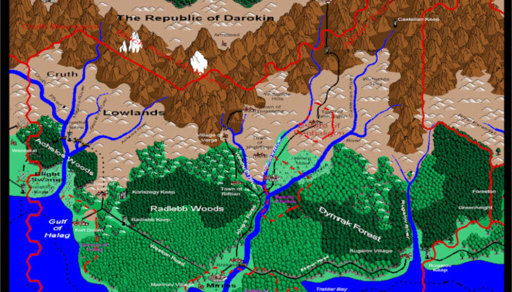
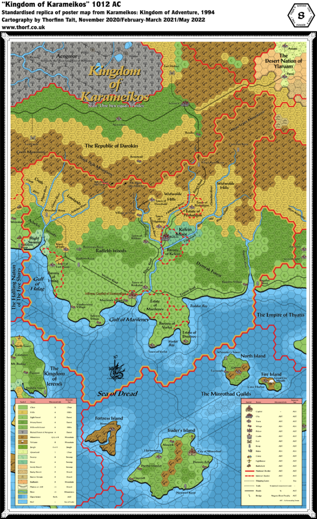
His first map is a remake of the 1012 AC map from Karameikos: Kingdom of Adventure. It features Aengmor in the north, as well as Mirros rather than Specularum. Chris expertly translated the hex symbols into Campaign Cartographer 2 art symbols, even including the named peaks as snow-topped mountains.
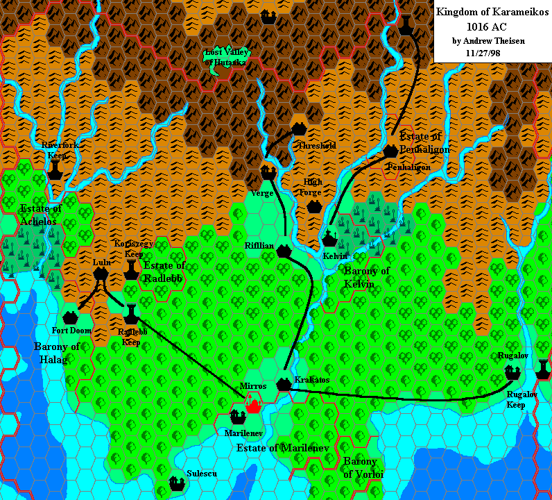
The tantalising fragments of adjacent realms in the corners of the map suggest what might have been, had he continued to map the rest of the Known World. Instead, his second map chose to zoom in on a small area of this one.
Fan-made Map by Christopher Montgomery (September 1998)
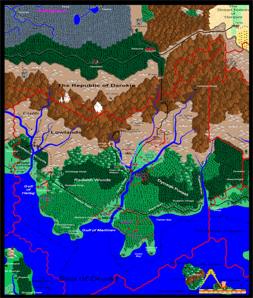
This is an original map created by one of Mystara’s excellent fan cartographers. For more information on the cartographer, including a gallery of all their maps, see also Appendix M: Mappers of Mystara.
The Atlas has been unable to contact the original cartographer. This map therefore appears here without explicit permission from its creator. Any information on how to get in touch with them would be most welcome.
Sources
- Karameikos: Kingdom of Adventure (1994) (PDF at DriveThruRPG)
Fan Sources
- None
References
- All of Christopher’s maps at the Atlas of Mystara
Chronological Analysis
This is a fan-made map. It was published in September 1998. The updated Atlas version of this map is not yet available. See also Appendix C for annual chronological snapshots of the area. For the full context of this map in Mystara’s publication history, see the upcoming Let’s Map Mystara 1998. (Please note that it may be some time before the project reaches this point.)
The following lists are from the Let’s Map Mystara project. Additions are new features, introduced in this map. Revisions are changes to previously-introduced features. Hex Art & Fonts track design elements. Finally, Textual Additions are potential features found in the related text. In most cases, the Atlas adopts these textual additions into updated and chronological maps.
Under Construction! Please check back again soon for updates.

