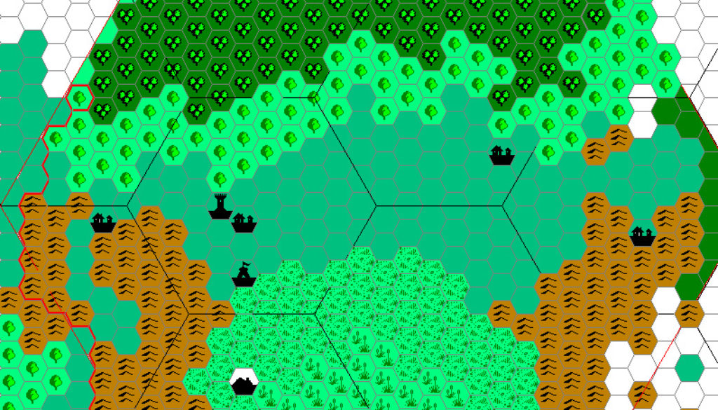
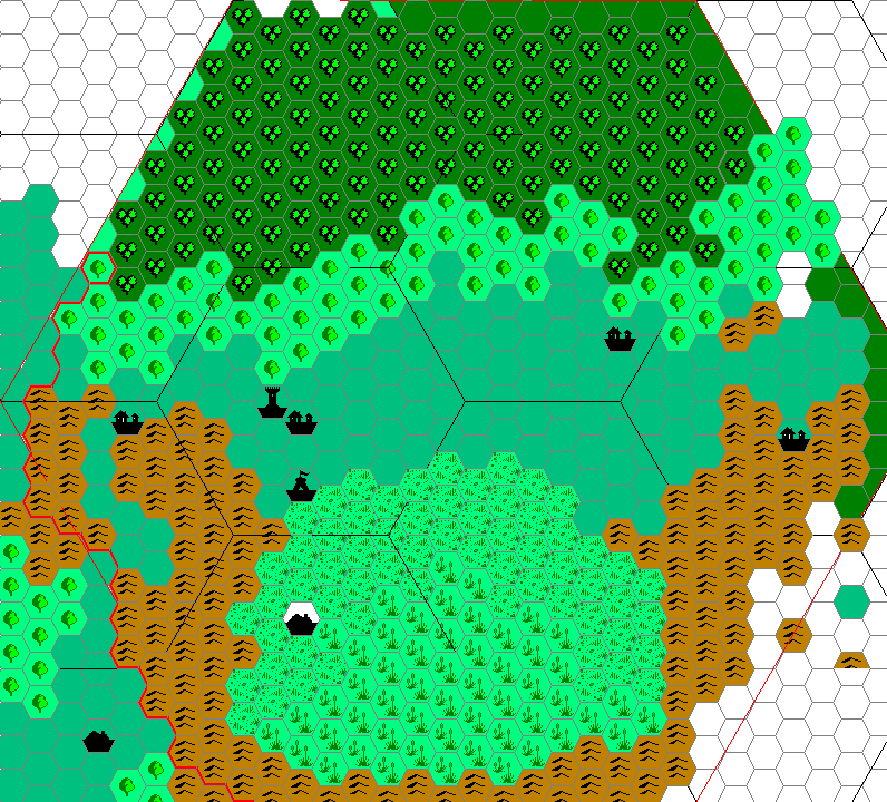
Cthulhudrew’s Fenhold, 1 mile per hex
Andrew posted this work-in-progress map in my Darokin Provinces thread at the old Mystara Message Board in early 2006. The map dates from earlier, as he said in his post that it was already old at that point.
The original map in CM9 was 2 miles per hex, but Andrew altered the scale to 1 mile per hex, likely to better fit the icons around Fenhold itself. Andrew also dealt with the problem of placement, nudging the town of Dolos out of the way to fit Fenhold in. (The town with a white hex background is the original position of Dolos, while the town in the bottom left is the new position.)
Fan-made Map by Andrew Theisen (January 2006)
This is an original map created by one of Mystara’s excellent fan cartographers. For more information on the cartographer, including a gallery of all their maps, see also Appendix M: Mappers of Mystara.
Sources
- CM9 Legacy of Blood (1987) (PDF at DriveThruRPG)
- Map IV, 2 miles per hex, Inside Cover (Cartography by Stephanie Tabat, Sue Myers, Gloria Habriga, and Dave Sutherland)
Secondary Sources
- Darokin Provinces discussion thread at Wizards’ Mystara Message Board in Appendix A: Archives
References
- Andrew’s entry in Appendix M: Mappers of Mystara
- Andrew’s author page at the Vaults of Pandius
Chronological Analysis
This is a fan-made map. It was published in 2006. The updated Atlas version of this map is not yet available. See also Appendix C for annual chronological snapshots of the area. For the full context of this map in Mystara’s publication history, see the upcoming Let’s Map Mystara 2006. (Please note that it may be some time before the project reaches this point.)
The following lists are from the Let’s Map Mystara project. Additions are new features, introduced in this map. Revisions are changes to previously-introduced features. Hex Art & Fonts track design elements. Finally, Textual Additions are potential features found in the related text. In most cases, the Atlas adopts these textual additions into updated and chronological maps.
Coming Soon


12 August 2021 @ 10:46 am
Through random searching a few months ago I found some very detailed maps of Wendar, Norwold, and the Northern Wildlands north of Wendar. I am no longer able to find them and the multi-chapter epic adventure I designed for three of my boys, is designed to have them visit that area as well as the Frost Giant kingdom northwest of Norwold (detailed up to the northern most ocean). Do you know where I can find these?
12 August 2021 @ 7:11 pm
Here at the Atlas you can find Geoff’s Northern Wildlands. For the rest, I suggest you look under Wendar and Norwold at the Vaults of Pandius.