
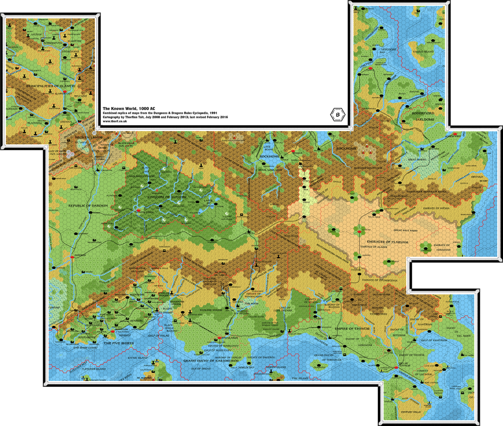
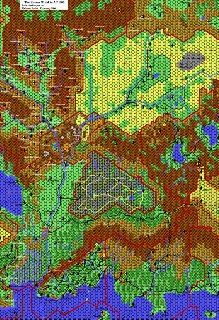
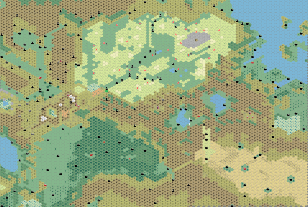
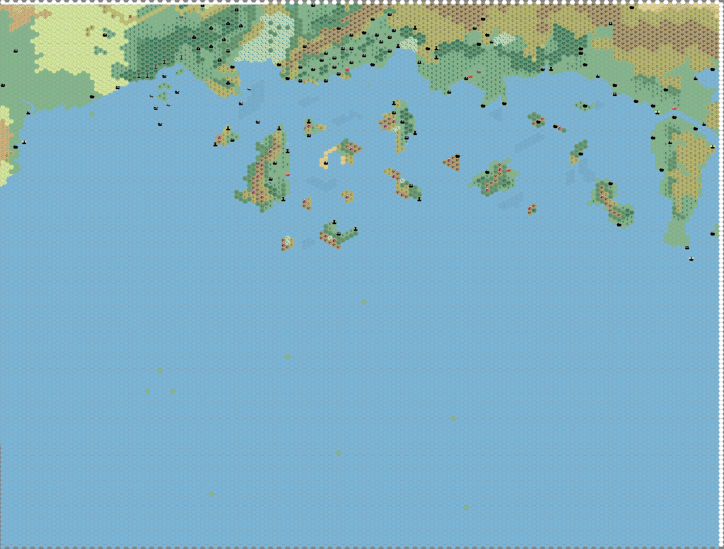
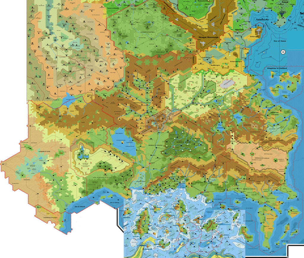
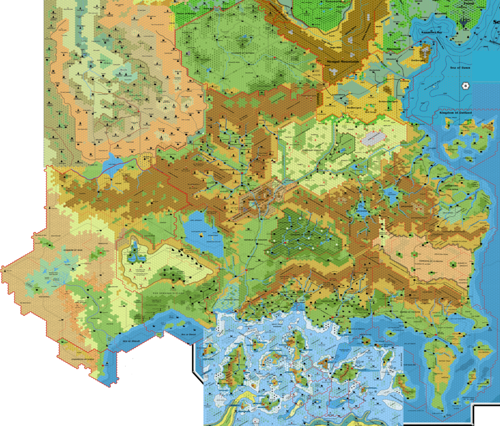
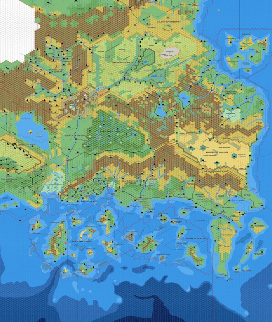
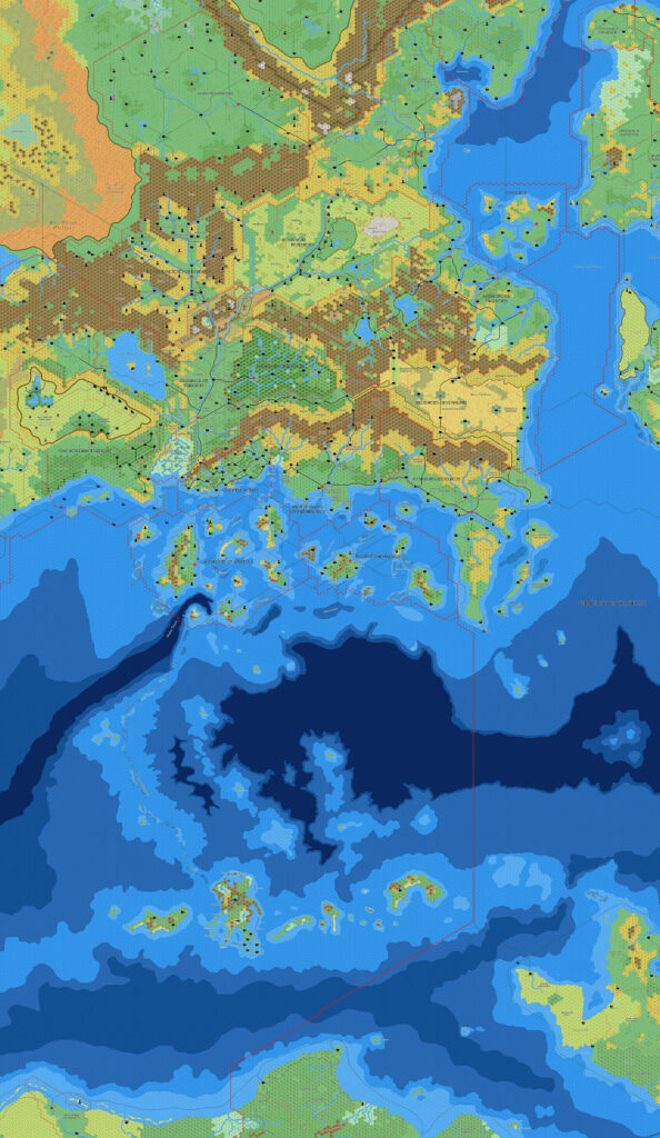
Rules Cyclopedia Known World, 8 miles per hex
1991 saw the release of the Rules Cyclopedia, compiling all of the rules from the BECMI era into a single volume. The book also included a short atlas of the Known World, with more than 10 pages of maps.
According to Bruce Heard, the Rules Cyclopedia’s maps were taken directly from the TM1 and TM2 trail maps. A close comparison confirms this, revealing them to be identical to the source maps. In the book, the maps comprised 10 separate pages, with a little overlap between sections. This replica presents the maps in combined form, so it’s possible to see at a glance exactly what areas the Rules Cyclopedia covered.
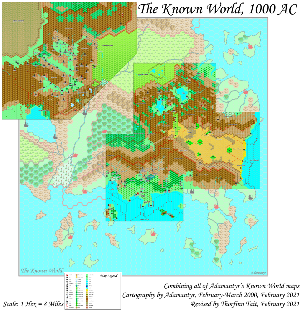
Combined Replica Map (December 2020)

One (or more) of the maps linked to above is a lower resolution version. You can download the full size version using the following link (right click and choose “Save Link As…”).
Mobile Users: Note that it may not be possible to view the full resolution image on your device.
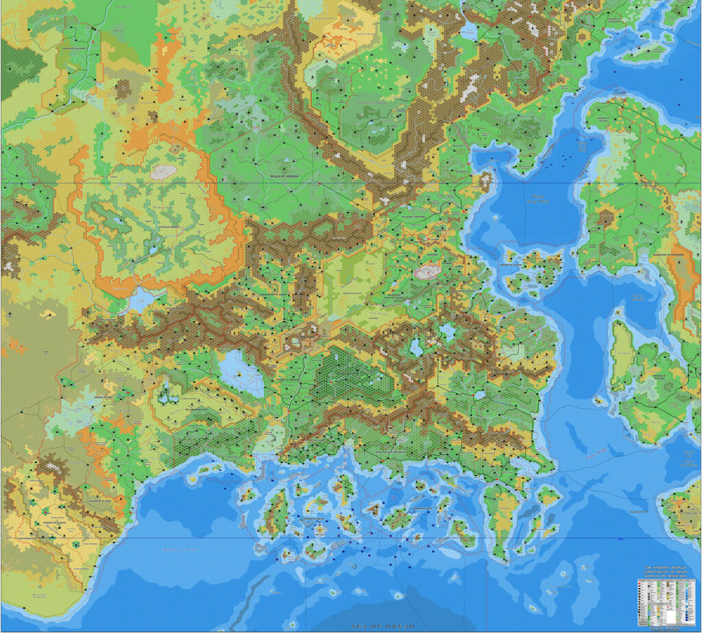
Rules Cyclopedia Known World, 8 miles per hex (300 DPI)
Sources
- Dungeons & Dragons Rules Cyclopedia (1991) (PDF at DriveThruRPG)
- 12 full page plates on pages 273-279 and 284-288 (Cartography by Dennis Kauth and Frey Graphics)
Chronological Analysis
These maps were excerpts from Maps 119 and 120. They were published in November 1991. The updated Atlas version is Known World, 8 miles per hex. See also Appendix C for annual chronological snapshots of the area. For the full context of this map in Mystara’s publication history, see the upcoming Let’s Map Mystara 1991.
The following lists are from the Let’s Map Mystara project. Additions are new features, introduced in this map. Revisions are changes to previously-introduced features. Hex Art & Fonts track design elements. Finally, Textual Additions are potential features found in the related text. In most cases, the Atlas adopts these textual additions into updated and chronological maps.
Additions
- None.
Revisions
- None.
Hex Art & Fonts
- Hex Art — Gazetteer-series standard.
- Fonts — Feinen throughout.
Textual Additions (Rules Cyclopedia, November 1991)
Under Construction! Please check back again soon for updates.
- Probably none.


21 June 2016 @ 6:23 pm
Really liking your updated website. Your maps are fantastic. Wondered if it would be possible to get this map of the known world as a pdf? I hav the cyclopedia and most of the old printed maps that was published, but it would be great to be able to print maps for game sessions without risking to bring out the originals
30 June 2016 @ 1:03 pm
Hi Niels! Thanks for the nice message about the new site. 🙂
I haven’t quite decided what to do about PDF versions yet. There’s a slight problem in that the new updated maps are created using Photoshop to composite files together, so it’s not possible to generate PDFs of those.
In the meantime, you should be able to get a PDF version of this particular map at the following link:
http://adobe.ly/296Dggk
10 July 2016 @ 1:58 am
Thank you for the link. I was under the impression that photoshop could output its files as pdf. Also the link is an .ai fil, and I am sure that you can save an illustrator file as a pdf.
Anyway, great maps. It is just great to be able to mess around with the maps, not risking the prescious old originals.
18 January 2019 @ 1:52 am
WOW!! Great! Thank you for all!