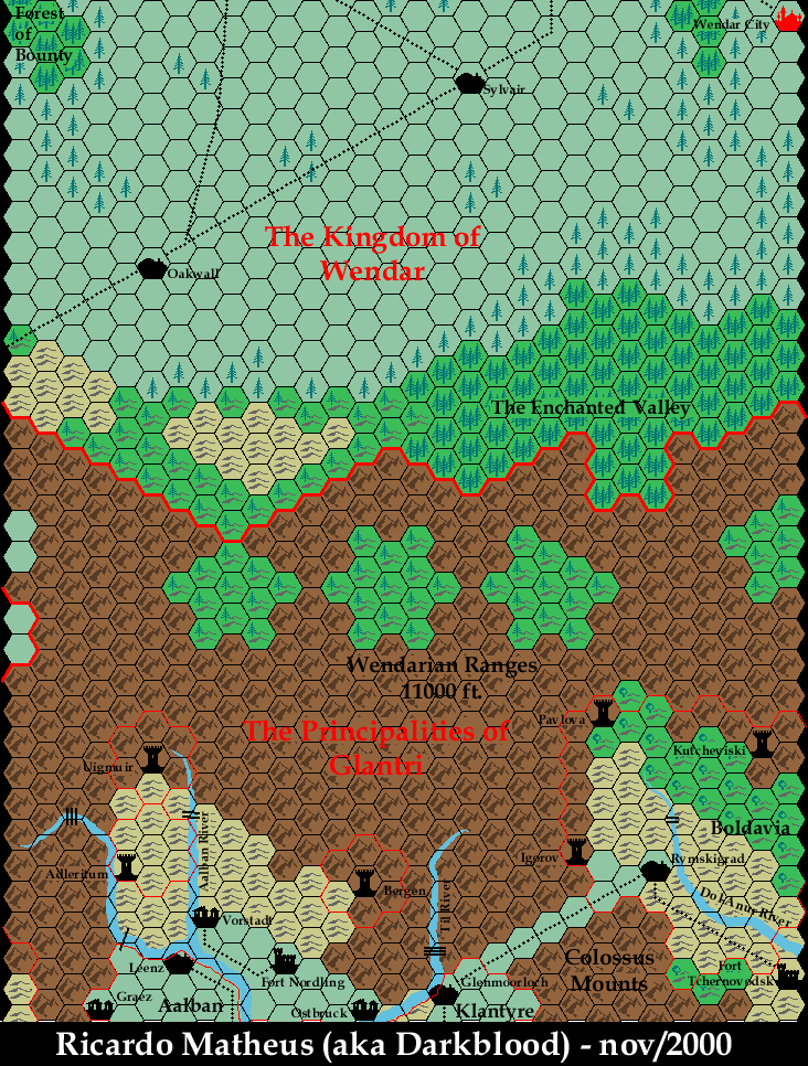
Darkblood’s Known World, 8 miles per hex, Grid N1
With the first two rows of four tiles completed, Ricardo’s next addition for his Mystara’s Map Navigator moved north from Grid 0. This was an exciting development, as it meant tackling parts of the nations of Wendar and Heldann, which official maps never covered at this level of detail, although by this time Thibault Sarlat had already released his own maps of the area.
In fact, at this time, Thibault was working on his revised Wendar map. Ricardo adopted features from Thibault’s map, and suggested some additions of his own, which Thibault incorporated. Thanks to their collaborative effort, the two maps are highly compatible.
This map had two versions: an initial version in late October, followed quickly by a revised version with rapids marked on the rivers.
Fan-made Map by Ricardo Matheus (November 2000)
This is an original map created by one of Mystara’s excellent fan cartographers. For more information on the cartographer, including a gallery of all their maps, see also Appendix M: Mappers of Mystara.
Sources
- GAZ3 The Principalities of Glantri (1987) (PDF at DriveThruRPG)
- Wrath of the Immortals (1992) (PDF at DriveThruRPG)
- Glantri: Kingdom of Magic (1995) (PDF at DriveThruRPG)
Secondary Sources
References
- Ricardo’s entry in Appendix M: Mappers of Mystara
- Ricardo’s author page at the Vaults of Pandius
Chronological Analysis
This is a fan-made map. It was published in 2000. The updated Atlas version of this map is split between: Glantri, 8 miles per hex, and Wendar, 8 miles per hex (currently available at Thorfinn Tait Cartography). See also Appendix C for annual chronological snapshots of the area. For the full context of this map in Mystara’s publication history, see the upcoming Let’s Map Mystara 2000. (Please note that it may be some time before the project reaches this point.)
The following lists are from the Let’s Map Mystara project. Additions are new features, introduced in this map. Revisions are changes to previously-introduced features. Hex Art & Fonts track design elements. Finally, Textual Additions are potential features found in the related text. In most cases, the Atlas adopts these textual additions into updated and chronological maps.
Coming Soon


