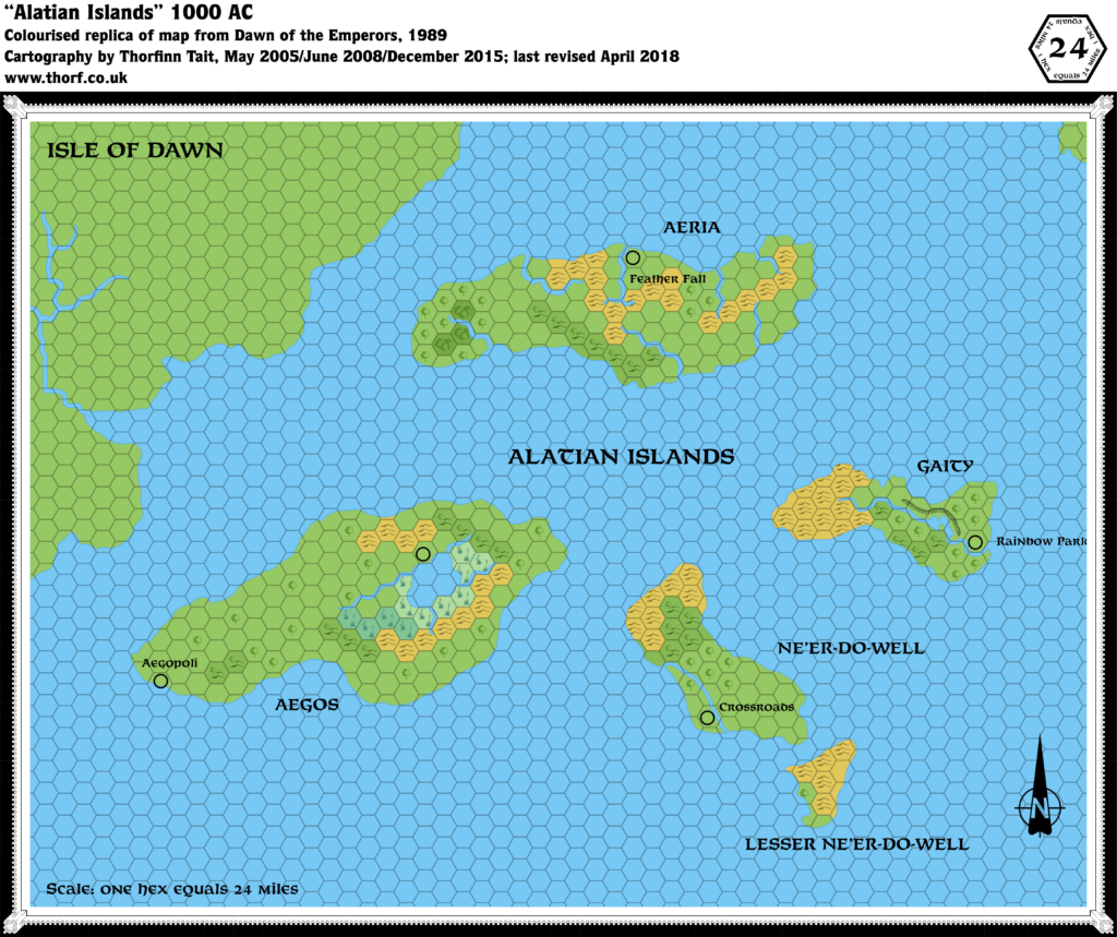
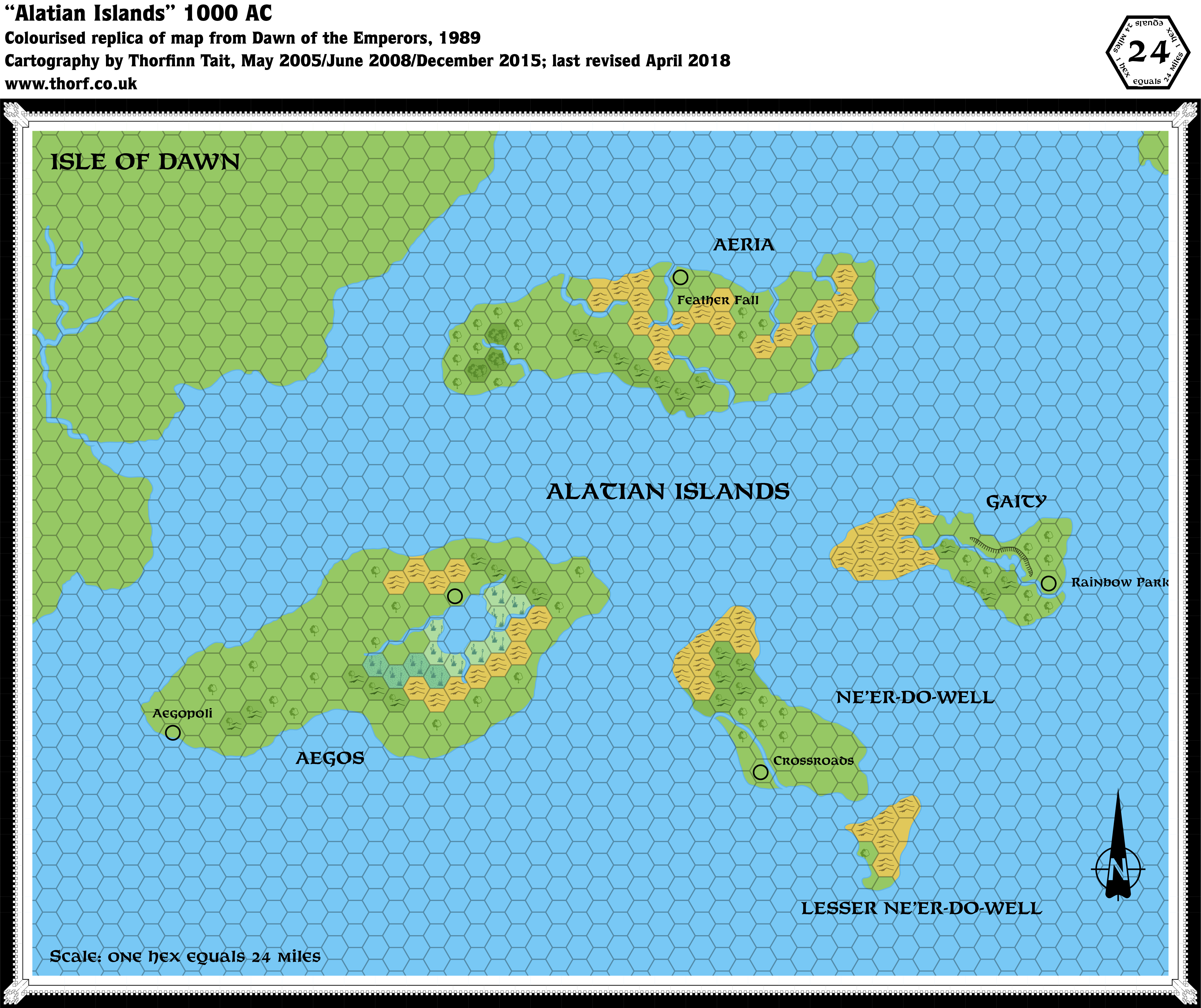
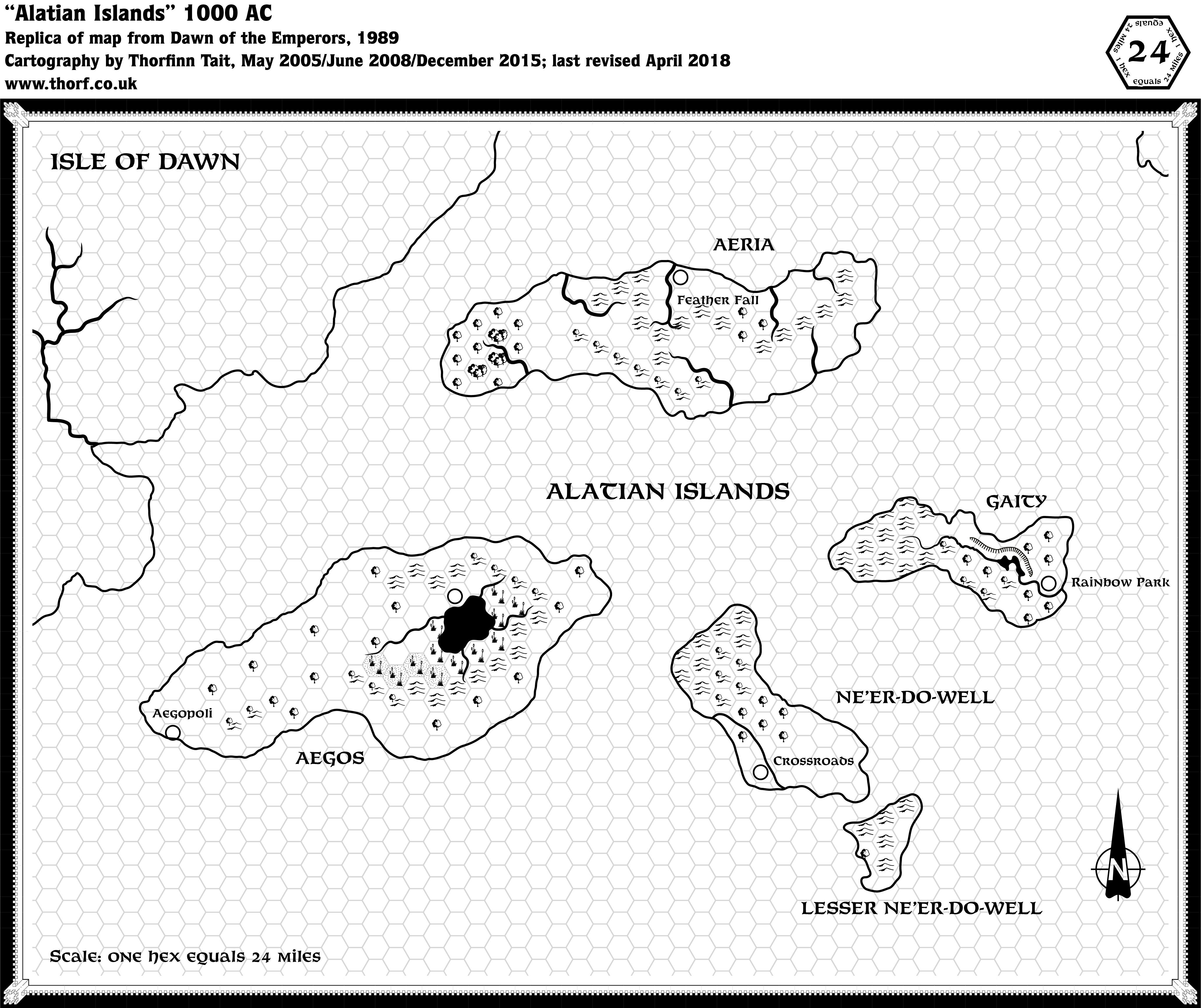
Dawn of the Emperors Alatian Islands, 24 miles per hex
This black and white map from Book One of Dawn of the Emperors provided a full map of the Alatians at this scale for the first time. The poster map of the Isle of Dawn from the same set already showed the western three quarters of the archipelago, but missed out the rest. The terrain matches well between the maps, although none of the villages from the poster map appear on this map, and peculiarly none of the grasslands shown on the poster map appear here.
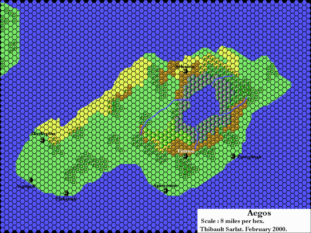
One interesting detail is the unnamed settlement marked north of the lake on Aegos. Wrath of the Immortals a few years later would mark a village named Selenion in the same spot, which may well be a reference to this map.
Replica Map (May 2018)
Sources
- Dawn of the Emperors (1989) (PDF at DriveThruRPG)
- Book One: The Dungeon Master’s Sourcebook, page 62
Chronological Analysis
The following lists are from the Let’s Map Mystara project. Additions are new features, introduced in this map. Revisions are changes to previously-introduced features. Hex Art & Fonts track design elements. Finally, Textual Additions are potential features found in the related text. In most cases, the Atlas adopts these textual additions into updated and chronological maps.
Under Construction! Please check back again soon for updates.
Additions
- Settlements —
Revisions
- Settlements —
Hex Art & Fonts
- Hex Art —
- Fonts —
Textual Additions
- Settlements —