
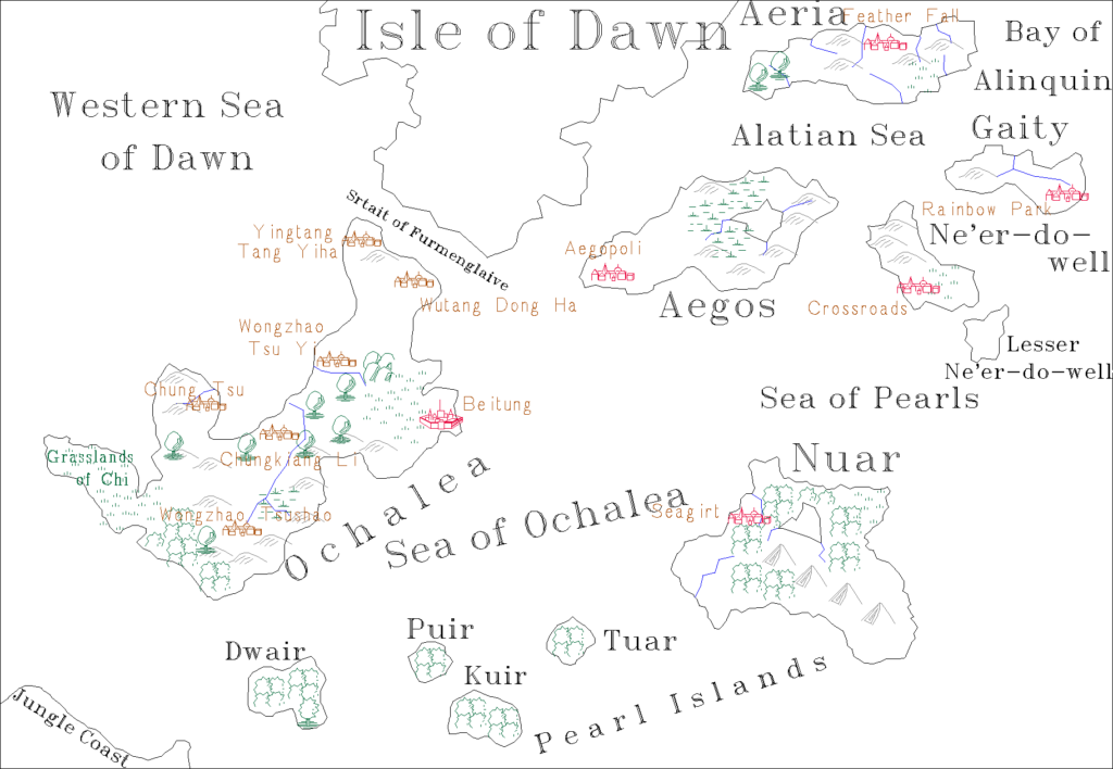
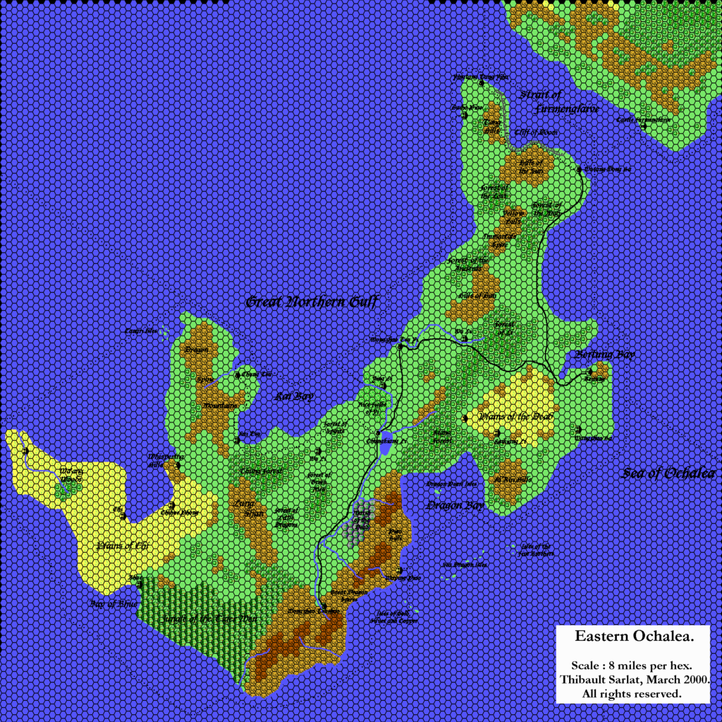
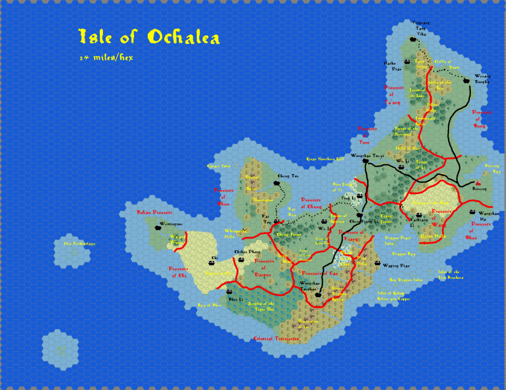
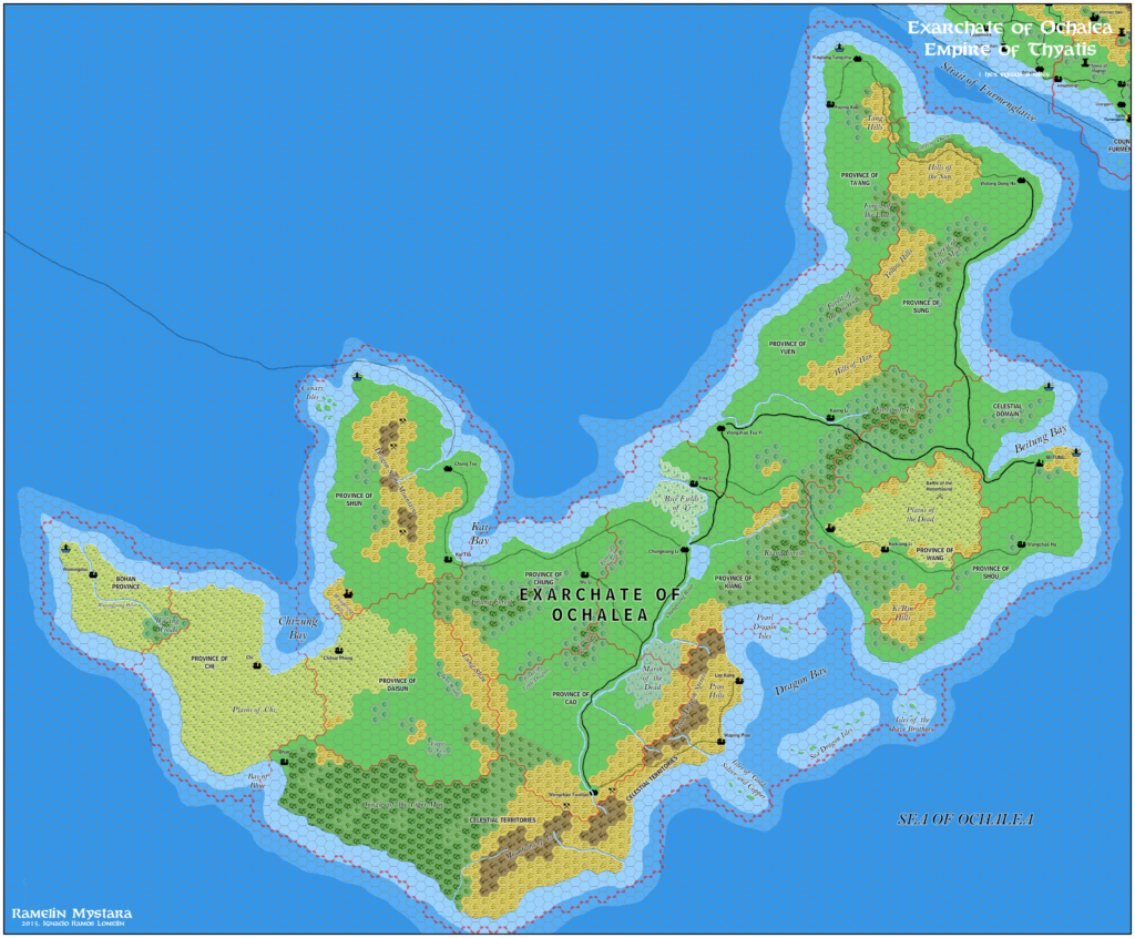
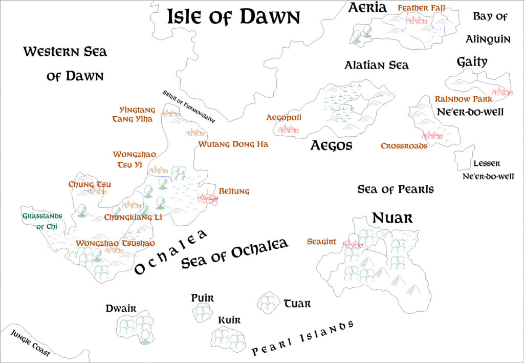
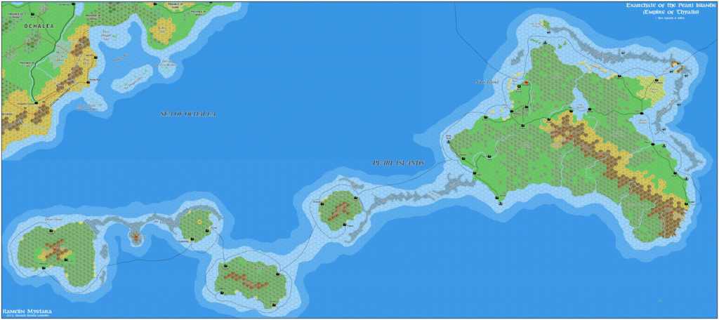
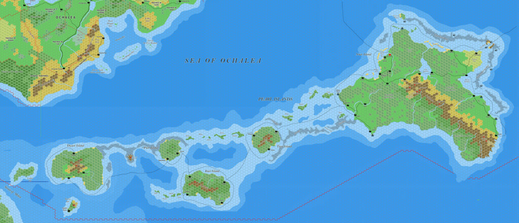
Dawn of the Emperors Ochalea and the Pearl Islands, 24 miles per hex
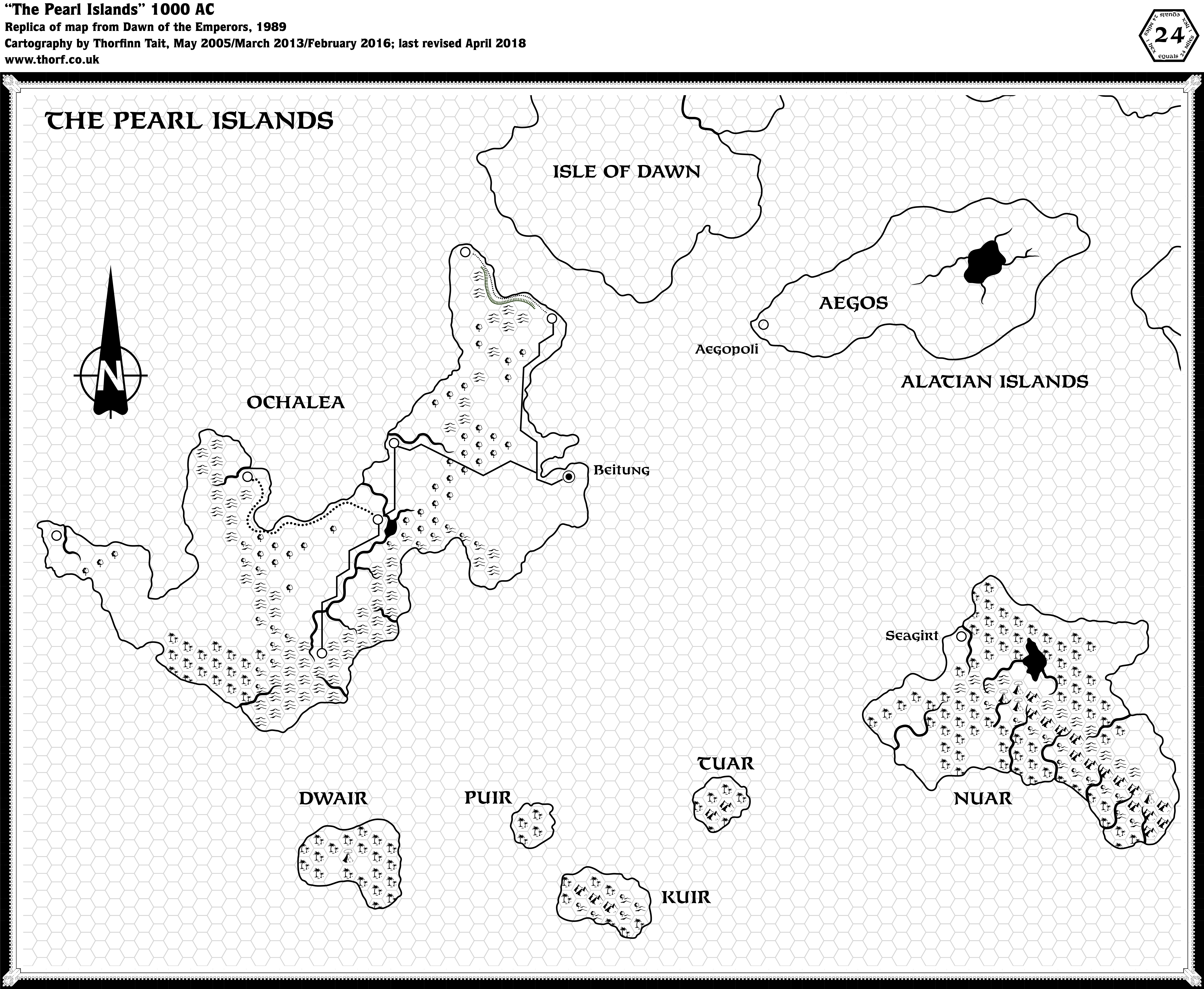
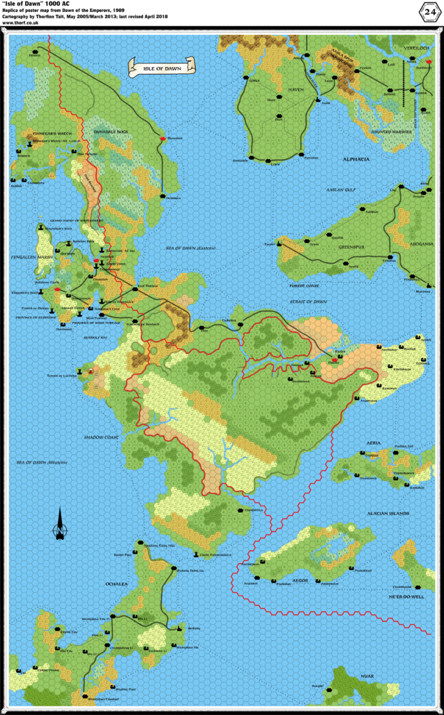
Dawn of the Emperors Book One provided this black and white map of Ochalea and the Pearl Islands. Despite its relative lack of detail, it remains the primary source for both these island nations, although the Isle of Dawn poster map from the same set showed most of Ochalea and the northern half of Nuar with a little more detail, including names for the settlements marked on this map as well as grassland hexes not shown on this map.
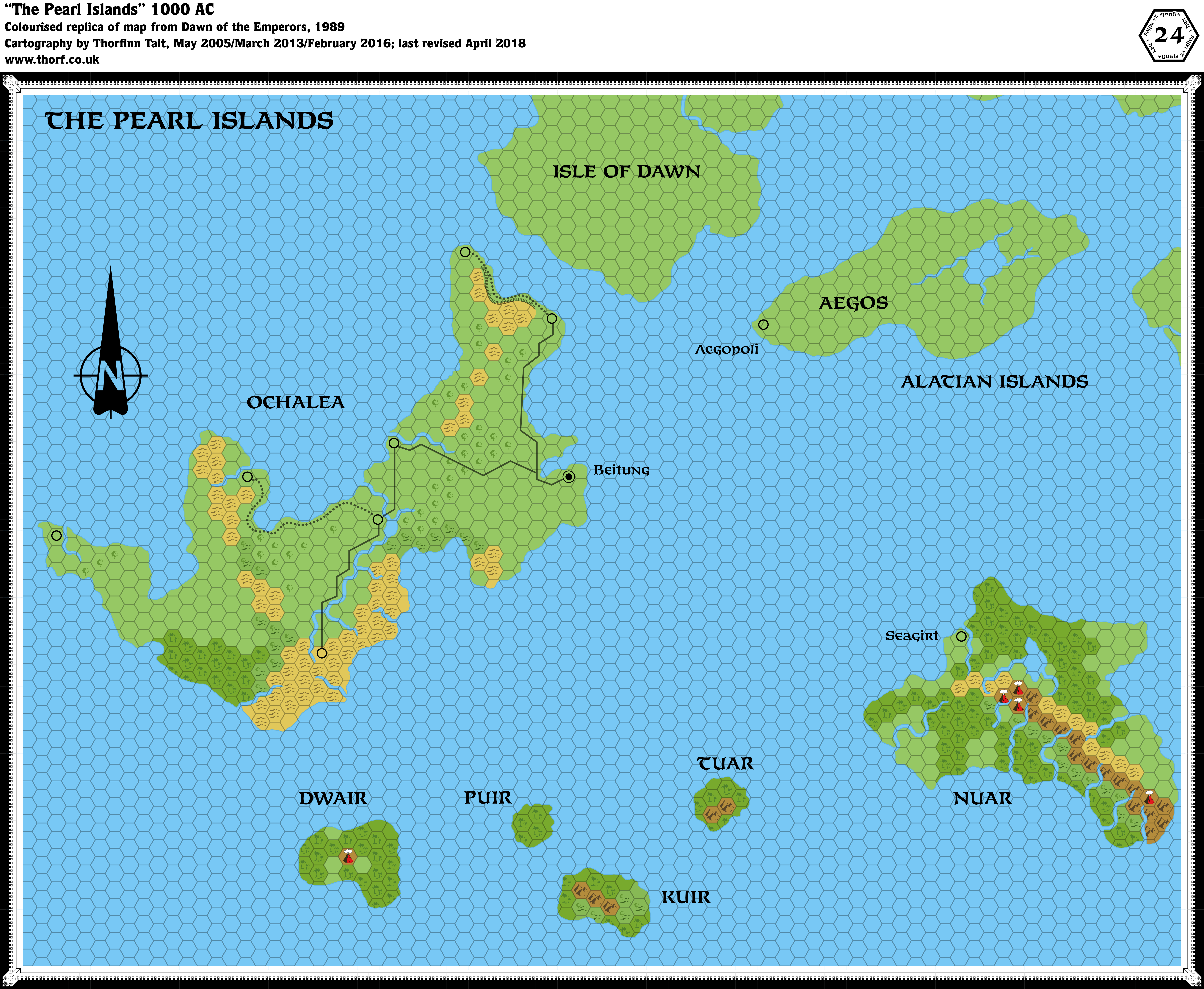
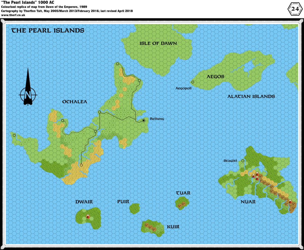
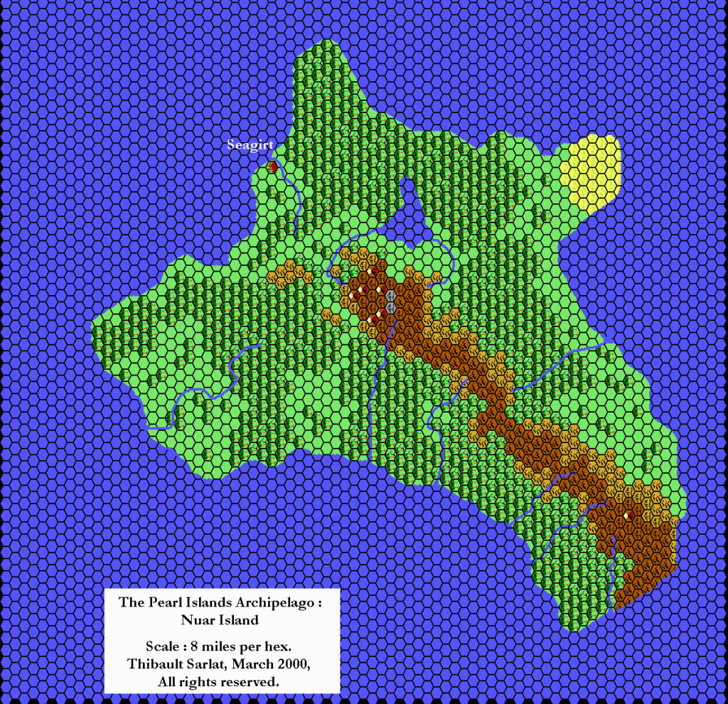
Replica Map (May 2018)
Sources
- Dawn of the Emperors (1989) (PDF at DriveThruRPG)
- Book One: The Dungeon Master’s Sourcebook, page 78
Chronological Analysis
This is Map 122. It was published in August 1989. The updated version of this map has not yet been released. See also Appendix C for annual chronological snapshots of the area. For the full context of this map in Mystara’s publication history, see Let’s Map Mystara 1989.
The following lists are from the Let’s Map Mystara project. Additions are new features, introduced in this map. Revisions are changes to previously-introduced features. Hex Art & Fonts track design elements. Finally, Textual Additions are potential features found in the related text. In most cases, the Atlas adopts these textual additions into updated and chronological maps.
Under Construction! Please check back again soon for updates.
")
")
")