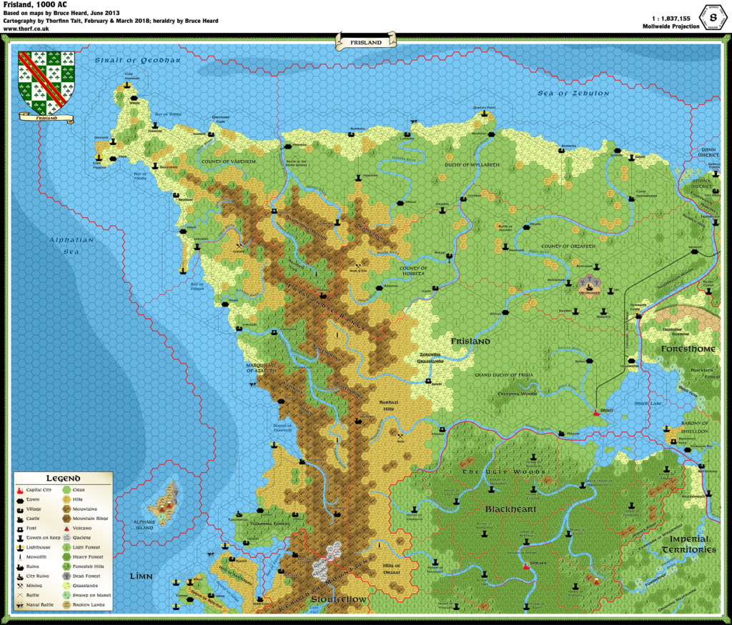
Frisland, 8 miles per hex
This kingdom at the northwestern tip of the Wizards’ Empire stands amongst the largest in mainland Alphatia and bears a most tumultuous history. Despite its harsh climate and inhospitable land, Frisland became a battleground for races, cultures, and faiths. A legacy of horror and of ancient evils still imbues the region, which to this day survives Alphatia’s efforts to scour the province of its troublesome heritage.
Greater Frisland incorporates six dominions: the Grand Duchy of Frisia, the neighboring Counties of Orzafeth and Hosseta, the Duchy of Wyllareth on the northern coast, the County of Västheim on the Frislandic Peninsula, and the Marches of Azafeth which hold the western coast along the Alphatian Sea. Greater Frisland remains sparsely populated, with vast stretches of its lands qualifying as wilderness. Population huddles in the vicinity of towns and villages, spreading up to 40 miles out along rivers and trails where settled lands gradually turn into borderlands and wilderness. The Kerothar Mountains separate the old Antalian colonies from the rest of Greater Frisland. The Azafeth Ridge, the Västmark Shield, the Frislandic Range, the Baalbethine Mounts, and the Beatha Spur are all part of the massive Kerothar system..
from Bruce Heard’s The Alphatian Province of Frisland
Map (updated 20th March 2018)

Sources
- Frisland, 8 mile per hex map by Bruce Heard
- Dawn of the Emperors (1989)
- The Empire of Alphatia 24 mile per hex poster map
Notes
As with all his Alphatia 8 mile per hex maps, Bruce Heard added a great deal of detail and character to the region when converting from 24 miles per hex. The Atlas considers Bruce’s map to be the definitive source for Frisland.
References
SaveSaveSaveSaveSaveSaveSaveSaveSaveSaveSave<span style="border-top-left-radius: 2px; border-top-right-radius: 2px; border-botto


