
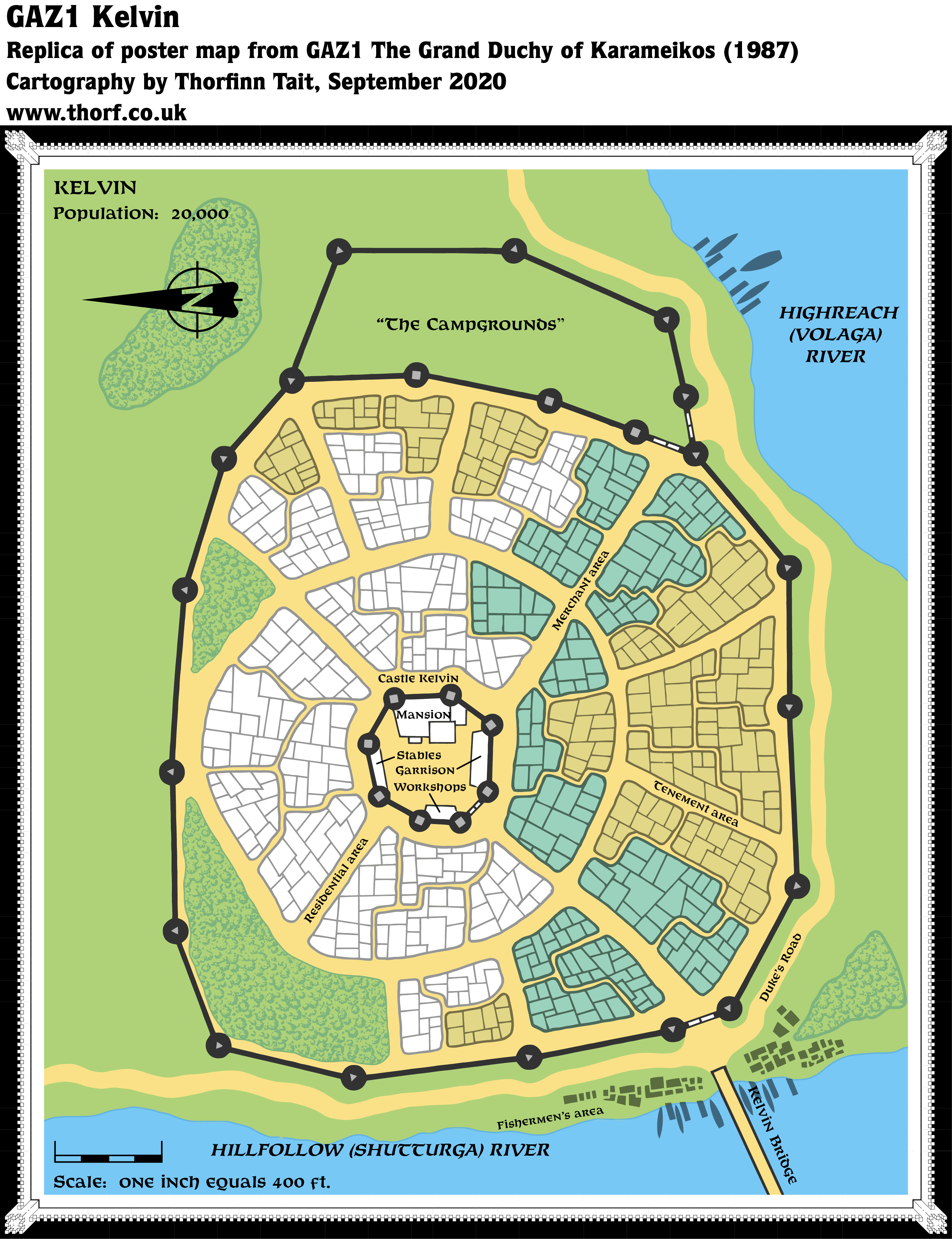
GAZ1 Kelvin
One of the many and welcome innovations of the Gazetteer series was the numerous town maps that came with each book. GAZ1 started this trend, with a new map for Kelvin, as well as revised maps for Specularum and Threshold.
This map is significant from a geographical perspective, as it details Kelvin’s precise placement at the conjunction of the Volaga and Shutturga Rivers — although this somewhat contradicted the hex map featured on the same poster map, which placed Kelvin 8 miles north of the confluence.
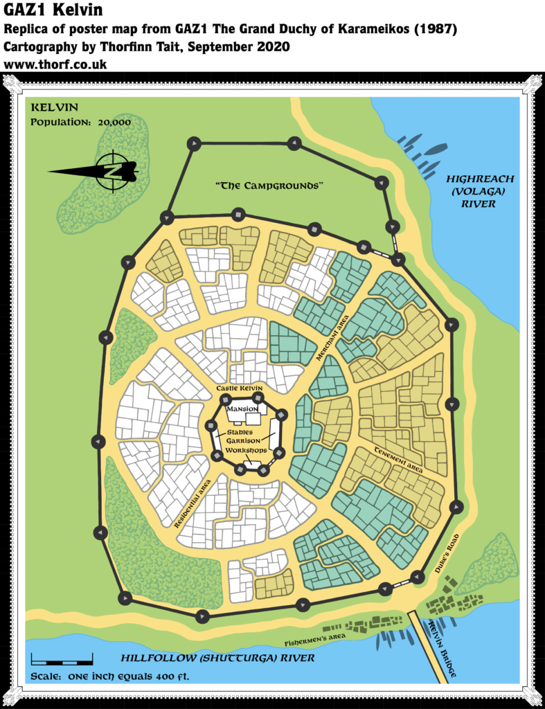
Replica Map (September 2020)
Sources
- GAZ1 The Grand Duchy of Karameikos (1987) (PDF at DriveThruRPG)
- Poster map (Cartography by Dennis Kauth, David C. Sutherland III, Ron Kauth)
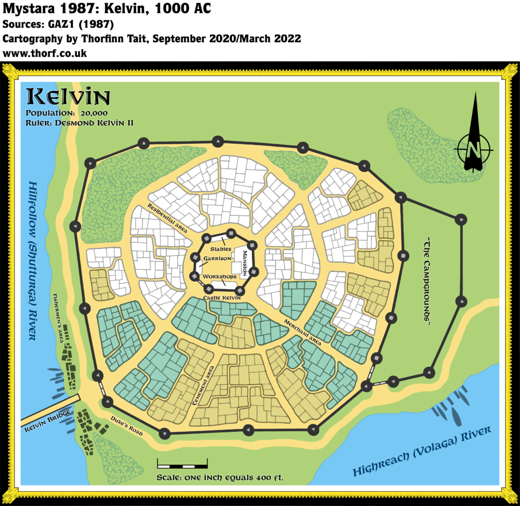
Chronological Analysis
This is a town map. It was published in April 1987. The updated version of this map has not yet been released. See also Appendix C for annual chronological snapshots of the area. For the full context of this map in Mystara’s publication history, see Let’s Map Mystara 1987.
The following lists are from the Let’s Map Mystara project. Additions are new features, introduced in this map. Revisions are changes to previously-introduced features. Hex Art & Fonts track design elements. Finally, Textual Additions are potential features found in the related text. In most cases, the Atlas adopts these textual additions into updated and chronological maps.
Coming Soon
")

