
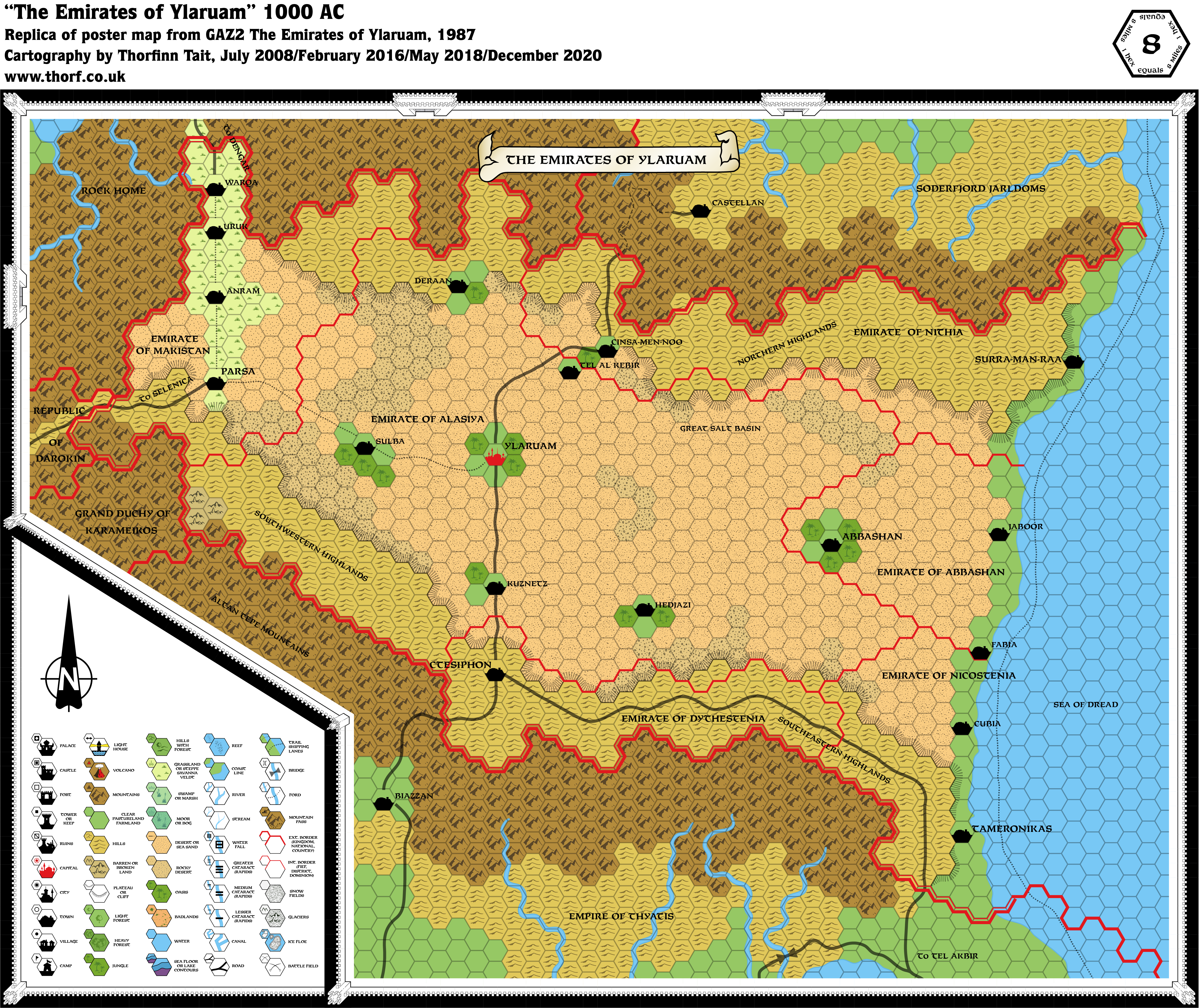
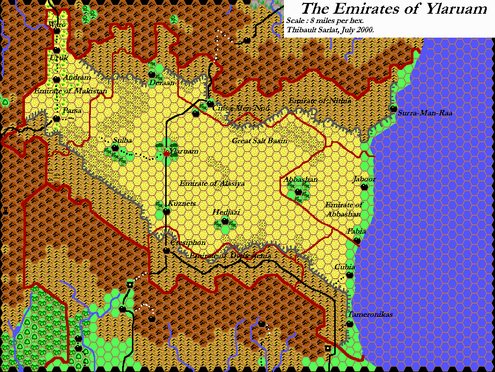
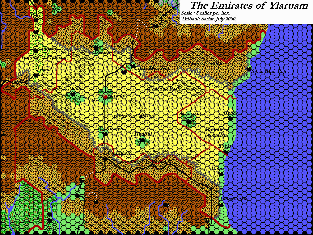
GAZ2 Ylaruam, 8 miles per hex
The second Gazetteer series map began a strange trend in not showing any villages. The lack of a central river prevented the Egypt-like treatment that later worked so well in HWR2’s Nithia. But it nevertheless did a decent job of making what the original 24 mile per hex map showed as an area of pure desert into a more interesting, varied landscape.
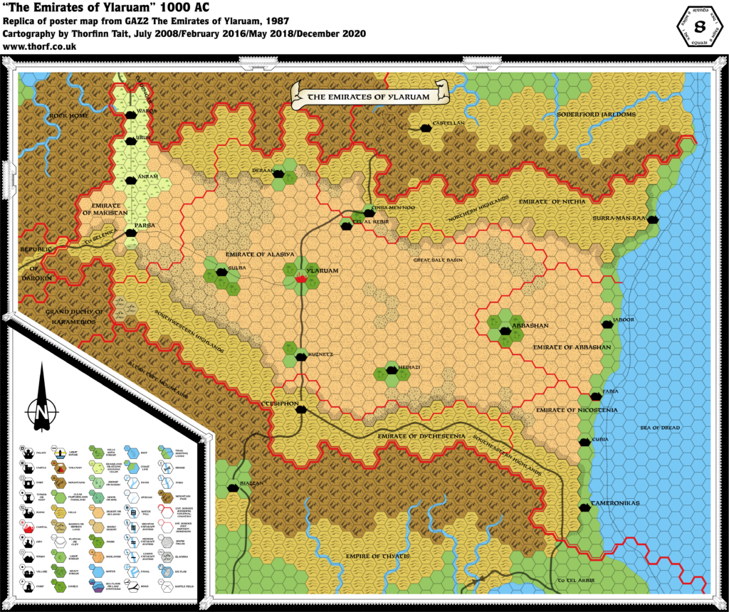
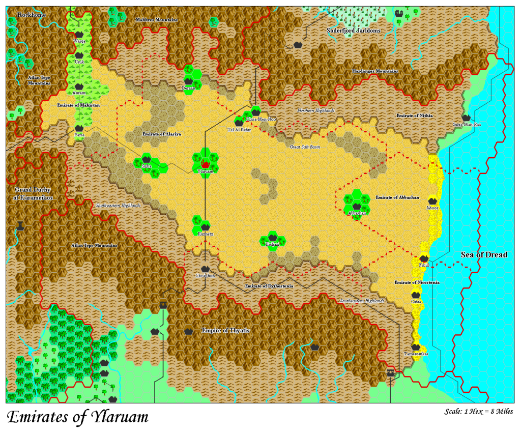
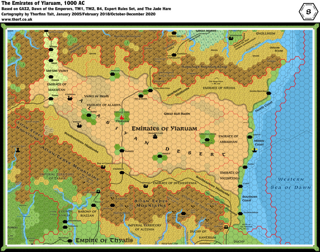
Replica Map (December 2020)
Sources
- GAZ2 The Emirates of Ylaruam (1987) (PDF at DriveThruRPG)
- Poster map (Cartography by Dennis Kauth, David C. Sutherland)
Chronological Analysis
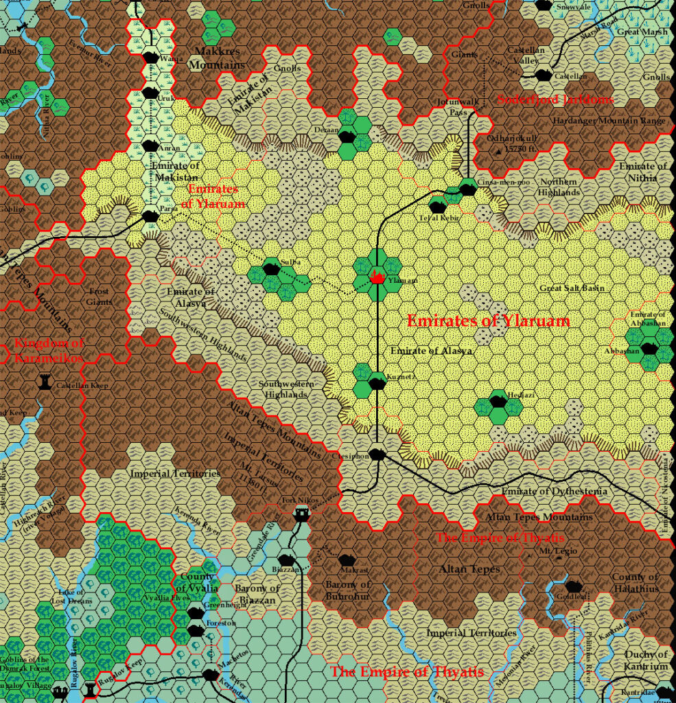
This is Map 61. It was published in August 1987. The updated version of this map is Ylaruam, 8 miles per hex. See also Appendix C for annual chronological snapshots of the area. For the full context of this map in Mystara’s publication history, see the upcoming Let’s Map Mystara 1987.
The following lists are from the Let’s Map Mystara project. Additions are new features, introduced in this map. Revisions are changes to previously-introduced features. Hex Art & Fonts track design elements. Finally, Textual Additions are potential features found in the related text. In most cases, the Atlas adopts these textual additions into updated and chronological maps.
Additions
- Dominions — The individual emirates make their debut here: Emirate of Abbashan, Emirate of Alasiya, Emirate of Dythestenia, Emirate of Makistan, Emirate of Nicostenia, and Emirate of Nithia.
- Settlements — Other than Ylaruam, all settlements are new here. (Parsa appeared in the corner of GAZ1’s map, but went unnamed at the time.) They are all towns: Warqa, Uruk, Anram, Parsa, Deraan, Sulba, Tel al Kebir, Kuznetz, Hedjazi, Ctesiphon, Cinsa-Men-Noo, Surra-Man-Raa, Abbashan, Jaboor, Fabia, Tameronikas, and Cubia.
- Terrain — These features were entirely new to this map:
- The Great Salt Basin is new here.
- The Northern Highlands and Southeastern Highlands, and Southwestern Highlands, raised areas of hilly terrain on the northern and southern edges of the Alasiyan Desert, are new, as are the plateaus separating them from the desert.
- More Oases have been added to the map, each centring on a town: Deraan, Sulba, Kuznetz, Hedjazi, and Cinsa-Men-Noo/Tel al Kebir.
Revisions
- Borders — A single hex in the far west of the nation has been changed from Ylaruam (in GAZ1) to Karameikos (here in GAZ2). It’s directly south of the Selenica-Parsa road.
- Nations — The nation has become the Emirates of Ylaruam, now with multiple emirates instead of a singular dominion.
- Settlements —
- Terrain — The following features were present or partially present on smaller scale maps, and have been revised here.
- The Alasiyan Desert has been divided into areas of sandy and rocky desert.
- The Oases of Ylaruam and Abbashan have been detailed as lands with clear and oasis hexes, each with a central settlement.
- The Ust-Urt Valley was previously marked as clear hexes. It is now an area of grasslands.
- Trails — The trails of Ylaruam have been present since Expert 1983, and were divided into roads and trails in X10. GAZ2 uses these trails pretty much as is, but conformed to the 8 mile hex grid. Additionally, the route between Cinsa-Men-Noo and Castellan has been partially converted into a winding mountain pass. No completely new trails were added.
Hex Art & Fonts
- Symbols — Gazetteer series standard. Shallow and deep water appeared for the first time in a Gazetteer map, as did the art for Reefs, although both of these appeared in the Legend as early as GAZ1.
- Fonts — Feinen throughout.
Textual Additions (GAZ2 1987)
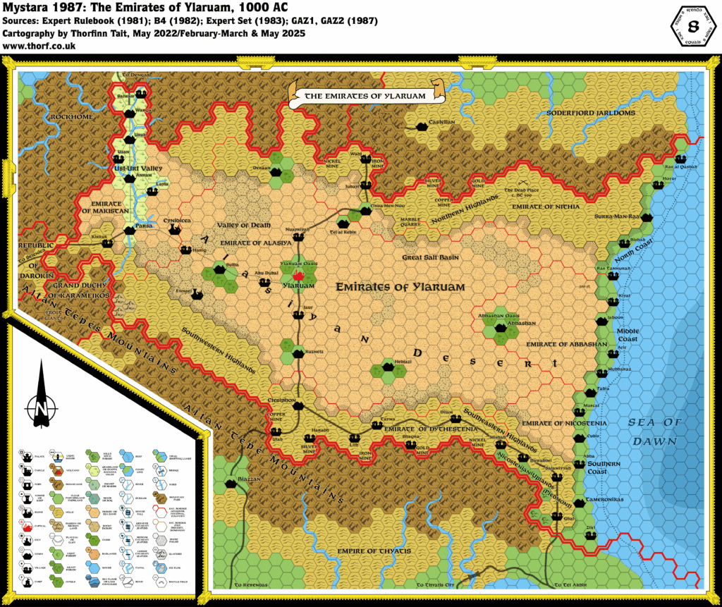
- Altitude — The Gazetteer describes the lay of the land on GAZ2 page 6: “like a great scoop open to the eastern sea”. The desert basin “dips down sharply” from the Altan Tepes in the west, “almost down to sea level in the salt flats west of Ylaruam, then sloping gently upwards again, becoming a high desert plain until it reaches the sea, where it drops several hundred feet in the last few miles before it reaches the coastline”.
- History — GAZ2 gives hints about various parts of Ylaruam in previous times:
- The Nithian Empire once flourished in this land, between 1500 and 500 BC (page 4). At that time, the River Nithia ran “from the mountains of Rockhome in the west to the Sea of Dawn in the east” (page 4). Their decline was caused by Immortal interference, which consisted of a number of factors: “the geologic uplift of the northern uplands and the subsidence of the Alasiyan Basin, which diverted the headwaters of the Nithia into the underground reservoirs of the Alasiyan Desert and precipitated the collapse of the Nithian Empire’s agricultural base.” (Page 4) In 2000 BC, there were “early agricultural settlements” along the River Nithia. By 1000 BC, Nithia featured “monumental architecture, large urban complexes in delta, conquest of neighbouring states and remote colonies, culture.” Finally in 500 BC the empire is said to “vanish utterly” in an “abrupt decline”. (All page 5)
- Ylaruam was an “insignificant village” in 825 AC (page 4).
- Migration — In 100 AC, Makistani tribal nomads enter the Ust-Urt Valley from the north, and settle there (page 5).
- Mines — GAZ2 page 11 mentions the mining of marble, gold, silver, iron, nickel, and copper in the Emirate of Nithia, in the area around Cinsa-Men-Noo and “in the wastelands to the east”. It also says that extensive exploitation of these “rich” deposits is only just beginning. Page 12 goes on to detail “nickel, gold, silver, copper, and carbon-rich iron” in the “lower slopes of the Altan Tepe range” in Dythestenia.
- Rivers — According to GAZ2 page 6, seasonal rivers known as wadis are present in the areas surrounding the Alasiyan Basin, especially the semi-arid highlands. The northern mountains of Nithia are said to be “a wasteland”, while Dythestenia’s highlands are noted to have “fertile wadis”. The same page states that there are various minor rivers which irrigate the Ust-Urt valley, all of which drain into the Alasiyan Desert Basin at the southern end of the valley.
- Seas — Although the map had a label for “Sea of Dread”, the text definitively states that Ylaruam borders on the Sea of Dawn (pages 2b, 4a, 5a, 8a, 36c). It is even included in the Glossary (page 36c), as “Sea of Dawn: sea to the east of the Emirates.” This appears to be the first mention of this body of water, which had previously been assumed to be simply a northeastern extension of the Sea of Dread.
- Settlements — GAZ2 provides a few extra details:
- Emirate capitals — the capital of each individual emirate is given in the text as follows: Ylaruam, capital of the Emirate of Alasiya (page 6a); Abbashan, capital of the Emirate of Abbashan (page 11a); Parsa, capital of the Emirate of Makistan (page 11c); Tameronikas, capital of the Emirate of Nikostenia (page 12b); Ctesiphon, capital of the Emirate of Dythestenia (page 12c); and Surra-Man-Raa, capital of the Emirate of Nithia (page 31b).
- Cubis — The map has Cubia, but the text has Cubis throughout (pages 11, 12, 31).
- Kirkuk — This village has no official location, as it was designed to be dropped onto the map wherever was most convenient. GAZ2 pages 38-52 detail the village, and various possible locations are discussed, especially in the Staging Tips section on page 44: “Ideally it belongs on any caravan route or track in a wilderness or borderland region near the foothills of the Altan Tepes.” The village map of Kirkuk places its major street and caravansary on an East-West route. Of course it’s possible for the town to lie along a short East-West section of a North-South trade route,
but taking things at face value it seems that the big road in the south is the most logical location. Considering the historical links to Thyatis, the Emirate of Dythestenia seems the most likely place.Fabrizio Nuzacci suggests that Dythestenia doesn’t have a large enough population to accommodate the village as outlined in GAZ2. Therefore it seems that the best location would be on the trade route just west of Parsa, at the veritable entrance to the Emirates of Ylaruam. - Villages — Although no villages were marked on GAZ2’s poster map, the Ylari Region Chart on page 31 gives the following list of town/village names to be “scattered around on detailed topographical maps”:
Jauf, Taymor,Tayma,Wahj,Muscat, Dubai,Abu Dubai, Doha,Salwaw,Jubayl, Qaysumah,Nuayriyah, Urayirah,Mubbaraz,Hofuf, Udayliyyah,Haradh,Mishab, Ras al Khafqi,Ras Tannurah, Abu Hadryah,Zilfi,Ghat, Ruywaydah,Shaqra, Diriyah,Dilam, Hillah,Layla,Hariq,Salamiyyah, Artawiyyah, Turayt, Hadithah, Ha’il, Unayzah,Dawadimi, Kasamin,Bishah, Baljurshi, Kahmis Mushayt,Abha, Dirs,Kiyat,Uzan,Lith,Afif,Ulah, Umm Lajj, Duba,Ras al Qasbah, and Haql. When these names are placed on the map, I will note that below. (For now, this applies to Chronological maps of Ylaruam, starting with 1987; eventually the Updated map will also be changed to match these additions.)- In the Emirate of Abbashan, Kiyat, Afif and Mubbaraz have been placed on the coastal plain (GAZ2 p10c).
- In the Emirate of Alasiya, Abu Dubai, Hariq, Jauf and Nuayriyah have been placed along the trade routes leading to Ylaruam. GAZ2 p10b notes “small villages”, but doesn’t give any hint as to where they would be — aside from the oases, of course, but there isn’t space to mark additional settlements in these.
- In the Emirate of Dythestenia, Tayma, Dilam and Mishab are a few settlements “found along the east-west caravan route”, while Ulah, Haradh, Lith and Shaqra are a few mining communities “nestled on the lower slopes of the Altan Tepe range” (GAZ2 p12c).
- In the Emirate of Makistan, Salwaw, Uzan and Layla have been placed on minor rivers in the Ust-Urt Valley (GAZ2 p11c).
- In the Emirate of Nithia, Wahj and Jubayl have been placed along the caravan route near Cinsa-Men-Noo (GAZ2 p11b). Hofuf, Ras al Qasbah, Ras Tannurah and Bishah have been placed on the Northern Coastal Plain (GAZ p11b).
- In the Emirate of Nicostenia, Muscat, Abha and Zilfi are “large villages along the coastal plain”, while Ghat, Salamiyyah and Dawadimi are “substantial settlements” on the upland plateau (GAZ2 p 12b).
- Spellings — The text includes various differences in spelling and style from the map.
- Capitalisation — The map has everything in capital letters, but the Gazetteer’s text provides the correct capitalisation as follows: Cinsa-Men-Noo, Surra-Man-Raa, Tel al Kebir.
- Terrain — The following terrain and terrain features were detailed in GAZ2’s text:
- Alasiyan Desert — Originating in X1, this phrase did not appear on GAZ2’s map, though it occurs often in the text, which uses the capitalised phrase “Alasiyan Desert” (e.g. on page 4) as well as the more standard “Alasiyan desert”. Both these terms seem to refer to the desert as a whole, including all the land from the Ust-Urt Valley in the west to the coastal plains in the east, and possibly also the highlands to the north and south. Other terms in use in GAZ2’s text are Alasiyan Basin (GAZ2 page 31), Rub Al-Khali and its English translation The Empty Quarter (also 31), and the Alasiyan Desert Basin (6), all of which are apparently synonyms for the Alasiyan Desert. The Atlas accepts all these terms, but for the sake of brevity only Alasiyan Desert is used on the map.
- Coastal Plain — GAZ2 page 6 describes this area in detail, but the map version is quite different from this description, which refers to the plain as a strip of land along the coast “from one to five miles wide”, “bounded by an escarpment of 200 to 500 feet in elevation”. The poster map’s coastal strip is perhaps one to ten miles wide, but this doesn’t seem significant enough to warrant revision. On the other hand, the escarpment dividing the desert and the plain can be added to the map.
- The Dead Place — The site of an Immortal battle during the fall of Nithia (i.e. c. BC 500), described on GAZ2 pages 63-64. It is said to be located “in a remote region of the Nithian highlands” and “in a rugged badlands swept by sand dunes”. It takes the form of a vast glassy obsidian bowl, mostly covered with sand but sometimes partially revealed by storms. The most remote location would seem to be half way between Surra-Man-Raa and Cinsa-Men-Noo. Note that page 31’s Ylari Region Chart refers to “The Dead Places (desolate areas of Nithia)”. The plural could simply be due to the fact that the area is taboo, and the nature and exact location of the Dead Place remains unknown.
- Ennaej — This label was featured in GAZ2’s cover art by Clyde Caldwell. It appears to be around the Southwestern Highlands region. The fan community has proposed various ideas for incorporating it into the map, for which see the discussions in the Ylaruam map thread at The Piazza.
- Great Salt Basin — GAZ2 page 31 refers to this as a “vast desolate salt lake”.
- Middle Coast — the Ylari Region Chart on page 31 of GAZ2 provides this name for the Abbashani coastal plain.
- Nicostenian Uplands — according to GAZ2 page 12, the uplands of Nicostenia are “the only substantial source of timber, charcoal and firewood in the Emirates”, suggesting that they are forested to some extent. Some forested hill hexes could therefore be added to this area.
- North Coast — the Ylari Region Chart on page 31 of GAZ2 provides this name for the Nithian coastal plain.
- Oases — the Ylari Region Chart on page 31 of GAZ2 refers to the oases around Abbashan and Ylaruam as the Abbashan Oasis and the Ylaruam Oasis.
- Piedmont — the Ylari Region Chart on page 31 provides this alternate name for the Nicostenian Uplands. In the real world, this is a region in northern Italy, and the name means “at the base of the mountain”. The name seems quite fitting as these hills are at the foot of the eastern spur of the Altan Tepes. Perhaps the name is of Thyatian origin. See Nicostenian Uplands above.
- Southern Coast — the Ylari Region Chart on page 31 of GAZ2 provides this name for the Nicostenian coastal plain.
- Ust-Urt Valley — the name for the fertile valley that makes up most of the Emirate of Makistan, referenced on GAZ2 pages 4, 6, 8, 11-12, 30-31, etc.
- Valley of Death — GAZ2 page 31 refers to this as a “salt basin west of Ylaruam”; page 6 also mentions “salt flats west of Ylaruam”, which are presumably one and the same. It has been assumed that this is the area of rocky desert north of Sulba.
")
")
")
5 February 2016 @ 6:08 pm
Would like to see an updated map (one day) of the 24 mph version from GAZ2 in the internal cover, that included the plateaus/valleys.
5 February 2016 @ 9:01 pm
That’s something I will be doing, but for now the focus is on the 8 miles per hex scale.
Incidentally, the 24 will be necessary to present zoomable maps, likely with world map/continental (hexless) maps, then 24, then finally 8 miles per hex.
18 February 2016 @ 3:05 am
Ylaruam does not load to the large image. :o/
18 February 2016 @ 8:21 am
Try this direct link:
https://atlasofmystara.com/wp-content/uploads/2016/02/gaz2-ylaruam-8.png
18 February 2016 @ 8:44 am
Thank you. Now, my collecting is back on track. The image url starts with “i1.wp.com/”. That seems to kill it for me.
19 February 2016 @ 10:57 am
As I understand it, this is WordPress’s way of speeding up the site. But it sometimes seems to do the opposite. You can get the direct link simply by zapping the extra domain name (as you said, the i1.wp.com bit).