GAZ4 Honor Island
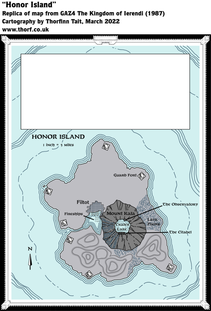
GAZ4 included a number of close-up maps, among them this nice detail map of Honor Island, with its town of Filtot. Since the island is barely three eight mile hexes from north to south, this map provides a much clearer picture than the Ierendi hex map — including the fact that the northern half of the island is largely flat, while the south is hilly.
Replica Map (March 2022)
Sources
- GAZ4 The Kingdom of Ierendi (1987) (PDF at DriveThruRPG)
- Inside gatefold cover map (Cartography by Frey Graphics, Steve Sullivan, Dave LaForce)
Chronological Analysis
This is Map 76. It was published in December 1987. The updated version of this map has not yet been released. See also Appendix C for annual chronological snapshots of the area. For the full context of this map in Mystara’s publication history, see Let’s Map Mystara 1987.
The following lists are from the Let’s Map Mystara project. Additions are new features, introduced in this map. Revisions are changes to previously-introduced features. Hex Art & Fonts track design elements. Finally, Textual Additions are potential features found in the related text. In most cases, the Atlas adopts these textual additions into updated and chronological maps.
Coming Soon


