
GAZ5 Sump and Weir
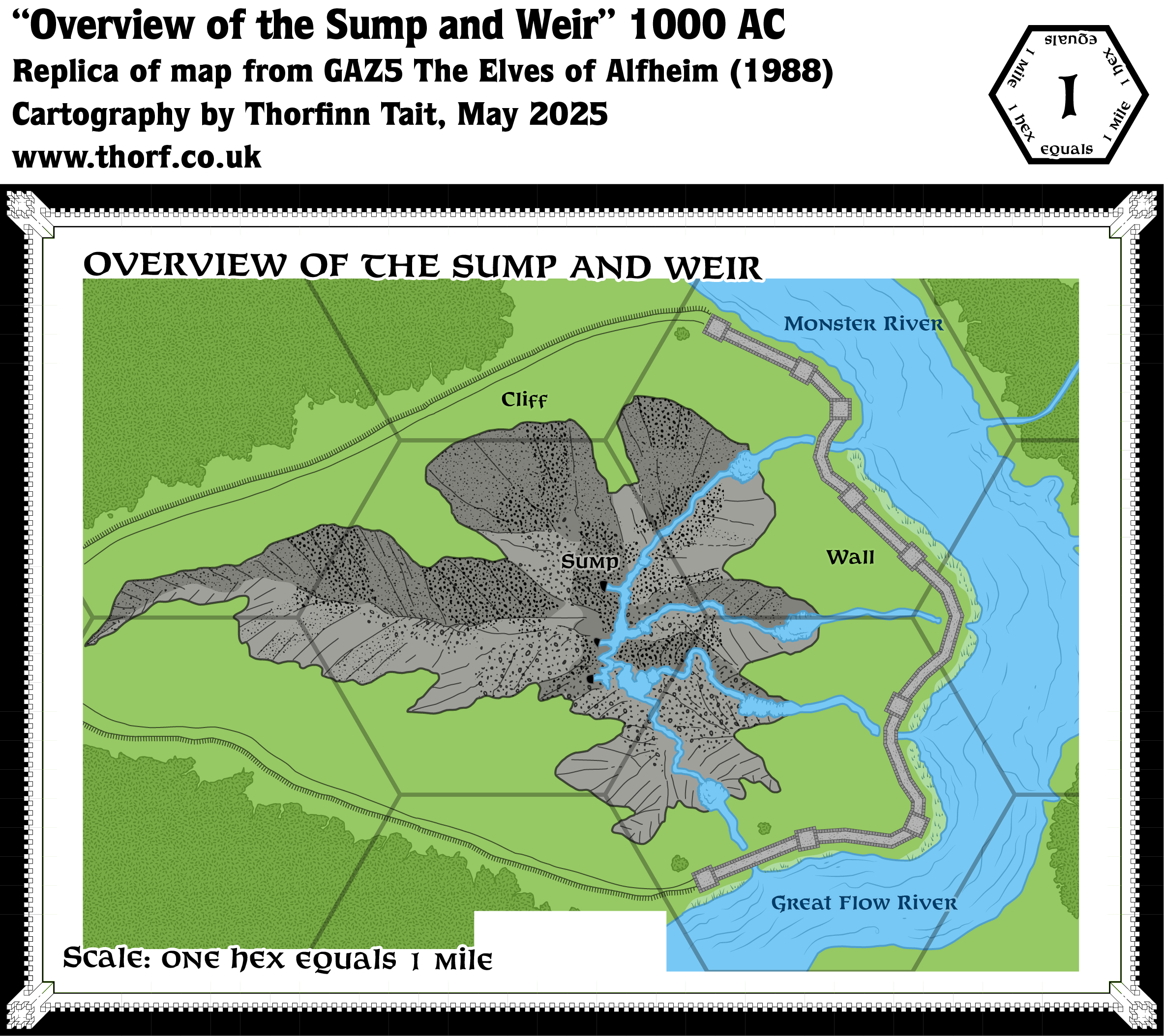
Alongside its Alfheim Town Area map, GAZ5 provided one other close-up map. This one covered the Sump and Weir, into which all of Alfheim’s magically augmented rain collects and drains. As with the Town Area map, this one used a peculiar setup with huge hexes overlaying what was otherwise not a hex map in form. The scale here matched the inset map of Alfheim Town in the corner of the Town Area map, with a nominal 1 mile per hex.
In terms of content, this map gave a clear overview of the crevasse that makes up the Sump, with three cave entrances draining the water into the underground realm. The width of the rivers was also easily discernible.
Replica Map (May 2025)
Sources
- GAZ5 The Elves of Alfheim (1988) (PDF at DriveThruRPG)
- Page 21 map (Cartography by Dave Sutherland, Dennis Kauth)
References
- New Map: GAZ5 Sump and Weir post at Patreon
Chronological Analysis
This is Map 84. It was published in March 1988. The updated version of this map has not yet been released. See also Appendix C for annual chronological snapshots of the area. For the full context of this map in Mystara’s publication history, see Let’s Map Mystara 1988.
The following lists are from the Let’s Map Mystara project. Additions are new features, introduced in this map. Revisions are changes to previously-introduced features. Hex Art & Fonts track design elements. Finally, Textual Additions are potential features found in the related text. In most cases, the Atlas adopts these textual additions into updated and chronological maps.
Under Construction! Please check back again soon for updates.
Additions
- XXX —
Revisions
- Spelling — The text’s Greenflow River is here labelled Great Flow River.
Hex Art & Fonts
- Hex Art —
- Fonts —
Textual Additions (GAZ5, March 1988)
- XXX —
")

