
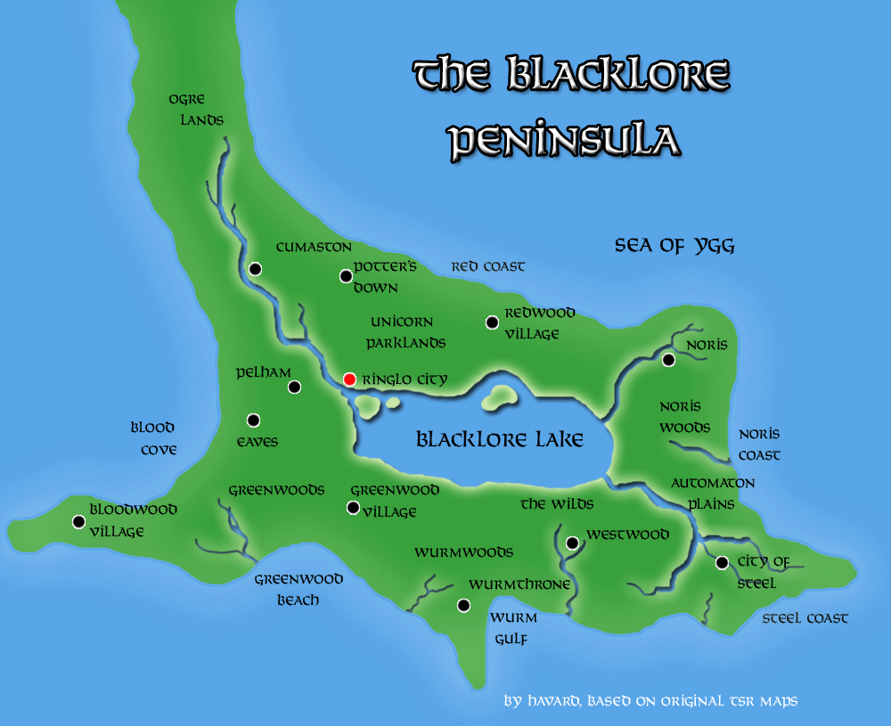
Håvard’s Blacklore Peninsula
Following on from his Hollow World maps, Håvard produced a close-up view of the Blacklore Peninsula in the extreme south. This is perhaps not a surprising choice, given his interest in Blackmoor, and the connection between the Blacklore Elves and Blackmoor.
All of the details here are new, as the Hollow World Set provided little information on the area. Håvard created settlements and other points of interest, complete with place names. The rivers and lake are also his invention.
One point of confusion may be the shape of the peninsula, which appeared as a long and thin sliver of land on the world map. However, the far southern region of any world map is almost always stretched out in the east-west dimension. So in fact Håvard’s depiction here is likely much closer to the proper shape than it appeared on those maps.
Robin would later revisit the area for her own map.
Fan-made Map by Håvard (August 2006)
This is an original map created by one of Mystara’s excellent fan cartographers. For more information on the cartographer, including a gallery of all their maps, see also Appendix M: Mappers of Mystara.
Sources
- Hollow World Campaign Set (1990) (PDF at DriveThruRPG)
- Hollow World Planetary Map
Fan Sources
- None
References
- All of Håvard’s maps at the Atlas of Mystara
- Håvard’s entry in Appendix M: Mappers of Mystara (upcoming)
- Håvard’s author page at the Vaults of Pandius
Chronological Analysis
This is a fan-made map. It was published in August 2006. The updated Atlas version of this map is not yet available. See also Appendix C for annual chronological snapshots of the area. For the full context of this map in Mystara’s publication history, see the upcoming Let’s Map Mystara 2006.
The following lists are from the Let’s Map Mystara project. Additions are new features, introduced in this map. Revisions are changes to previously-introduced features. Hex Art & Fonts track design elements. Finally, Textual Additions are potential features found in the related text. In most cases, the Atlas adopts these textual additions into updated and chronological maps.
Under Construction! Please check back again soon for updates.
Additions
- Lake — New
- Rivers — All new
- Settlements — All new
Revisions
- Coastlines —
- Terrain —
Hex Art & Fonts
- Art — Photoshop effect-based topographical style.
- Fonts — Solemnity.


