
Håvard’s Hollow World
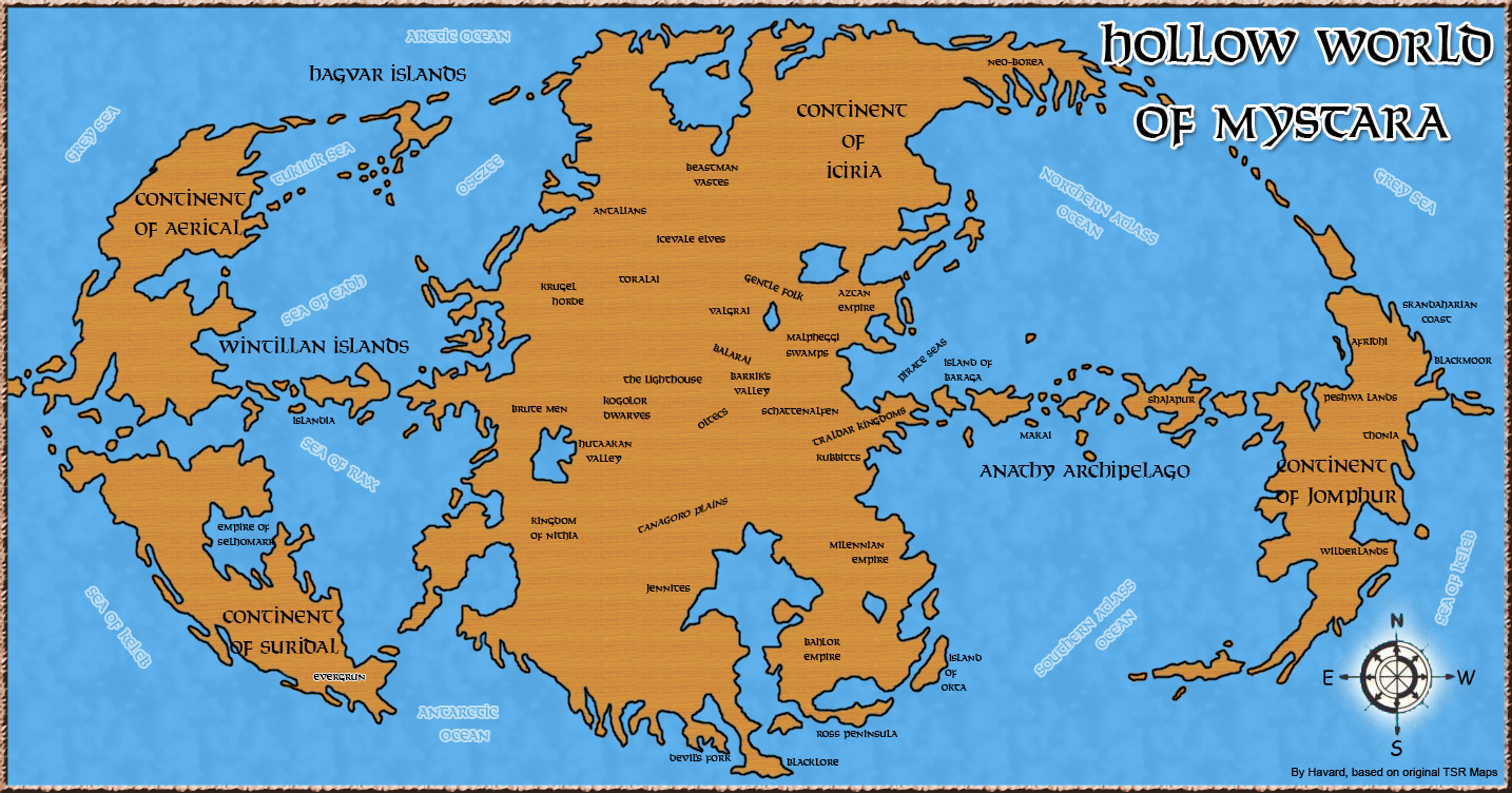
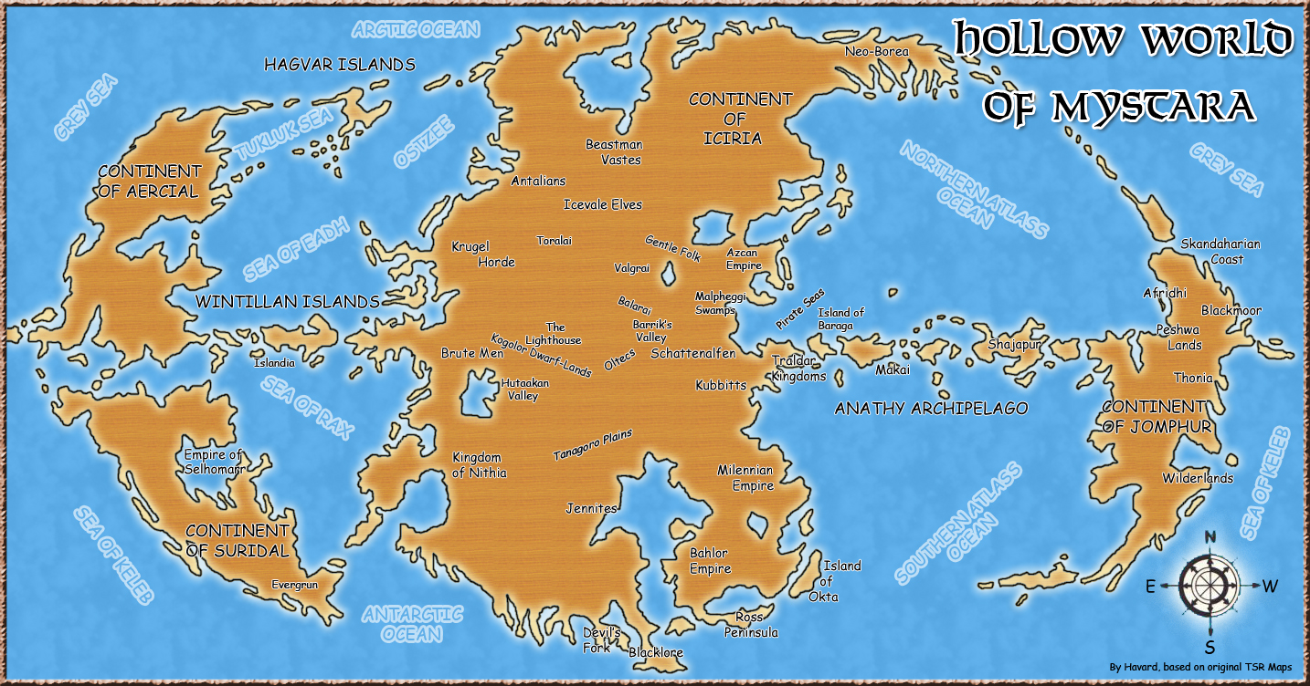
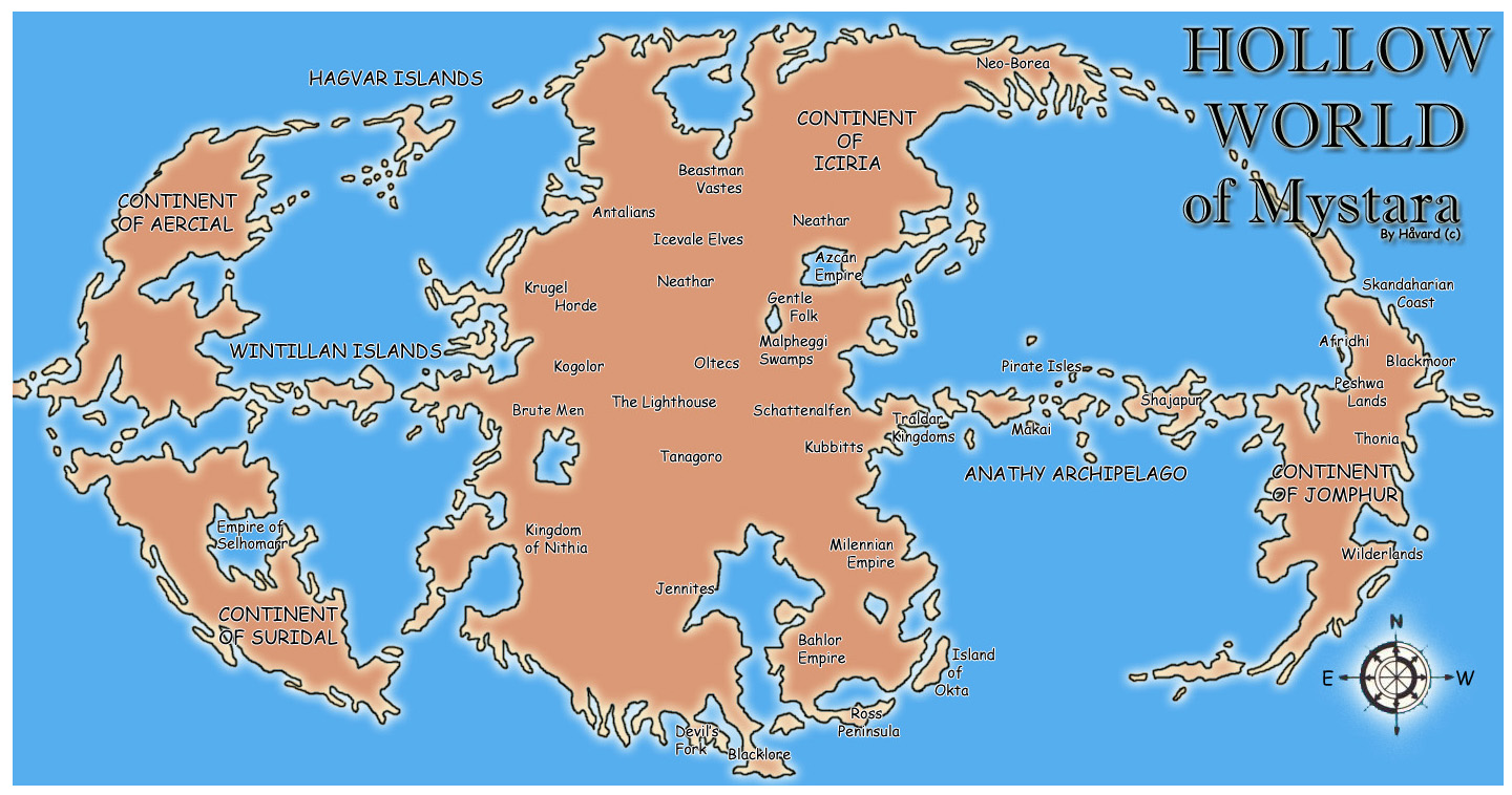
In December 2004, Håvard created an overview map of the Hollow World in Photoshop. It showed the coastlines of the world in an attractive parchment-like style, on a blue background. He clipped out the graticule and the map border, matching the style of the original Master Set world map of Mystara.
As he explained in his post to the Mystara Message Board at the time, he placed not only the official nations but also a number of fan creations, as well as Blackmoor and its surrounding nations:
Here is a map I made of the Hollow World marking the location of the canon civilisations of that world as well as Blackmoor and its neighbours, the Wilderlands, the Empire of Bahlor and the Selhomarr Empire.
He further explained:
Notes: Selhomarr is created by Geoff Gander. Bahlor is created by James Mishler. The location of Blackmoor, Skandahar, the Afridhi and the Wilderlands in the Hollow World is not official. All other cultures are taken from official HW material. Oostdok and Ashmorain are the only official HW cultures that have not been included as they exist on the floating continents. The Merry Pirate Isles have been renamed the Pirate Isles as IMC at least, the name Merry Pirates is only something they use about themselves.
He revisited the map in June 2008, quickly iterating through a few versions before settling on a final style using his trademark font, Solemnity. Version 2 added Barrik’s Valley/Vale from the arcade game, Warriors of the Eternal Sun. In Version 3 Håvard added in all the sea labels, and changed the title to Solemnity. He also experimented with the style, adding a parchment texture and cloud patterns to the blue background. Finally, in Version 4 he changed all of the text to Solemnity, and revised his graphics for the coastlines.
All four versions are included below.
Fan-made Map by Håvard (June 2008)
Fan-made Maps by Håvard (June 2008)
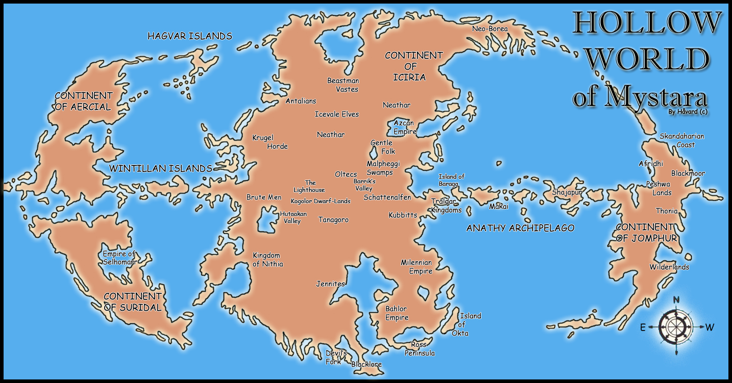
Fan-made Map by Håvard (December 2004)
This is an original map created by one of Mystara’s excellent fan cartographers. For more information on the cartographer, including a gallery of all their maps, see also Appendix M: Mappers of Mystara.
Sources
- Hollow World Campaign Set (1990) (PDF at DriveThruRPG)
- Hollow World Planetary Map
Fan Sources
- Geoff’s Selhomarr, 40 miles per hex (November 1997)
- The Bahlor Empire: Taymor in the Hollow World by James Mishler (September 1998) (Vaults of Pandius)
- Hollow World maps by Håvard (November 2005) (Vaults of Pandius)
- Hollow World Planetary Map by Håvard (June 2008) (Vaults of Pandius)
References
- All of Håvard’s maps at the Atlas of Mystara
- Håvard’s entry in Appendix M: Mappers of Mystara (upcoming)
- Håvard’s author page at the Vaults of Pandius
Chronological Analysis
This is a fan-made map. It was first published in December 2004, then revised in June 2008. The updated Atlas version of this map is not yet available. See also Appendix C for annual chronological snapshots of the area. For the full context of this map in Mystara’s publication history, see the upcoming Let’s Map Mystara 2004 and 2008.
The following lists are from the Let’s Map Mystara project. Additions are new features, introduced in this map. Revisions are changes to previously-introduced features. Hex Art & Fonts track design elements. Finally, Textual Additions are potential features found in the related text. In most cases, the Atlas adopts these textual additions into updated and chronological maps.
Under Construction! Please check back again soon for updates.
Additions
- Nations —
Revisions
- Nations —
Hex Art & Fonts
- Art — Atlas style overview map using coastlines with decorational texturing.
- Fonts — Imprint Shadow (first versions title), Comic Sans MS (first version labels), Solemnity (later versions).
")
")
")