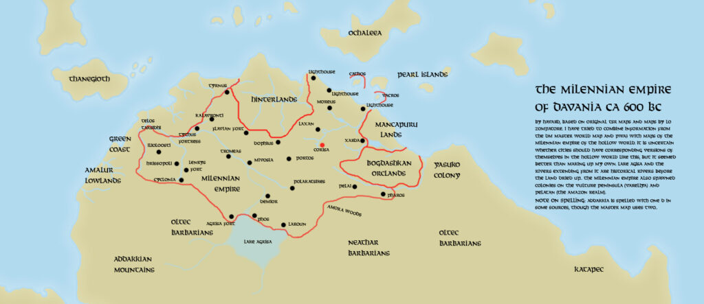
Håvard’s Milenian Empire, 600 BC v1
Håvard produced two versions of this map over a short period of time. He started by posting this first version to a thread at The Piazza. It outlined his thoughts for the original Outer World Milenian Empire at its height, around 600 BC. The first posted version apparently included an error with the date, listing it as 600 AC, but this is the corrected version.
His vision of Milenia involved placing Hollow World Milenian settlements in the indicated region of Davania, including familiar names such as Corisa, Laroun, Dophius, and even Lake Agrisa. In the thread, he explained it as follows:
The date 600 BC is a bit arbitrary, but I figured by then, the Empire had reached its full extension and was already establishing colonies on the Vulture Peninsula and expeditions towards Pelatan. That also helps when placing neighbouring civilizations, though I am not certain about how long some of those neighbours have been around. I suppose it can be argued that many of the features of the map resemble the Hollow World version too closely, but I thought that might work better than making up cities of my own.
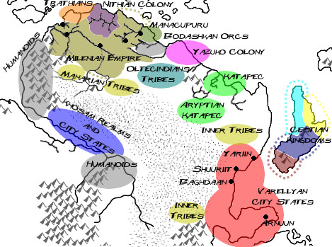
This prompted feedback from the community, culminating in a second map less than a week later.
Fan-made Map by Håvard (January 2009)
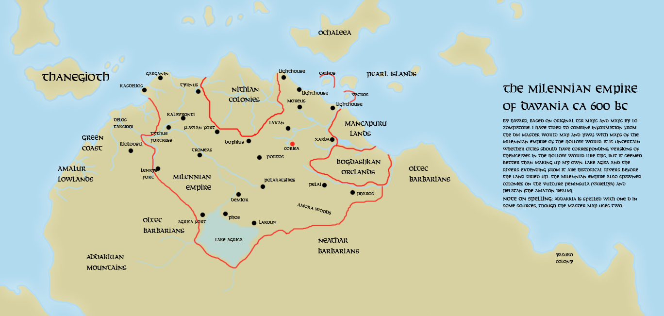
This is an original map created by one of Mystara’s excellent fan cartographers. For more information on the cartographer, including a gallery of all their maps, see also Appendix M: Mappers of Mystara.
Sources
- Hollow World Campaign Set (1990) (PDF at DriveThruRPG)
- HWR3 The Milenian Empire (1992) (PDF at DriveThruRPG)
Fan Sources
- The Milenian Empire of Davania discussion thread at The Piazza (January 2009)
References
- All of Håvard’s maps at the Atlas of Mystara
- Håvard’s entry in Appendix M: Mappers of Mystara (upcoming)
- Håvard’s author page at the Vaults of Pandius
Chronological Analysis
This is a fan-made map. It was published in January 2009. The updated Atlas version of this map is not yet available. See also Appendix C for annual chronological snapshots of the area. For the full context of this map in Mystara’s publication history, see the upcoming Let’s Map Mystara 2009.
The following lists are from the Let’s Map Mystara project. Additions are new features, introduced in this map. Revisions are changes to previously-introduced features. Hex Art & Fonts track design elements. Finally, Textual Additions are potential features found in the related text. In most cases, the Atlas adopts these textual additions into updated and chronological maps.
Under Construction! Please check back again soon for updates.
Additions
- Nations —
Revisions
- Nations —
Hex Art & Fonts
- Art — Texture and Photoshop effect-based topographical style.
- Fonts — Solemnity.