
Hollow World Set Outer World Antarctic Cap
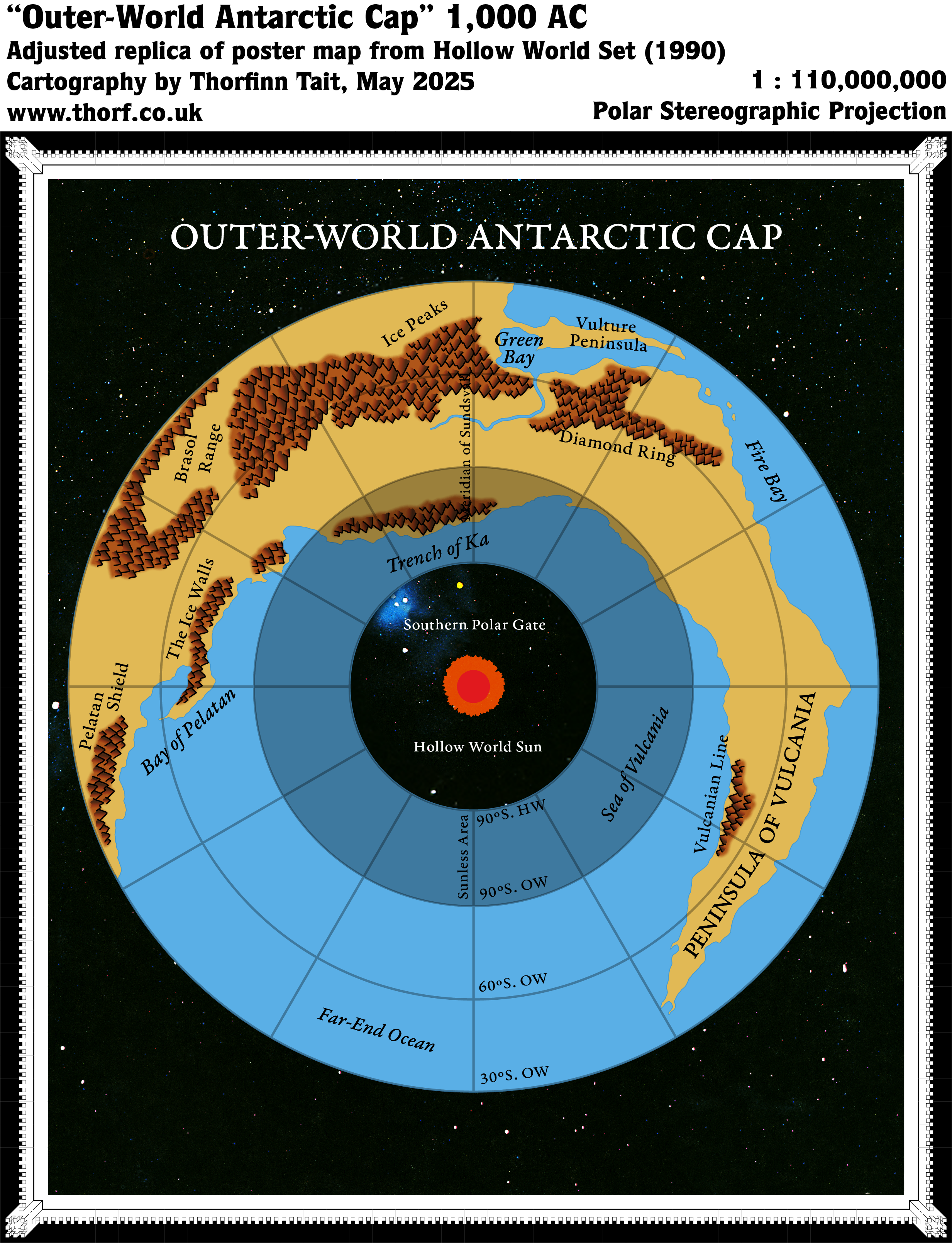
Just as the Outer World Arctic Cap map showed the norther polar opening, the Antarctic Cap map illustrated the southern gate into the Hollow World. (For an overview of these maps, see the post for the Arctic Cap.) This map gave a clear indication as to what lands were intended to fold into the opening, with just the southern tip of Davania and a few slivers of the Vulcanian Peninsula on the inner slope towards the Hollow World.
As with all of the Hollow World Set’s Outer World maps, this one suffered from the misconception of stretched continents and the lack of a massive Far End Ocean taking up an entire hemisphere. However, that didn’t take away from the usefulness of its detailing. Other than the stretching, there’s nothing wrong with the map.
Replica Map (May 2025)
Sources
- Hollow World Campaign Set (1990) (PDF at DriveThruRPG)
- Poster map 3 (Cartography by David C Sutherland, David S LaForce, Dennis Kauth, Frey Graphics)
References
- New Map: Outer World Antarctic Cap post at Patreon
Chronological Analysis
This is Map 150. It was published in August 1990. The updated version of this map has not yet been released. See also Appendix C for annual chronological snapshots of the area. For the full context of this map in Mystara’s publication history, see Let’s Map Mystara 1990.
The following lists are from the Let’s Map Mystara project. Additions are new features, introduced in this map. Revisions are changes to previously-introduced features. Hex Art & Fonts track design elements. Finally, Textual Additions are potential features found in the related text. In most cases, the Atlas adopts these textual additions into updated and chronological maps.
Under Construction! Please check back again soon for updates.
Additions
- XXX —
Revisions
- XXX —
Hex Art & Fonts
- Hex Art —
- Fonts —
Textual Additions (Hollow World Set, August 1990)
- XXX —
")
")
")