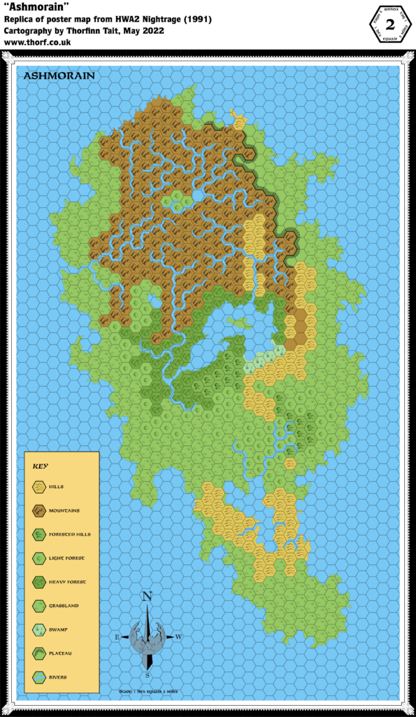
HWA2 Ashmorain, 2 miles per hex
The second Hollow World module included a detailed map of one of the floating continents, Ashmorain. The map shows the surface facing the Hollow World sun, with a coastline of rugged cliffs, and rivers that presumably empty into the void. Although the terrain is quite detailed, Ashmorain is a nature reserve, so there are no settlements, and unfortunately no terrain labels, either.
Replica Map (May 2022)
Sources
- HWA2 Nightrage (1991) (PDF at DriveThruRPG)
- Poster map (Cartography by Dennis Kauth)
Chronological Analysis
This is Map 160. It was published in January 1991. The updated version of this map has not yet been released. See also Appendix C for annual chronological snapshots of the area. For the full context of this map in Mystara’s publication history, see Let’s Map Mystara 1991.
The following lists are from the Let’s Map Mystara project. Additions are new features, introduced in this map. Revisions are changes to previously-introduced features. Hex Art & Fonts track design elements. Finally, Textual Additions are potential features found in the related text. In most cases, the Atlas adopts these textual additions into updated and chronological maps.
Coming Soon

