HWR1 Azcan Empire
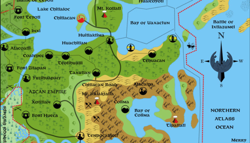
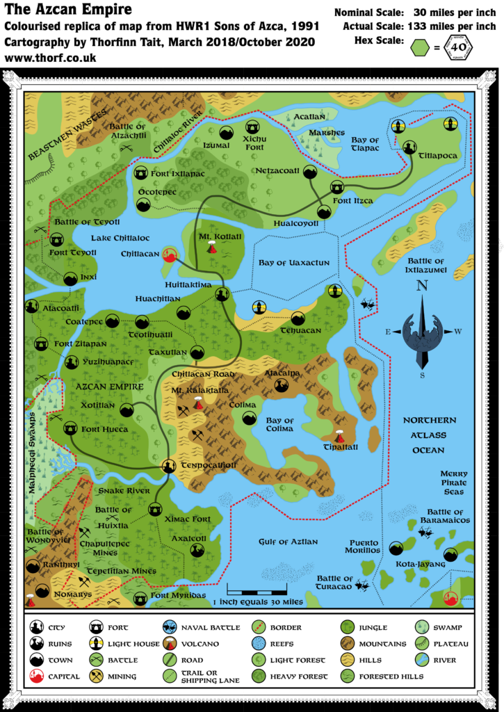
The second of HWR1’s black and white maps, this one shows the whole Azcan Empire. While the other map didn’t conform to any hex grid, with symbols placed closely together, this one is quite clearly based on the Hollow World Set‘s 40 mile per hex Northern Iciria map. All its symbols fit the usual hex grid pattern, although there is no grid marked. It’s essentially a hex map without a grid.
The scale problems of the previous map recur here too, with the nominal scale wildly different from the actual scale, by a factor of four. But this is easily fixed with a simple scale correction.
Aside from the settlement symbols in circles, these maps have one more thing not shown on most other Hollow World maps: borders. The Hollow World Set neglected to show borders for any of the nations on its maps. This map provides the border for Azca, at least. It also provides an example of how the other nations’ borders can be drawn.
Replica Map (October 2020)
Sources
- HWR1 Sons of Azca (1991) (PDF at DriveThruRPG)
- Page 27 map (Cartography by Dave Sutherland, Dennis Kauth)
Chronological Analysis
This is Map 179. It was published in August 1991. The updated version of this map has not yet been released. See also Appendix C for annual chronological snapshots of the area. For the full context of this map in Mystara’s publication history, see Let’s Map Mystara 1991.
The following lists are from the Let’s Map Mystara project. Additions are new features, introduced in this map. Revisions are changes to previously-introduced features. Hex Art & Fonts track design elements. Finally, Textual Additions are potential features found in the related text. In most cases, the Atlas adopts these textual additions into updated and chronological maps.
Coming Soon

