HWR1 Southern Azcan Territories
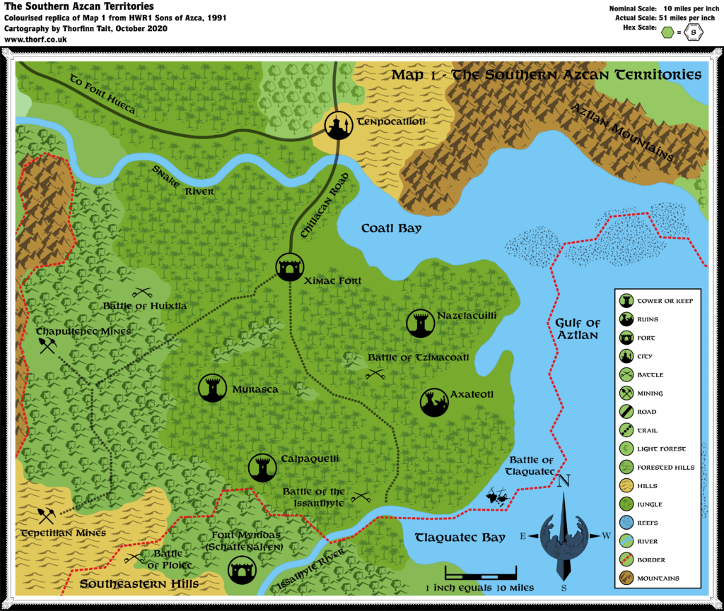
In addition to the full size poster map of the Azcan Empire, in the standard hex map style, HWR1 included two black and white maps with a rather unique style all of their own. The terrain was in a style reminiscent of DA3’s South Blackmoor map, with symbols drawn freely without reference to a hex grid — except that these maps didn’t include a hex grid at all.
The settlement icons and symbols in the map legend are even more unconventional, bound by circles instead of hexes. This style appears only in these two maps in HWR1. It’s quite a refreshing change from the usual hex maps.
Note that I have added coloured background shapes based on the symbols and reference to other maps of the area. These were not present in the original black and white maps.
The map’s marked scale of 10 miles per inch is wildly inaccurate. I have added a corrected scale, including an 8 mile hex to give an idea of the scope of the map, which in fact covers the southern third of the Azcan Empire. In other words, this map presents an area almost the same size as the poster map.
Replica Map (October 2020)
Sources
- HWR1 Sons of Azca (1991) (PDF at DriveThruRPG)
- “Map 1 – The Southern Azcan Territories”, page 21 (Cartography by Dave Sutherland, Dennis Kauth)
Chronological Analysis
This is Map 178. It was published in August 1991. The updated version of this map has not yet been released. See also Appendix C for annual chronological snapshots of the area. For the full context of this map in Mystara’s publication history, see Let’s Map Mystara 1991.
The following lists are from the Let’s Map Mystara project. Additions are new features, introduced in this map. Revisions are changes to previously-introduced features. Hex Art & Fonts track design elements. Finally, Textual Additions are potential features found in the related text. In most cases, the Atlas adopts these textual additions into updated and chronological maps.
Coming Soon


