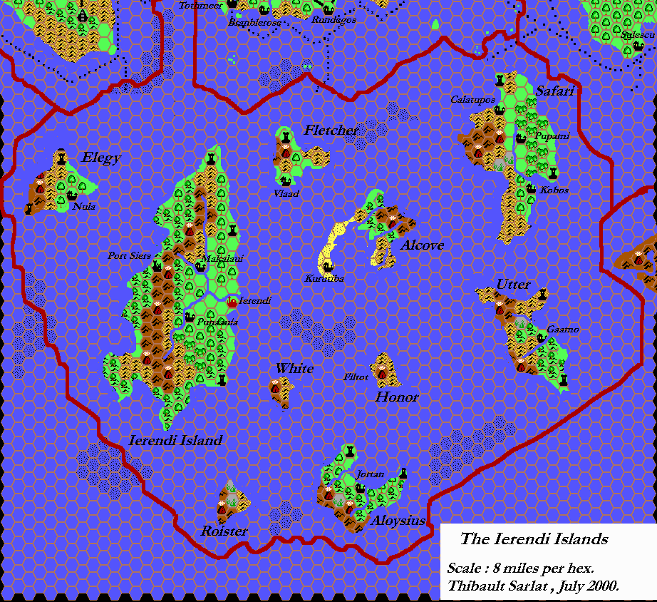
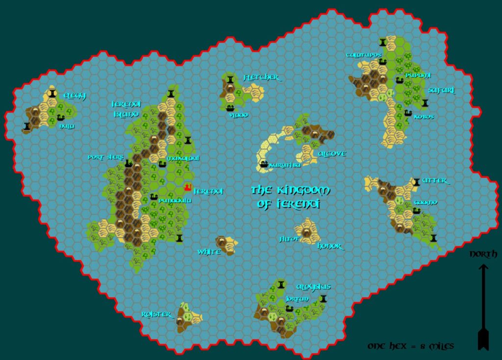
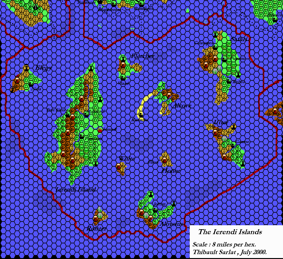
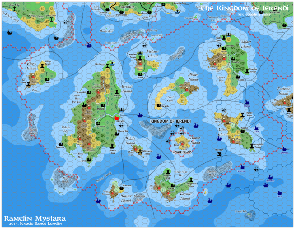
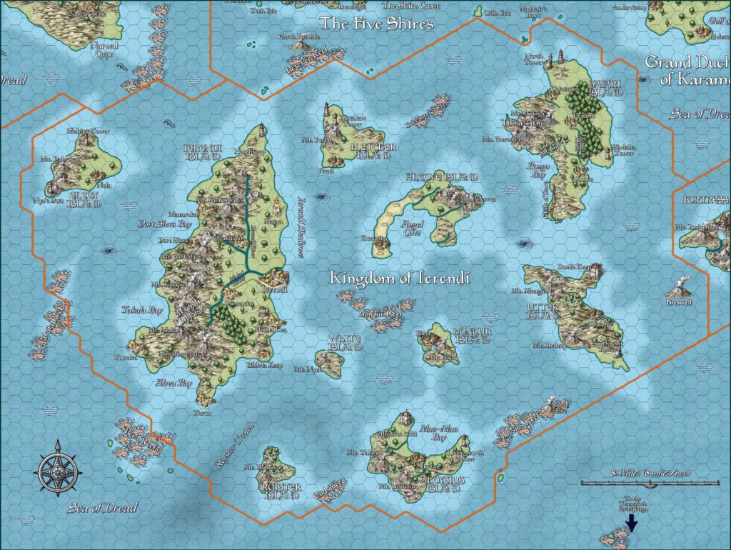
Ierendi, 8 miles per hex
To some, it is a vacationer’s paradise. Tropical islands, set in sapphire seas, fringed with shell-covered beaches: the perfect spot to “get away from it all.” To others, it is a place to be feared. Pirates’ hideaways, disease-ridden jungles, psychotic natives: the perfect spot to avoid.
The Kingdom of Ierendi comprises ten islands, each with a specific attraction for the adventure-seeking visitor. The native population includes the Makai, the original tribe to inhabit the islands, and various settlers who have chosen these exotic locales as their home (well for some, perhaps “chosen” isn’t quite the proper word…).
from GAZ4 The Kingdom of Ierendi, by Anne Gray McCready
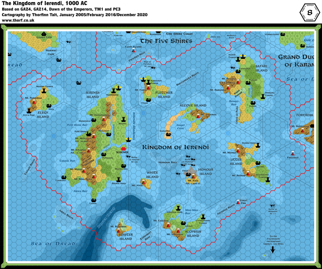
Map (December 2020)
Sources
- GAZ4 The Kingdom of Ierendi (1987) (PDF at DriveThruRPG)
- Dawn of the Emperors (1989) (PDF at DriveThruRPG)
- TM1 The Western Countries (1989)
- PC3 The Sea People (1990) (PDF at DriveThruRPG)
- Rules Cyclopedia (1991) (PDF at DriveThruRPG)
- GAZ14 The Atruaghin Clans (1991) (PDF at DriveThruRPG)
Comments
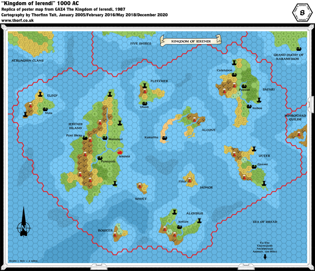
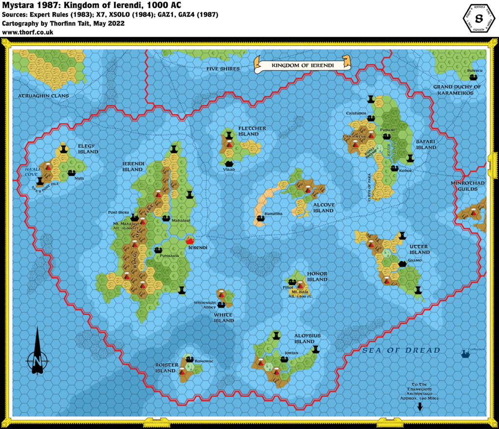
Ierendi’s original map in GAZ4 was rather sparse, but thankfully the gazetteer itself provided lots of extra details, and the area enjoyed some more development on TM1. The other major source for Ierendi is PC3. Even though it dealt mainly with what lies beneath the Sea of Dread, its map provided a revised look at most of Minrothad and all of Ierendi’s waters, with various details that also affect the surface world. The updated map reflects all of these things.
Notes
- Aleea Reefs — shown as a single reef on GAZ4 and (partially visible) on TM1, while PC3 provided a different shape, with five small islands round the reef’s edges. The Atlas goes with PC3’s version.
- Cliffs of Para — from GAZ4 page 44 Safari Island map.
- Coastal waters — TM1 redrew Ierendi’s coastal waters, adding more detail and placing shallow water under most of the reefs (which GAZ4 had exclusively placed on deeper water). PC3 then extensively revised shallow and deep water throughout the area, providing depth measurements. The Atlas considers PC3 the best source for these.
- Honour Island — coastline and scale have been redrawn based on the large scale map in the inside of GAZ4’s cover fold, with the island positioned so that the volcano hex appears in roughly the correct place. Happily, this also allows Filtot to be shown in a separate hex. The terrain of the island has also been revised according to this map, with ash in the northern half. Page 60: “A bleak jumble of jagged lava flows, cinder fields, and barren volcanic slopes, Honour Island was never repopulated by Makai natives or mainland immigrants. Only the hardiest of plants grow here, occasional sprinkles of green against the bleak, black volcanic landscape.”
- Honour Reef — this reef from GAZ4 and TM1 gained a name in PC3.
- Islands — PC3 added a number of minor islands to the seas south and southwest of Ierendi. The updated map includes these, and also adds shallow water around them.
- Kuali Swamp — from GAZ4 page 44 Safari Island map.
- Labels — as with Minrothad, Ierendi’s original GAZ4 poster map was rather sparse when it comes to labels. Only the islands and settlements were labelled, leaving other terrain nameless. Many labels were added to the area on TM1, including labels for the towers, volcanoes, reefs, rivers and bays.
- Lighthouses — TM1 added all the lighthouses.
- Mt. Kala — GAZ4 page 61: “The volcano itself is 1,500 feet in elevation at the crater rim. The crater floor, covered with a lake, is 250 feet below the crater rim.” The lake is of course too small to mark on the map, but the name and altitude have been added.
- Reefs — as mentioned in the note for coastal waters, GAZ4’s map had reefs over deeper water. This is rather illogical, and TM1 fixed the error. PC3 further built upon this, redrawing the reefs and making sure they were mostly over shallow water.
- Sea battles — PC3 shows many shipwreck symbols for sea battles. Since these are distinct from the trident symbol for “underwater battles”, they have been added to the updated Ierendi map. Some of the battle names may not be relevant to the surface world, but unless they were clearly placed on a trident symbol, I have included them for the sake of completeness.
- Takala Reefs — shown as a single nameless reef on GAZ4’s map; gained a name on TM1, but still shown as a single reef despite the plural name; split into separate parts (though not all shown) on PC3’s map. The Atlas uses PC3’s version, with GAZ4’s shape to provide the missing section.
- Tikka Mountains — from GAZ4 page 44, Safari Island map.
- Trails and Shipping lanes — these were all added in TM1.
- Villages — GAZ4 only showed a few villages; most were added on TM1, especially to Ierendi Island.
- Volcanic islands — these symbols on PC3’s map have been added to the updated map.
- Wautili River — this river was shown, complete with name, on page 44’s Safari Island map in GAZ4. It also showed a tributary as well as another unnamed river on the island. The name was later included on TM1.
- Whaling Spots — GAZ14’s whaling spots included one in Ierendi’s waters.
- Whirlpools — the whirlpools shown on PC3’s map clearly also affect the surface world, and have therefore been added to the updated map.
References
- Ierendi at the Vaults of Pandius
- Ierendi map thread at The Piazza
- Mapping Issues: How to Mark Capitals at The Piazza
Thanks to:
Andrew Theisen (Cthulhudrew)

7 February 2016 @ 1:17 am
I’m learnin’ all about this setting. These maps are a blessing. Thank you.
7 February 2016 @ 1:56 pm
You’re very welcome! 😀