
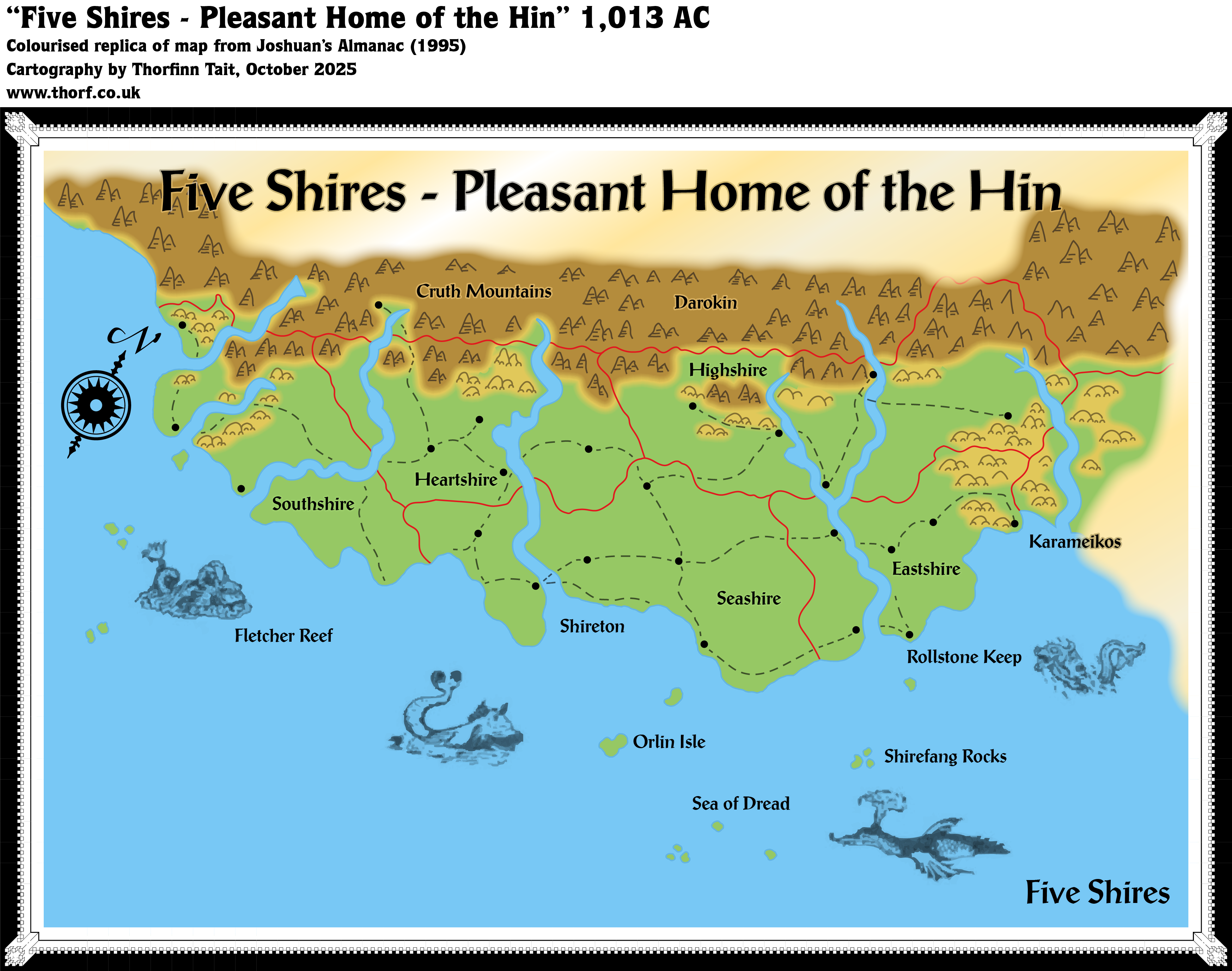
Joshuan’s Almanac Five Shires
The fourth and last of the Almanac series, Joshuan’s Almanac, went in a somewhat different direction from the previous three volumes. It presented everything — including the maps — in a more in-world style. Gone were the hex or even square gridded maps, replaced by deliberately stylised or incomplete, non-omniscient maps such as might be used by characters in Mystara.
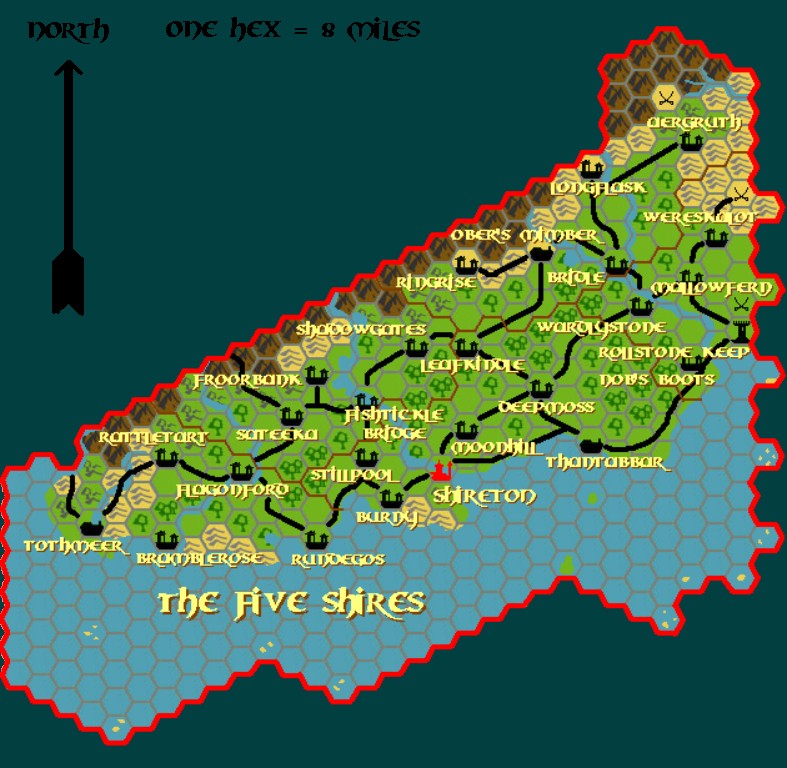
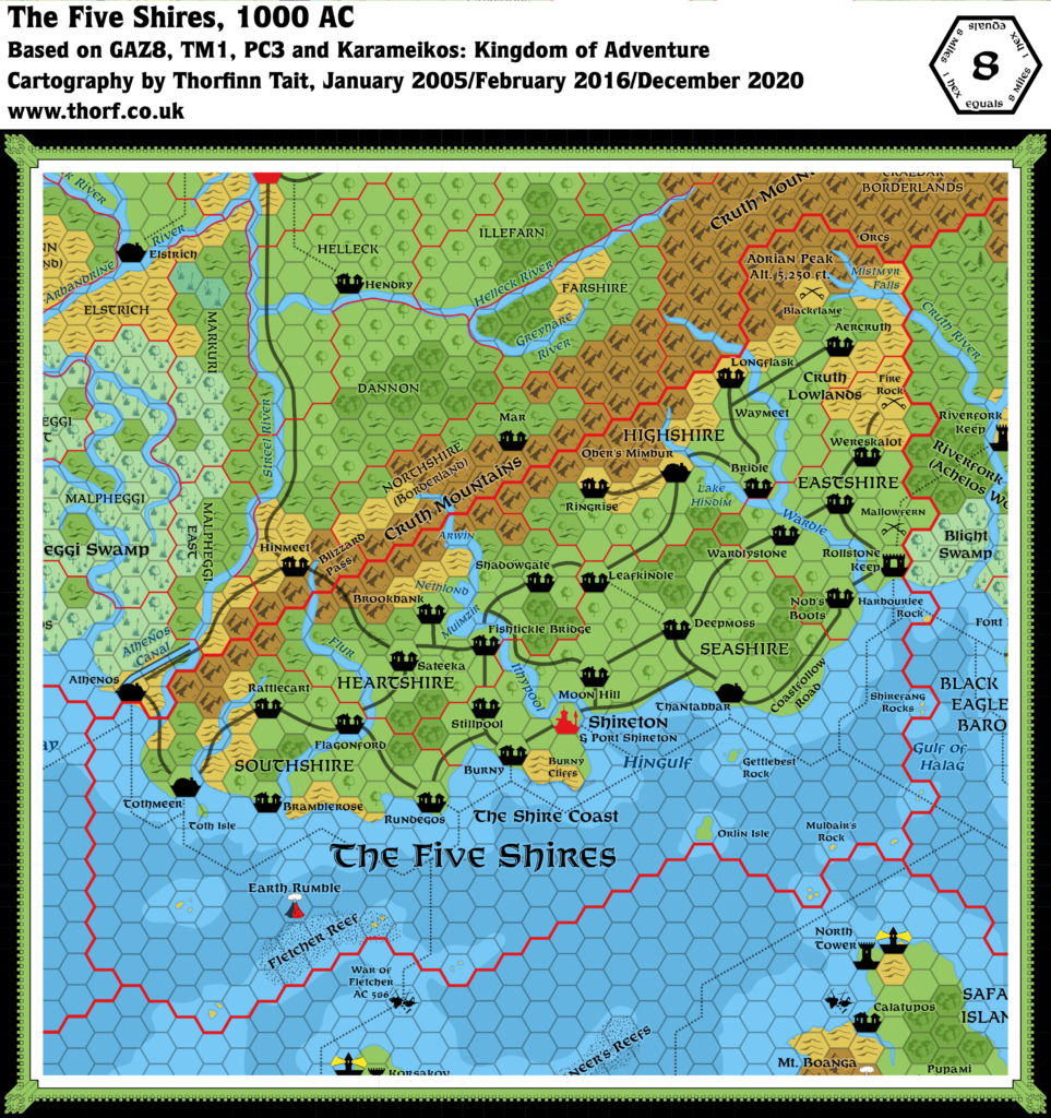
There were also far fewer maps. This map of the Five Shires was one of the chosen few to make it into the pages of Joshuan’s Almanac. While it didn’t add anything new to the area, instead it attempted to portray the Shires in the way that a native might think of it. This was immediately obvious from the orientation of the map, with north pointing off to the top right; the map was instead oriented with the mountain range covering the northern border, the lands stretching away beneath them.
Accuracy-wise, the map was quite a good fit with GAZ8’s, though with various details left out — all of the forests and most of the settlement labels, for example. One peculiar detail was in the borders marked in the Cruth Mountains, with an extra line of unknown meaning. My replica has left this out for now.
Replica Map (October 2025)
Sources
- Joshuan’s Almanac (1995) (PDF at DriveThruRPG)
- Page 30 map, Cartography by Eric Hotz, Paul Hanchette
References
- New Map: Joshuan’s Almanac Five Shires post at Patreon
Chronological Analysis
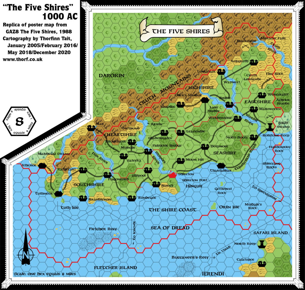
This is Map 291. It was published in December 1995. The updated version of this map is Five Shires, 8 miles per hex. See also Appendix C for annual chronological snapshots of the area. For the full context of this map in Mystara’s publication history, see Let’s Map Mystara 1995.
The following lists are from the Let’s Map Mystara project. Additions are new features, introduced in this map. Revisions are changes to previously-introduced features. Hex Art & Fonts track design elements. Finally, Textual Additions are potential features found in the related text. In most cases, the Atlas adopts these textual additions into updated and chronological maps.
Under Construction! Please check back again soon for updates.
Additions
- XXX —
Revisions
- XXX —
Hex Art & Fonts
- Hex Art —
- Fonts —
Textual Additions (Joshuan’s Almanac, December 1995)
- XXX —
")


29 December 2025 @ 2:41 am
It almost seems like the Karameikos label is pointing to that town to its upper left as opposed to the region to the east where it actually is.