
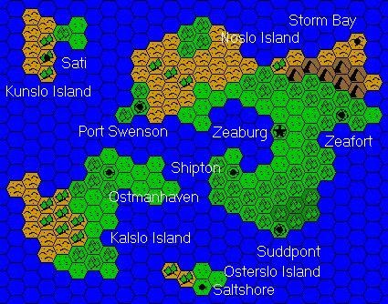
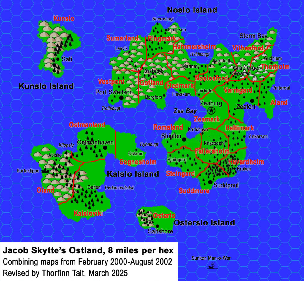
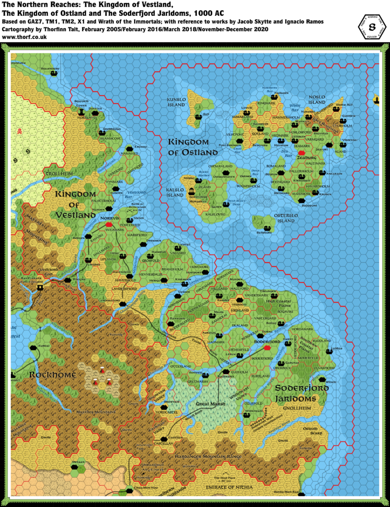
Jacob’s Ostland, 8 miles per hex
Jacob was a longtime Mystara Mailing List member from 1999 until 2006. He was especially active in the earlier half of this period, creating numerous articles, stories, and other Mystara lore that you can now find archived at the Vaults of Pandius. His biggest contribution is surely his Complete Domains of Ostland. He wrote as follows in the Foreword to his project:
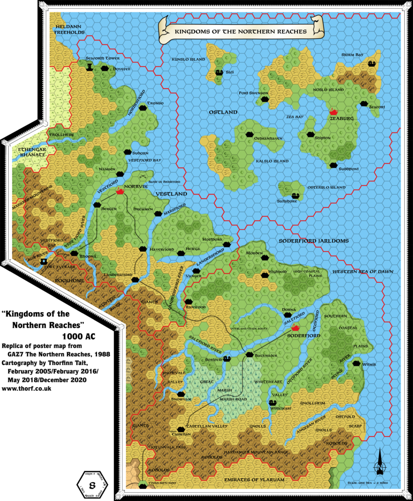
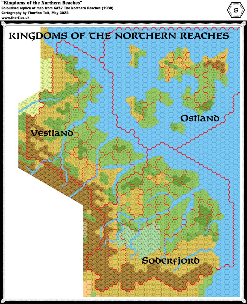
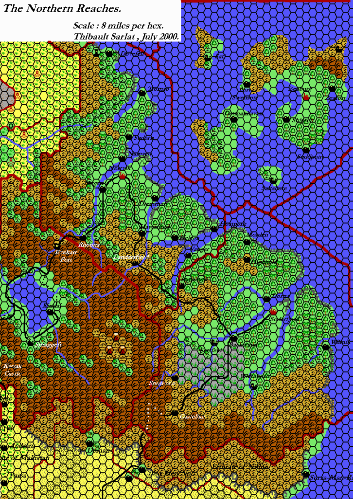
It’s a road that started with me looking at GAZ7 The Northern Reaches and wondering why it was so short on details. The setting seemed rich and ripe with possibilities, but in the end the GAZ did not fulfil any of my expectations, seeming to come short of being a proper place for a campaign.
I believe it was back in February 2000 that I decided to do something about it, and the first of the Domains of Ostland became reality. Working from a short list of dominions, clan halls and rulers found in the GAZ, I started fleshing out each domain in turn, with particular attention given to the various NPCs.
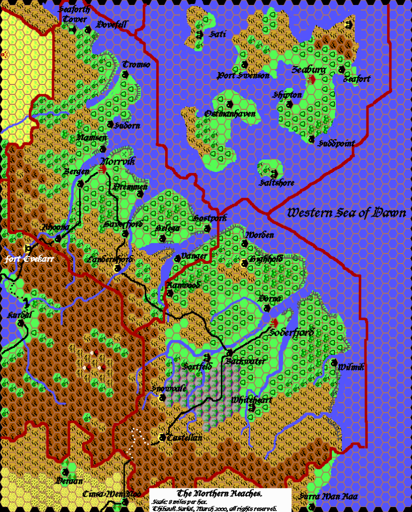
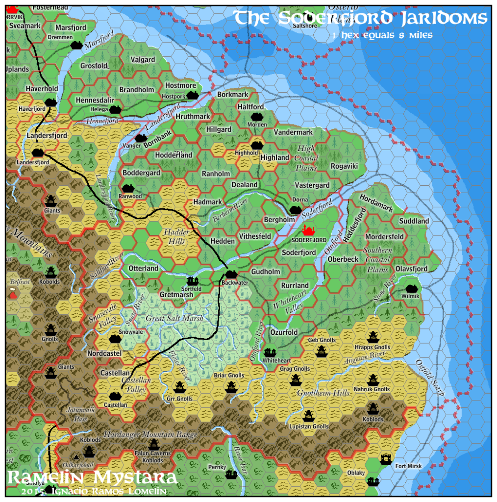
Although his focus was on NPCs, Jacob also provided quite a lot of new geographical information for Ostland — including an overview map, and individual maps for each domain.
This is the overview map. I have dated it to the publishing of his finished project in August 2002, but it may well have been completed much earlier — possibly as early as February 2000, when he began his project.
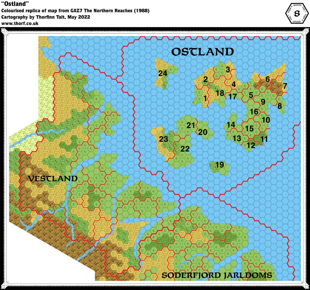
Content-wise, this map is mostly a reprise of GAZ7’s original 8 mile per hex map. There are only a few differences to speak of, the most striking being that the coasts are all trimmed to delete partial hexes. This was likely due to limitations of the mapping software Jacob was using — possibly Campaign Cartographer. Otherwise, there are a couple of hexes with different terrain, but little else of note. The main additions of Jacob’s designs are in the individual domain write-ups and their maps.
Fan-made Map by Jacob Skytte (August 2002)
This is an original map created by one of Mystara’s excellent fan cartographers. For more information on the cartographer, including a gallery of all their maps, see also Appendix M: Mappers of Mystara.
The Atlas has been unable to contact the original cartographer. This map therefore appears here without explicit permission from its creator. Any information on how to get in touch with them would be most welcome.
Sources
- GAZ7 The Northern Reaches (1988) (PDF at DriveThruRPG)
Fan Sources
- The Complete Domains of Ostland 1st Ed by Jacob Skytte (August 2002) (Vaults of Pandius)
References
- All of Jacob’s maps at the Atlas of Mystara
- Jacob’s author page at the Vaults of Pandius
Chronological Analysis
This is a fan-made map. It was probably published in August 2002. The updated Atlas version of this map is not yet available. See also Appendix C for annual chronological snapshots of the area. For the full context of this map in Mystara’s publication history, see the upcoming Let’s Map Mystara 2002.
The following lists are from the Let’s Map Mystara project. Additions are new features, introduced in this map. Revisions are changes to previously-introduced features. Hex Art & Fonts track design elements. Finally, Textual Additions are potential features found in the related text. In most cases, the Atlas adopts these textual additions into updated and chronological maps.
Additions
- None.
Revisions
- Coasts — All of the coasts have been normalised to the hex grid, trimming off partial hexes. This is surely a stylistic choice (likely due to the software used) rather than a deliberate redesign.
- Terrain — There are only two hexes that are different from GAZ7: a single light forest hex on Kunslo Island (marked plains in GAZ7), and a single forested hills hex on the northern coast of Noslo Island (marked light forest in GAZ7).
Hex Art & Fonts
- Hex Art — High saturation pixel art hexes.
- Font — Unknown. Looks like Rosity Light, but is probably something much more common.
Textual Additions (Complete Domains of Ostland, 2000-2002)
- See the individual posts for each domain.
")
")
")