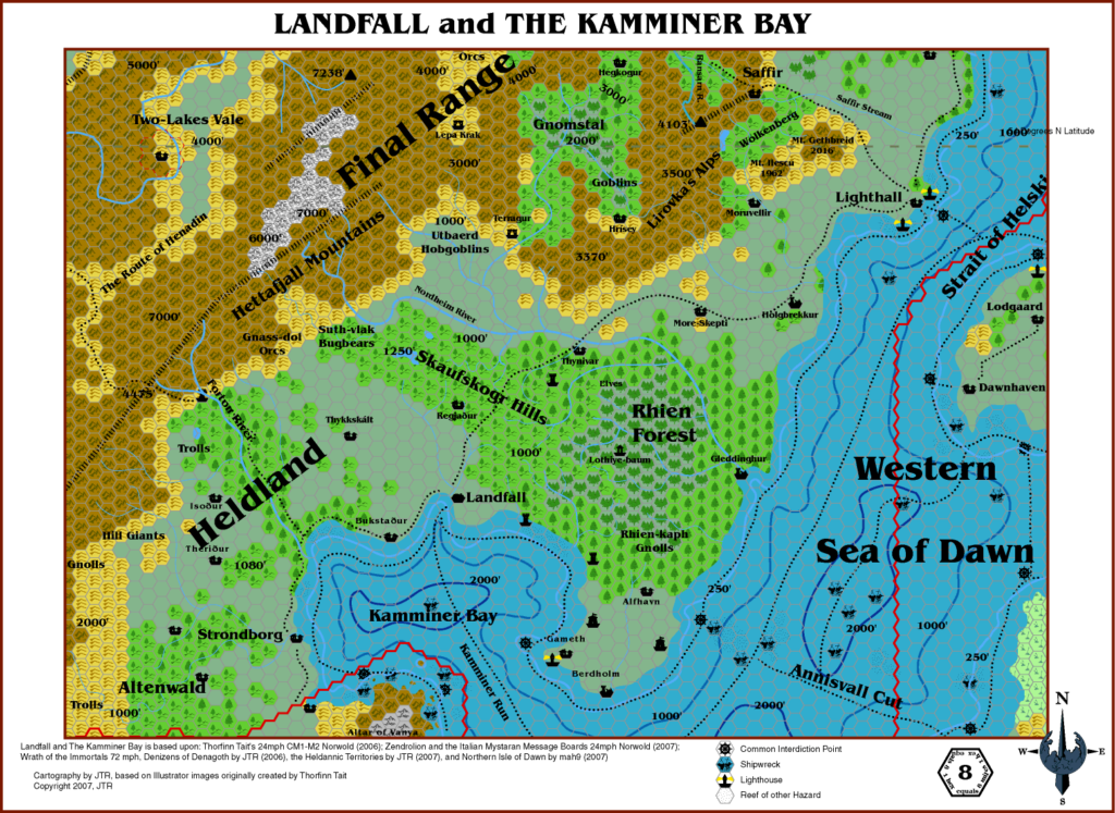
JTR’s Landfall, 8 miles per hex
After detailing Heldann in Gaz F7, JTR next moved north into the realm of Norwold, beginning with Heldann’s direct neighbour, Landfall. Although various fan-made products had dealt with Norwold as a whole, by this point few had touched on this area in detail. As always, JTR referenced his sources extensively in the notes on the map. Unfortunately, he likely did not have access to Thibault Sarlat’s version of the area (2004-2005), and so they are sadly incompatible.
On the other hand, JTR based his terrain here on the Italian MMB’s Norwold map, by Simone Neri, so there is compatibility there. Ultimately, the issue of compatibility is one that would become more and more of an issue as fan products moved further from the original sources. These days, most fans are used to the idea of multiple continuities, to the point that everyone seems to have their own version of Mystara.
In terms of new details, JTR took the few official references (from CM1, Companion, and a scant few others) and added his own inventions on the theme to fill out the rest of the terrain. The result is a rich, fully detailed landscape befitting of the Gaz F series and indeed its inspirational predecessor, the Gazetteer series.
Fan-made Map by JTR (July 2007)

This is an original map created by one of Mystara’s excellent fan cartographers. For more information on the cartographer, including a gallery of all their maps, see also Appendix M: Mappers of Mystara.
Sources
- Wrath of the Immortals (1992) (PDF at DriveThruRPG)
Fan Sources
- Atlas of Mystara (2005-)
- Simone Neri’s Norwold, 24 miles per hex (2007) (Vaults of Pandius)
- Gaz F2 The Denizens of Denagoth (30 April 2006)
- Gaz F7 The Heldannic Order (8 May 2007)
- Gaz F8 The Streets of Landfall (7 July 2007)
- Mark’s Northern Isle of Dawn (2007) (Vaults of Pandius)
References
- All of JTR’s maps at the Atlas of Mystara
- JTR’s entry in Appendix M: Mappers of Mystara (upcoming)
- JTR’s author page at the Vaults of Pandius
Chronological Analysis
This is a fan-made map. It was published in July 2007. The updated Atlas version of this map is not yet available. See also Appendix C for annual chronological snapshots of the area. For the full context of this map in Mystara’s publication history, see the upcoming Let’s Map Mystara 2007. (Please note that it may be some time before the project reaches this point.)
The following lists are from the Let’s Map Mystara project. Additions are new features, introduced in this map. Revisions are changes to previously-introduced features. Hex Art & Fonts track design elements. Finally, Textual Additions are potential features found in the related text. In most cases, the Atlas adopts these textual additions into updated and chronological maps.
Coming Soon


