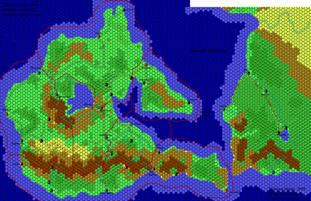
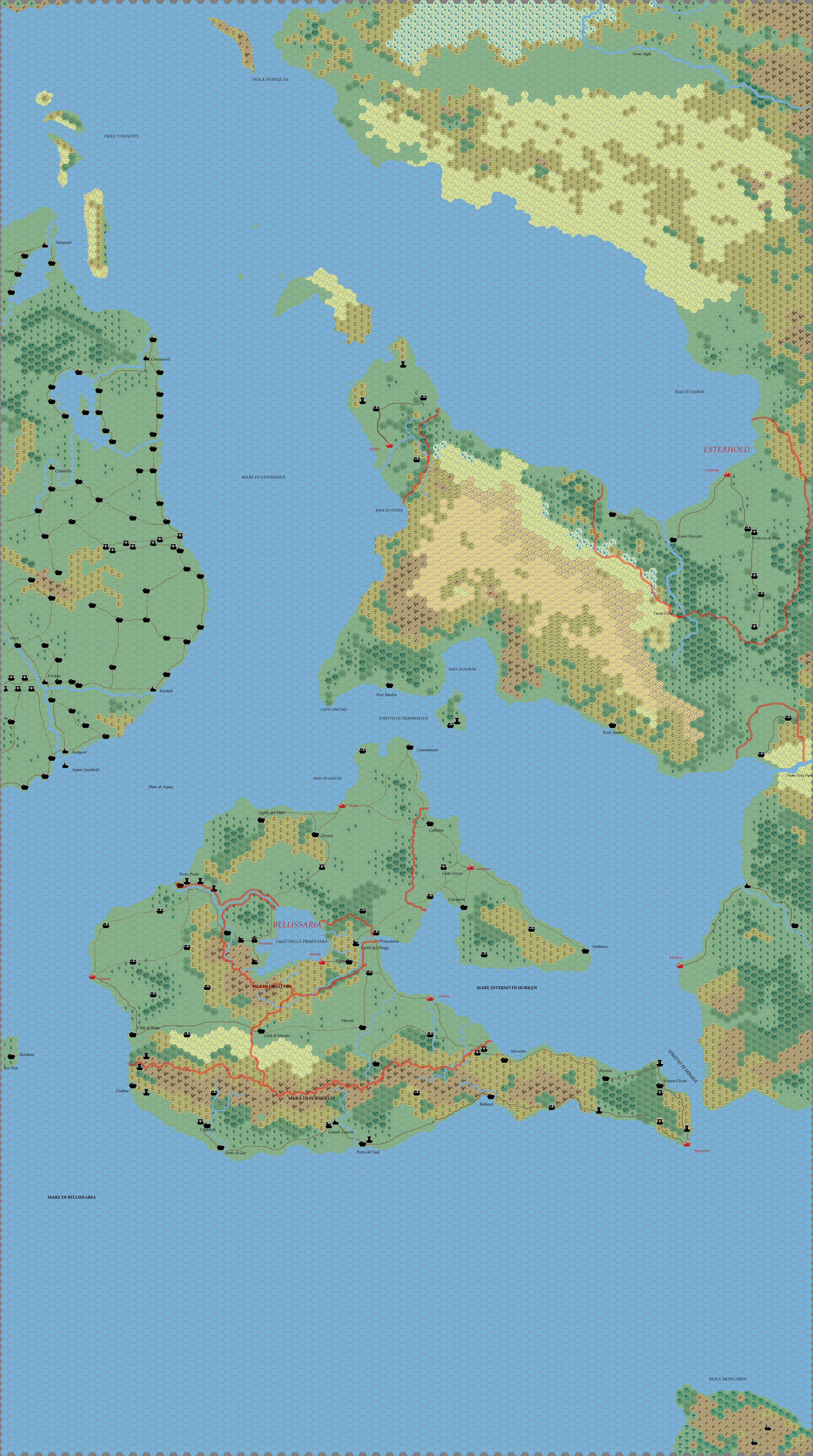
Kal’s Bellissaria and Esterhold, 24 miles per hex
In the mid-2000s, Andrea Francolini made a series of maps for his campaign, sharing them on the Italian Mystara Message Board of the time. The first set is date stamped early January 2005, though of course he must have created the maps the previous year; maps such as these cannot be assembled overnight, after all.
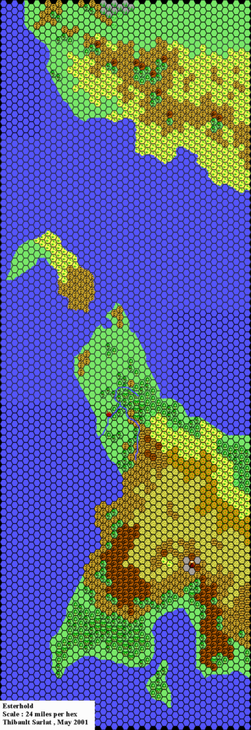
There were three parts to this set. This is the eastern section, comprising the west coast of Skothar with the Esterhold Peninsula, along with Bellissaria and half of Alphatia. The latter is a close replica of the Dawn of the Emperors map of the same scale, but everything else is a conversion of 72 mile per hex maps. Rather than doing this conversion from scratch, Andrea referenced available sources such as the work of Thibault Sarlat, who had already converted all of this area to 24 miles per hex a few years previously.
The main difference between Andrea’s map and Thibault’s is the art style, and the extensive labelling. Thibault was still transitioning from his longtime Grid Cartographer program to the slightly more modern Hexmapper at this time, and Andrea completed and shared his maps first.
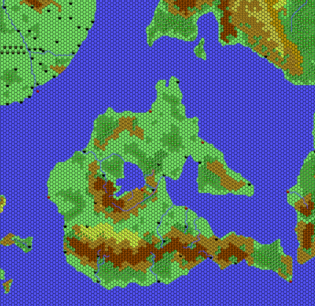
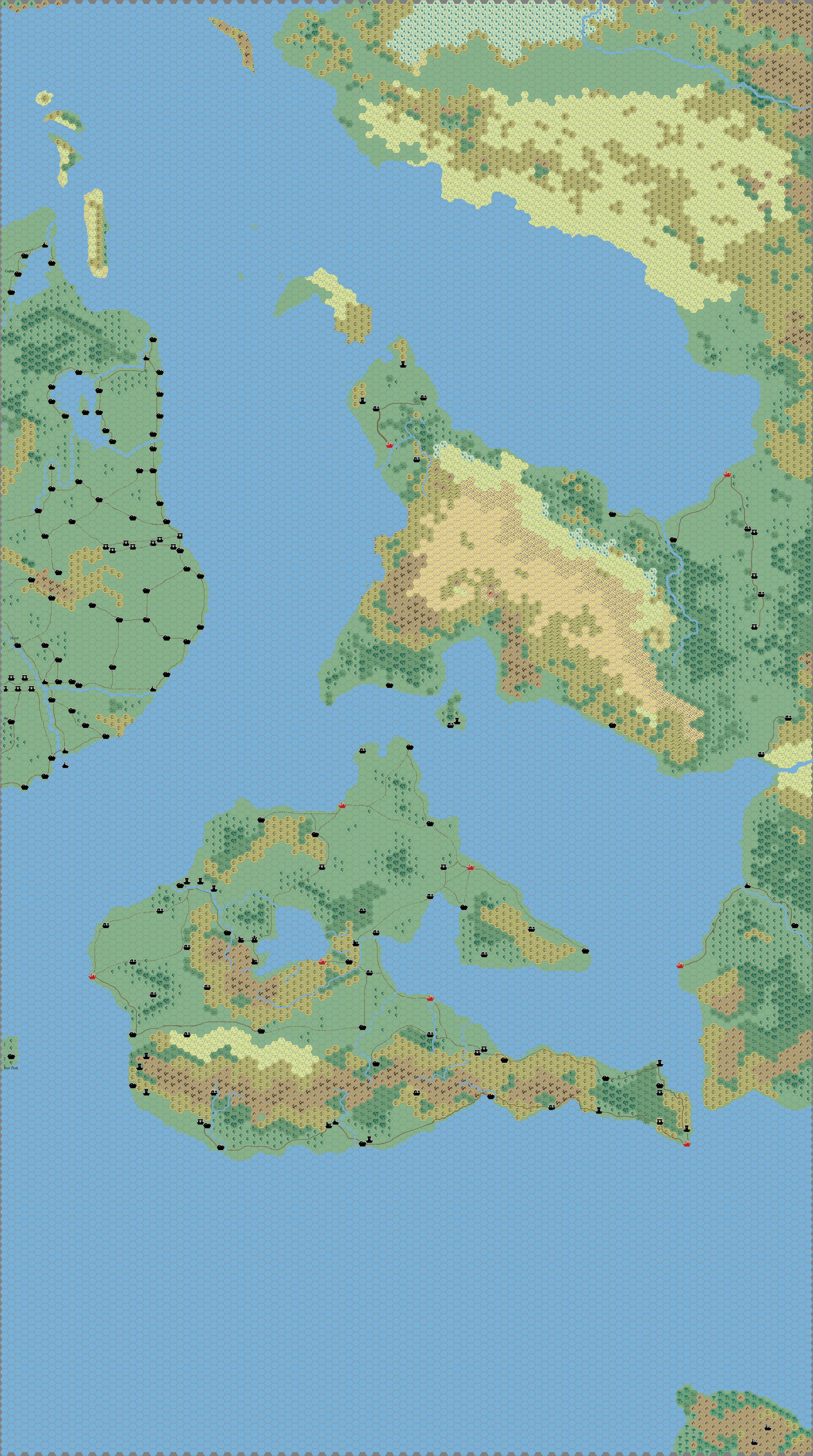
Andrea’s labels are all in Italian. He also released a version without any labels (second below).
Fan-made Map by Andrea Francolini (January 2005)
This is an original map created by one of Mystara’s excellent fan cartographers. For more information on the cartographer, including a gallery of all their maps, see also Appendix M: Mappers of Mystara.
Sources
- Dawn of the Emperors (1989) (PDF at DriveThruRPG)
- Poor Wizard’s Almanac (1992)
- Poor Wizard’s Almanac III (1994)
Fan Sources
- Thibault’s Esterhold, 24 miles per hex (2001)
- Thibault’s Bellissaria, 24 miles per hex v2 (2002)
- Thibault’s Mystara, 24 miles per hex (2002)
References
- All of Andrea’s maps at the Atlas of Mystara
- Andrea’s entry in Appendix M: Mappers of Mystara (upcoming)
- Andrea’s author page at the Vaults of Pandius
Chronological Analysis
This is a fan-made map. It was published in January 2005. The updated Atlas version of this map is not yet available. See also Appendix C for annual chronological snapshots of the area. For the full context of this map in Mystara’s publication history, see the upcoming Let’s Map Mystara 2005. (Please note that it may be some time before the project reaches this point.)
The following lists are from the Let’s Map Mystara project. Additions are new features, introduced in this map. Revisions are changes to previously-introduced features. Hex Art & Fonts track design elements. Finally, Textual Additions are potential features found in the related text. In most cases, the Atlas adopts these textual additions into updated and chronological maps.
Under Construction! Please check back again soon for updates.