
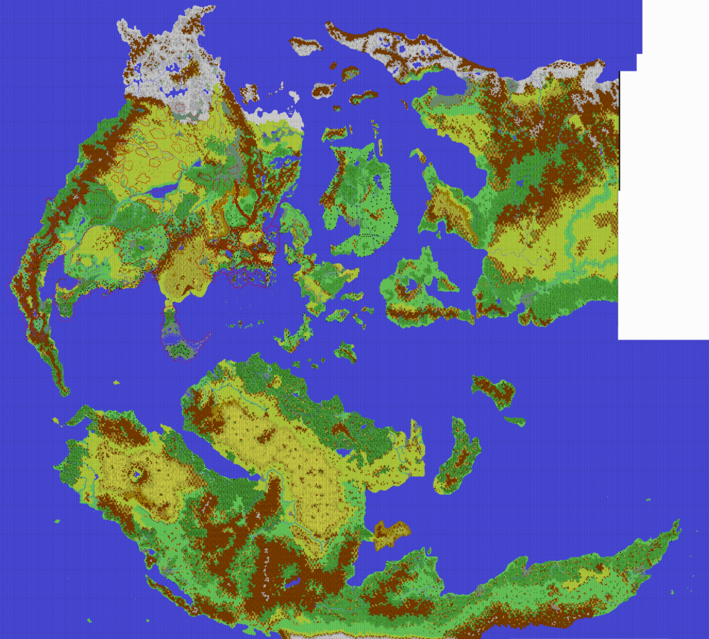
Kal’s Mystara, 24 miles per hex
Andrea’s map of the entire world at 24 miles per hex has to be one of the most iconic Mystara maps anyone in our community has created. It is usually referred to simply as “Kal’s map” — and most Mystara fans know immediately what map it refers to.
Not only was he the first to succeed at such a mammoth task, but he did it using mid-2000s computers, with all of their limitations. Looking at discussions from the time, it’s easy to find comments about problems with just opening the file, let alone viewing it with ease. At 24,000 x 13,592 pixels, it’s no surprise that there would be problems. Even today, a map this size may cause problems for the viewer, despite dramatic improvements in computing power in the intervening years.
The map itself is a simple slotting together of the two halves, Mystara West and Mystara East. Andrea’s version was a JPG, with one extra feature: red borders for some of the major empires, as well as the nations of Skothar’s southern coast. He also had labels (in Italian) for the countries of the extreme east, though this may have been an oversight, as he stated that he was providing it without labels to make it more useful for other fans.
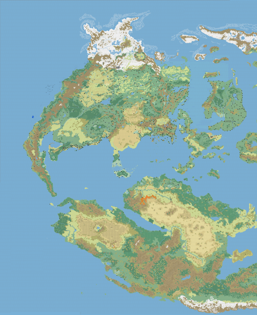
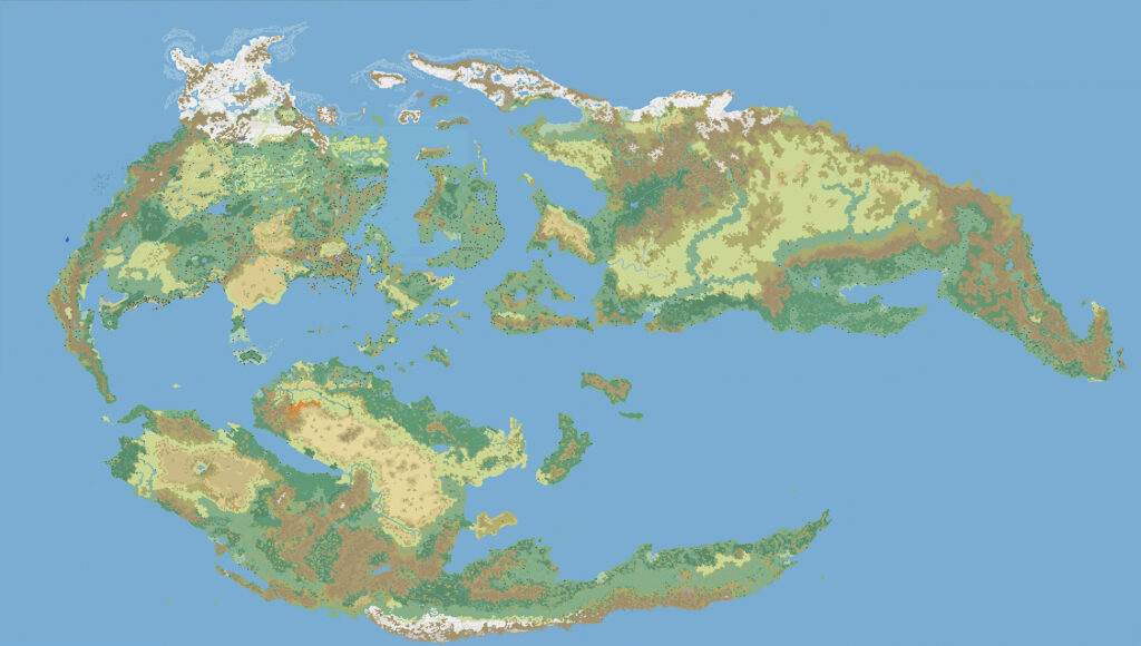
Below are both versions: first, the combination of the two halves (a PNG); then Andrea’s original full map file (a JPG).
Note that, as with all of Andrea’s maps, this world map includes many customisations for his home campaign.
In the years since its posting, many fans have used, adapted, remade, and customised Kal’s world map. Among them, Stone Reed Marshall (aka Multizar) was surely the most dedicated. He printed out the whole map and assembled it on his garage wall. You can see the end result over at this thread at The Piazza.
Fan-made Map by Andrea Francolini (c. November 2006)


This is an original map created by one of Mystara’s excellent fan cartographers. For more information on the cartographer, including a gallery of all their maps, see also Appendix M: Mappers of Mystara.
Sources
- Everything…
Fan Sources
- Christian’s Skothar, 72 miles per hex (1999)
- Thibault’s Skothar, 72 miles per hex (1999)
- Thibault’s Skothar, 72 miles per hex (2000)
- Thibault’s Mystara, 24 miles per hex (2002)
- Kal’s Brun, 24 miles per hex v1 (2005)
- Kal’s Mystara West, 24 miles per hex (2006)
- Kal’s Mystara East, 24 miles per hex (2006)
References
- All of Andrea’s maps at the Atlas of Mystara
- Andrea’s entry in Appendix M: Mappers of Mystara (upcoming)
- Andrea’s author page at the Vaults of Pandius
Chronological Analysis
This is a fan-made map. It was published in around November 2006. The updated Atlas version of this map is not yet available. See also Appendix C for annual chronological snapshots of the area. For the full context of this map in Mystara’s publication history, see the upcoming Let’s Map Mystara 2006. (Please note that it may be some time before the project reaches this point.)
The following lists are from the Let’s Map Mystara project. Additions are new features, introduced in this map. Revisions are changes to previously-introduced features. Hex Art & Fonts track design elements. Finally, Textual Additions are potential features found in the related text. In most cases, the Atlas adopts these textual additions into updated and chronological maps.
Under Construction! Please check back again soon for updates.
")
")
")
16 December 2025 @ 2:37 pm
Hello! Relatively new and casual fan here. I’m wondering why Ylaruam is a grassland/forest and Alfheim is a dark forest. Is there a specific year in the setting’s timeline this map is dated to? If so, when is that?
16 December 2025 @ 5:05 pm
Hi there!
This map includes various features of the cartographer’s home campaign. Ylaruam and Alfheim are presumably different in Kal’s version of Mystara, but I’m afraid I don’t know the specifics.
In a wider sense, this is something you can find with various fan-made maps. I try to highlight it in the short article at the top of each map’s post.