
LoZompatore’s Mystara 900 BC to 1009 AC
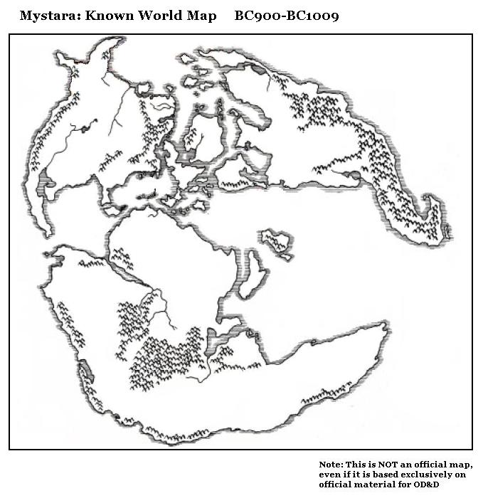
The last of Michele’s triptych looking at changes to the world’s geography over time, this one shows the modern world. It is pretty much just a reproduction of the Master Set world map. Note that the title lists 1009 BC, but this clearly was intended to be AC, meaning that the map is largely valid for any time up until the sinking of Alphatia.
The main change from the previous map is the Tangor Peninsula, which previously had been a shattered archipelago. He explained that 900 BC was the date he estimated for the transition from archipelago to peninsula. This change is not documented in official sources, though the shattered peninsula appears without explanation in the Hollow World Set‘s Precataclysmic Map.
The previous maps dealt with the world from just after the Great Rain of Fire in 3000 BC to the catastrophes of 1750 BC, then from there until the uplifting of the Tangor Peninsula in 900 BC.
Fan-made Map by Michele Carpita (November 2005)
This is an original map created by one of Mystara’s excellent fan cartographers. For more information on the cartographer, including a gallery of all their maps, see also Appendix M: Mappers of Mystara.
Sources
- Master Rules Set (1985) (PDF at DriveThruRPG)
- Hollow World Campaign Set (1990) (PDF at DriveThruRPG)
- Outer World Planetary Map
- Outer World Precataclysmic Map
Fan Sources
References
- All of Michele’s maps at the Atlas of Mystara
- Michele’s entry in Appendix M: Mappers of Mystara (upcoming)
- Michele’s author page at the Vaults of Pandius
Chronological Analysis
This is a fan-made map. It was published in November 2005. The updated Atlas version of this map is not yet available. See also Appendix C for annual chronological snapshots of the area. For the full context of this map in Mystara’s publication history, see the upcoming Let’s Map Mystara 2005.
The following lists are from the Let’s Map Mystara project. Additions are new features, introduced in this map. Revisions are changes to previously-introduced features. Hex Art & Fonts track design elements. Finally, Textual Additions are potential features found in the related text. In most cases, the Atlas adopts these textual additions into updated and chronological maps.
Under Construction! Please check back again soon for updates.
Additions
- XXX —
Revisions
- XXX —
Hex Art & Fonts
- Hex Art —
- Fonts —
")
")
")