
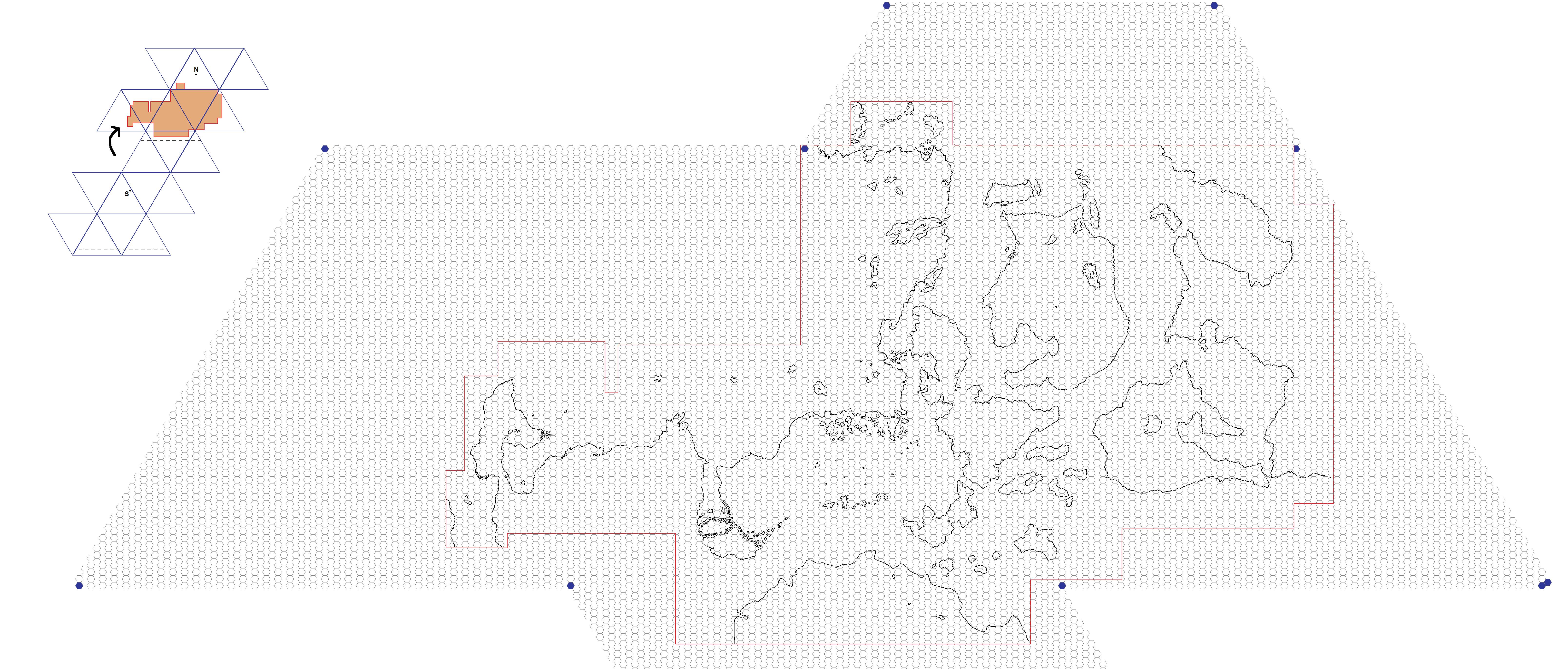
LoZompatore’s Mystara Icosahedral, 72 miles per hex
Michele posted these maps as part of a wider discussion we were having in mid-2008 about how to deal with curvature and map projections. At this stage, in the community as a whole we were not particularly versed in this area of geography, and we were in the process of stumbling through all of these issues. Within that context, Michele and others had proposed the use of an icosahedral net (commonly known as a d20) to map the world. Doing so would allow us to map the world accurately without having to worry about projections.
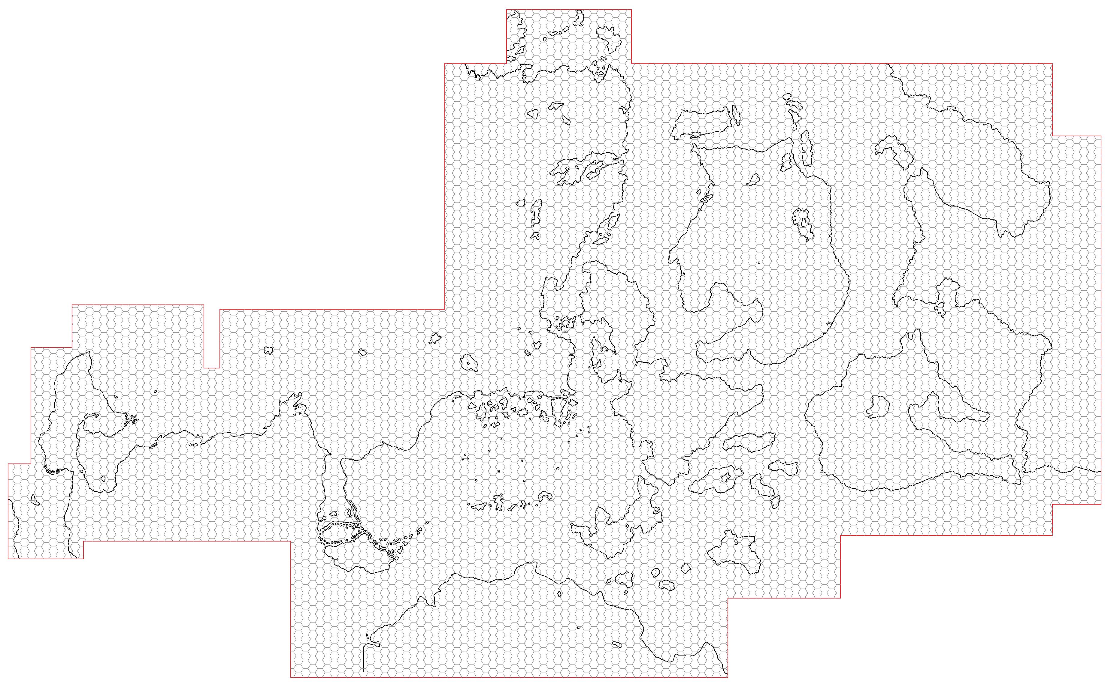
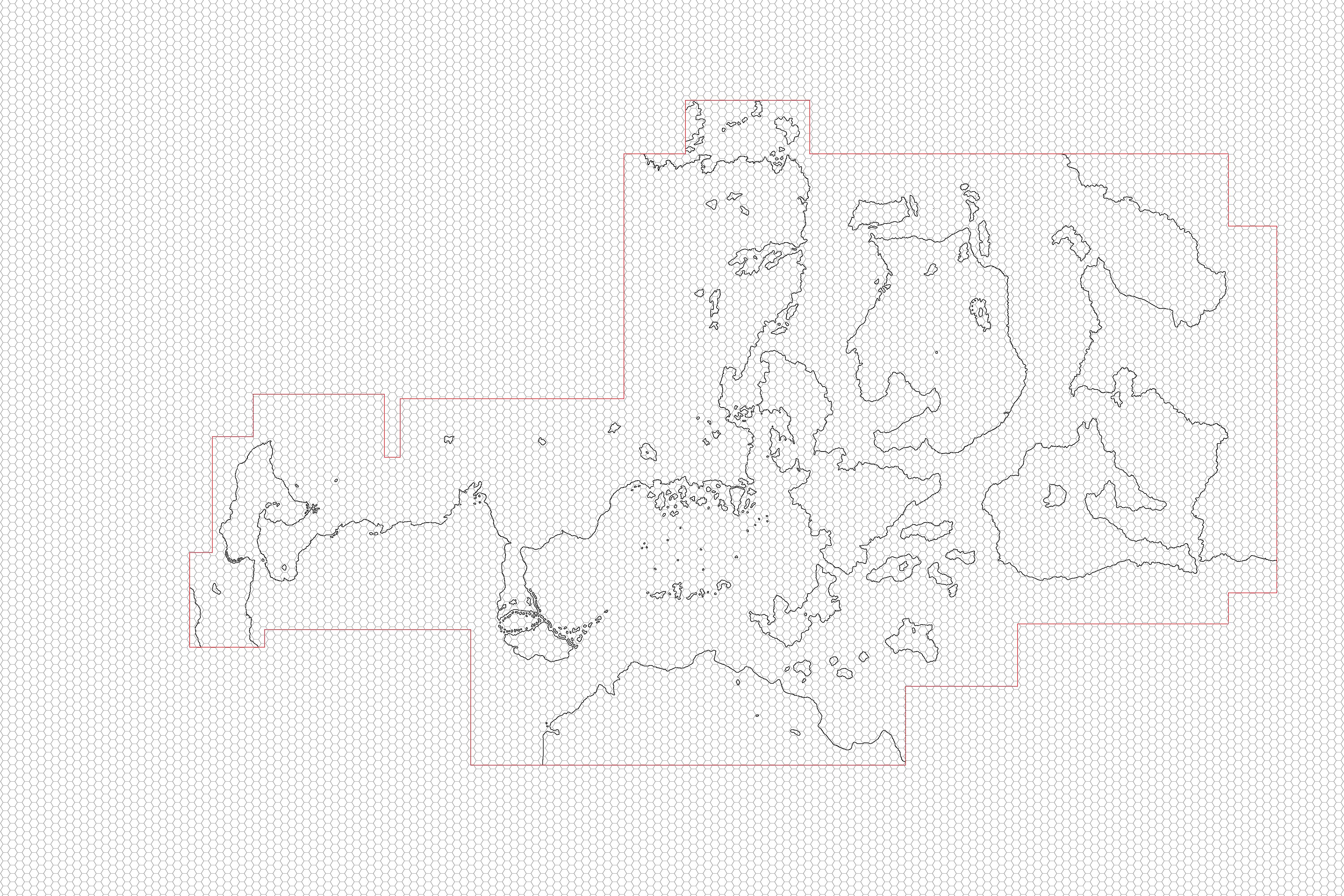
To do this, Michele put together a composite of all Mystara’s officially mapped areas in the 72 mile per hex continental scale. His maps showed the full extent of the areas appearing in official maps, including all the official 72 mile per hex maps plus the Savage Coast and Arm of the Immortals converted from 24 miles per hex.
As these maps were intended to show how mapped areas would fit onto the icosahedral net, Michele stuck to just presenting the coastlines. It’s possible to see where the “faces of the d20” interact with the maps in Michele’s chosen configuration.
The extra versions show just the contiguous mapped area, with the hex grid outside of the area first cropped out and then left in.
Fan-made Maps by Michele Carpita (August 2008)
This is an original map created by one of Mystara’s excellent fan cartographers. For more information on the cartographer, including a gallery of all their maps, see also Appendix M: Mappers of Mystara.
Sources
- Dawn of the Emperors (1989) (PDF at DriveThruRPG)
- Poor Wizard’s Almanac (1992) (PDF at DriveThruRPG)
- Poor Wizard’s Almanac II (1993) (PDF at DriveThruRPG)
- Poor Wizard’s Almanac III (1994) (PDF at DriveThruRPG)
Fan Sources
- Mapping Issues: Curvature, Latitude and Global Projection discussion thread at The Piazza (June 2008-April 2009)
- Michele’s post in that thread with these maps
References
- All of Michele’s maps at the Atlas of Mystara
- Michele’s entry in Appendix M: Mappers of Mystara (upcoming)
- Michele’s author page at the Vaults of Pandius
Chronological Analysis
This is a fan-made map. It was published in August 2008. The updated Atlas version of this map is not yet available. See also Appendix C for annual chronological snapshots of the area. For the full context of this map in Mystara’s publication history, see the upcoming Let’s Map Mystara 2008.
The following lists are from the Let’s Map Mystara project. Additions are new features, introduced in this map. Revisions are changes to previously-introduced features. Hex Art & Fonts track design elements. Finally, Textual Additions are potential features found in the related text. In most cases, the Atlas adopts these textual additions into updated and chronological maps.
Under Construction! Please check back again soon for updates.
Additions
- XXX —
Revisions
- XXX —
Hex Art & Fonts
- Hex Art —
- Fonts —
")
")
")