
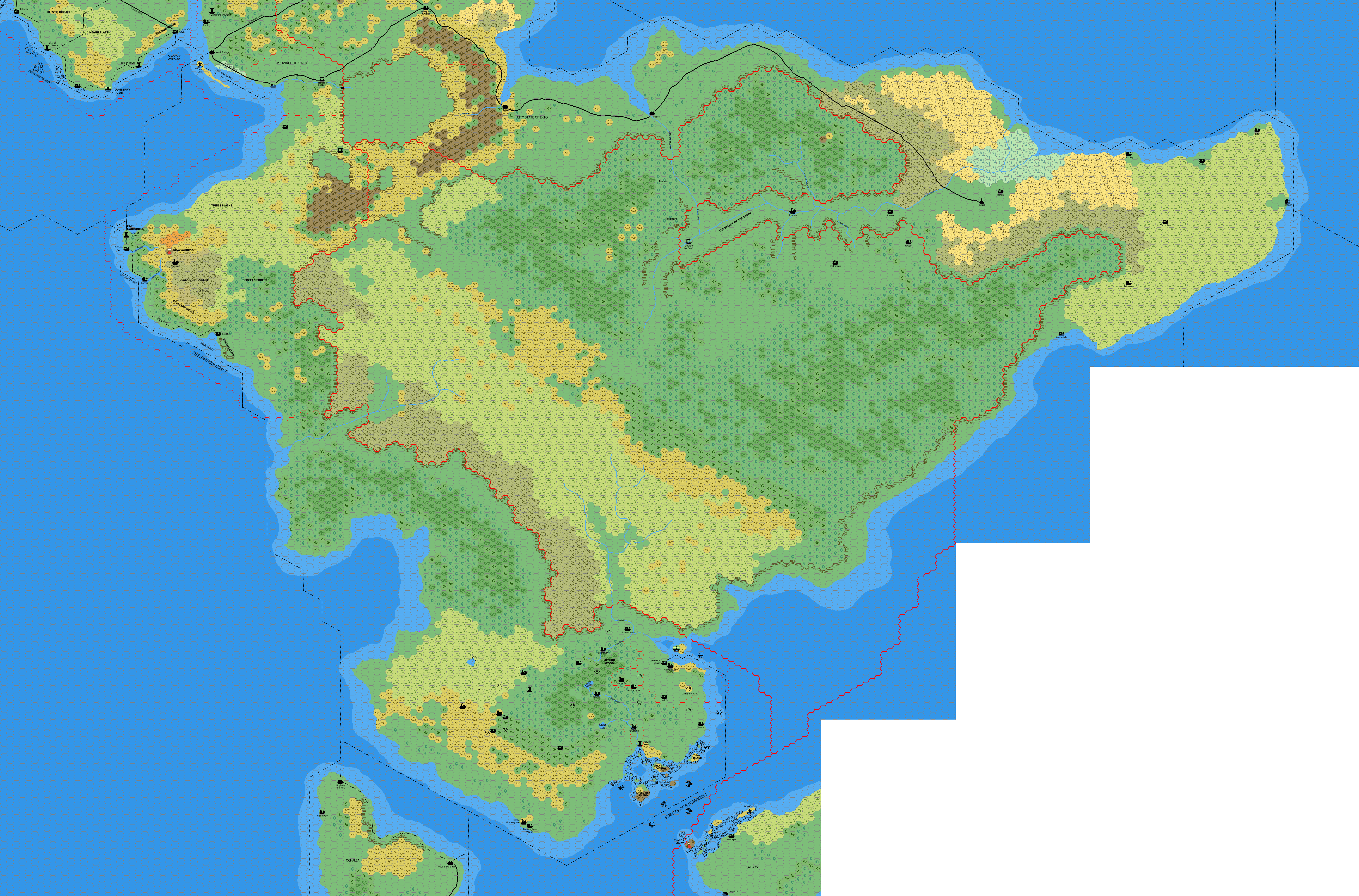
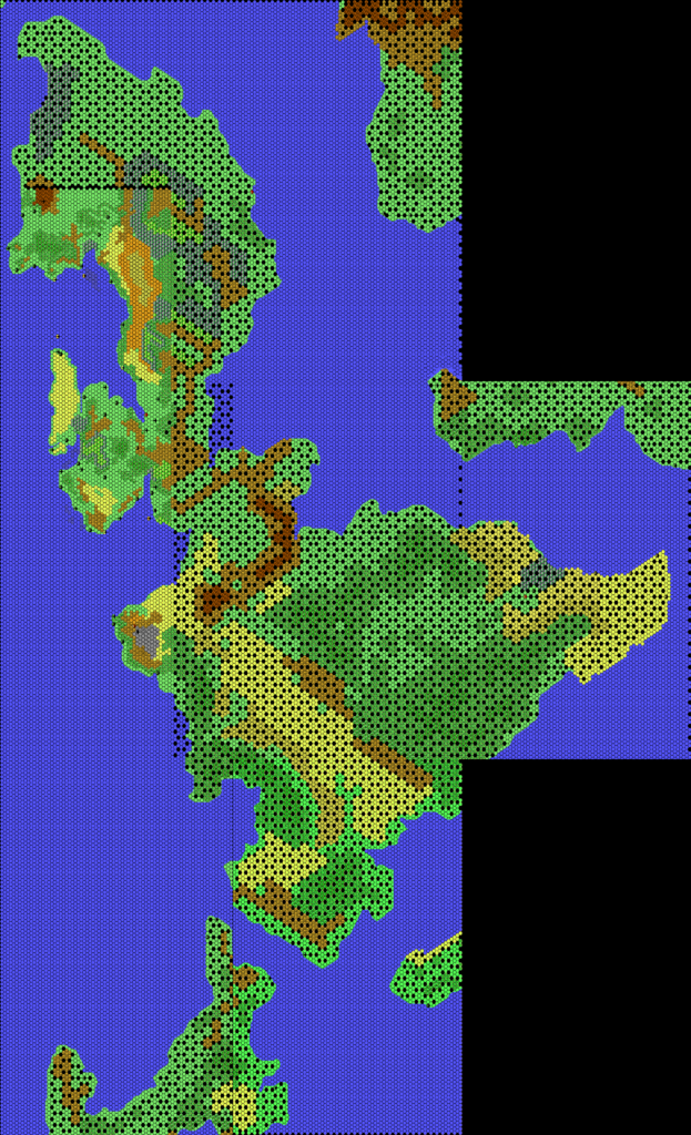
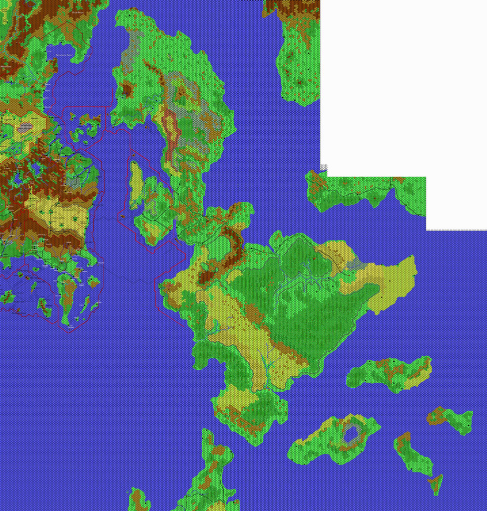
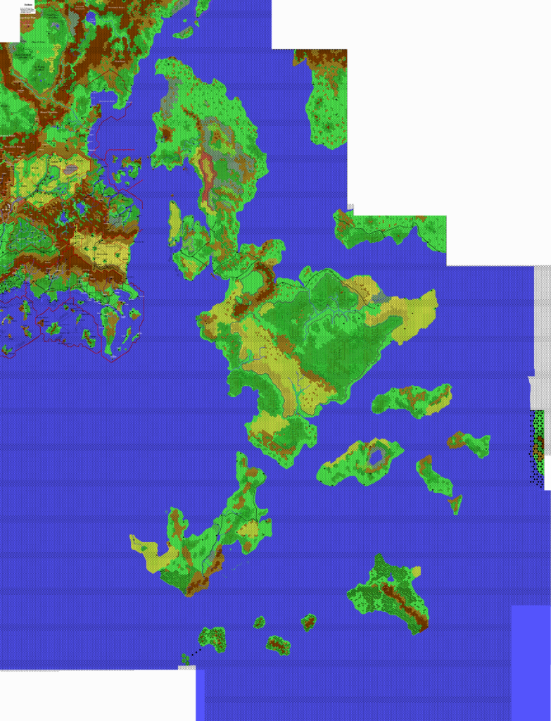
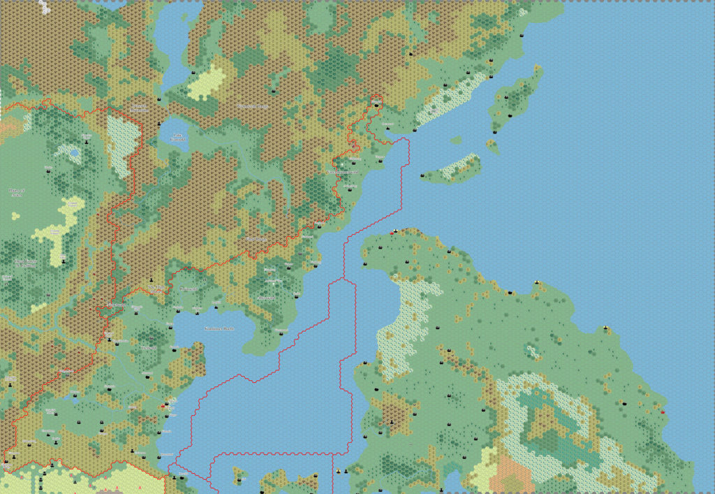
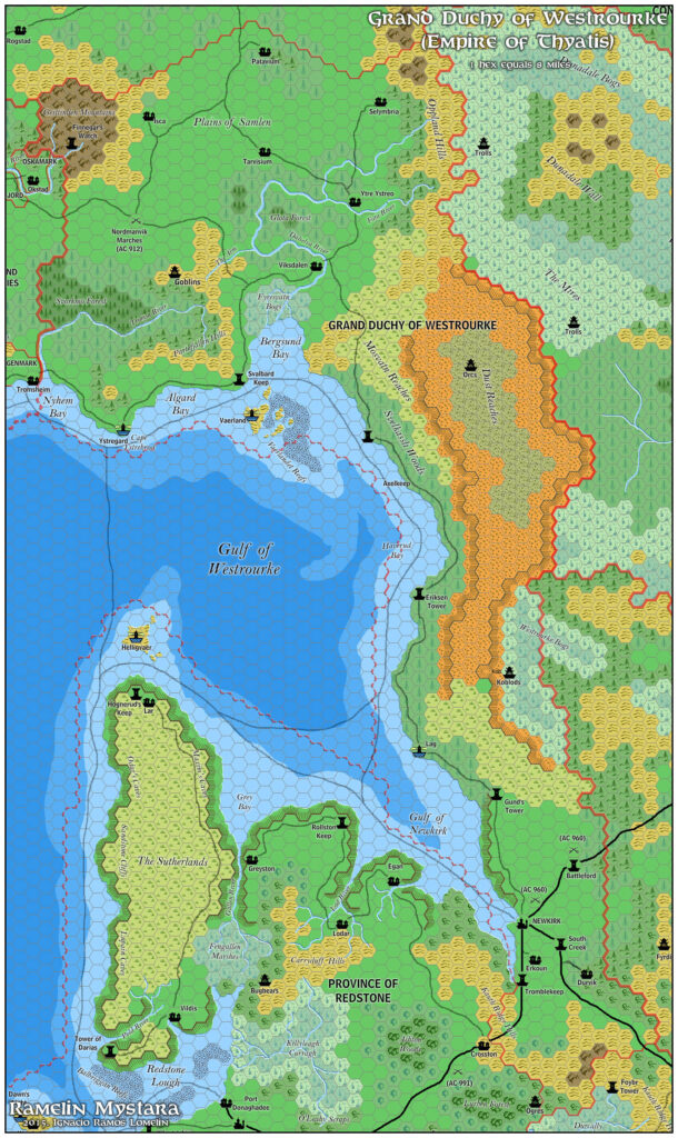
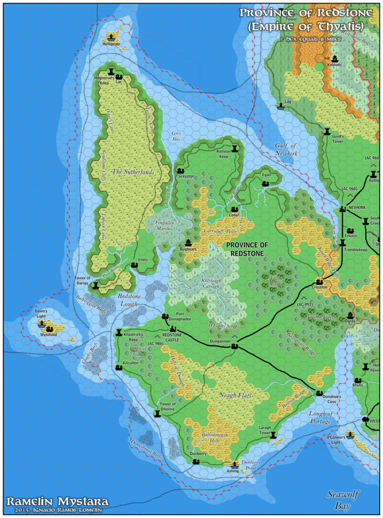
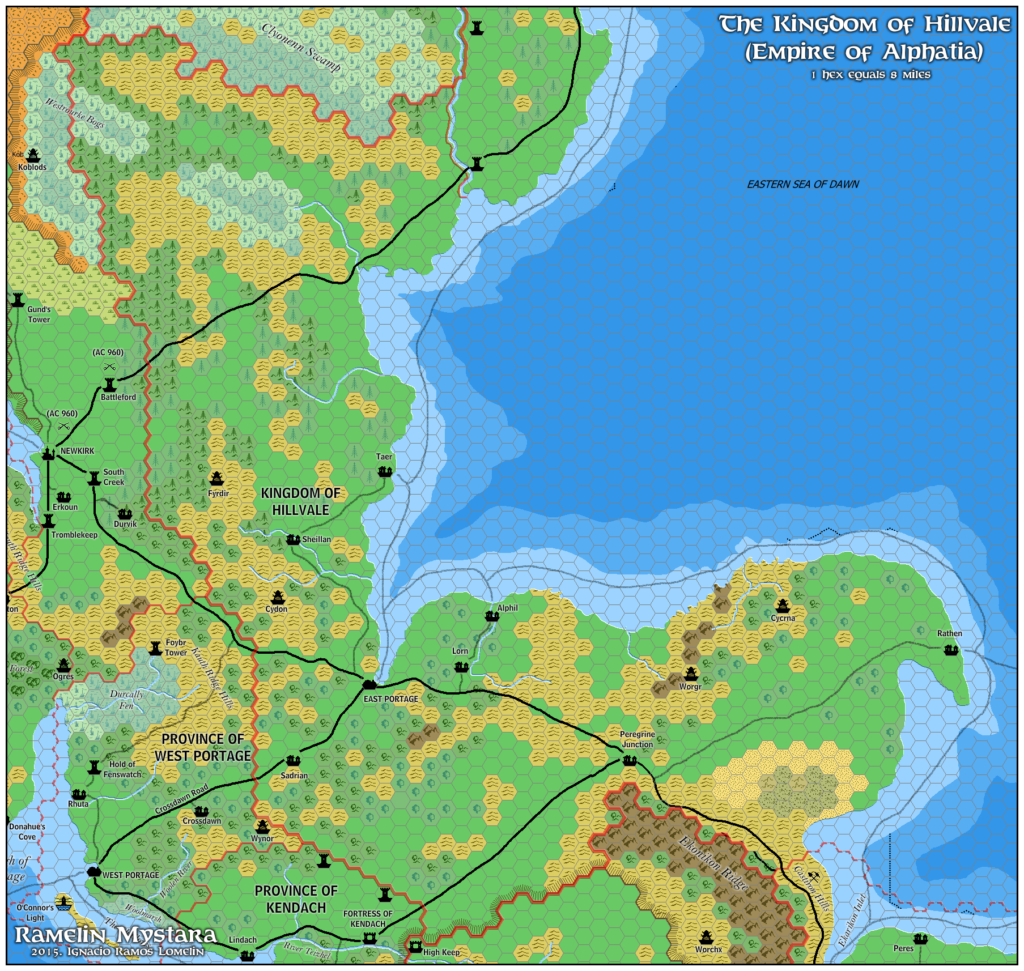
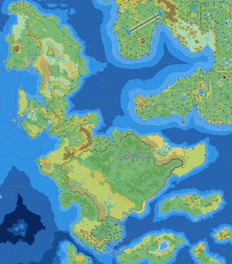
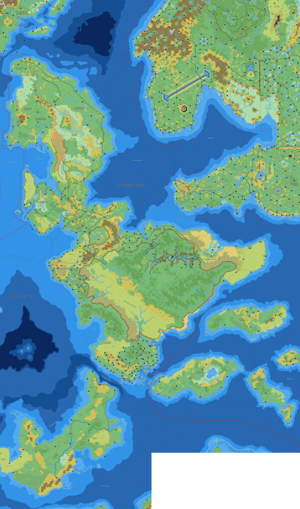
Mark’s Isle of Dawn South, 8 miles per hex
This was Mark’s final map in 2006, before taking an extended break from his mapping projects.
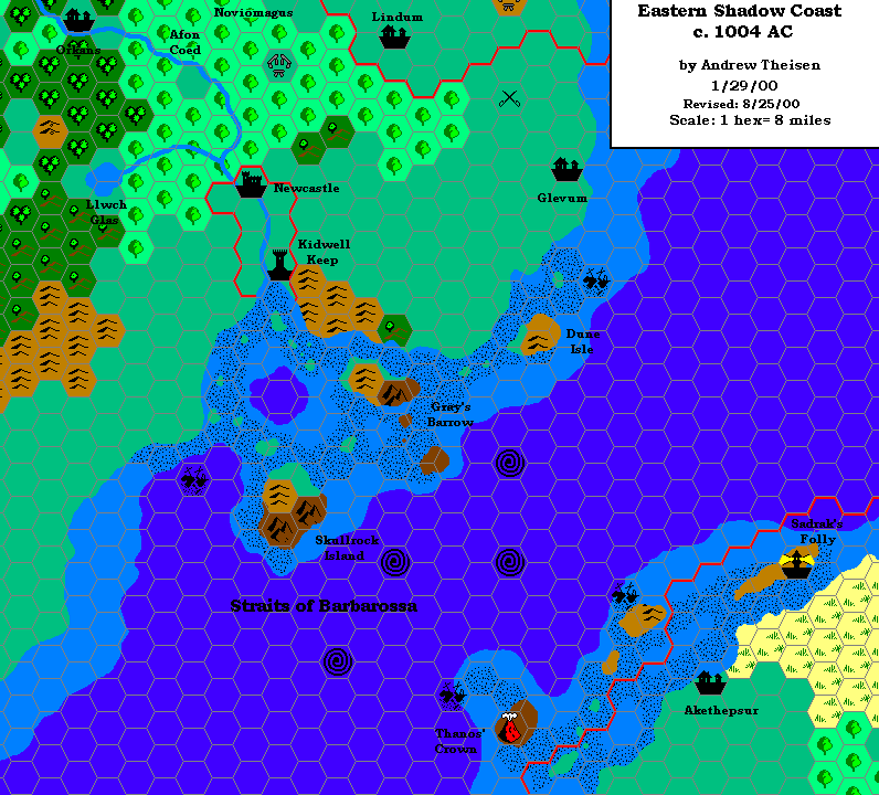
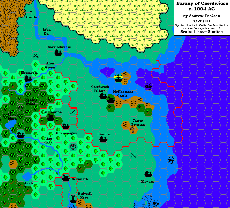
The map adds labels and some details to his previous full Isle of Dawn, 8 miles per hex map. In addition to Thibault Sarlat’s terrain, Mark also referenced Andrew Theisen’s Caerdwicca and Eastern Shadow Coast maps from 2000. As a result, the area of the map around the Straits of Barbarossa is far more complete than the rest.
It’s a huge map, and clearly Mark still intended to add more detail to it when he set it aside. Perhaps that’s why he never posted a reassembled version, adding labels to the full map. He would, of course, come back to the Isle of Dawn many years later to remedy this situation, though.
Fan-made Map by Mark Howard (October 2006)
This is an original map created by one of Mystara’s excellent fan cartographers. For more information on the cartographer, including a gallery of all their maps, see also Appendix M: Mappers of Mystara.
Sources
- Dawn of the Emperors (1989) (PDF at DriveThruRPG)
- TM2 The Eastern Countries (1989) (PDF at DriveThruRPG)
Fan Sources
- Cthulhudrew’s Eastern Shadow Coast, 8 miles per hex (August 2000)
- Cthulhudrew’s Caerdwicca, 8 miles per hex (August 2000)
- Thibault’s Isle of Dawn, 8 miles per hex v4 (September 2002)
- Mark’s Isle of Dawn, 8 miles per hex v1 (April 2006)
- Mark’s Isle of Dawn North, 8 miles per hex (September 2006)
References
- All of Mark’s maps at the Atlas of Mystara
- Mark’s entry in Appendix M: Mappers of Mystara (upcoming)
- Mark’s author page at the Vaults of Pandius
Chronological Analysis
This is a fan-made map. It was published in October 2006. The updated Atlas version of this map is not yet available. See also Appendix C for annual chronological snapshots of the area. For the full context of this map in Mystara’s publication history, see the upcoming Let’s Map Mystara 2006.
The following lists are from the Let’s Map Mystara project. Additions are new features, introduced in this map. Revisions are changes to previously-introduced features. Hex Art & Fonts track design elements. Finally, Textual Additions are potential features found in the related text. In most cases, the Atlas adopts these textual additions into updated and chronological maps.
Under Construction! Please check back again soon for updates.
")
")
")