
Mark’s Karameikos, 8 miles per hex v1
By some strange coincidence — or perhaps serendipity — Mark Howard began mapping and sharing his maps at the same time as I did. Mark’s earliest maps date to the first days of 2005, although he didn’t begin sharing them until February. Like me, he created his own system and artwork for mapping, with his own carefully-chosen colour palette, and hex art evocative of TSR’s old Mystara hex maps.
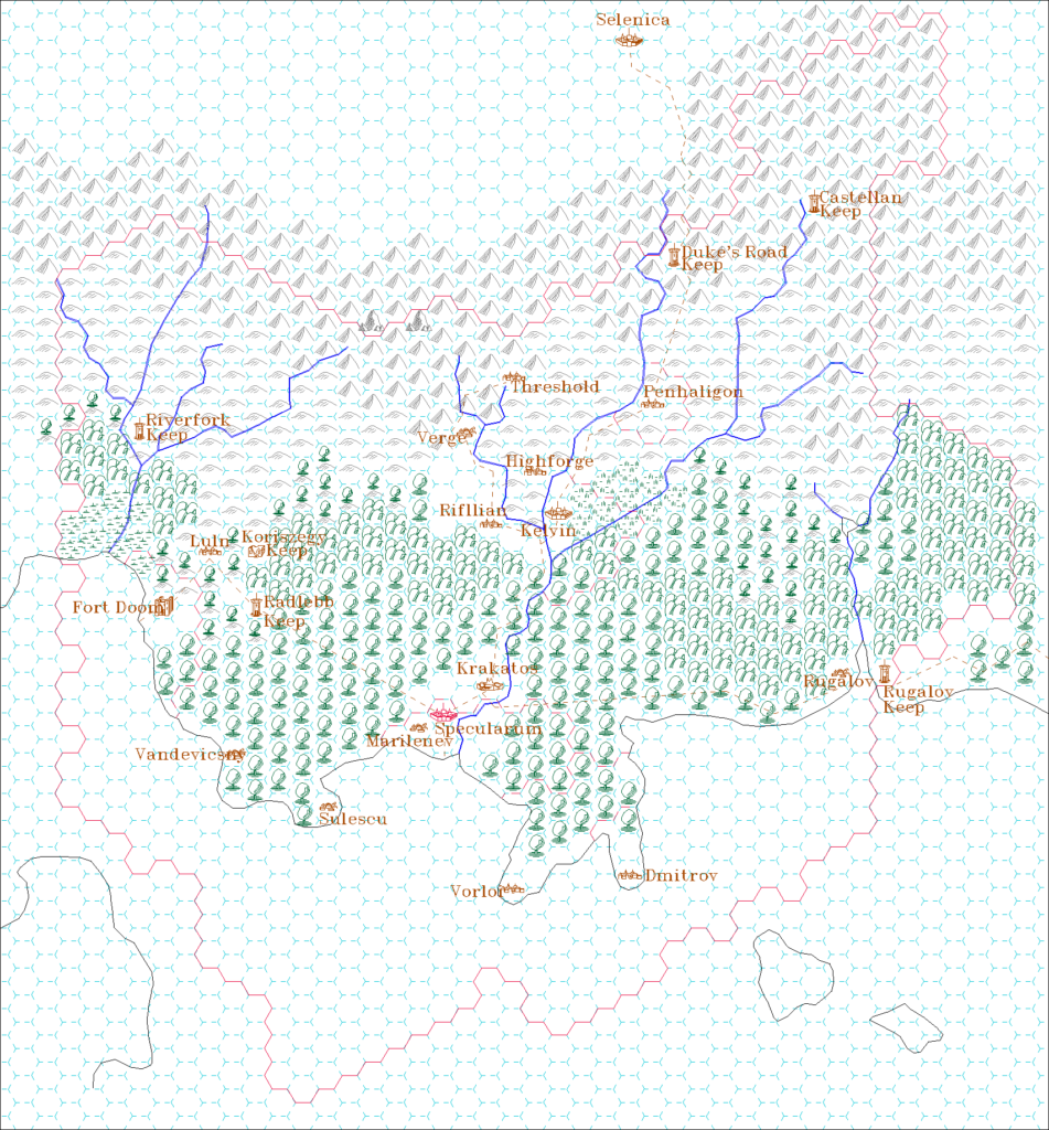
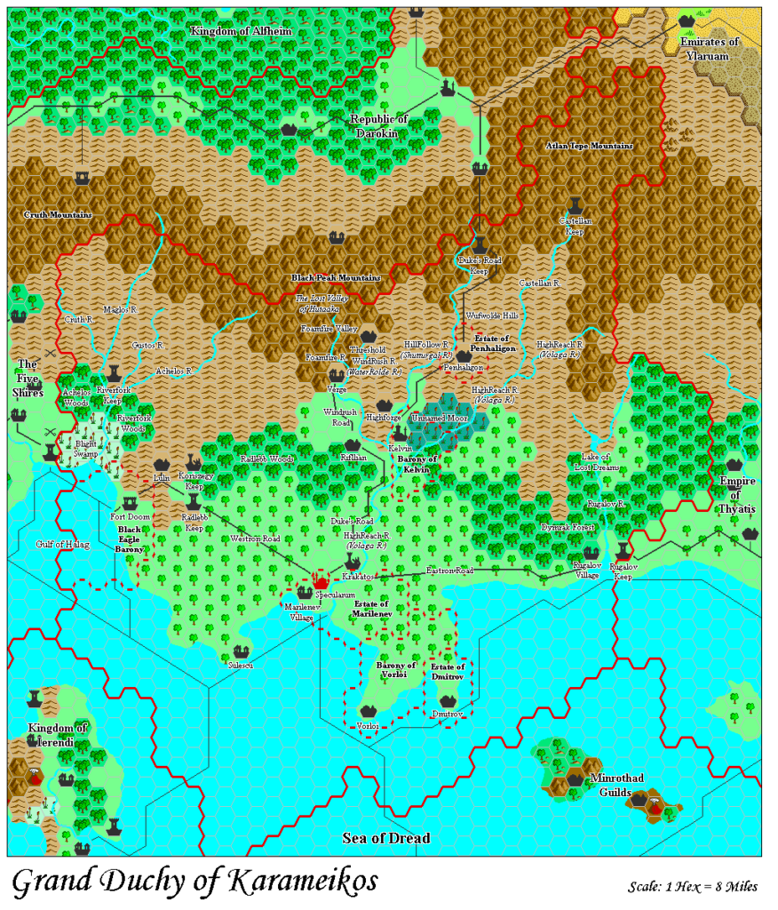
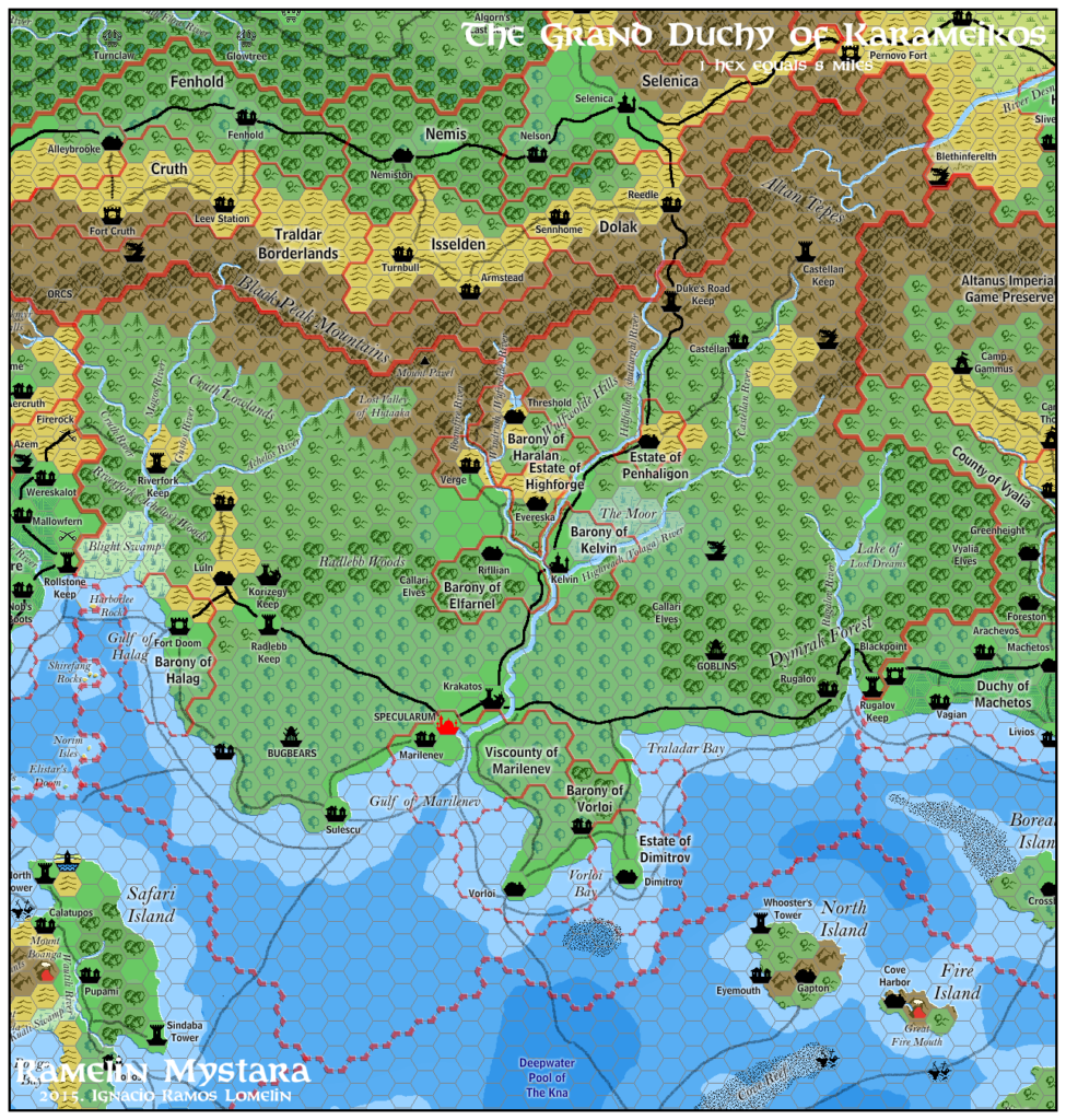
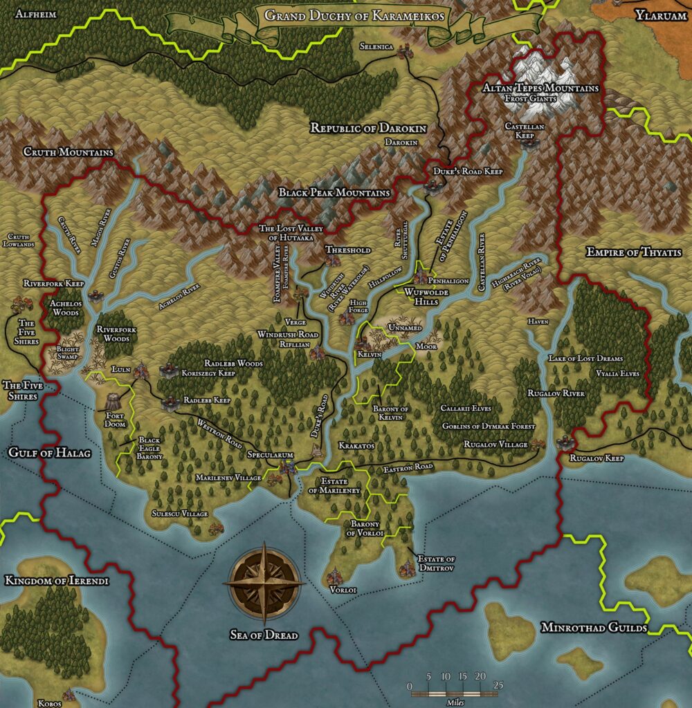
The earliest dated of Mark’s maps that I have found is this one from early January 2005. Appropriately for his first map, it depicts Karameikos. The cropping is close — though not identical — to DDA3 Eye of Traldar’s single page Karameikos map, and the content is also very similar.
There is one major departure: Mark moved Kelvin south a single hex, relocating it to the river fork of the Hillfollow and the Highreach. This was surely to match GAZ1’s Kelvin town map, which shows that the city is located right at the fork. Mark may well have been the first to do this, and it has since become a common feature on fan-made maps, including the Atlas of Mystara’s Updated map.
Fan-made Map by Mark Howard (January 2005)
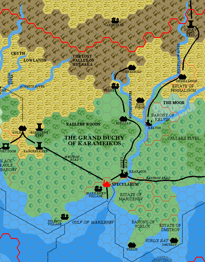
by Mark Howard, January 2005
This is an original map created by one of Mystara’s excellent fan cartographers. For more information on the cartographer, including a gallery of all their maps, see also Appendix M: Mappers of Mystara.
Sources
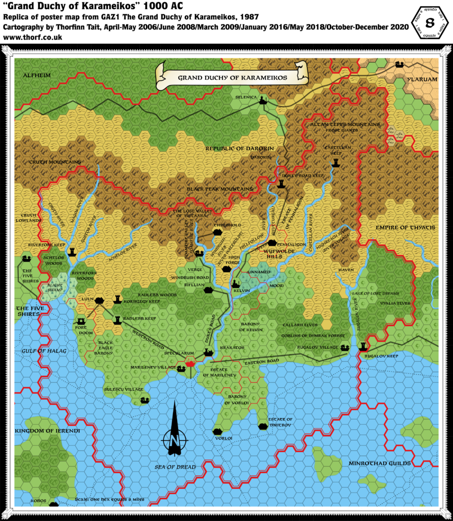
- GAZ1 The Grand Duchy of Karameikos (1987) (PDF at DriveThruRPG)
- DDA3 Eye of Traldar (1991) (PDF at DriveThruRPG)
- Karameikos, 8 miles per hex
Fan Sources
- None
References
- All of Mark’s maps at the Atlas of Mystara
- Mark’s entry in Appendix M: Mappers of Mystara (upcoming)
- Mark’s author page at the Vaults of Pandius
Chronological Analysis
This is a fan-made map. It was published in January 2005. The updated Atlas version of this map is not yet available. See also Appendix C for annual chronological snapshots of the area. For the full context of this map in Mystara’s publication history, see the upcoming Let’s Map Mystara 2005.
The following lists are from the Let’s Map Mystara project. Additions are new features, introduced in this map. Revisions are changes to previously-introduced features. Hex Art & Fonts track design elements. Finally, Textual Additions are potential features found in the related text. In most cases, the Atlas adopts these textual additions into updated and chronological maps.
Under Construction! Please check back again soon for updates.
Additions
Revisions
- Settlements — Kelvin has been moved one hex south to match its town map’s location at the riverfork.
")
")
")
28 June 2025 @ 8:17 pm
Moved Kelvin compared to what other source?
29 June 2025 @ 9:36 pm
The map is based on GAZ1’s 8 mile per hex map, which places Kelvin a full hex away from the river’s fork. This is in clear contradiction to the Kelvin town map, also from GAZ1. Mark moved Kelvin one hex south to sit at the river fork.
For what it’s worth, previous 6 mile per hex maps also placed it at the river fork. B10’s 3 mile per hex map actually placed it one hex away from the fork, similar to GAZ1’s hex map’s location. However, all of this was superseded by the release of the town map — the largest scale and therefore the most detailed depiction of the town.
It’s therefore no surprise that a lot of fans adopted the same edit as Mark made here.