
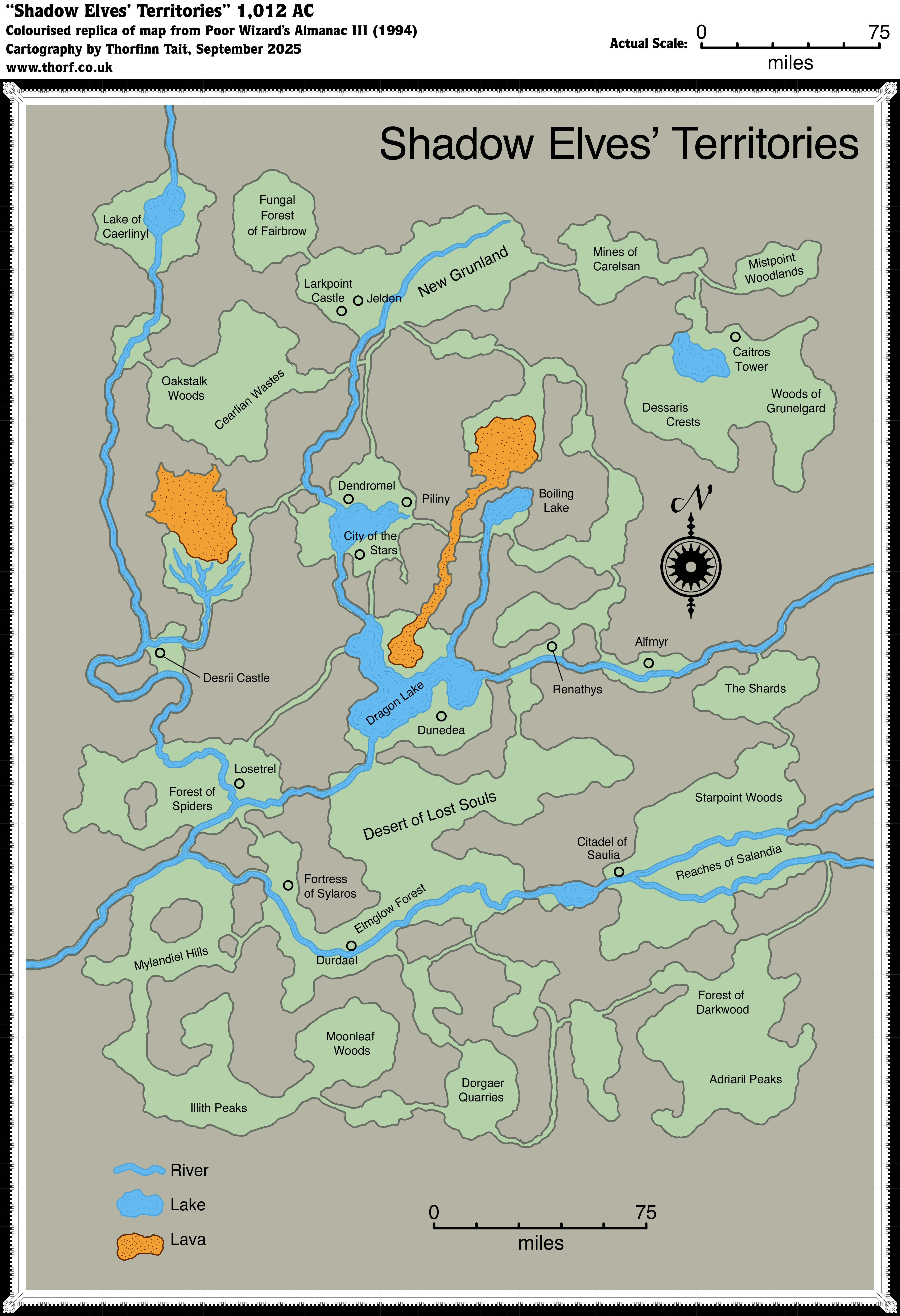
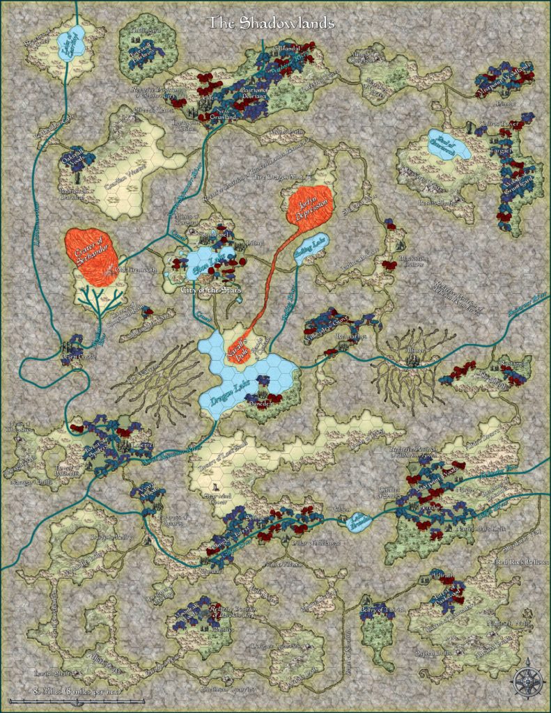
Poor Wizard’s Almanac III Shadow Elves’ Territories
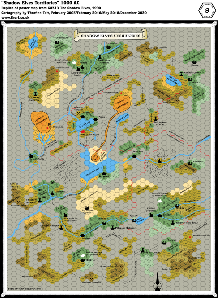
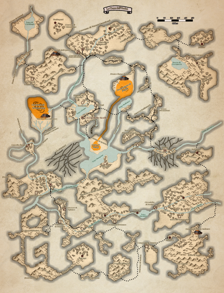
The third Poor Wizard’s Almanac provided a single page version of GAZ13’s four page poster map. While it left out much of the original map’s detail, on the other hand it added something entirely new that had been sadly missing from GAZ13’s version: cavern walls. The hex map had used grey hex symbols to show areas of solid rock, with no roughened walls between those hexes and the terrain hexes denoting caverns. This map sorted that problem.
Sadly, the two maps were not quite a perfect fit, and some compromises would be necessary to join them together into a single map. To make comparison easier, I have reproduced this map at the same scale as GAZ13’s 8 mile per hex map.
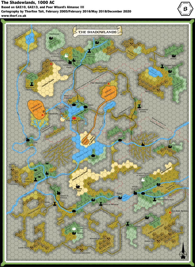
Replica Map (September 2025)
Sources
- Poor Wizard’s Almanac III (1994) (PDF at DriveThruRPG)
- Page 53 map, Cartography by Diesel
References
- New Map: Poor Wizard’s Almanac III Shadow Elves’ Territories post at Patreon
Chronological Analysis
This is Map 269. It was published in December 1994. The updated version of this map is Shadowlands, 8 miles per hex. See also Appendix C for annual chronological snapshots of the area. For the full context of this map in Mystara’s publication history, see Let’s Map Mystara 1994.
The following lists are from the Let’s Map Mystara project. Additions are new features, introduced in this map. Revisions are changes to previously-introduced features. Hex Art & Fonts track design elements. Finally, Textual Additions are potential features found in the related text. In most cases, the Atlas adopts these textual additions into updated and chronological maps.
Under Construction! Please check back again soon for updates.
Additions
- XXX —
Revisions
- XXX —
Hex Art & Fonts
- Hex Art —
- Fonts —
Textual Additions (Poor Wizard’s Almanac III, December 1994)
- XXX —

")

23 December 2025 @ 1:25 am
Man, this is great.