
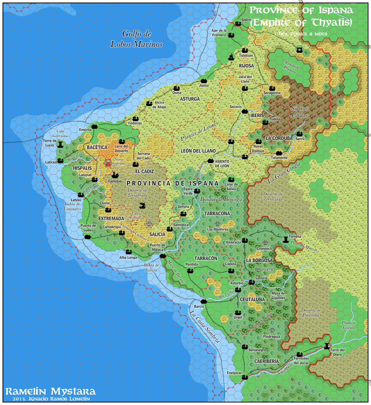
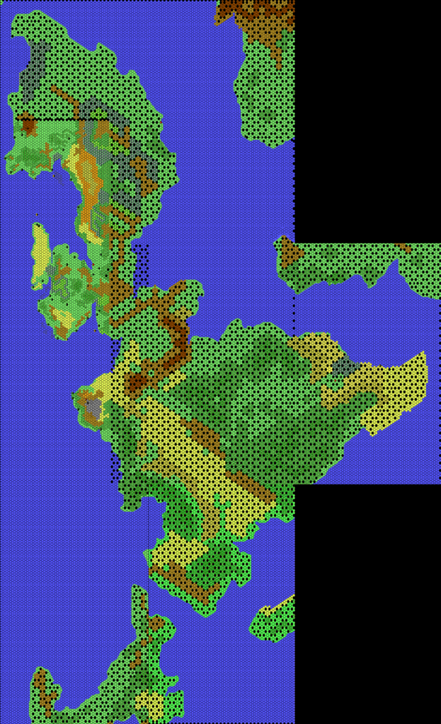
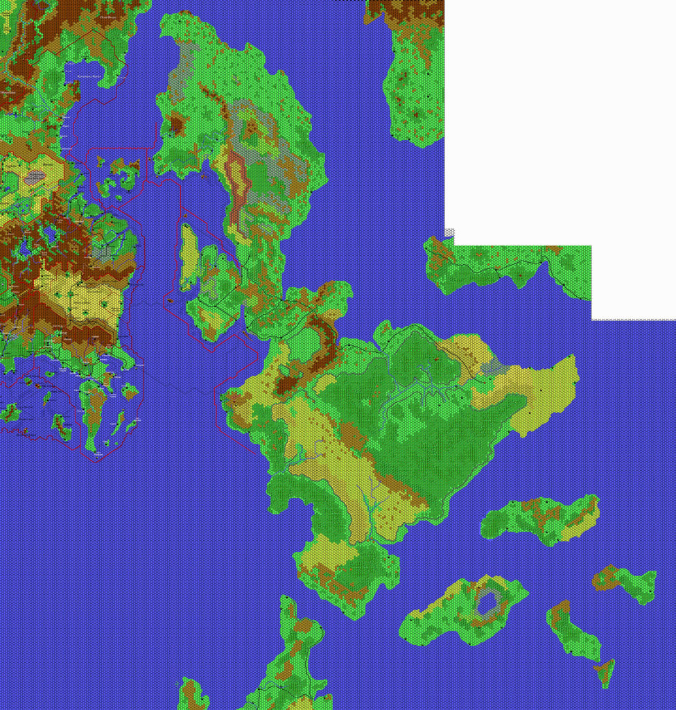
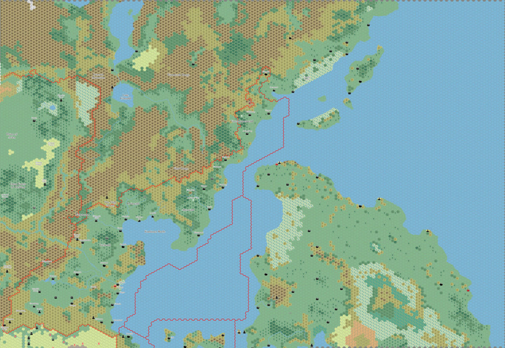
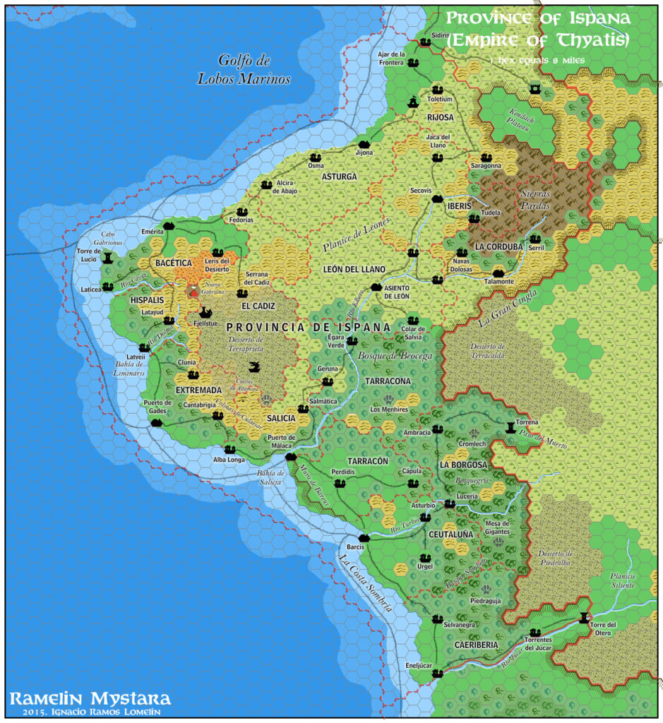
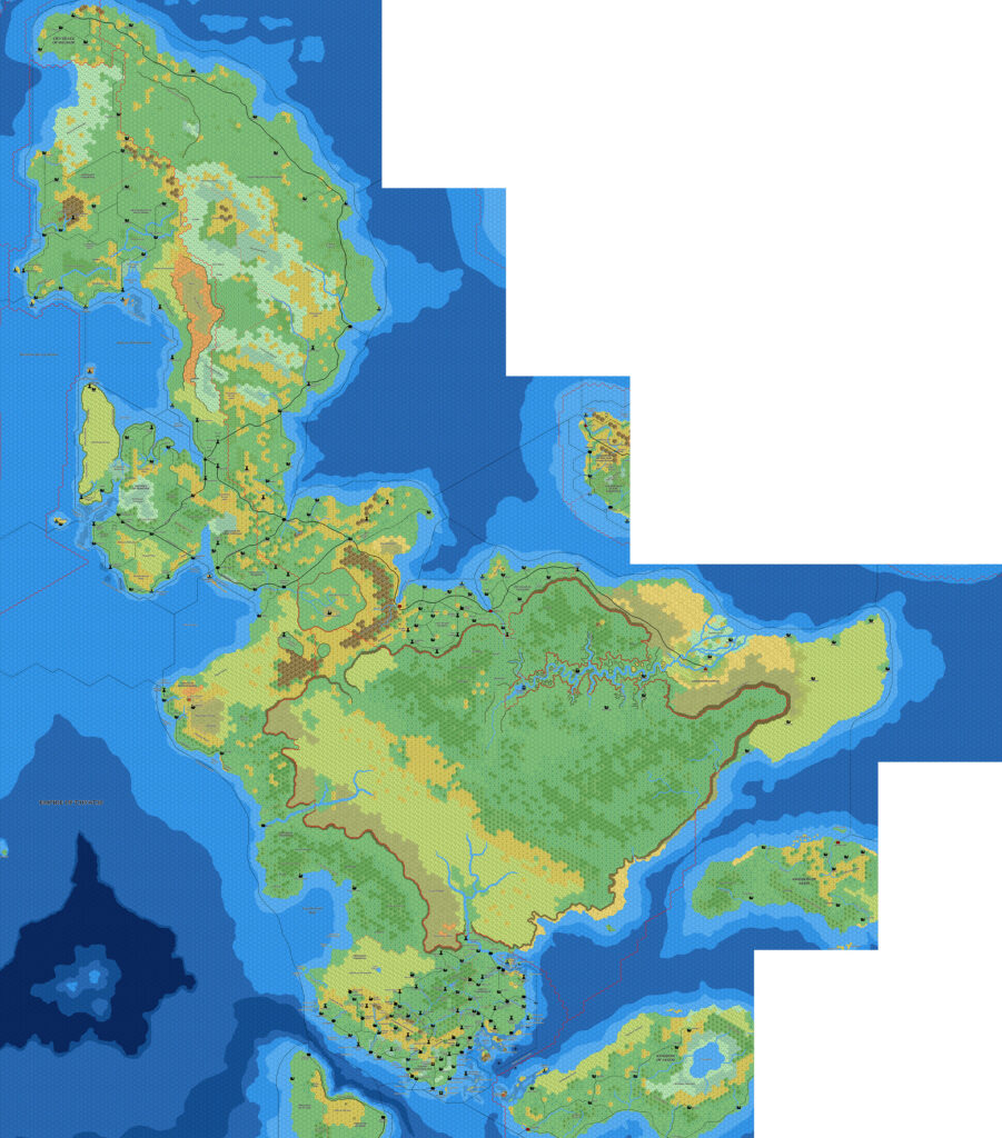
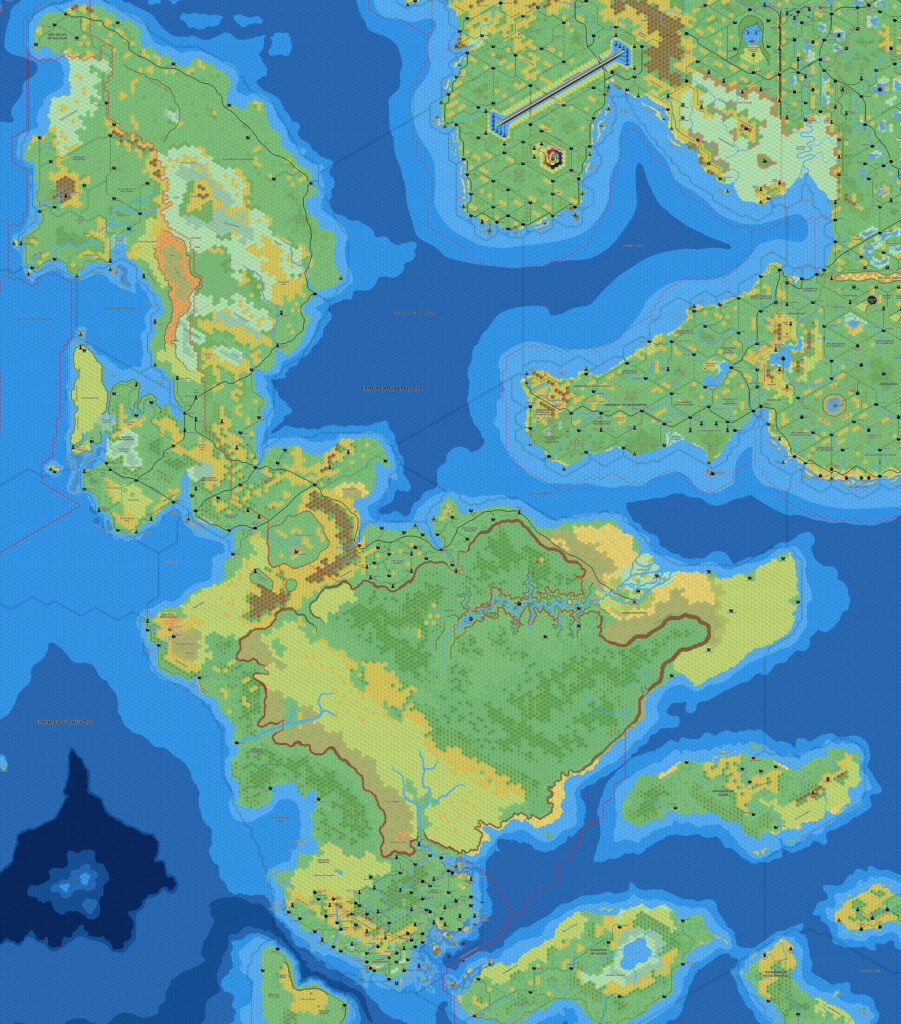
Ramelin’s Ispana, 8 miles per hex v1
Jose posted this map on Pinterest in November 2015 along with his Ekto and Trikelios and a few other maps. Like the Ekto/Trikelios map, this one developed a small part of the Isle of Dawn at 8 miles per hex.
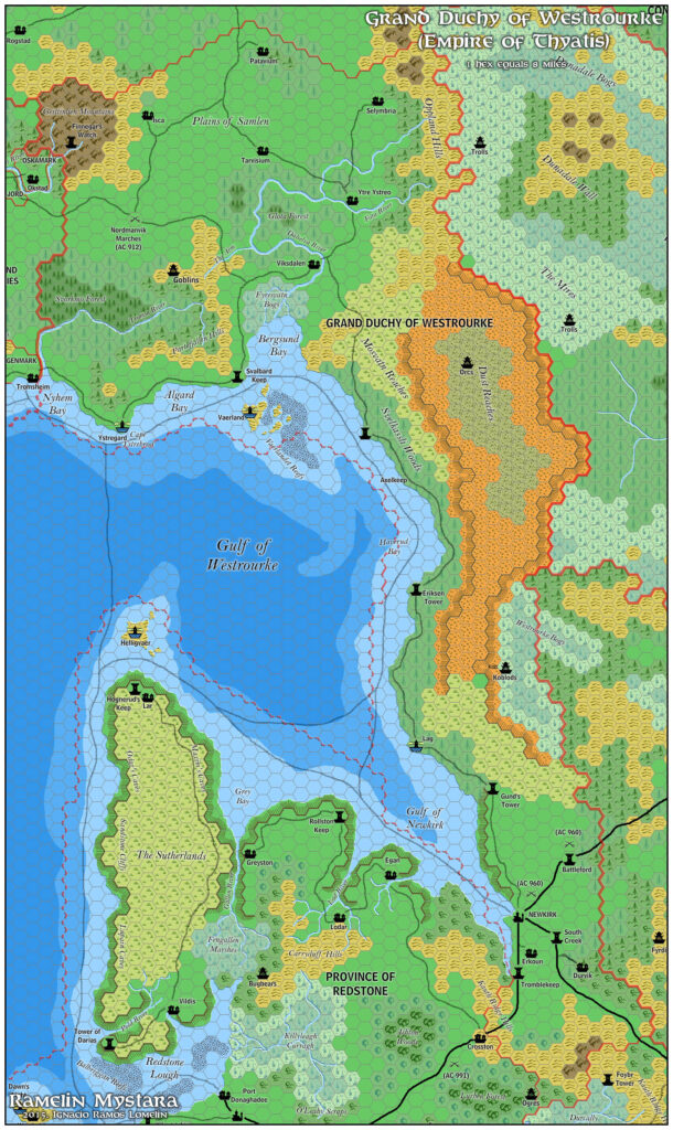
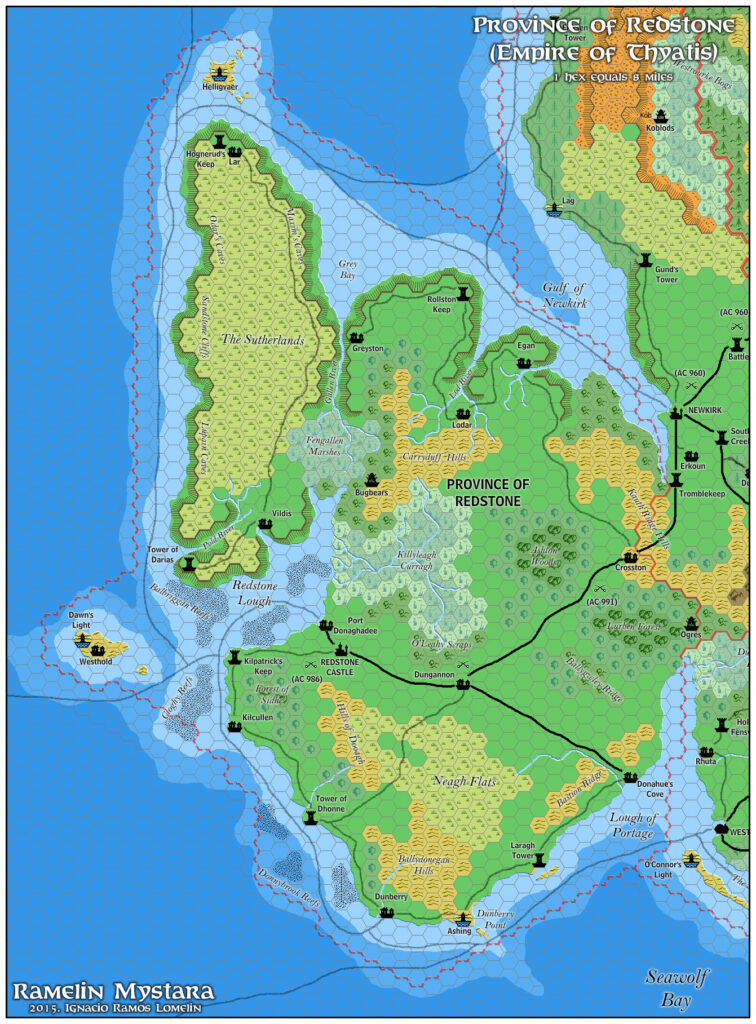
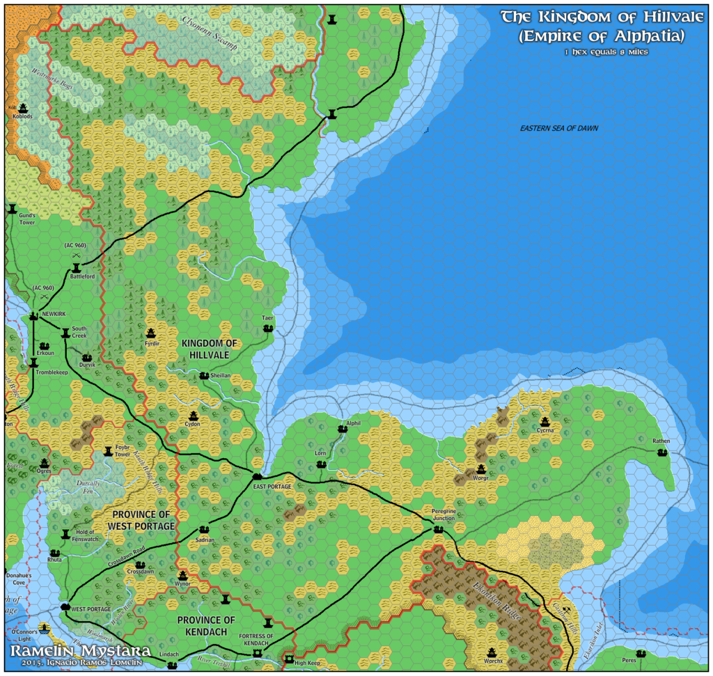
On TM2, this was Provincia Septentriona, but Jose changed it to Provincia de Ispana, likely to provide a homeland for the Ispan culture. Accordingly, he made it a lot more heavily populated and changed all the names from Latin to a more Spanish style. The Shadow Coast became La Costa Sombría, Cape Gabrionus became Cabo Gabrionus, Tigris Plains became Planice de Leones, and so on. Apart from the Tower of Lucinius (Torre de Lucio), Laticea, Latveil (Latveii), Perdidis, the ruins of Fjellstue, and the volcano of Nova Gabriona (Nueva Gabriona), Jose added all of the settlements on the map. He also displaced Perdidis from its original location, placing Puerto de Málaca in its original location.
All in all Jose did some major development on this region, but like his reinterpretations of Ethengar and Ylaruam, the result is somewhat different from the official take on the region. Unlike those maps, there was far, far less here of importance in the first place, so the change is a lot less drastic.
Fan-made Map by Jose Ignacio Ramos Lomelin (November 2015)
This is an original map created by one of Mystara’s excellent fan cartographers. For more information on the cartographer, including a gallery of all their maps, see also Appendix M: Mappers of Mystara.
Sources
- Dawn of the Emperors (1989) (PDF at DriveThruRPG)
- TM2 The Eastern Countries (1989) (PDF at DriveThruRPG)
Fan Sources
- Thibault’s Isle of Dawn, 8 miles per hex v4 (September 2002)
- Mark’s Isle of Dawn South, 8 miles per hex (October 2006)
References
- All of Jose’s maps at the Atlas of Mystara
- Jose’s entry in Appendix M: Mappers of Mystara (upcoming)
- Jose’s author page at the Vaults of Pandius
Chronological Analysis
This is a fan-made map. It was published in November 2015. The updated Atlas version of this map is not yet available. See also Appendix C for annual chronological snapshots of the area. For the full context of this map in Mystara’s publication history, see the upcoming Let’s Map Mystara 2015.
The following lists are from the Let’s Map Mystara project. Additions are new features, introduced in this map. Revisions are changes to previously-introduced features. Hex Art & Fonts track design elements. Finally, Textual Additions are potential features found in the related text. In most cases, the Atlas adopts these textual additions into updated and chronological maps.
Coming Soon
")

")