
Ramelin’s Meriander, 8 miles per hex v1
Jose shared this map of northeastern Bellissaria as early as November 2015 on his Pinterest page. At the same time he also posted his Alatian Islands along with a few other maps. It wasn’t until 2017 that he shared the other parts of Bellissaria — beginning with a full composite map of the whole island continent, and then later the other individual parts. It’s unclear as to why, but regardless it seems he had already completed at least partial work on Bellissaria by late 2015.
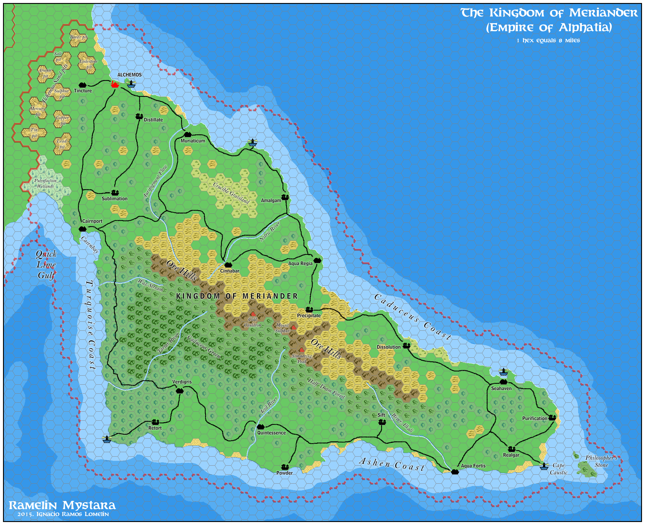
The map follows the same pattern he set with his Ekto and Trikelios map (also released at the same time), mimicking Bruce Heard’s development of Alphatian provinces a few years before. For Meriander’s theme, Jose chose alchemy, populating the kingdom with settlements named after alchemical terms. In keeping with the more sparse nature of Bellissaria, he added less settlements than can be found in Mainland Alphatia.
This was the first 8 mile per hex map of Bellissaria to be shared in the community. Previous fan cartographers had tackled it at 24 miles per hex, but to my knowledge no one had made an 8 mile per hex map of it until Jose. As noted above, two years later he went on to map the whole of Bellissaria as well as a second version of this map of Meriander.
Fan-made Map by Jose Ignacio Ramos Lomelin (November 2015)
This is an original map created by one of Mystara’s excellent fan cartographers. For more information on the cartographer, including a gallery of all their maps, see also Appendix M: Mappers of Mystara.
Sources
- Dawn of the Emperors (1989) (PDF at DriveThruRPG)
Fan Sources
- LoZompatore’s Meriander, 24 miles per hex (July 2006)
- LoZompatore’s Bellissaria, 24 miles per hex (July 2006)
References
- All of Jose’s maps at the Atlas of Mystara
- Jose’s entry in Appendix M: Mappers of Mystara (upcoming)
- Jose’s author page at the Vaults of Pandius
Chronological Analysis
This is a fan-made map. It was published in November 2015. The updated Atlas version of this map is not yet available. See also Appendix C for annual chronological snapshots of the area. For the full context of this map in Mystara’s publication history, see the upcoming Let’s Map Mystara 2015.
The following lists are from the Let’s Map Mystara project. Additions are new features, introduced in this map. Revisions are changes to previously-introduced features. Hex Art & Fonts track design elements. Finally, Textual Additions are potential features found in the related text. In most cases, the Atlas adopts these textual additions into updated and chronological maps.
Coming Soon
")

")