
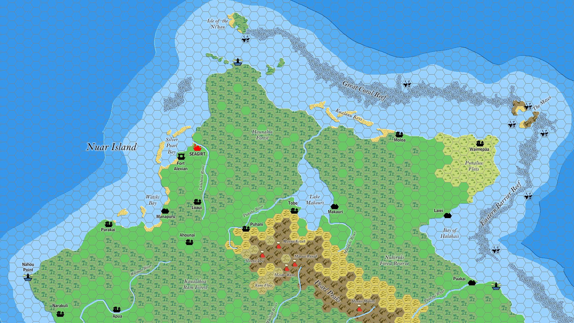
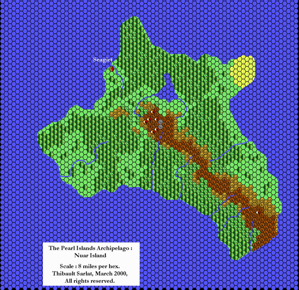
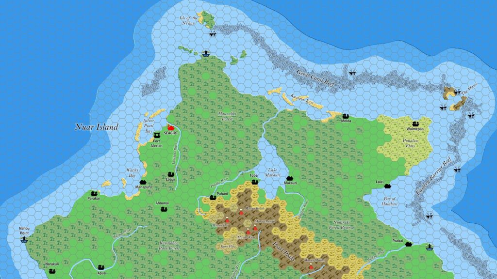
Ramelin’s Nuar, 8 miles per hex
This map fragment dates back to October 2015, the month before Jose finalised and began posting large chunks of his mapping project. It’s a work-in-progress version of the largest of the Pearl Islands, Nuar Island. Comparison with the finished map of the whole archipelago from the next month reveals that most features were already in place, with a lot of new features, settlements and labels but no trails or shipping lanes.
Once again, this is an early example of Jose’s talent for adding fine details to existing maps that merge seamlessly with previous lore.
Fan-made Map by Jose Ignacio Ramos Lomelin (October 2015)
This is an original map created by one of Mystara’s excellent fan cartographers. For more information on the cartographer, including a gallery of all their maps, see also Appendix M: Mappers of Mystara.
Sources
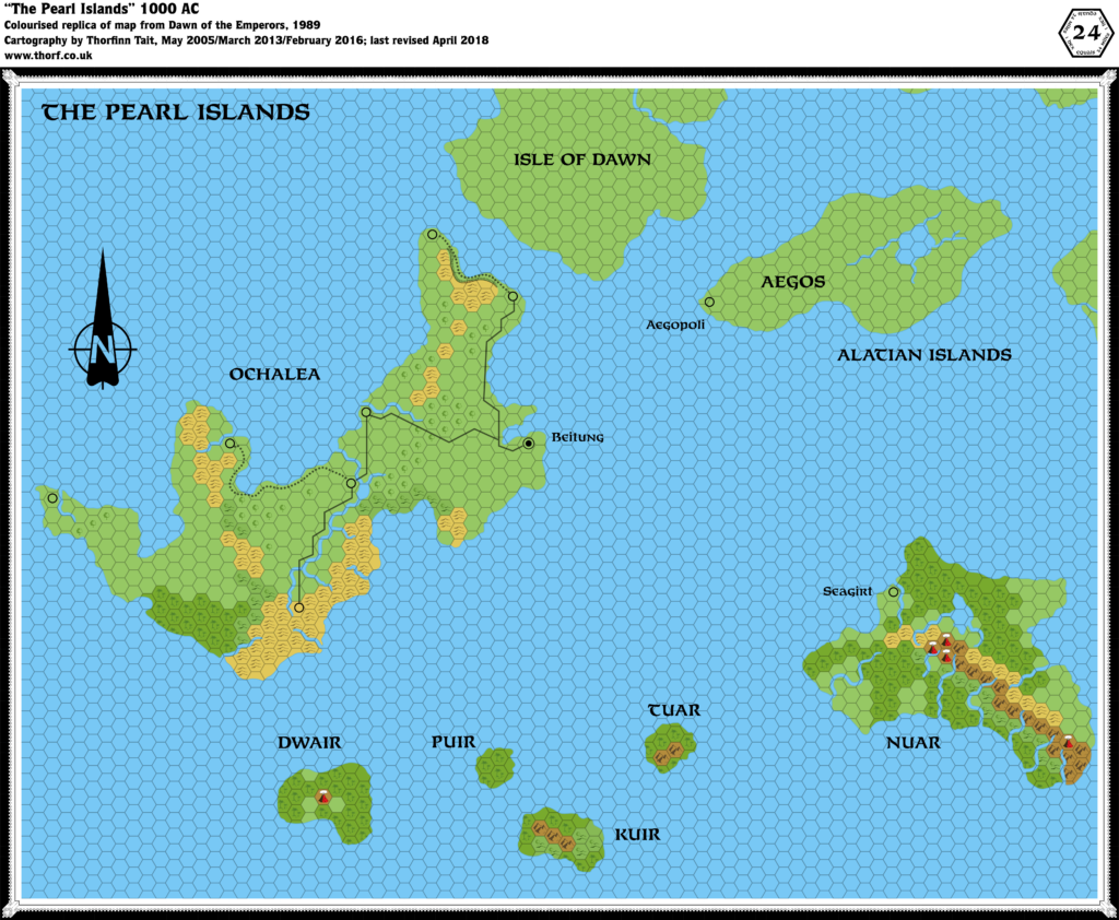
- Dawn of the Emperors (1989) (PDF at DriveThruRPG)
Fan Sources
- None
References
- All of Jose’s maps at the Atlas of Mystara
- Jose’s entry in Appendix M: Mappers of Mystara (upcoming)
- Jose’s author page at the Vaults of Pandius
Chronological Analysis
This is a fan-made map. It was published in October 2015. The updated Atlas version of this map is not yet available. See also Appendix C for annual chronological snapshots of the area. For the full context of this map in Mystara’s publication history, see the upcoming Let’s Map Mystara 2015.
The following lists are from the Let’s Map Mystara project. Additions are new features, introduced in this map. Revisions are changes to previously-introduced features. Hex Art & Fonts track design elements. Finally, Textual Additions are potential features found in the related text. In most cases, the Atlas adopts these textual additions into updated and chronological maps.
Coming Soon


10 January 2026 @ 11:37 pm
Comment pasted from Facebook:
Great map, but his names are Hawaiian, even tho the illustration of Nuari people in DotE is Papuan.
In a revised map, the names oughta be re-modeled on Papuan placenames.
Thorfinn Tait replied:
Sionainn Mac Innéirghe — Thanks! That’s very useful to know.
Would you mind posting this comment on the Atlas page, too? I fear it will be lost in the Facebook nether and I’ll have forgotten about this by the time I next come to this map for reference.
For that matter, if you could suggest some alternate names that would be even better. My knowledge of Papua is not much, and to complicate things further I’ve heard it has a vast number of different local languages.
11 January 2026 @ 12:40 am
In this regard, your wish is my command…I re-rendered all of the Ramelin semi-Hawaiian Pearl Island placenames into the real-world Motu language. (See attached file.) Motu is traditional language of Port Moresby, the capital of Papua New Guinea. Motu was the basis for the Hiri Motu (a.k.a. Police Motu) language–the main creole language there in the early 20th century. Seagirt serves as an M-analogue of Port Moresby.
https://drive.google.com/file/d/1vy2Krj0uMB6VfVrsBhg95zFX-sZkNxns/view?usp=sharing
With regard to the real-world diversity of New Guinea, this linguistic diversity is not really reflected in the canonical names of Pearl Islands, which are similar in form (Nuar, Tuar, Kuir, Puir, Dwair), nor in the sparse number of villages in the Ramelin map, and so we depict the Pearl Islands as basically an M-Motu culture, rather than hundreds of M-Papuan cultures.