Rolf’s Skothar
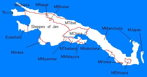
The Mystaran Orient Project (the MOrient Project for short) was a community effort to add more Asian-themed cultures to Mystara. The idea was that there were too few of these, and they would be a great fit as inspiration for new cultures to populate the empty and undeveloped lands of Mystara’s northeastern continent, Skothar. This took place in the late 1990s. Judging by MML posts mentioning the project, the peak was 1996, and it continued to be discussed actively until around 2000.
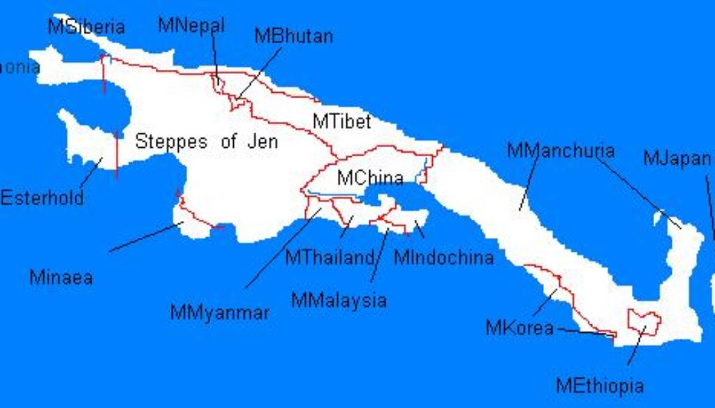
Although it generated a lot of discussions and ideas to develop the region, the project only seems to have resulted in a single map: this overview of the placement of the cultures in Skothar. The version of Skothar used is clearly the one from the Hollow World Campaign Set world map. It’s a little sad that there weren’t more maps, and also that Skothar has continued to be rather neglected by Mystara’s cartographers in the years since.
I am not 100% sure that this map is by Rolf Schoefnagel. If someone directly involved with the project back then can confirm this, I would be much obliged. There is an instance of Rolf asking about maps on the project webpage, so it seems likely that it is indeed by Rolf.
Fan-made Map by Rolf Schoefnagel (January 1997)

This is an original map created by one of Mystara’s excellent fan cartographers. For more information on the cartographer, including a gallery of all their maps, see also Appendix M: Mappers of Mystara.
The Atlas has been unable to contact the original cartographer. This map therefore appears here without explicit permission from its creator. Any information on how to get in touch with them would be most welcome.
Sources
- Hollow World Campaign Set (1990) (PDF at DriveThruRPG)
Fan Sources
- Mystaran Orient Webpage (Vaults of Pandius)
References
- All of Rolf’s maps at the Atlas of Mystara
Chronological Analysis
This is a fan-made map. It was published in January 1997. The updated Atlas version of this map is not yet available. See also Appendix C for annual chronological snapshots of the area. For the full context of this map in Mystara’s publication history, see the upcoming Let’s Map Mystara 1997.
The following lists are from the Let’s Map Mystara project. Additions are new features, introduced in this map. Revisions are changes to previously-introduced features. Hex Art & Fonts track design elements. Finally, Textual Additions are potential features found in the related text. In most cases, the Atlas adopts these textual additions into updated and chronological maps.
Under Construction! Please check back again soon for updates.


2 July 2025 @ 10:05 am
Hi, this is Rolf – greetings from Vienna.
Today, some AI bot found this page.
I’m afraid I have absolutely no memory of this map – although it is likely that I was the one who did this sketch.
Love that you’re collecting all this old stuff, keep it up!
cheers
2 July 2025 @ 10:08 am
Hi Rolf! Wonderful to hear from you. Thank you so much for commenting!
The map is almost 30 years old now, so it’s no surprise if you don’t remember it. Amazing to think that the old MML was so long ago.