")
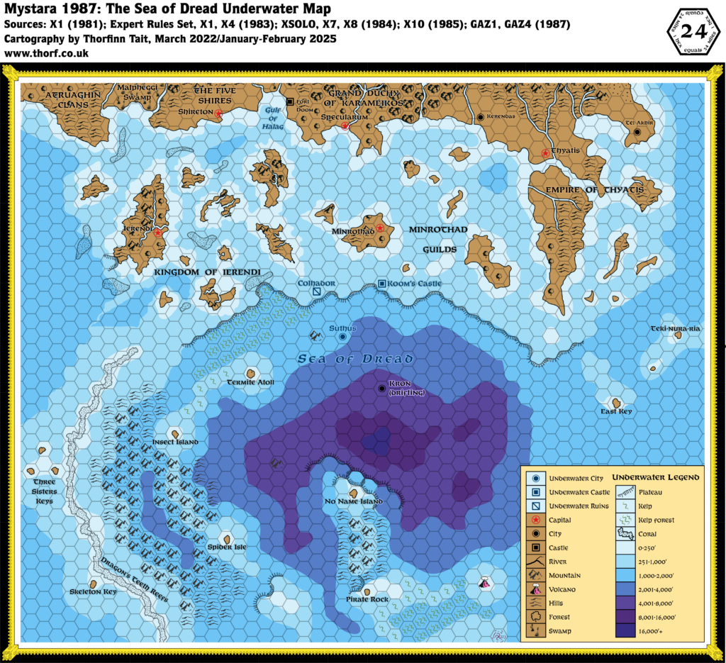
Sea of Dread Underwater, 24 miles per hex (1987)
The Sea of Dread had not changed significantly since this map’s introduction in 1984, but 1987’s GAZ4 changed that quite significantly. It added new more detailed coastlines to the Ierendi islands, as well as revised sea depths and a new set of reefs between the islands. In general the depths are reasonably compatible with X7’s, with a few exceptions. I have tried to keep the details of both in this map.
Chronological Map (February 2025)
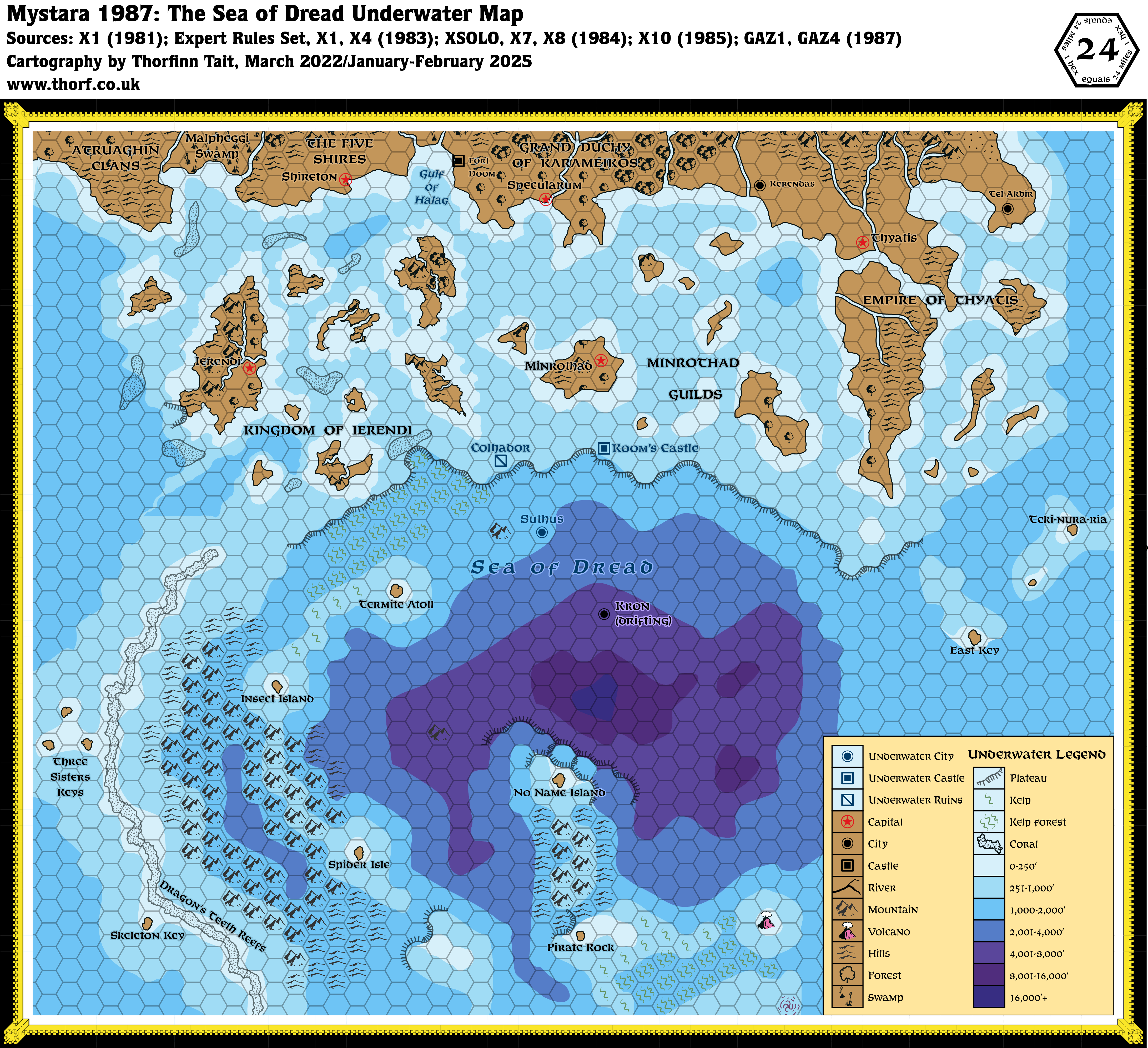
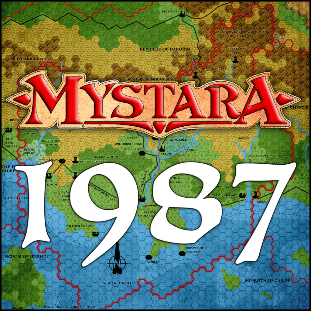
This map is part of the Mystara 1987 series of chronological maps. It is an updated map, incorporating all available sources and made internally consistent with other maps in its series. But it only uses sources published in or before 1987.
For more information, see Appendix C: Cartographic Chronology.
Sources
- Mystara 1984
- GAZ1 The Grand Duchy of Karameikos (1987) (PDF at DriveThruRPG)
- GAZ4 The Kingdom of Ierendi (1987) (PDF at DriveThruRPG)
Revisions
For detailed notes, see the posts for each individual source map at the links above.
- Depths — GAZ4 presented new depths, which I have merged with X7’s as far as possible. See the Textual Additions for GAZ4 Ierendi, 8 miles per hex for details.
- Islands — I switched in GAZ4’s more detailed coastlines for all of Ierendi’s islands.
- Reefs — Added GAZ4’s reefs.
- Rivers — Added GAZ4’s rivers, as well as GAZ1’s Rugalov River and Lake of Lost Dreams.
- Settlements — X10 provided another coastal city, Shireton.
- Terrain — The land has been updated using GAZ1 and GAZ4’s 24 mile per hex maps.
References
- Let’s Map Mystara 1987 — the original project thread for this map
- Let’s Map Mystara Together discussion thread at The Piazza (link leads to this map’s post)
- Undersea at the Vaults of Pandius
- New Map: Sea of Dread Underwater 1987 preview post at Patreon