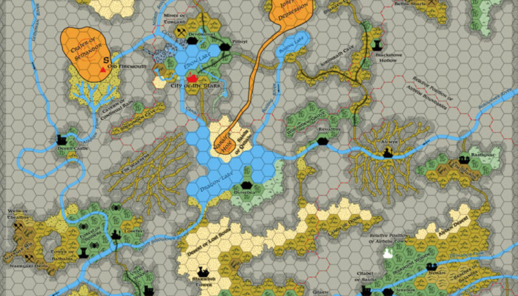
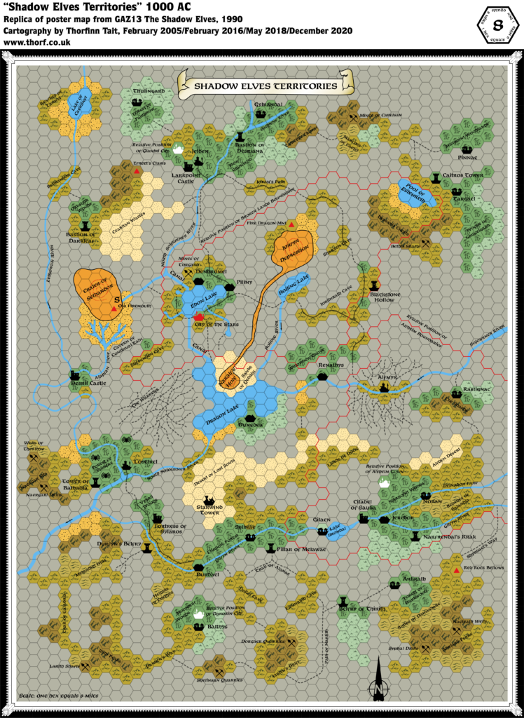
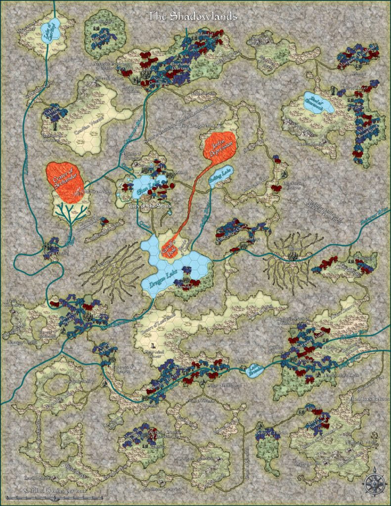
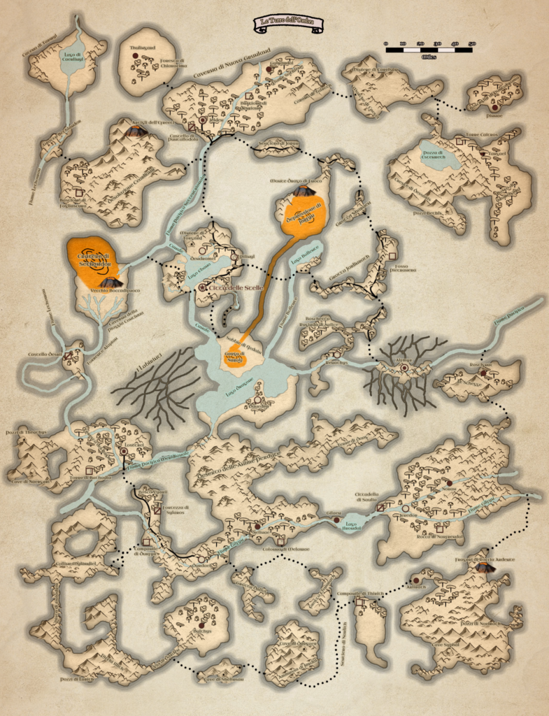
Shadowlands, 8 miles per hex
The domain of the shadow elves covers one of the greatest regions of any country covered in the Gazetteer series. If it were suddenly moved to the surface, it would extend from Belcadiz in Glantri, east to the regions of the Ethengarian Yakuts and the Dwarfgate Mountains, then south to the Cruth Mountains and west in a line below the city of Darokin as far as Lake Amsorak.
The shadow elves, spread out over their underground expanse, number about 550,000, with more than half of these concentrated in the clans’ four major cities.
from GAZ13 The Shadow Elves, by Carl Sargent and Gary Thomas
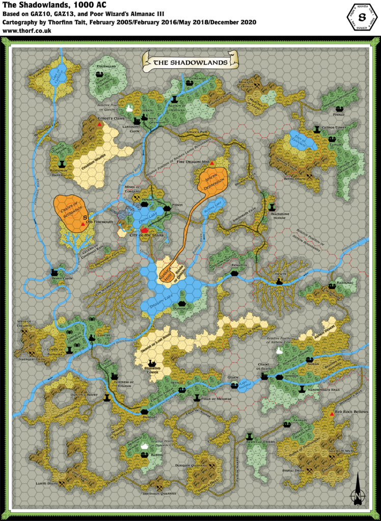
Map (December 2020)
Sources
- GAZ13 The Shadow Elves (1990) (PDF at DriveThruRPG)
- GAZ10 The Orcs of Thar (1989) (PDF at DriveThruRPG)
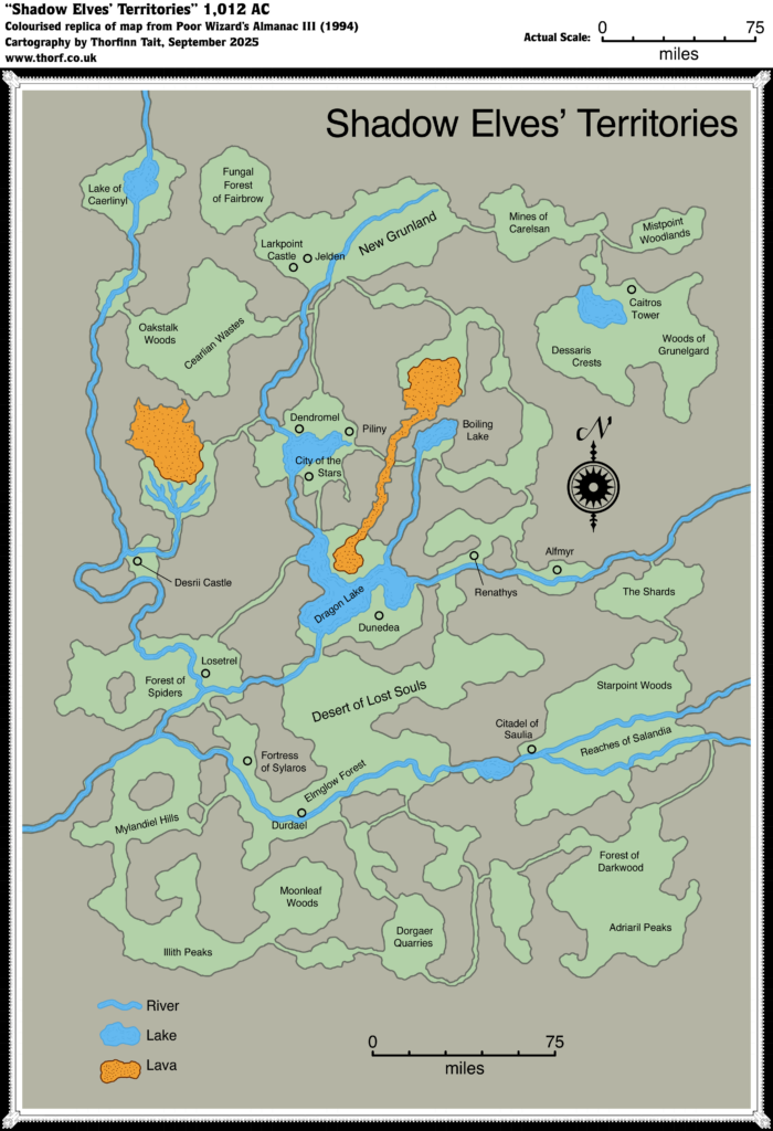
- Poor Wizard’s Almanac III (1994)
Comments
This was always one of my favourite maps, and it’s easy to see why: almost every section of the map has its own label, and there are so many locations for adventures just waiting to be used. Also, it revealed a whole new world existing right below the world we had all come to know.
The updated map is an adaptation of GAZ13’s map, implementing cavern walls similar to those seen in GAZ10’s underground map. The walls mean that there is actually a little less land area, but they seem a lot more realistic, and much less general than the hex edges.
The cavern of the City of the Stars has been adapted from the 2 mile per hex map, which is why the style is different. The walls of this cavern conform much more to the hex grid, and they’re much smoother; the Shadow Elves have presumably smoothed out the walls of this cavern more than any other.
Notes
- Boiling Lake — this lake is at a significantly higher level than the other waterways of the Shadow Elf Territories. (GAZ13 DM’s Guide page 17)
- Dragon Lake — the lake is said to be 800 feet deep at its deepest point. Above the lake, the vaulted ceiling of the cavern rises to 400 feet in places. (GAZ13 DM’s Guide page 17)
- Fonts — for reference, GAZ13’s labels used fonts as follows: Country names: 15.8 pt Feinen Bold; Settlements: 9.4-9.6 pt Feinen Bold; Major Lakes, Lava Lakes and Canals: 9.4-9.6 pt Feinen Bold Italic; Terrain Features: 7.9-8 pt Feinen Bold; Minor Lakes, Mines and “Relative Position” labels: 7.9-8 pt Feinen Bold Italic.
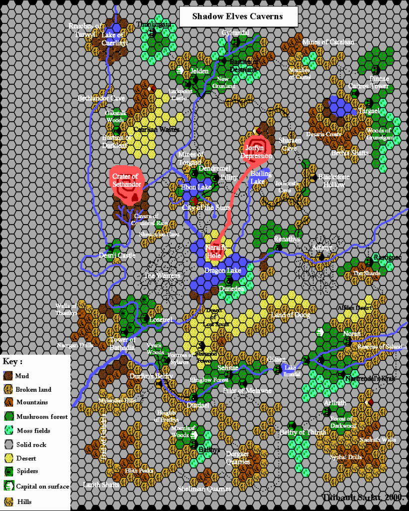
- Mountains and Hills — going by GAZ13’s description, there aren’t any caverns large enough to host a mountain, much less mountain ranges. Nevertheless the official maps distinguish hills, mountains and broken terrain. In the Atlas, these are considered to be indications of the grade and consistency of the cavern or tunnel. Thus, hills indicate gentle slopes of the cavern or tunnel floor; mountains indicate steeper slopes; and broken lands indicate a mix, but with lots of ups and downs.
- New Grunland — both maps (GAZ13 and Poor Wizard’s Almanac III) put the New Grunland label in the area nearby, and call the city itself Jelden. GAZ13’s “New Grunland” label is tucked away in a corner of the cavern, in the smaller point size reserved for terrain features and area names, while the “Jelden” label is in the larger point size used for settlements, and is placed unambiguously right next to the city. Poor Wizard’s Almanac III has a similar situation, with “New Grunland” clearly marking the area, while Jelden is the city’s name. However, despite this all references in the text, in both GAZ13 as well as the Poor Wizard’s Almanac series, refer to the northern city of the Shadowlands as “New Grunland”. Jelden has no textual references to speak of, appearing only on the map, and on the GAZ13’s 2 mile per hex map as the name for the road heading north. The Atlas is undecided on this issue, and for now places both labels ambiguously next to the city.
- Settlements on top of symbols – numerous settlements on GAZ13’s map were marked on top of terrain hexes with symbols. This is a minor art error; usually settlements are placed on top of empty hexes of the appropriate terrain colour. Also, the village of Balthys in the south is placed on top of a fungal forest-coloured broken land symbol. It seems most likely this is intended to be just a fungal forest coloured hex, and the updated map marks it as such.
- Shesunden Cave — this small cavern about 20 miles southwest of the City of the Stars was missed out from the map in Poor Wizard’s Almanac III. Perhaps this was done because the cavern, as shown on GAZ13’s map, appears to be inaccessible, though it would presumably be better to add an entrance tunnel than to delete it altogether. The updated map of course includes it.
- Sojourner Rivers — the current of the great Sojourner Rivers is said to be slow and lazy, and sometimes almost entirely absent. This implies that the caverns the rivers flow through are all on roughly the same level. (GAZ13 DM’s Guide page 17)
- Tunnels — all of GAZ13’s dashed line tunnels have been converted to tunnels showing terrain, in keeping with GAZ10’s underground style and the Poor Wizard’s Almanac III map.
- Tunnel error — on GAZ13’s map, just above the relative position of Glantri City a tunnel is marked which covers two hexes, the uppermost of which is not solid rock, but moss fields. Almost certainly an error.
- Water — much of the water in Ebon Lake and Dragon Lake filters down from the Broken Lands above. Dragon Lake is also fed by the Sump and Weir in Alfheim. (GAZ13 DM’s Guide page 17)
References
- Shadow Elves’ Territories at the Vaults of Pandius
- Shadowlands map thread at The Piazza
- City of the Stars, 2 miles per hex map thread at The Piazza
- Official name for the Shadow Elf Territories discussion thread at The Piazza
Thanks to:
John Calvin (Chimpman), Kheldren, Lost Woodrake, Sheldon Morris (Hugin), Andrew Theisen (Cthulhudrew)

